Browse All

1873 Jersey City - Plate D. [County Atlas, State Atlas] Jersey City - Plate D. |

1816 Mappe-monde. World Atlas Mappe-monde sur la projection de Mercato … |

1873 Jersey City - Plate E. [County Atlas, State Atlas] Jersey City - Plate E. |

1873 Jersey City - Plate F. [County Atlas, State Atlas] Jersey City - Plate F. |

1873 Jersey City - Plate G. [County Atlas, State Atlas] Jersey City - Plate G. |

1873 Jersey City - Plate H. [County Atlas, State Atlas] Jersey City - Plate H. |

1873 Jersey City - Plate I. [County Atlas, State Atlas] Jersey City - Plate I. |

1873 Jersey City - Plate J. [County Atlas, State Atlas] Jersey City - Plate J. |

1873 Jersey City - Plate K. [County Atlas, State Atlas] Jersey City - Plate K. |

1873 Jersey City - Plate L. [County Atlas, State Atlas] Jersey City - Plate L. |

1873 Jersey City - Plate M. [County Atlas, State Atlas] Jersey City - Plate M. |

1873 Jersey City - Plate N. [County Atlas, State Atlas] Jersey City - Plate N. |

1816 Mappe-monde 1. World Atlas Mappe-monde 1ere feuille. (Par H. Brue, … |

1873 Jersey City - Plate O. [County Atlas, State Atlas] Jersey City - Plate O. |

1873 Jersey City - Plate P. [County Atlas, State Atlas] Jersey City - Plate P. |

1873 Jersey City - Plate Q. [County Atlas, State Atlas] Jersey City - Plate Q. |

1873 Jersey City - Plate R. [County Atlas, State Atlas] Jersey City - Plate R. |

1873 Jersey City - Plate S. [County Atlas, State Atlas] Jersey City - Plate S. |

1873 Jersey City - Plate T. [County Atlas, State Atlas] Jersey City - Plate T. |

1873 Hoboken - Plate A. [County Atlas, State Atlas] Hoboken - Plate A. |

1873 Hoboken - Plate B. [County Atlas, State Atlas] Hoboken - Plate B. |

1873 Hoboken - Plate C. [County Atlas, State Atlas] Hoboken - Plate C. |

1816 Mappe-monde 2. World Atlas Mappe-monde sur la projection de Mercato … |

1873 Hoboken - Plate D. Sub-Plan to Jersey Ci … [County Atlas, State Atlas] Hoboken - Plate D. Sub-Plan to Jersey Ci … |

1873 Hoboken - Plate E. [County Atlas, State Atlas] Hoboken - Plate E. |

1873 Southern Part of West Hoboken - Plate A. [County Atlas, State Atlas] Southern Part of West Hoboken - Plate A. |
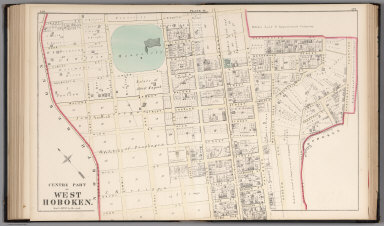
1873 Centre Part of West Hoboken - Plate B. [County Atlas, State Atlas] Centre Part of West Hoboken - Plate B. |

1873 West Hoboken - Plate C. [County Atlas, State Atlas] West Hoboken - Plate C. |

1873 Northern Part of the Town of Union - Pla … [County Atlas, State Atlas] Northern Part of the Town of Union - Pla … |

1873 Southern Part of the Town of Union. [County Atlas, State Atlas] Southern Part of the Town of Union. |

1873 Northern Part of the Union Township - Pl … [County Atlas, State Atlas] Northern Part of the Union Township - Pl … |

1873 Southern Part of the Town of Union - Pla … [County Atlas, State Atlas] Southern Part of the Town of Union - Pla … |

1816 Mappe-monde 3. World Atlas Mappe-monde 3e feuille. H. Brue, dir. (P … |

1873 Plan of Weehawken Township. [County Atlas, State Atlas] Plan of Weehawken Township. |

1873 North Bergen Township. [County Atlas, State Atlas] North Bergen Township. |

1873 Part of Plan of North Bergen Township. [County Atlas, State Atlas] Part of Plan of North Bergen Township. |

1873 Part of North Bergen Township. [County Atlas, State Atlas] Part of North Bergen Township. |

1873 Part of Kearney Township. [County Atlas, State Atlas] Part of Kearney Township. |

1873 Part of Harrison East Newark - Plate A. [County Atlas, State Atlas] Part of Harrison East Newark - Plate A. |

1873 Part of Harrison, East Newark - Plate B. [County Atlas, State Atlas] Part of Harrison, East Newark - Plate B. |

1873 Formerly Greenville, now Part of Sixth D … [County Atlas, State Atlas] Formerly Greenville, now Part of Sixth D … |

1873 City of Bayonne. [County Atlas, State Atlas] City of Bayonne. |

1816 Mappe-monde 4. World Atlas Mappe-monde 4e feuille. H. Brue, dir. (P … |

1915 Douglas County, Washington. County Atlas Outline Map of Douglas County, Washingto … |

1915 Mansfield, Washington. County Atlas Mansfield. |

1915 Waterville, Washington. County Atlas Waterville. |

1816 Europe. World Atlas Carte encyprotype de l'Europe reduite de … |

1747 South Britain, or England and Wales. Geography Book A new and very accurate map of South Bri … |

1915 Orondo and Fisher Orchard Tracks, Washin … County Atlas Orondo and Fisher Orchard Tracks. |

1915 Trinidad, Washington. County Atlas Trinidad. |