Who What Where WhenREMOVE |
Author
Burr, David H., 1803-1875
Full Title
Map of the County of Clinton. By David H. Burr. Published by the Surveyor General, pursuant to an Act of the Legislature. Entered according to an Act of Congress Jany. 5th. 1829 by David H. Burr of the State of New York. Engd. by Rawdon, Clark & Co., Albany & Rawdon, Wright & Co., N. York.
Publisher
D.H. Burr
Author
Burr, David H., 1803-1875
Full Title
Map of the County of Franklin. By David H. Burr. Published by the Surveyor General, pursuant to an Act of the Legislature. Entered according to an Act of Congress Jany. 5th. 1829 by David H. Burr of the State of New York. Engd. by Rawdon, Clark & Co., Albany & Rawdon, Wright & Co., New York.
Publisher
D.H. Burr
Author
Burr, David H., 1803-1875
Full Title
Map of the County of St. Lawrence. By David H. Burr. Published by the Surveyor General, pursuant to an Act of the Legislature. Entered according to an Act of Congress Jany. 5th. 1829 by David H. Burr of the State of New York. Engd. by Rawdon, Clark & Co., Alby. & Rawdon, Wright & Co., N. York.
Publisher
D.H. Burr
Author
Burr, David H., 1803-1875
Full Title
Map of the County of Jefferson. By David H. Burr. Published by the Surveyor General, pursuant to an Act of the Legislature. Entered according to an Act of Congress Jany. 5th. 1829 by David H. Burr of the State of New York. Engd. by Rawdon, Clark & Co., Albany & Rawdon, Wright & Co., N. York.
Publisher
D.H. Burr
Author
Mitchell, Samuel Augustus
Full Title
West Indies.
Publisher
S.A. Mitchell
Author
Burr, David H., 1803-1875
Full Title
Map of the County of Lewis. By David H. Burr. Published by the Surveyor General, pursuant to an Act of the Legislature. Entered according to an Act of Congress Jany. 5th. 1829 by David H. Burr of the State of New York. Engd. by Rawdon, Clark & Co., Alby. & Rawdon, Wright & Co., New York.
Publisher
D.H. Burr
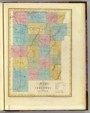
Author
Burr, David H., 1803-1875
Full Title
Map of the County of Herkimer. By David H. Burr. Published by the Surveyor General, pursuant to an Act of the Legislature. Entered according to an Act of Congress Jany. 5th. 1829 by David H. Burr of the State of New York. Engd. by Rawdon, Clark & Co., Albany & Rawdon, Wright & Co., New York.
Publisher
D.H. Burr
Author
Burr, David H., 1803-1875
Full Title
Map of the County of Oneida. By David H. Burr. Published by the Surveyor General, pursuant to an Act of the Legislature. Entered according to an Act of Congress Jany. 5th. 1829 by David H. Burr of the State of New York. Engd. by Rawdon, Clark & Co., Albany & Rawdon, Wright & Co., N.Y.
Publisher
D.H. Burr
Author
Burr, David H., 1803-1875
Full Title
Map of the County of Madison. By David H. Burr. Published by the Surveyor General, pursuant to an Act of the Legislature. Entered according to an Act of Congress Jany. 5th. 1829 by David H. Burr of the State of New York. Engd. by Rawdon, Clark & Co., Albany & Rawdon, Wright & Co., N.Y.
Publisher
D.H. Burr
Author
Burr, David H., 1803-1875
Full Title
Map of the County of Oswego. By David H. Burr. Published by the Surveyor General, pursuant to an Act of the Legislature. Entered according to an Act of Congress Jany. 5th. 1829 by David H. Burr of the State of New York. Engd. by Rawdon, Clark & Co., Albany & Rawdon, Wright & Co., N.Y.
Publisher
D.H. Burr
Author
Burr, David H., 1803-1875
Full Title
Map of the County of Otsego. By David H. Burr. Published by the Surveyor General, pursuant to an Act of the Legislature. Entered according to an Act of Congress Jany. 5th. 1829 by David H. Burr of the State of New York. Engd. by Rawdon, Clark & Co., Albany & Rawdon, Wright & Co., New York.
Publisher
D.H. Burr
Author
Burr, David H., 1803-1875
Full Title
Map of the County of Chenango. By David H. Burr. Published by the Surveyor General, pursuant to an Act of the Legislature. Entered according to an Act of Congress Jany. 5th. 1829 by David H. Burr of the State of New York. Engd. by Rawdon, Clark & Co., Albany & Rawdon, Wright & Co., N. York.
Publisher
D.H. Burr
Author
Burr, David H., 1803-1875
Full Title
Map of the County of Broome. By David H. Burr. Published by the Surveyor General, pursuant to an Act of the Legislature. Entered according to an Act of Congress Jany. 5th. 1829 by David H. Burr of the State of New York. Engd. by Rawdon, Clark & Co., Albany & Rawdon, Wright & Co., N.Y.
Publisher
D.H. Burr
Author
Burr, David H., 1803-1875
Full Title
Map of the County of Cortland by David H. Burr. Published by the Surveyor General, pursuant to an Act of the Legislature. Entered according to an Act of Congress Jany. 5th. 1829 by David H. Burr of the State of N. York. Engd. by Rawdon, Clark & Co., Albany & Rawdon, Wright & Co., N.Y.
Publisher
D.H. Burr
Author
Burr, David H., 1803-1875
Full Title
Map of the County of Tompkins. By David H. Burr. Published by the Surveyor General, pursuant to an Act of the Legislature. Entered according to an Act of Congress Jany. 5th. 1829 by David H. Burr of the State of New York. Engd. by Rawdon, Clark & Co., Albany & Rawdon, Wright & Co., N.Y.
Publisher
D.H. Burr
Author
Mitchell, Samuel Augustus
Full Title
South America.
Publisher
S.A. Mitchell
Author
Burr, David H., 1803-1875
Full Title
Map of the County of Tioga. By David H. Burr. Published by the Surveyor General, pursuant to an Act of the Legislature. Entered according to an Act of Congress Jany. 5th. 1829 by David H. Burr of the State of New York. Engd. by Rawdon, Clark & Co., Albany & Rawdon, Wright & Co., N. York.
Publisher
D.H. Burr
Author
Burr, David H., 1803-1875
Full Title
Map of the County of Steuben. By David H. Burr. Published by the Surveyor General, pursuant to an Act of the Legislature. Entered according to an Act of Congress Jany. 5th. 1829 by David H. Burr of the State of New York. Engd. by Rawdon, Clark & Co., Albany & Rawdon, Wright & Co., N. York.
Publisher
D.H. Burr
Author
Burr, David H., 1803-1875
Full Title
Map of the County of Onondaga. By David H. Burr. Published by the Surveyor General, pursuant to an Act of the Legislature. Entered according to an Act of Congress Jany. 5th. 1829 by David H. Burr of the State of New York. Engd. by Rawdon, Clark & Co., Albany & Rawdon, Wright & Co., New York.
Publisher
D.H. Burr
Author
Burr, David H., 1803-1875
Full Title
Map of the County of Cayuga. By David H. Burr. Published by the Surveyor General, pursuant to an Act of the Legislature. Entered according to an Act of Congress Jany. 5th. 1829 by David H. Burr of the State of New York. Engd. by Rawdon, Clark & Co., Albany & Rawdon, Wright & Co., N.Y.
Publisher
D.H. Burr
Author
Burr, David H., 1803-1875
Full Title
Map of the County of Seneca. By David H. Burr. Published by the Surveyor General, pursuant to an Act of the Legislature. Entered according to an Act of Congress Jany. 5th. 1829 by David H. Burr of the State of New York. Engd. by Rawdon, Clark & Co., Albany & Rawdon, Wright & Co., N. York.
Publisher
D.H. Burr
Author
Burr, David H., 1803-1875
Full Title
Map of the counties of Ontario & Yates. By David H. Burr. Published by the Surveyor General, pursuant to an Act of the Legislature. Entered according to an Act of Congress Jany. 5th. 1829 by David H. Burr of the State of New York. Engd. by Rawdon, Clark & Co., Albany & Rawdon, Wright & Co., N.Y.
Publisher
D.H. Burr
Author
Burr, David H., 1803-1875
Full Title
Map of the County of Wayne. By David H. Burr. Published by the Surveyor General, pursuant to an Act of the Legislature. Entered according to an Act of Congress Jany. 5th. 1829 by David H. Burr of the State of New York. Engd. by Rawdon, Clark & Co., Albany & Rawdon, Wright & Co., N.Y.
Publisher
D.H. Burr
Author
Burr, David H., 1803-1875
Full Title
Map of the County of Livingston. By David H. Burr. Published by the Surveyor General, pursuant to an Act of the Legislature. Entered according to an Act of Congress Jany. 5th. 1829 by David H. Burr of the State of New York. Engd. by Rawdon, Clark & Co., Albany & Rawdon, Wright & Co., N. York.
Publisher
D.H. Burr
Author
Burr, David H., 1803-1875
Full Title
Map of the County of Monroe. By David H. Burr. Published by the Surveyor General, pursuant to an Act of the Legislature. Entered according to an Act of Congress Jany. 5th. 1829 by David H. Burr of the State of New York. Engd. by Rawdon, Clark & Co., Albany & Rawdon, Wright & Co., N.Y.
Publisher
D.H. Burr
Author
Burr, David H., 1803-1875
Full Title
Map of the County of Orleans. By David H. Burr. Published by the Surveyor General, pursuant to an Act of the Legislature. Entered according to an Act of Congress Jany. 5th. 1829 by David H. Burr of the State of New York. Engd. by Rawdon, Clark & Co., Albany & Rawdon, Wright & Co., N. York.
Publisher
D.H. Burr
Author
Mitchell, Samuel Augustus
Full Title
Venezuela, New Grenada & Equador. (with) Plan of a Proposed Communication Between the Atlantic & Pacific Oceans.
Publisher
S.A. Mitchell
Author
Burr, David H., 1803-1875
Full Title
Map of the County of Genesee. By David H. Burr. Published by the Surveyor General, pursuant to an Act of the Legislature. Entered according to an Act of Congress Jany. 5th. 1829 by David H. Burr of the State of New York. Engd. by Rawdon, Clark & Co., Albany & Rawdon, Wright & Co., N. York.
Publisher
D.H. Burr
Author
Burr, David H., 1803-1875
Full Title
Map of the County of Allegany. By David H. Burr. Published by the Surveyor General, pursuant to an Act of the Legislature. Entered according to an Act of Congress Jany. 5th. 1829 by David H. Burr of the State of New York. Engd. by Rawdon, Clark & Co., Albany & Rawdon, Wright & Co., N. York.
Publisher
D.H. Burr
Author
Burr, David H., 1803-1875
Full Title
Map of the County of Niagara. By David H. Burr. Published by the Surveyor General, pursuant to an Act of the Legislature. Entered according to an Act of Congress Jany. 5th. 1829 by David H. Burr of the State of New York. Engd. by Rawdon, Clark & Co., Albany & Rawdon, Wright & Co., N. York.
Publisher
D.H. Burr
Author
Burr, David H., 1803-1875
Full Title
Map of the County of Erie. By David H. Burr. Published by the Surveyor General, pursuant to an Act of the Legislature. Entered according to an Act of Congress Jany. 5th. 1829 by David H. Burr of the State of New York. Engd. by Rawdon, Clark & Co., Albany & Rawdon, Wright & Co., New York.
Publisher
D.H. Burr
Author
Burr, David H., 1803-1875
Full Title
Map of the County of Cattaraugus. By David H. Burr. Published by the Surveyor General, pursuant to an Act of the Legislature. Entered according to an Act of Congress Jany. 5th. 1829 by David H. Burr of the State of New York. Engd. by Rawdon, Clark & Co., Albany & Rawdon, Wright & Co., N. York.
Publisher
D.H. Burr
Author
Burr, David H., 1803-1875
Full Title
Map of the County of Chautauque (sic). By David H. Burr. Published by the Surveyor General, pursuant to an Act of the Legislature. Entered according to an Act of Congress Jany. 5th. 1829 by David H. Burr of the State of New York. Engd. by Rawdon, Clark & Co., Albany & Rawdon, Wright & Co., New York.
Publisher
D.H. Burr
Author
Mitchell, Samuel Augustus
Full Title
Brazil. (with) two inset maps: Paraguay and Environs of Rio Janeiro.
Publisher
S.A. Mitchell
Author
Codazzi, Agustin, 1793-1859
Full Title
Mapa-mundi historico. Lith. de Thierry freres a Paris. (Caracas 1840)
Publisher
[Agostino Codazzi, Thierry Freres.]
Author
Codazzi, Agustin, 1793-1859
Full Title
America historica, fisica y politica actual. 1840. Gravee par Muschani. Imprimee chez Thierry freres a Paris. (Caracas 1840)
Publisher
[Agostino Codazzi, Thierry Freres.]
Author
Codazzi, Agustin, 1793-1859
Full Title
Mapa de las costas de Tierra-Firme, desde el Orinoco hasta Yucatan: de las islas Antillas y la mayor parte de las Lucayas con las derrotas que siguio Dn. Cristobal Colon en sus descubrimientos por estos mares y las derrotas de otros navigantes que reconocieron las costas de Venezuela. Lith. de Thierry Frs. a Paris. (Caracas 1840)
Publisher
[Agostino Codazzi, Thierry Freres.]
Author
Codazzi, Agustin, 1793-1859
Full Title
Mapa politico de Venezuela antes de la Revolucion de 1810. Mapa politico de la Republica de Venezuela en 1840. Lith. de Thierry freres a Paris. (Caracas 1840)
Publisher
[Agostino Codazzi, Thierry Freres.]
Author
Codazzi, Agustin, 1793-1859
Full Title
Mapa fisico de Venezuela divida en hoyas hydrograficas. Mapa fisico de Venezuela dividida en tres zonas. Lith. de Thierry freres a Paris. (Caracas 1840)
Publisher
[Agostino Codazzi, Thierry Freres.]
Author
Codazzi, Agustin, 1793-1859
Full Title
Mapa de Venezuela para servir a la historia de las campanas de la guerra de independencia en los anos 1812 ... (a) parte de 1819. Lith. de Thierry freres a Paris. (Caracas 1840)
Publisher
[Agostino Codazzi, Thierry Freres.]
Author
Codazzi, Agustin, 1793-1859
Full Title
Mapa de Venezuela, Nueva Granada y Quito, para servir a la historia de las campanas de la guerra de independencia en los anos 1819 y 1820. Lith. de Thierry Frs. a Paris. (Caracas 1840)
Publisher
[Agostino Codazzi, Thierry Freres.]
Author
Codazzi, Agustin, 1793-1859
Full Title
Mapa de los tres Departamentos Venezuela, Cundinamarca y Ecuador que formaron la Republica de Colombia, para servir a la historia de las campanas de la guerra de independencia en los anos de 1821, 1822 y 1823. Lith. de Thierry Frs. a Paris. (Caracas 1840)
Publisher
[Agostino Codazzi, Thierry Freres.]
Author
Monin, C.V.
Full Title
Tableau Comparatif de la Hauteur des Montagnes de la Longueur de Cours des Fleuves et de l'Elevation des Principales Chutes d' Eau dan les Cinq Parties du Monde Faisant Partie de l'Atlas Classique de C.V. Monin. A Paris, Chez Hoquart, Marchand d'Estampes, Rue St. Jacques 64..
Publisher
Librairie Classique
Author
Monin, C.V.
Full Title
Tableau de Geographie Physique.
Publisher
Librairie Classique
Author
Codazzi, Agustin, 1793-1859
Full Title
Mapa que contiene una parte de la Republicas del Ecuador, Peru y Bolivia para servir a la Historia de las Campanas del ejerito Colombiano en el alto y bajo Peru, sacado de otro pulicado en 1826 y corregido segun las observaciones e itinerarios de los oficiales facultativos que acompanaron los ejercitos en sus diferentes operaciones. Lith. de Thierry Freres a Paris. (Caracas 1840)
Publisher
[Agostino Codazzi, Thierry Freres.]
Author
Monin, C.V.
Full Title
Tableau de Systeme Solaire.
Publisher
Librairie Classique
Author
Monin, C.V.
Full Title
Mappemonde en Deux Hemispheres. Paris, Hocquart, Editeur.
Publisher
Librairie Classique
Author
Monin, C.V.
Full Title
Carte Generale de L'Europe, Dressee par B. Beaupre d'apres les Cartes les plus modernes. Paris. Hocquart, Editeur. Hoquart, aine Editeur.
Publisher
Librairie Classique
Author
Monin, C.V.
Full Title
France, En trente-deux Provinces ou Gouvernemens militaires par C.V. Monin. Hoquart, aine Editeur.
Publisher
Librairie Classique
|