Who What Where WhenREMOVE |
Author
Smiley, Thomas T.
Full Title
United States. (with) Eastern States.
Publisher
Hogan & Thompson
Author
Smiley, Thomas T.
Full Title
Middle States.
Publisher
Hogan & Thompson
Author
Smiley, Thomas T.
Full Title
Southern States. (with) South Part of Florida.
Publisher
Hogan & Thompson
Author
Smiley, Thomas T.
Full Title
Western States. (with) inset map of Upper Michigan.
Publisher
Hogan & Thompson
Author
Smiley, Thomas T.
Full Title
South America. Engraved by E.F. Woodward.
Publisher
Hogan & Thompson
Author
Smiley, Thomas T.
Full Title
Asia. Engraved by E.F. Woodward.
Publisher
Hogan & Thompson
Author
Smiley, Thomas T.
Full Title
Africa.
Publisher
Hogan & Thompson
Author
Smiley, Thomas T.
Full Title
Europe. Engraved by E.F. Woodward.
Publisher
Hogan & Thompson
Author
Smiley, Thomas T.
Full Title
World Globular Projection.
Publisher
Hogan & Thompson
Author
Smiley, Thomas T.
Full Title
Pacific Ocean.
Publisher
Hogan & Thompson
Author
Mitchell, Samuel Augustus
Full Title
Map of North America. Entered ... 1839, by S. Augustus Mitchell ... Pennsylvania.
Publisher
Thomas, Cowperthwait & Co.
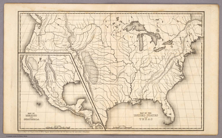
Author
Mitchell, Samuel Augustus
Full Title
Map of the United States and Texas. (with) Map of Mexico and Guatimala. Entered ... 1839, by S. Augustus Mitchell ... Pennsylvania.
Publisher
Thomas, Cowperthwait & Co.
Author
Mitchell, Samuel Augustus
Full Title
Map of South America. Entered ... 1839, by S. Augustus Mitchell ... Pennsylvania.
Publisher
Thomas, Cowperthwait & Co.
Author
Mitchell, Samuel Augustus
Full Title
Map of Europe. Entered ... 1839, by S. Augustus Mitchell ... Pennsylvania.
Publisher
Thomas, Cowperthwait & Co.
Author
Mitchell, Samuel Augustus
Full Title
Map of Asia (with) Map of Palestine or the Holy Land. Entered ... 1839, by S. Augustus Mitchell ... Pennsylvania.
Publisher
Thomas, Cowperthwait & Co.
Author
Mitchell, Samuel Augustus
Full Title
Map of Africa (with) Map of Liberia. Entered ... 1839, by S. Augustus Mitchell ... Pennsylvania.
Publisher
Thomas, Cowperthwait & Co.
Author
Mitchell, Samuel Augustus
Full Title
Map of Oceanica. Entered ... 1839, by S. Augustus Mitchell ... Pennsylvania.
Publisher
Thomas, Cowperthwait & Co.
Author
Robert Sayer and John Bennett (Firm)
Full Title
North America, As Divided amongst the European Powers By Samuel Dunn, Mathematician. London: Printed for Robt. Sayer ... 10 Jany. 1774.
Publisher
Sayer and Bennett
Author
Robert Sayer and John Bennett (Firm)
Full Title
A Compleat Map of the West Indies, Containing the Coasts of Florida, Louisiana, New Spain, and Terra Firma: with all the Islands. By Samuel Dunn, Mathematician. London: Printed for Robt. Sayer ... 10 January 1774.
Publisher
Sayer and Bennett
Author
Robert Sayer and John Bennett (Firm)
Full Title
A General Map of the Northern British Colonies in America, which comprehends the Province of Quebec, the Government of Newfoundland, Nova-Scotia, New-England and New-York. from the Maps Published by the Admiralty and Board of Trade, Regulated by the Astronomic and Trigonometric Observations of Major Holland, and Corrected from Governor Pownall's Late Map 1776. London: Printed for Robt. Sayer & Jno. Bennett ... 14th August 1776.
Publisher
Sayer and Bennett
Author
Robert Sayer and John Bennett (Firm)
Full Title
A General Map of the Middle British Colonies, in America. containing Virginia, Maryland, the Delaware Counties, Pennsylvania and New Jersey. With the addition of New York, and of the Greatest Part of New England, as also of the Bordering Parts of the Province of Quebec, improved from several Surveys made after the late War, and Corrected from Governor Pownall's Late Map 1776. (with) A Sketch of the Upper Parts of Canada. London: Printed for R. Sayer & J. Bennett ... 15th October 1776.
Publisher
Sayer and Bennett
Author
Robert Sayer and John Bennett (Firm)
Full Title
A General Map of the Southern British Colonies, in America. containing North and South Carolina, Georgia, East and West Florida, with the Neighbouring Indian Countries. From the Modern Surveys of Engineer de Brahm, Capt. Collet, Mouzon & Others; and from the Large Hydrographical Survey of the Coasts of East and West Florida. By B. Romans, 1776. (with) Plan of Charleston and ... St. Augustine. London: Printed for R. Sayer & J. Bennett ... 15th Octr. 1776.
Publisher
Sayer and Bennett
Author
Robert Sayer and John Bennett (Firm)
Full Title
A Survey of Lake Champlain, including Lake George, Crown Point and St. John. Surveyed by Order of His Excellency Major-General Sr. Jeffery Amherst, Knight of the most Honble. Order of the Bath, Commander in Chief of His Majesty's Forces in North America, (now Lord Amherst) by William Brassier, Draughtsman. (with) A Particular Plan of Lake George. Surveyed in 1756. By Capt. Jackson. London: Printed for Robt. Sayer & Jno. Bennett ... Augst. 5th 1776.
Publisher
Sayer and Bennett
Author
Thompson, Thos. H.
Full Title
Map of the States of California and Nevada Carefully Compiled From Actual Surveys, Personal examinations and information furnished by the County Surveyors of the State expressly for this Work. Published by Thompson & West. 120 Sutter St. San Francisco. (with) inset map of San Bernardino and San Diego Counties.
Publisher
Thos H. Thompson & Co.
Author
Thompson, Thos. H.
Full Title
Map of Sonoma County California. 1877. (with) Sonoma Daily and Weekly Democrat, and McCunes Block.
Publisher
Thos H. Thompson & Co.
Author
Thompson, Thos. H.
Full Title
Map of Occidental (with) Plan of Geyserville. (both) Sonoma Co. California, 1877. Map Number One. (Salt Point, Mendocino, and Cloverdale Townships.)
Publisher
Thos H. Thompson & Co.
Author
Thompson, Thos. H.
Full Title
Plat of Sebastopol. (with) Map of Guerneville. (with) Plat of Bodega Corners. Map Number Three. (Salt Point, Ocean, Mendocino, Redwood, Bodega, and Analy Townships.)
Publisher
Thos H. Thompson & Co.
Author
Thompson, Thos. H.
Full Title
Plat of Windsor (with) Plat of Town of Fulton. Map Number Five. (Santa Rosa and Sonoma Townships.) (facing page) View of J.B. Armstrong's Villa Plats, at Norwood, adjoining the City of Santa Rosa. (with) City Stables, Santa Rosa. (with) Hinds' Hotel, Freestone. (with) "Oak Wood Villa," Res. of Mrs. Dr. Barrett, Healdsburg. (with) Res. of J.J. Wheeler, Santa Rosa. (with) Res. of Mary Brooks, Russian River Tp. (all) Sonoma County, Cal.
Publisher
Thos H. Thompson & Co.
Author
Thompson, Thos. H.
Full Title
Map Number Six. (Russian River, Santa Rosa, Analy Townships.)
Publisher
Thos H. Thompson & Co.
Author
Thompson, Thos. H.
Full Title
Map of the City of Healdsburg, Sonoma Co. Cal. 1877. (with) Santa Rosa Brewery, Santa Rosa, Cal. Joost & Metzger, Proprs. Map Number Seven. (Ocean, Bodega, and Analy Townships.)
Publisher
Thos H. Thompson & Co.
Author
Thompson, Thos. H.
Full Title
Map Number Eight. (Analy, Santa Rosa, Vallejo, and Petaluma Townships.)
Publisher
Thos H. Thompson & Co.
Author
Thompson, Thos. H.
Full Title
Map of Sonoma City, Sonoma Co. Cal. 1877. Map Number Nine. (Santa Rosa, Vallejo, and Sonoma Townships.)
Publisher
Thos H. Thompson & Co.
Author
Thompson, Thos. H.
Full Title
Map Number Ten. (Petaluma, Vallejo, and Sonoma Townships.)
Publisher
Thos H. Thompson & Co.
Author
Thompson, Thos. H.
Full Title
Cypress Hill Cemetery, Petaluma. Map Number Eleven. (Petaluma and Vallejo Townships.)
Publisher
Thos H. Thompson & Co.
Author
Thompson, Thos. H.
Full Title
Map of Petaluma City. 1877.
Publisher
Thos H. Thompson & Co.
Author
Thompson, Thos. H.
Full Title
Map of The City of Santa Rosa, 1876, Sonoma County California. (with) Map Number Twelve. (Vallejo Township.) (with view of) Santa Rosa Times building.
Publisher
Thos H. Thompson & Co.
Author
[Carey, Mathew, Lewis, Samuel]
Full Title
The British Possessions in North America from the best Authorities by Samuel Lewis 1794. (above neat line) Engraved for Carey's American Edition of Guthrie's Geography improved. (untitled inset of New Greenland, Labrador New Britain, and Prince William's Land.)
Publisher
Mathew Carey
Author
Mitchell, Samuel Augustus
Full Title
Map of Oceanica. Engraved to Illustrate Mitchell's School and Family Geography. No. 16. Engraved by J.H. Young. Entered ... 1839, by S. Augustus Mitchell ... Connecticut.
Publisher
Thomas, Cowperthwait & Co.
Author
Sotzmann, Daniel Friedrich
Full Title
Connecticut entworfen von D.F. Sotzmann. No. VI. Hamburg bey Carl Ernst Bohn 1796 ... P. Schmidt Sculp. zu Ebelings Erdbeschreibung von Amerika.
Publisher
Carl Ernst Bohn
Author
Sotzmann, Daniel Friedrich
Full Title
New Hampshire entworfen von D.F. Sotzmann. No. II. Hamburg bey Carl Ernst Bohn 1796 ... P. Schmidt Sculpsit. zu Ebelings Erdbeschreibung von Amerika. (inset map) Nordlicher Theil der Grafschast Grafton.
Publisher
Carl Ernst Bohn
Author
Sotzmann, Daniel Friedrich
Full Title
Pennsylvania entworfen von D.F. Sotzmann. No. IX. Hamburg bey Carl Ernst Bohn 1797. W. Sander Sc. zu Ebelings Erdbeschreibung von Amerika.
Publisher
Carl Ernst Bohn
Author
Sotzmann, Daniel Friedrich
Full Title
Rhode Island entworfen von D.F. Sotzmann. No. V. Hamburg bey Carl Ernst Bohn 1797. ... gestochen von H. Kliewer. zu Ebelings Erdbeschreibung von Amerika.
Publisher
Carl Ernst Bohn
Author
Sotzmann, Daniel Friedrich
Full Title
Vermont entworfen von D.F. Sotzmann. No. XVI. Hamburg bey Carl Ernst Bohn 1796. P. Schmidt Sc. zu Berlin. zu Ebelings Erdbeschreibung von Amerika.
Publisher
Carl Ernst Bohn
Author
[Carey, Mathew, Lewis, Samuel]
Full Title
The Province of Maine, From the best Authorities by Samuel Lewis, 1794. (above neat line) Engraved for Carey's American Edition of Guthrie's Geography improved.
Publisher
Mathew Carey
Author
Lucas, Fielding Jr.
Full Title
Palestine. S. Hufty Sc. Philada. Published by F. Lucas Jr. Baltimore.
Publisher
Fielding Lucas Jr.
Author
[Carey, Mathew, Lewis, Samuel]
Full Title
The State of New Hampshire. Compiled chiefly from Actual Surveys. By Samuel Lewis, 1794.
Publisher
Mathew Carey
Author
Carey, Mathew
Full Title
Vermont From actual Survey Delineated & Engraved by Amos Doolittle N.H. (above neat line) Engraved for Carey's American Edition of Guthrie's Geography Improved.
Publisher
Mathew Carey
Author
[Carey, Mathew, Lewis, Samuel]
Full Title
The State of Massachusetts, Compiled from the best Authorities By Samuel Lewis. (above neat line) Engraved for Carey's American Edition of Guthries Geography improved by J.T. Scott.
Publisher
Mathew Carey
Author
Anonymous
Full Title
The United States; North America; South America; Europe; Africa; Asia.
Publisher
No Publisher
Author
Carey, Mathew
Full Title
Connecticut From the best Authorities Delineated & Engraved by A. Doolittle N. Haven. (above neat line) Engraved for Carey's American Edition of Guthries Geography improved by J.T. Scott.
Publisher
Mathew Carey
|