Who What Where WhenREMOVE |
Author
Hall, S. (Sidney)
Full Title
Africa. By Sidney Hall. London, published by Longman, Rees, Orme, Brown & Green, Paternoster Row, Feby. 1, 1829.
Publisher
Longman, Rees, Orme, Brown and Green
Author
Hall, S. (Sidney)
Full Title
Egypt. By Sidney Hall. London, published by Longman, Rees, Orme, Brown & Green, Paternoster Row, Feby. 1, 1829.
Publisher
Longman, Rees, Orme, Brown and Green
Author
Hall, S. (Sidney)
Full Title
Nubia and Abyssinia. By Sidney Hall. London, published by Longman, Rees, Orme, Brown & Green, Paternoster Row, Jany. 1830.
Publisher
Longman, Rees, Orme, Brown and Green
Author
Hall, S. (Sidney)
Full Title
Southern Africa. By Sidney Hall. London, published by Longman, Rees, Orme, Brown & Green, Paternoster Row, Octr. 1st. 1828.
Publisher
Longman, Rees, Orme, Brown and Green
Author
Hall, S. (Sidney)
Full Title
Western Africa. By Sidney Hall. London, published by Longman, Rees, Orme, Brown & Green, Paternoster Row, Octr. 1st. 1829.
Publisher
Longman, Rees, Orme, Brown and Green
Author
Hall, S. (Sidney)
Full Title
Northern Africa. By Sidney Hall. London, published by Longman, Rees, Orme, Brown & Green, Paternoster Row, June 1, 1829.
Publisher
Longman, Rees, Orme, Brown and Green
Author
Hall, S. (Sidney)
Full Title
North America. By Sidney Hall. London, published by Longman, Rees, Orme, Brown & Green, Paternoster Row, Augt. 1, 1829.
Publisher
Longman, Rees, Orme, Brown and Green
Author
Hall, S. (Sidney)
Full Title
United States. By Sidney Hall. London, published by Longman, Rees, Orme, Brown & Green, Paternoster Row, June, 1828.
Publisher
Longman, Rees, Orme, Brown and Green
Author
Hall, S. (Sidney)
Full Title
British North America by Sidney Hall. London, published by Longman, Rees, Orme, Brown & Green, Paternoster Row, April 1st. 1829.
Publisher
Longman, Rees, Orme, Brown and Green
Author
Hall, S. (Sidney)
Full Title
Mexico and Guatimala (sic). By Sidney Hall. London, published by Longman, Rees, Orme, Brown & Green, Paternoster Row, March, 1828.
Publisher
Longman, Rees, Orme, Brown and Green
Author
Hall, S. (Sidney)
Full Title
West Indies. By Sidney Hall. London, published by Longman, Rees, Orme, Brown & Green, Paternoster Row, Decr. 1st. 1827.
Publisher
Longman, Rees, Orme, Brown and Green
Author
Hall, S. (Sidney)
Full Title
Canada, New Brunswick and Nova Scotia. By Sidney Hall. London, published by Longman, Rees, Orme, Brown & Green, Paternoster Row, Jany. 1830.
Publisher
Longman, Rees, Orme, Brown and Green
Author
Hall, S. (Sidney)
Full Title
South America. By Sidney Hall. London, published by Longman, Rees, Orme, Brown & Green, Paternoster Row, Octr. 1, 1829.
Publisher
Longman, Rees, Orme, Brown and Green
Author
Hall, S. (Sidney)
Full Title
Colombia. By Sidney Hall. London, published by Longman, Rees, Orme, Brown & Green, Paternoster Row, Decr. 1828.
Publisher
Longman, Rees, Orme, Brown and Green
Author
Hall, S. (Sidney)
Full Title
Brazil and Paraguay. By Sidney Hall. London, published by Longman, Rees, Orme, Brown & Green, Paternoster Row, August 1828.
Publisher
Longman, Rees, Orme, Brown and Green
Author
Hall, S. (Sidney)
Full Title
Peru. By Sidney Hall. London, published by Longman, Rees, Orme, Brown & Green, Paternoster Row, April, 1828.
Publisher
Longman, Rees, Orme, Brown and Green
Author
Hall, S. (Sidney)
Full Title
Chili, La Plata, and Bolivia or Upper Peru by Sidney Hall. London, published by Longman, Rees, Orme, Brown & Green, Paternoster Row, Feby. 1, 1829.
Publisher
Longman, Rees, Orme, Brown and Green
Author
Meyer, Joseph, 1796-1856
Full Title
Vergleichende Ubersicht der grossten Strome der Erde nach ihrer Lauflange geordnet mit Angabe ihrer Quellen, Mundungen, Nebenflusse und Hauptuferplatze ... (Grosser Hand-Atlas uber alle Theile der Erde in 170 Karten. Herausgegeben von J. Meyer. Hildburghausen Verlag des Bibliographischen Instituts, 1860)
Publisher
Bibliographischen Instituts
Author
Radefeld, Carl Christian Franz, 1788-1874
Full Title
Nordliche Himmelskugel 1846. Gezeichnet von Hauptm. Radefeld. Stich, Druck und Verlag des Bibliographischen Instituts in Hildburghausen, (1860)
Publisher
Bibliographischen Instituts
Author
Radefeld, Carl Christian Franz, 1788-1874
Full Title
Suedliche Himmelskugel 1846. Gezeichnet von Hauptm. Radefeld. Stich, Druck und Verlag des Bibliographischen Instituts in Hildburghausen, (1860)
Publisher
Bibliographischen Instituts
Author
Meyer, Joseph, 1796-1856
Full Title
Sonnen-System. Stahlstich, Direction v. Kleinknecht, aus der Schweinfurter Geograph. Graviranstalt des Bibliograph. Instituts zu Hildburghsn., Amsterdam, Paris u. Philadelphia, (1860)
Publisher
Bibliographischen Instituts
Author
Radefeld, Carl Christian Franz, 1788-1874
Full Title
Mond-Karte. Nach den besten Quellen entworfen und gezeichnet vom Hauptm. C. Radefeld 1847. Instit. Bibl. excud. Schleifmann sc. (1860)
Publisher
Bibliographischen Instituts
Author
Willard, Emma
Full Title
Introductory Map. To Accompany Willard's History Of The United States. Locations and Wanderings Of The Aboriginal Tribes. (Arrow) Shows The Direction Of their Wanderings. Engraved & Printed by Saml. Maverick.
Publisher
White, Gallaher, & White
Author
Willard, Emma
Full Title
First Map Or Map Of 1578. To Accompany Willard's History Of The United States. (Inset) Queen Elizabeth Signs for Sir Humphrey Gilbert. The First patent Granted by an English Sovereign to Lands Within the Territory of the United States 1578. Engraved & Printed by Saml. Maverick.
Publisher
White, Gallaher, & White
Author
Willard, Emma
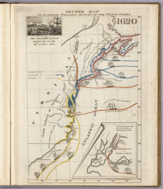
Full Title
Second Map. To Accompany Willard's History Of The United States 1620. (Inset) The Pilgrims Land at Plymouth on the 22nd. of Dec. 1620. (inset map) Places Near The Mouth of the Hudson Visited by the Dutch. Engraved & Printed by Saml. Maverick.
Publisher
White, Gallaher, & White
Author
Radefeld, Carl Christian Franz, 1788-1874
Full Title
Welt-Karte in Mercators Projektion. Nach den bessten Quellen entworf. und gezeichn. vom Hauptm. Radefeld. 1844. Verlag des Bibliograph. Instituts zu Hildburghausen, Amsterdam, Paris u. Philadelphia, (1860)
Publisher
Bibliographischen Instituts
Author
Willard, Emma
Full Title
Third Map or Map Of 1643. To Accompany Willard's History Of The United States. (Inset) The Commencement of the Confederacy in the Union of Plymouth and Massachusetts and New Haven and Connecticut 1643. (inset map) Places Mentioned in the History of the Pequod War. Engraved & Printed by Saml. Maverick N.Y.
Publisher
White, Gallaher, & White
Author
Willard, Emma
Full Title
Fourth Map or Map Of 1692. To Accompany Willard's History Of The United States. (Inset) Massachusetts Receives a New Charter, Including Maine and Other Large Territories by the Arrival of Sir Wm. Phipps. (inset map) Places Mentioned in the History of King Philip's War. (Engraved & Printed by) Saml. Maverick & Co. N.Y.
Publisher
White, Gallaher, & White
Author
Willard, Emma
Full Title
Fifth Map or Map Of 1733. To Accompany Willard's History Of The United States. (Inset) Genl. Oglethorpe with a Colony Commence the Settlement of Georgia 1733. He meets the Indian Chief's in Council at Savannah. (Engraved & Printed by) Saml. Maverick & Co. N.Y.
Publisher
White, Gallaher, & White
Author
Willard, Emma
Full Title
Sixth Map or Map Of 1763. To Accompany Willard's History Of The United States. (Inset) The Death of Gen. Wolf Occurs at the Time of Quebec's Being Taken by the English ... that leads to the Peace of Paris 1763. (inset map) Quebec. Engraved & Printed by Saml. Maverick.
Publisher
White, Gallaher, & White
Author
Willard, Emma
Full Title
Seventh Map or Map Of 1776. To Accompany Willard's History Of The United States. (Inset) A Committee of Five draw up the Declaration of Independence. 1776. (inset map) Boston and Vicinity. (inset) (untitle map showing Lake George and surroundings). (inset) Charleston and Vicinity. Engraved & Printed by Saml. Maverick &Co. N.Y.
Publisher
White, Gallaher, & White
Author
Willard, Emma
Full Title
Eighth Map or Map Of 1789. To Accompany Willard's History Of The United States. (Inset) Federal Government Commen CD 1789. (2 untitled inset maps). (Engraved & Printed by) Saml. Maverick & Co. N.Y.
Publisher
White, Gallaher, & White
Author
Willard, Emma
Full Title
Principal Seat of the Revolutionary War in the Southern Section of the U.S. To Accompany Willard's History Of The United States. (inset map) Principal Seat of the Revolutionary War in the northern section of the U.S. Engraved & Printed by Saml. Maverick.
Publisher
White, Gallaher, & White
Author
Willard, Emma
Full Title
Ninth Map Or Map Of 1826. To Accompany Willard's History Of The United States. Referred to in the History, As the Map of the President Day. 1826. Saml. Maverick & Co. N.Y.
Publisher
White, Gallaher, & White
Author
Willard, Emma
Full Title
Principal Seat of the War of 1812-13-14. To Accompany Willard's History Of The United States. Engraved & Printed by Saml. Maverick. N.Y.
Publisher
White, Gallaher, & White
Author
Radefeld, Carl Christian Franz, 1788-1874
Full Title
Erd-Karte in der Globular-Projektion. Zu J. Meyer's-Handatlas gehoerend No. 1. Entworfen u. gezeichnet vom Hauptm. Radefeld. Stahlstich, Direction v. Kleinknecht, aus der Schweinfurter Geograph. Graviranstalt des Bibliographisches Instituts zu Hildburghausen, Amsterdam, Paris u. Philadelphia, (1860)
Publisher
Bibliographischen Instituts
Author
[Meyer, Joseph, 1796-1856, Society for the Diffusion of Useful Knowledge (Great Britain)]
Full Title
Lissabon, Lisboa, 1844. (with view) Lissabon von der Quinta da Torrinha-Val de Pereiro. (with) Umgebunge von Lissabon. Aus der Geographischen Graviranstalt des Bibliographischen Instituts zu Hildburghausen, Amsterdam, Paris u. Philadelphia, (1860)
Publisher
Bibliographischen Instituts
Author
Radefeld, Carl Christian Franz, 1788-1874
Full Title
Spanien, westliche Halfte. Nach den besten Quellen entworf. u. gezeichnet, von Hauptm. Radefeld. 1847. (with) Madrid. Stich, Druck und Verlag des Bibliographischen Instituts zu Hildburghausen, (1860)
Publisher
Bibliographischen Instituts
Author
Radefeld, Carl Christian Franz, 1788-1874
Full Title
(Spanien, oestliche Halfte. Nach den besten Quellen entworf. u. gezeichnet, von Hauptm. Radefeld. 1847) (with Canarische Inseln) (with Fernando Po) Stich, Druck und Verlag des Bibliographischen Instituts zu Hildburghausen, (1860)
Publisher
Bibliographischen Instituts
Author
[Meyer, Joseph, 1796-1856, Society for the Diffusion of Useful Knowledge (Great Britain)]
Full Title
Plan von Madrid, 1844. Verlag des Bibliographischen Instituts zu Hildburghausen, Amsterdam, Paris u. Philadelphia, (1860)
Publisher
Bibliographischen Instituts
Author
Radefeld, Carl Christian Franz, 1788-1874
Full Title
Frankreich, 1845. Entw. u. gez. v. Hauptm. Radefeld. (with) Umgebung von Paris. (with) Corsica. Stahlstich, Druck u. Verlag des Bibliographischen Instituts zu Hildburghausen, Amsterdam, Paris u. Philadelphia, (1860)
Publisher
Bibliographischen Instituts
Author
[Meyer, Joseph, 1796-1856, Society for the Diffusion of Useful Knowledge (Great Britain)]
Full Title
Westliche Halfte von Paris ... Ostliche Halfte von Paris. Enthaltend die Quartiere. Verlag vom Bibliographischen Instituts. (Hildburghausen, 1860)
Publisher
Bibliographischen Instituts
Author
Radefeld, Carl Christian Franz, 1788-1874
Full Title
Neueste Karte von Grossbritannien und Ireland. Nach den bessten Quellen entworf. u. gezeichn. von Hauptm. Radefeld. 1844. Aus der Geographischen Graviranstalt des Bibliographischen Instituts zu Hildburghausen, Amsterdam, Paris u. Philadelphia, (1860)
Publisher
Bibliographischen Instituts
Author
Radefeld, Carl Christian Franz, 1788-1874
Full Title
Neueste Karte von England. Nach den bessten Quellen entworfen u. gezeichnet vom Hauptm. Radefeld. 1844. Verlag des Bibliographischen Instituts zu Hildburghausen, Amsterdam, Paris u. Philadelphia, (1860)
Publisher
Bibliographischen Instituts
Author
Radefeld, Carl Christian Franz, 1788-1874
Full Title
Neueste Karte von Schotland. Nach den bessten Quellen entworfen u. gezeichnet von Hauptm. Radefeld. 1844. Verlag des Bibliographischen Instituts zu Hildburghausen, Amsterdam, Paris u. Philadelphia, (1860)
Publisher
Bibliographischen Instituts
Author
Radefeld, Carl Christian Franz, 1788-1874
Full Title
Neueste Karte von Ireland. Nach den besten Quellen entworfen u. gezeichnet von Hauptm. Radefeld. 1844. Verlag des Bibliograph. Instituts zu Hildburghausen, Amsterdam, Paris u. Philadelphia, (1860)
Publisher
Bibliographischen Instituts
Author
Woodbridge, William C.
Full Title
Map Of The World. Adapted To Woodbridge's Geography. Exhibiting The Eastern & Western Hemisphere, And the Land Hemisphere, Together With Comparative View Of the Rivers And Lake of the Two Continents. Includes 2 insets and Comparative View of Rivers & Lakes on The Eastern and Western Continents. Entered ... 1845, by W.C. Woodbridge ... Massachusetts. Hartford. Published By Wm. Jas. Hamersley.
Publisher
Wm. Jas. Hamersley
Author
[Meyer, Joseph, 1796-1856, Society for the Diffusion of Useful Knowledge (Great Britain)]
Full Title
London, 1845, nach den besten Materialien entworfen. (Verlag des Bibliographischen Instituts zu Hildburghausen, Amsterdam, Paris u. Philadelphia, 1860)
Publisher
Bibliographischen Instituts
Author
Woodbridge, William C.
Full Title
Moral And Political Chart Of The Inhabited World. Exhibiting The Prevailing Religion, Form Of Government, Degree Of Civilization, and Population of Each Country. By W.C. Woodbridge. (Engraved by) C. Pelton & W. Williams. Entered .. . 1845, by W.C. Woodbridge ... Massachusetts. Hartford. Published By Wm. Jas. Hamersley. (inset map) Central Europe. (inset map) Untitled map of Polynesia.
Publisher
Wm. Jas. Hamersley
Author
Woodbridge, William C.
Full Title
Isothermal Chart Or View Of Climates: Showing also The Situations Of The Principal Plants & Animals Of The World. By W.C. Woodbridge. Entered .. . 1843, by W.C. Woodbridge ... Massachusetts. Hartford. Published By Wm. Jas. Hamersley. (inset map) Animals of New Holland.
Publisher
Wm. Jas. Hamersley
|