Who What Where WhenREMOVE |
Author
Jefferys, Thomas
Full Title
A map of Canada and the north part of Louisiana with the adjacent countrys. By Thos. Jefferys, Geographer to His Royal Highness the Prince of Wales. T. Jefferys sculp. (1760)
Publisher
Thomas Jefferys
Author
Jefferys, Thomas
Full Title
A plan of the city of Quebec, the capital of Canada, as it surrendered 18 Septembr. 1759 to the British fleet and army commanded by Vice Adml. Saunders & Brigadr. Genl. Townshend. Published according to act of Parliament Janry. 15, 1760 by Thos. Jefferys at Charing Cross. Price 2 s.
Publisher
Thomas Jefferys
Author
Jefferys, Thomas
Full Title
Plan of the town and fortifications of Montreal or Ville Marie in Canada. Published by Thos. Jefferys, Geographer to His Royal Highness the Prince of Wales at Charing Cross, Jan 30, 1758. Price 2s. (1760)
Publisher
Thomas Jefferys
Author
Jefferys, Thomas
Full Title
A new map of Nova Scotia and Cape Britain, with the adjacent parts of New England and Canada, composed from a great number of actual surveys, and other materials regulated by many new astronomical observations of the longitude as well as latitude; with an explanation. 1755 published according to Act of Parliament by Thos. Jefferys, Geographer to His Royal Highness the Prince of Wales at the corner of St. Martins Lane, Charing Cross, London. (1760)
Publisher
Thomas Jefferys
Author
[Gridley, Richard, Jefferys, Thomas]
Full Title
A plan of the city and fortifications of Louisburg; from a survey made by Richard Gridley, Lieut. Coll. of the Train of Artillery in 1745. ... A plan of the city and harbour of Louisburg with the French batteries that defended it and those of the English, shewing that part of Gabarus Bay in which they landed, and the ground on which they encamped during the siege in 1758. (with) A map of Gabarus Bay, adjoining Louisburg. Published by Thos. Jefferys, Geographer to the Prince of Wales at Charing Cross, Octobr. 9, 1758. Price 2s.
Publisher
Thomas Jefferys
Author
[Gridley, Richard, Jefferys, Thomas]
Full Title
An authentic plan of the River St. Laurence from Sillery to the Fall of Montmorenci, with the operations of the Siege of Quebec under the command of Vice-Adml. Saunders & Major Genl. Wolfe down to the 5. Septr. 1759. Drawn by a captain in his majesties navy. (with) A view of the action gained by the English Sepr. 13, 1759 near Quebec, brought from thence by an officer of distinction. (with) Part of the upper river of St. Laurence.
Publisher
Thomas Jefferys
Author
[Anville, Jean Baptiste Bourguignon d, 1697-1782, Jefferys, Thomas]
Full Title
North America from the French of Mr. d'Anville, improved with the back settlements of Virginia and course of Ohio. Illustrated with geographical and historical remarks. 1755 published according to Act by Thos. Jefferys Geographer to His Royal Highness the Prince of Wales near Charing Cross. (1760)
Publisher
Thomas Jefferys
Author
[Brion de la Tour, Louis, Jefferys, Thomas]
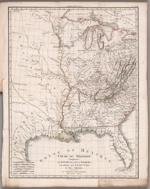
Full Title
Plan of New Orleans the capital of Louisiana; with the disposition of its quarters and canals as they have been traced by Mr. de la Tour in the year 1720. (with) The course of Mississipi River from Bayagoulas to the sea. (with) The east mouth of the Mississipi, with the plan of Fort la Balise which defends the entrance and channel of that river. Nov: 1759, published according to Act of Parliament by T. Jefferys at Charing Cross. Price 2 s.
Publisher
Thomas Jefferys
Author
Jefferys, Thomas
Full Title
The West Indies exhibiting the English, French, Spanish, Dutch & Danish settlements. Collected from the best authorities by Thomas Jefferys, Geographer to His Royal Highness the Prince of Wales. Published according to the Act by Thos. Jefferys, Geographer to His Royal Highness the Prince of Wales near Charing Cross. (1760)
Publisher
Thomas Jefferys
Author
Jefferys, Thomas
Full Title
The island of Hispaniola called by the French St. Domingo. Subject to France & Spain, from the best authorities by Thomas Jefferys, Geographer to His Royal Highness the Prince of Wales. T. Jefferys sculp. (1760)
Publisher
Thomas Jefferys
Author
Jefferys, Thomas
Full Title
An authentic plan of the town and harbour of Cap Francois in the isle of St. Domingo. By Thomas Jefferys, Geographer to His Royal Highness, the Prince of Wales. (1760)
Publisher
Thomas Jefferys
Author
Jefferys, Thomas
Full Title
Guadaloupe, one of the Caribbee islands subject to France in the West Indies, from the best authorities by T. Jefferys. Published by T. Jefferys at Charing Cross. (1760)
Publisher
Thomas Jefferys
Author
Jefferys, Thomas
Full Title
Plan of the town of Basse Terre, the capital of Guadaloupe from an authentic survey. Published by Thos. Jefferys Geographer to his Royal Highness the Prince of Wales, near Charing Cross, London. T. Jefferys sculp. (1760)
Publisher
Thomas Jefferys
Author
[Houel, Jean Pierre Louis Laurent, 1735-1813, Jefferys, Thomas]
Full Title
Martinico, one of the Caribbee Islands, in the West Indies; subject to the French, according to the observations of Mr. Houel, Engineer. By Thos. Jefferys, Geographer to His Royal Highness the Prince. Published by Thos. Jefferys near Charing Cross, London.
Publisher
Thomas Jefferys
Author
Caylus, Anne Claude Philippe, comte de, 1692-1765
Full Title
Plan of the town and citadel of Fort Royal the capital of Martinico with the bay of Cul de Sac Royal. By Mr. de Caylus, Engineer General of the French Islands. (1760)
Publisher
Thomas Jefferys
Author
[Caylus, Anne Claude Philippe, comte de, 1692-1765, Jefferys, Thomas]
Full Title
Plan of the town and fort of Grenada, by Mr. de Caylus, Engineer General of the French Islands. (with) The Isle of Grenada. T. Jefferys, sculp. (1760)
Publisher
Thomas Jefferys
Author
Jefferys, Thomas
Full Title
The island and colony of Cayenne subject to the French on the continent of South America. By Thomas Jefferys, Geographer to His Royal Highness the Prince of Wales. T. Jefferys sculp.
Publisher
Thomas Jefferys
Author
[Jefferys, Thomas, Marchais, R. de]
Full Title
Plan of the town of Cayenne and Fort St. Michael. Drawn by the Chevalier de Mareechais. T. Jefferys sculp. (1760)
Publisher
Thomas Jefferys
Author
Chevalier, August
Full Title
The commercial, pictorial and tourist map of San Francisco, in colors and illustrated with litho-engraved pictures of all public buildings, parks, monuments, and recommended business houses, etc. Designed, engraved & copyrighted by Aug. Chevalier. Copyrighted 15th Dec. 1903 by Aug. Chevalier. 1st edition, 1904, August. Galloway Litho Co., S.F.
Publisher
Aug. Chevalier
Author
Egloffstein, Baron F.W. von
Full Title
Geological map and profiles of some of the principal mining districts of Mexico. Geographical Institute, Baron F.W. Von Egloffstein, No. 164 Broadway N. York. Lettering by Oliver J. Stuart, N.Y. Entered ... 1864, by F.W. von Egloffstein ... New York. Printed by W. Pate. (with) The Geological profiles. (to accompany) Contributions to the Geology and the Physical Geography of Mexico, including a Geological and Topographical Map ... 1864.
Publisher
D. Appleton & Company.
Author
[Gunnison, J.W., Preuss, C., Stansbury, Howard]
Full Title
Map of the Great Salt Lake And Adjacent Country in the Territory Of Utah. Surveyed in 1849 and 1850, under the orders of Col. J.J. Abert ... by Capt. Howard Stansbury ... aided by Lieut. J.W. Gunnison ... and Albert Carrington. Drawn By Lieut. Gunnison And Charles Preuss. Ackerman Lith. 379 Broadway N.Y.
Publisher
Ackerman Lith.
Author
[Gunnison, J.W., Preuss, C., Stansbury, Howard]
Full Title
Map of a Reconnoissance between Fort Leavenworth on the Missouri River, and the Great Salt Lake in the Territory Of Utah, made in 1849 and 1850 under the orders of Col. J.J. Abert ... By Capt. Howard Stansbury ... aided by Lieut. J.W. Gunnison ... and Albert Carrington. The adjacent country laid down from the latest and most authentic data. Drawn by Lieut. Gunnison and Charles Preuss. Ackerman Lith. 379 Broadway N.Y.
Publisher
Ackerman Lith.
Author
[Poirson, J.B., Herbin de Halle, Etienne de.]
Full Title
Carte de la Republique Francaise Apres la paix d'Amiens; pour servir a l'mtelligence de la Statistique generale de la France. Divisee en 108 Departmens ... Dressse par J.B. Poirson, Ingenieur Geographe. Grave par Tardieu l'aine Rue de Sorbonne No. 385. (to accompany) Statistique Generale et Particuliere De La France et De Ses Colonies, avec une Nouvelle Description ... 1804. (inset) Isle de Corse.
Publisher
F. Buisson
Author
[Poirson, J.B., Herbin de Halle, Etienne de.]
Full Title
Carte physique de la navigation interieure de la France, indiquant: les bassins des cinq grands fleuves, le cours des rivieres navigables, flottables et autres, qui forment leurs affluens, et les canaux éxecueés et projettes, &c. pour servir a la Statistique Generale et Particuliere de la France. Dressee par J.B. Poirson, Ingenieur Geographe. Les montagnes gravees par B. Tardieu, les eaux filees par Perrier, oncle ; ecrit par Giraldon.(on upper right margin) No.XI. (to accompany) Statistique Generale et Particuliere De La France et De Ses Colonies, avec une Nouvelle Description ... 1804.
Publisher
F. Buisson
Author
[Poirson, J.B., Herbin de Halle, Etienne de.]
Full Title
Carte des iles Antilles. Par J.B. Poirson . Nivose An XI, 1803. Grave par Tardieu l'aine, rue de Sorbonne, no. 385.(on upper right margin) No.XII. (to accompany) Statistique Generale et Particuliere De La France et De Ses Colonies, avec une Nouvelle Description ... 1804.
Publisher
F. Buisson
Author
[Poirson, J.B., Herbin de Halle, Etienne de.]
Full Title
Carte de St. Domingue ... Par J.B. Poirson, en Nivose de l'An XI (1803). Grave par Tardieu l'aine, rue de Sorbonne, no. 385. (on upper right margin) No.XIII. (to accompany) Statistique Generale et Particuliere De La France et De Ses Colonies, avec une Nouvelle Description ... 1804.
Publisher
F. Buisson
Author
[Poirson, J.B., Herbin de Halle, Etienne de.]
Full Title
Carte de la Guiane Francaise et Hollandaise, Dressee d'apres la carte de N. Buache et la Carte Manuscrite de Simon Mentelle ... Par J.B. Poirson, en Nivose An 1803. Grave par Tardieu l'aine, rue de Sorbonne, no. 385. (on upper right margin) No.XIV. (to accompany) Statistique Generale et Particuliere De La France et De Ses Colonies, avec une Nouvelle Description ... 1804.
Publisher
F. Buisson
Author
[Poirson, J.B., Herbin de Halle, Etienne de.]
Full Title
Carte d'Afrique ; Par J.B. Poirson, ingenieur géographe, en Nivose An VI, 1803. Grave par Tardieu l'aine, rue de Sorbonne, no. 385. (on upper right margin) No.XV. (to accompany) Statistique Generale et Particuliere De La France et De Ses Colonies, avec une Nouvelle Description ... 1804.
Publisher
F. Buisson
Author
[Poirson, J.B., Herbin de Halle, Etienne de.]
Full Title
Carte de la cote occidentale de l'Afrique, depuis le Cap Blanc jusquà la riv.re de Serra Leone ; comprenant le cours des riv.res du Senegal et de la Gambie ; par J. B. Poirson, ingenieur geographe ; grave par Tardieu l'aine rue de Sorbonne, no. 385. (on upper right margin) No.XVI. (to accompany) Statistique Generale et Particuliere De La France et De Ses Colonies, avec une Nouvelle Description ... 1804.
Publisher
F. Buisson
Author
[Poirson, J.B., Herbin de Halle, Etienne de.]
Full Title
Carte de la Inde, par J. B. Poirson, ingenieur geographe ; An XI (1803), grave par Tardieu l'aine rue de Sorbonne, no. 385. (on upper right margin) No.XVII. (to accompany) Statistique Generale et Particuliere De La France et De Ses Colonies, avec une Nouvelle Description ... 1804.
Publisher
F. Buisson
Author
[Poirson, J.B., Herbin de Halle, Etienne de.]
Full Title
Cours du Mississippi comprenant la Louisiane, les 2 Florides, une partie des Etats-Unis et pays adjacents. Par J. B. Poirson, ingenieur geographe ; Nivose An XI (1803), grave par Tardieu l'aine rue de Sorbonne, no. 385. (on upper right margin) No.XVIII. (to accompany) Statistique Generale et Particuliere De La France et De Ses Colonies, avec une Nouvelle Description ... 1804.
Publisher
F. Buisson
Author
Smith, J. Calvin
Full Title
A New Map For Travellers Through the United States Of America Showing the Railroads, Canals & Stage Roads. With The Distances, by J. Calvin Smith. Published by J. Calvin Smith, New-York. MDCCCLVI. Entered ... 1856, by J. Calvin Smith ... New York. (inset) Map Of Oregon Northern California Santa Fe &c. (& 4 additional inset maps). (to accompany) Smith's Hand-Book For Travelers Through The United States Of America.
Publisher
J. Calvin Smith & Son
Author
Thomas, Cowperthwait & Co.
Full Title
Map of Mexico including Yucatan. Entered... 1846, by Thomas, Cowperthwait & Co. ... Pennsylvania. (to accompany) Description Of The Republic Of Mexico, ... Illustrated By A Map, In Which Is Included Smaller Maps Of The Valley Of Mexico, And The Fields Of Palo Alto, And Resaca De La Palma. (insets) Valley of Mexico including the Federal District ; Fields of Palo Alto and Resaca de la Palma.
Publisher
Thomas, Cowperthwait & Co.
Author
Northern Pacific Railway Company
Full Title
(Text Page to) The Yellowstone National Park via Northern Pacific Railway. Northern Pacific, Yellowstone Park Line. Puget Sound and Alaska. (inset) Northern Pacific Railway and connections. Poole Bros., Chicago. (inset of steamship routes to southeastern Alaska from Puget Sound)
Publisher
Poole Bros.
Author
[United States Exploring Expedition (1838-1842), Wilkes, Charles, 1798-1877]
Full Title
Chart Of The World Shewing The Tracks of the U.S. Exploring Expedition in 1838, 39, 40, 41 & 42. Charles Wilkes Esq. Commander. Eng. by Sherman & Smith, N.Y.
Publisher
Lea & Blanchard
Author
[United States Exploring Expedition (1838-1842), Wilkes, Charles, 1798-1877]
Full Title
Chart of the Antarctic Continent Shewing the Icy Barrier Attached to it. Discovered by the U.S. Ex. Ex. Charles Wilkes Esq. Commander. 1840. Eng. by Sherman & Smith, N.Y.
Publisher
Lea & Blanchard
Author
[United States Exploring Expedition (1838-1842), Wilkes, Charles, 1798-1877]
Full Title
Chart of the Viti Group or Feejee Islands by the U.S. Ex. Ex. Charles Wilkes Esq. Commander. 1840. Eng. by Sherman & Smith, N.Y.
Publisher
Lea & Blanchard
Author
[United States Exploring Expedition (1838-1842), Wilkes, Charles, 1798-1877]
Full Title
Map of the Oregon Territory by the U.S. Ex. Ex. Charles Wilkes Esqr. Commander. 1841. J.H. Young & Sherman & Smith, N.Y. (with) Columbia River reduced from a survey made by the U.S. Ex. Ex. 1841.
Publisher
Lea & Blanchard
Author
[United States Exploring Expedition (1838-1842), Wilkes, Charles, 1798-1877]
Full Title
Map of Part of the Island of Hawaii, Sandwich Islands, Shewing the Craters and Eruption of May and June 1840. By the U.S. Ex. Ex. 1841. Sherman & Smith, N.Y.
Publisher
Lea & Blanchard
Author
Cook, James, 1728-1779
Full Title
A chart of the southern extremity of America 1775. (with) Part of Staten Land. No. II. Published Febry. 1st, 1777 by Wm. Strahan in New Street, Shoe Lane & Thos. Cadell in the Strand, London.
Publisher
W. Strahan and T. Cadell
Author
Cook, James, 1728-1779
Full Title
Chart of the discoveries made in the South Atlantic Ocean in his majesty's ship Resolution, under the command of Captain Cook in Jany. 1775. J. Russell sculp. No. IV. Published Febry. 1st, 1777 by Wm. Strahan in New Street, Shoe Lane & Thos. Cadell in the Strand, London.
Publisher
W. Strahan and T. Cadell
Author
Cook, James, 1728-1779
Full Title
Kerguelen's Land called by C. Cook Island of Desolation. (with) Islands discovered by M. Marion du Fresne 1772 called by C. Cook in 1776 Prince Edward Isles. Writing by Harmar. (Drawn by Lieut. Henry Roberts. London: G. Nicol and T. Cadell, 1785)
Publisher
G. Nicol and T. Cadell
Author
Cook, James, 1728-1779
Full Title
Sketch of Port Palliser on Kerguelen's-Land. Plan of Christmas Harbour on Kerguelen's-Land. 1777. (Copied by Lieut. Henry Roberts. London, G. Nicol and T. Cadell, 1785)
Publisher
G. Nicol and T. Cadell
Author
[Bligh, William, 1754-1817, Cook, James, 1728-1779]
Full Title
Chart of Van Diemen's Land. Harmar script. (By William Bligh. London, G. Nicol and T. Cadell, 1785)
Publisher
G. Nicol and T. Cadell
Author
Cook, James, 1728-1779
Full Title
Plan of Adventure Bay in Van Diemens Land. (with) View of the south side of Adventure Bay. (Copied by Lieut. Henry Roberts. London, G. Nicol and T. Cadell, 1785)
Publisher
G. Nicol and T. Cadell
Author
[Bligh, William, 1754-1817, Cook, James, 1728-1779]
Full Title
Chart of the Friendly Islands. Writing by W. Harrison. (By William Bligh and James Cook. London, G. Nicol and T. Cadell, 1785)
Publisher
G. Nicol and T. Cadell
Author
[Bligh, William, 1754-1817, Cook, James, 1728-1779]
Full Title
Sketch of Tongataboo Harbour, 1777. The writing engraved by Mw. Smith. (By William Bligh. London, G. Nicol and T. Cadell, 1785)
Publisher
G. Nicol and T. Cadell
Author
[Bligh, William, 1754-1817, Cook, James, 1728-1779]
Full Title
(Plans of islands in the South Pacific. Wanooaette I. Wateeoo I. Mangeea Island. Toobouai Island. By William Bligh. London, G. Nicol and T. Cadell, 1785)
Publisher
G. Nicol and T. Cadell
Author
[Bligh, William, 1754-1817, Cook, James, 1728-1779, Edgar, Thomas]
Full Title
Sketch of the harbours on the north side of Eimeo. (By William Bligh and Thomas Edgar. London, G. Nicol and T. Cadell, 1785)
Publisher
G. Nicol and T. Cadell
|