Who What Where WhenREMOVE |
Author
Bache, A. D.
Full Title
Preliminary sketch of Galveston Bay, Texas. (with) Clopper's Bar. (with) Red Fish Bar. U.S. Coast Survey. A.D. Bache, Superintendent. 1852. Second edition. (with logo) U.S. Coast Survey Office.
Publisher
U.S.
Author
Bache, A. D.
Full Title
Reconnaissance of the Western Coast of the United States from San Francisco to San Diego by the hydrographic party under the command of Lieut. James Alden, U.S.N., assistant. U.S. Coast Survey. A.D. Bache, Superintendent. Drawn by W.B. McMurtrie; reduction for engraving by W.M.C. Fairfax. Outlines & topography engraved by G. McCoy; views by G. McCoy & S.V. Hunt; lettering by W. Smith. Electrotype copy no. 6 by G. Mathiot, U.S.C.S. (with logo) U.S. Coast Survey Office.
Publisher
U.S.
Author
Bache, A. D.
Full Title
San Diego Entrance and approaches, California. From a trigonometrical survey under the direction of A.D. Bache, Superintendent of the Survey of the Coast of the United States. R.D. Cutts & Geo. Davidson, assistants and A.M. Harrison, sub assistant. Published in 1853. (with) General sketch of San Diego Bay and Los Coronados. Redd. drng. by F. Herbst. Engg. by S. Siebert, G. McCoy & E. Yeager. Electrotype copy no. 1 by G. Mathiot, U.S.C.S. No. 45. (with logo) U.S. Coast Survey Office.
Publisher
U.S.
Author
Bache, A. D.
Full Title
Reconnaissance of Catalina Harbor and the anchorage on the N.E. side of the island, California. J. No. 4. U.S. Coast Survey, A.D. Bache, Superintendent. By the hydrographic party under the command of Lieut. James Alden, U.S.N., assistant. 1852. (with) View of Catalina Harbor. Topography and view by W.B. McMurtrie. Topography engraved by A. Rolle, view by G. McCoy, lettering by E.F. Woodward. Electrotype copy no. 1 by G. Mathiot, U.S.C.S. (with logo) U.S. Coast Survey Office.
Publisher
U.S.
Author
Bache, A. D.
Full Title
Preliminary sketch of Santa Barbara, California. U.S. Coast Survey. A.D. Bache, Superintendent. Topography by A.M. Harrison sub-assistant. Hydrography by the party under the command of Lieut. James Alden, U.S.N., assistant. 1853. (with) View of the town and mission of Santa Barbara. Reduction for engraving by J. Lambert, draughtsman. Topography engraved by M.F.O. Strobel, view of J. Jung, lettering by W. Smith. Electrotype copy no. 1 by G. Mathiot, U.S.C.S. (with logo) U.S. Coast Survey Office. No. 45.
Publisher
U.S.
Author
Bache, A. D.
Full Title
Reconnaissance of the harbors of Santa Cruz, San Simeon, Coxo and San Luis Obispo, California. U.S. Coast Survey. A.D. Bache, Superintendent. By the hydrographic party under the command of Lieut. James Alden, U.S. Navy, assistant. 1852. Reduction for engraving by Frs. Herbst and E. Hergesheimer. Outlines and topography engraved by H.C. Evens and Max. F.O. Strobel, lettering by H.M. Knight. (with logo) U.S. Coast Survey Depot.
Publisher
U.S.
Author
Bache, A. D.
Full Title
Monterey Harbor, California. From a trigonometrical survey under the direction of A.D. Bache, Superintendent of the Survey of the Coast of the United States. Triangulation by R.D. Cutts, assistant. Topography by R.D. Cutts, asst. and A.M. Harrison, sub-asst. Hydrography by the party under the command of Lieut. James Alden, N.S.N (sic), asst. Published in 1852. (with) View of Pt. Pinos N. 3/4 (by compass) 5 miles. View of W.B. McMurtrie, reduction of topography for engraving by J. Lambert. Topography engraved by S. Siebert, view by S.V. Hunt, lettering by E.F. Woodward. Electrotype copy no. 2 by G. Mathiot, U.S.C.S. (with logo) U.S. Coast Survey Office.
Publisher
U.S.
Author
Bache, A. D.
Full Title
Reconnaissance of San Pedro Harbor, California. U.S. Coast Survey. A.D. Bache, Superintendent. By the hydrographic party under the command of Lieut. Comdg. James Alden, U.S.N., assistant. 1852. (with) View of San Pedro, Pt. Fermin bearing W.N.W. (compass) 4 miles. Reduction for engraving by Frs. Herbst. Outlines & topography engraved by H.C. Evens; view by S.V. Hunt; lettering by S.E. Stull. Electrotype copy no. 1 by G. Mathiot, U.S.C.S. (with logo) U.S. Coast Survey Office.
Publisher
U.S.
Author
Bache, A. D.
Full Title
U.S. Coast Survey A.D. Bache, Superintendent, city of San Francisco and its vicinity, California. From a trigonometrical survey by R.D. Cutts, assistant. Topography by A.F. Rodgers sub-assistant. Hydrography by the party under the command of Lieut. James Alden U.S.N. Asst. 1853. U.S. Coast Survey Office. Verified I.I. Stevens ... Outlines and Topography engraved by Max. F.O. Strobel; Lettering by E.F. Woodward. Electrotype copy no. 1 by G. Mathiot, U.S.C.S.
Publisher
U.S.
Author
Bache, A. D.
Full Title
Mare Island Straits, California. U.S. Coast Survey, A.D. Bache, Superintendent. Triangulation by J.S. Williams and R.D. Cutts, assts., U.S.C.S. and Lt. S.F. Blunt, U.S.N., Joint Commn. Army & Navy officers. Topography by R.D. Cutts, asst., U.S.C.S. Hydrography by the party under the command of W.P. McArthur, Lieut U.S.N. and asst. U.S.C.S. 1851.
Publisher
U.S.
Author
Bache, A. D.
Full Title
Preliminary survey of Humboldt Bay, California. U.S. Coast Survey. A.D. Bache, Superintendent. (with) Sketch of Humboldt Bay. (with) View of Red Bluff, entrance Humboldt Bay ... By the hydrographic party under the command of Lieut. James Alden, U.S.N. and assist. U.S.C.S. 1852. Second edition. Topography engraved by G. McCoy and H.M. Knight, view by G. McCoy, outlines by T. Donohoo, lettering by W. Smith. Topography & view by W.B. McMurtrie, reduction for engraving-outlines by M.I. McClery, topography by Frs. Herbst, hydrography by M.C. Gritzner. (with logo) U.S. Coast Survey Office.
Publisher
U.S.
Author
Bache, A. D.
Full Title
Reconnaissance of Trinidad Bay, California. U.S. Coast Survey, A.D. Bache, Superintendent. By the hydrographic party under the command of Lieut. James Alden, U.S.N. and asst. U.S.C.S. 1851. (with) View of Trinidad Head and city. Topography & view by W.B. McMurtrie.
Publisher
U.S.
Author
Bache, A. D.
Full Title
Preliminary survey of Shoalwater Bay, Washington. U.S. Coast Survey. A.D. Bache, Superintendent. By the hydrographic party under the command of Lieut. James Alden, U.S.N., asst. 1853. Redd. drng. by A. Boschke. Engg. by J. Young & S.E. Stull. Electrotype copy no. 1 by G. Mathiot, U.S.C.S. (with logo) U.S. Coast Survey Office.
Publisher
U.S.
Author
Bache, A. D.
Full Title
Reconnaissance of the western coast of the United States from Gray's Harbor to the entrance of Admiralty Inlet. U.S. Coast Survey. A.D. Bache, Superintendent. By the hydrographic party under the command of Lieut. James Alden, U.S.N., asst. Redd. drng. by E. Hergesheimer. Engg. by G. McCoy, E.F. Woodward & W. Smith. (with logo) U.S. Coast Survey Office.
Publisher
U.S.
Author
Bache, A. D.
Full Title
Cape Flattery and Nee-ah Harbor, Washington. U.S. Coast Survey. A.D. Bache, Superintendent. Topography by G. Davidson, assistant U.S.C.S. Hydrography by the party under the command of Lieut. James Alden, U.S.N. assistant. (with) View of Cape Flattery, Tatoosh I. bearing North (compass) 3 miles. 1853. Redd. drng. by J. Lambert. Engg. by S. Siebert & J. Young. Electrotype copy no. 1 by G. Mathiot, U.S.C.S. (with logo) U.S. Coast Survey Office.
Publisher
U.S.
Author
Bache, A. D.
Full Title
False Dungeness Harbor, Washington. U.S. Coast Survey. A.D. Bache, Superintendent By the hydrographic party under the command of Lieut. James Alden, U.S.N., assist. 1853. Redd. drng. by J.R. Key. Engg. by W. Smith, & App. J.S. Pettit. Electrotype copy no. 1 by G. Mathiot, U.S.C.S. (with logo) U.S. Coast Survey Office.
Publisher
U.S.
Author
Bache, A. D.
Full Title
(Covers to) Maps and charts of the United States Coast Survey. A.D. Bache, Superintendent. To July, 1854.
Publisher
U.S.
Author
Bache, A. D.
Full Title
(Presentation Page to) Maps and charts of the United States Coast Survey. A.D. Bache, Superintendent. To July, 1854.
Publisher
U.S.
Author
Bache, A. D.
Full Title
(Title Page to) Maps and charts of the United States Coast Survey. A.D. Bache, Superintendent. To July, 1854.
Publisher
U.S.
Author
Bache, A. D.
Full Title
(Contents to) Maps and charts of the United States Coast Survey. A.D. Bache, Superintendent. To July, 1854.
Publisher
U.S.
Author
Bache, A. D.
Full Title
Sketch of Ocracoke Inlet, North Carolina. U.S. Coast Survey, A.D. Bache, Superintendent. Triangulation by A.S. Wadsworth, assistant. Topography by I.H. Adams, ass't. Hydrography by the party under the command of Lt. R. Wainwright, U.S.N., assistant. 1852. (with logo) U.S. Coast Survey Office.
Publisher
U.S.
Author
Bache, A. D.
Full Title
Preliminary sketch of Beaufort Harbor, North Carolina. From a trigonometrical survey under the direction of A.D. Bache, Superintendent of the Survey of the Coast of the United States. Triangulation by C.P. Bolles, assistant. Topography by H.L. Whiting, asst. Hydrography by the party under the command of J.N. Maffitt, U.S.N. asst. 1851. (with logo) U.S. Coast Survey Office.
Publisher
U.S.
Author
Bache, A. D.
Full Title
Reconnaissance of New River and Bar, North Carolina. U.S. Coast Survey. A.D. Bache, Superintendent. By the party under the command of Lieut. J.N. Maffitt, U.S. Navy Asst., U.S.C.S. in November 1851. 1852. Electrotype copy no. 1 by G. Mathiot, U.S.C.S. (with logo) U.S. Coast Survey Office.
Publisher
U.S.
Author
Bache, A. D.
Full Title
Sketch of Frying-Pan Shoals and Cape Fear River. U.S. Coast Survey. A.D. Bache, Superintendt. By the parties under the command of Lieuts. T.A. Jenkins & J.N. Maffitt, U.S.N., assistants, U.S.C.S. (with logo) U.S. Coast Survey Office.
Publisher
U.S.
Author
Bache, A. D.
Full Title
Preliminary chart of North Edisto River. From a trigonometrical survey under the direction of A.D. Bache, Superintendent of the Survey of the Coast of the United States. Triangulation by C.O. Boutelle, assistant. Topography by G.D. Wise, asst. Hydrography by the party under the command of Lieut. J.N. Maffit(t), U.S.N. asst. 1853. Drng. by J.R.P. Mechlin & E. Hergesheimer. Engg. by E.F. Woodward & app. T.H. Oehlschlager. Electrotype copy no. 1 by G. Mathiot, U.S.C.S.
Publisher
U.S.
Author
[Mainwaring, C., Henderson, C.F.]
Full Title
(Covers to) Log Of H.M.S. "Swiftsure" Bearing the (flag of) Rear Admiral H.M.L. Lyons commanded by Captain C. Mainwaring. C.F. Henderson.
Publisher
N.P: Manuscript
Author
[Mainwaring, C., Henderson, C.F.]
Full Title
(Inside Front Cover to) Log Of H.M.S. "Swiftsure" Bearing the (flag of) Rear Admiral H.M.L. Lyons commanded by Captain C. Mainwaring. C.F. Henderson.
Publisher
N.P: Manuscript
Author
[Mainwaring, C., Henderson, C.F.]
Full Title
HMS Swiftsure From Rio de Janiero to San Salvador, Homeward Bound.
Publisher
N.P: Manuscript
Author
[Mainwaring, C., Henderson, C.F.]
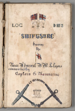
Full Title
(Title Page) Log Of H.M.S. "Swiftsure" Bearing the (flag of) Rear Admiral H.M.L. Lyons commanded by Captain C. Mainwaring. C.F. Henderson.
Publisher
N.P: Manuscript
Author
[Mainwaring, C., Henderson, C.F.]
Full Title
(Text Page) H.M.S. Swiftsure from Honolulu to Esquimalt, Thursday July 10-11, 1884.
Publisher
N.P: Manuscript
Author
[Mainwaring, C., Henderson, C.F.]
Full Title
(Text Page) H.M.S. Swiftsure, Honolulu to Esquimalt, Jul 12-16, 1884.
Publisher
N.P: Manuscript
Author
[Mainwaring, C., Henderson, C.F.]
Full Title
(Text Page) H.M.S. Swiftsure Moored off Esquimalt, Jul 17-20, 1884.
Publisher
N.P: Manuscript
Author
[Mainwaring, C., Henderson, C.F.]
Full Title
(View) HMS Swiftsure, plans of holds.
Publisher
N.P: Manuscript
Author
[Mainwaring, C., Henderson, C.F.]
Full Title
(Text Page) H.M.S. Swiftsure, ... Jul 21-24, 1884 to Esquimalt.
Publisher
N.P: Manuscript
Author
[Mainwaring, C., Henderson, C.F.]
Full Title
(Text Page) H.M.S. Swiftsure, Moored off Esquimalt, Jul 25-28, 1884.
Publisher
N.P: Manuscript
Author
[Mainwaring, C., Henderson, C.F.]
Full Title
(View) HMS Swiftsure profile.
Publisher
N.P: Manuscript
Author
[Mainwaring, C., Henderson, C.F.]
Full Title
(Text Page) H.M.S. Swiftsure, Moored off Esquimalt, Jul 29 - Aug 1, 1884
Publisher
N.P: Manuscript
Author
[Mainwaring, C., Henderson, C.F.]
Full Title
(Text Page) H.M.S. Swiftsure, Moored off Esquimalt, Aug 2-9, 1884.
Publisher
N.P: Manuscript
Author
[Mainwaring, C., Henderson, C.F.]
Full Title
(Text Page) H.M.S. Swiftsure, Constance Cove, Esquimalt, Aug 10-13, 1884. Daily Register of Barometer for August 1884.
Publisher
N.P: Manuscript
Author
[Mainwaring, C., Henderson, C.F.]
Full Title
(Text Page) H.M.S. Swiftsure, Constance Cove, Esquimalt, Aug 14-17, 1884.
Publisher
N.P: Manuscript
Author
[Mainwaring, C., Henderson, C.F.]
Full Title
(Text Page) H.M.S. Swiftsure, Constance Cove, Esquimalt, Aug 18-21, 1884.
Publisher
N.P: Manuscript
Author
[Mainwaring, C., Henderson, C.F.]
Full Title
HMS Swiftsure. Esquimalt to Burrard Inlet.
Publisher
N.P: Manuscript
Author
[Mainwaring, C., Henderson, C.F.]
Full Title
(Text Page) H.M.S. Swiftsure, Constance Cove, Esquimalt, Aug 22-25, 1884.
Publisher
N.P: Manuscript
Author
[Mainwaring, C., Henderson, C.F.]
Full Title
(Text Page) H.M.S. Swiftsure, Esquimalt to English Bay, BC, Aug 26-28, 1884.
Publisher
N.P: Manuscript
Author
[Mainwaring, C., Henderson, C.F.]
Full Title
Burrand Inlet.
Publisher
N.P: Manuscript
Author
[Mainwaring, C., Henderson, C.F.]
Full Title
(Text Page) H.M.S. Swiftsure, Constance Cove, Esquimalt, Aug 29-31, 1884.
Publisher
N.P: Manuscript
Author
[Mainwaring, C., Henderson, C.F.]
Full Title
(Text Page) H.M.S. Swiftsure, Moored in Constance Cove, Sep 1-8, 1884.
Publisher
N.P: Manuscript
Author
[Mainwaring, C., Henderson, C.F.]
Full Title
(Text Page) H.M.S. Swiftsure, Moored off Esquimalt, Sep 9-16, 1884.
Publisher
N.P: Manuscript
Author
[Mainwaring, C., Henderson, C.F.]
Full Title
(Text Page) H.M.S. Swiftsure, Moored off Esquimalt, Sep 17-20, 1884. Daily Register of Barometer for September 1884.
Publisher
N.P: Manuscript
|