Who What Where WhenREMOVE |
Author
[Spain, Dirección de Hydrographia, Bauza, Felipe]
Full Title
Carta Esferica Que Comprehende La Costa Ocidental de America Desde Sieto Grados De Latitude Sur Hasta Nueve Grados De Latitude Norte. Levantada De Orden Del Rey N.S. En 1791. Por varios Oficiales De Su Real Armada. Presentada A S.M. Por Mano Del Exmo. Senor Don Antonio Cornel Secretario de Estado y del Despacho Universal de Guerra, encargado del de Marina y de la Direccion general de la Real Armada ... Año de 1800. Felipe Bauzá lo delinió. Fernando Selma la grabó.
Publisher
Direccion de Hydrographia
Author
[Spain, Dirección de Hydrographia, Bauza, Felipe, Mexico Republica]
Full Title
Carta Esferica de las Costas Y Golfo De Californias Llamado Mar De Cortes que Comprende desde et Cabo Corrientes hasta el Puerto de S. Diego Constuida Por les oficiales de la Marina Espanola, y publicado por orn del Exmo Sr. D. Guadalupe Victoria Primer Presidente de la Republica Mexico Ano de 1825. (with 3 inset chart maps).
Publisher
Republica Mexico
Author
U.S. Coast Survey
Full Title
U.S. Coast Survey A.D. Bache, Superintendent Reconnaissance Of The Western Coast Of The United States, Middle Sheet, From San Francisco To Umpquah River. By the Hydrographic Party under the command of Lieut. James Alden U.S.N. Assist. Geographical Positions by G. Davidson Assistant. 1854. Corrected to 1869. Drawn by W.B. McMurtrie; Reduction for engraving by A. Lindenkohl. Engd. by G. McCoy, J. Knight, J.L Hazzard & G.B. Metzeroth. No. 602. Electrotype Copy No. 6 by G. Mathiot U.S.C.S.
Publisher
U.S. Coast Survey
Author
U.S. Coast Survey
Full Title
Tomales Bay California. From a Trigonometrical Survey under the direction of A.D. Bache Superintendent of the Survey Of The Coast Of The United States. Triangulation by G.A. Fairfield and G. Davidson Assts. Coast Survey. Topography by A.F. Rodgers Asst. and J.S. Lawson Sub-Asst. Hydrography by the Party under the command of J. Alden and B.F. Sands Comdrs. U.S.N. Asst. Coast Survey ... Issued in May 1878 C.P. Patterson Superintendent. Verified J.E. Hilgard ... (Tomales Bay) U.S.C. & G.S. No. 5618 Price 25 Cents. Plate No. 1152. Electrotype Copy No. 2 by G. Mathiot U.S.C.S.
Publisher
U.S. Coast Survey
Author
U.S. Coast Survey
Full Title
U.S. Coast Survey A.D. Bache, Superintendent Reconnaissance Of The Western Coast Of The United States From Gray's Harbor To The Entrance of Admiralty Inlet. By the Hydrographic Party under the command of Lieut. James Alden U.S.N. Asst. 1853. Verified H.W. Benham, Capt. of Engrs. Asst. in charge of Office. Redd. Drng. by E. Hergesheimer. Engg. by G. McCoy, E.F. Woodward & W. Smith. Electrotype Copy No. 3 by G. Mathiot U.S.C.S.
Publisher
U.S. Coast Survey
Author
U.S. Coast Survey
Full Title
Bodega Bay, California. From a Trigonometrical Survey under the direction of A.D. Bache Superintendent of the Survey Of The Coast Of The United States. Triangulation by G.A. Fairfield and G. Davidson Assists. Topography by A.F. Rodgers Assist. Hydrography by the party under the command of Comdr. B.F. Sands U.S.N. Asst. (Polyconic Projection). (Date of first publication 1864). U.S. Coast Survey Office. Price 20 Cents. Verified J.E. Hilgard ... Redd. Drng. by F. Fairfax and W.B. McMurtrie. Edgd. by W.A. Thompson and E.H. Sipe. (Bodega Bay) U.S.C. & G.S. 5627.
Publisher
U.S. Coast Survey
Author
U.S. Coast Survey
Full Title
Georgia Strait And Strait Of Juan De Fuca, Washington ... Published Oct. 1898, H.S. Pritchett, Superintendent. Verified: O.H. Tittmann, Assistant in charge of the Office. Gershom Bradford, Assist. and Hydrographic Inspector. United States Coast And Geodetic Survey. Treasury Department ... Corrections from Corps of Engineers, U.S.A., to 1900 ... Electrotype Copy No. 1 U.S.C. & G.S. 6300.
Publisher
U.S. Coast Survey
Author
Kearney, James
Full Title
Pensacola Harbor and Bar. Florida. Surveyed in 1822 By Major James Kearney, Topo. Engineer, assisted by Lieuts. Thompson, Turnbull and Butler, 4th Artillery. Drawn by Lieut. Turnbull. W.J. Stone Sc. Wash.
Publisher
U.S.
Author
U.S. Coast Survey
Full Title
San Francisco Entrance, California. Published at Washington, D.C., January, 1907, By The U.S. Coast And Geodetic Survey. O.H. Tittmann, Superintendent. (Date of first publication 1903) ... Corrections from survey by the Corps of Engineers, U.S.A. to October, 1906. United States Of America Department Of Commerce And Labor ... C. & G.S. 5532.
Publisher
U.S. Coast Survey
Author
U.S. Coast Survey
Full Title
San Francisco Entrance, California. Published at Washington, D.C., September, 1903, By The U.S. Coast And Geodetic Survey. O.H. Tittmann, Superintendent ... Corrections from survey by Corps of Engineers U.S.A. to December, 1903. United States Of America Department Of Commerce And Labor ... Andrew B. Graham Co., Lithographers, Washington, D.C. C. & G.S. 5532.
Publisher
U.S. Coast Survey
Author
British Admiralty Hydrographic Office
Full Title
North America - East Coast Approaches To New York From The United States Chart, Published In 1874. Corrected 1877 ... London. Published at the Admiralty, 23rd Octr. 1877; under the Superintendence of Captain F.J. Evans ... Sold by J.D. Potter, Agent for the sale of the Admiralty Charts, 31 Poultry & 11 King Street, Tower Hill. Engraved by Davies & Company. Small corrections ... I.85.
Publisher
British Admiralty Hydrographic Office
Author
U.S. Coast Survey
Full Title
U.S. Coast Survey A.D. Bache Supdt. Preliminary Survey Of The Entrance To Umquah River, Oregon. Geographical position determined by G. Davidson Assist. Hydrography by the Party under the command of Lieut. J. Alden U.S.N. Assist. 1854. U.S. Coast Survey Office. Price 20 Cents. Verified H.W. Benham ... Redd. Drng. by R.S. Lanckoronski. Engd. by J.L. Hazzard and J.J. Knight. Electrotype Copy No. 1 by G. Mathiot U.S.C.S.
Publisher
U.S. Coast Survey
Author
U.S. Coast Survey
Full Title
U.S. Coast Survey A.D. Bache Supdt. Reconnaissance of Bellingham Bay, Washington Ter. By the Hydrographic party under the command of Lieut. Comdg. J. Alden U.S.N. Asst. 1856. U.S. Coast Survey Office. Price 15 Cents. Verified A.P. Hill ... Redd. Drng. by F. Stout. Engd. by J.J. Knight & App. R.F. Bartle.
Publisher
U.S. Coast Survey
Author
U.S. Coast Survey
Full Title
Port Townshend, Washington Ter. From a Trigonometrical Survey under the direction of A.D. Bache Superintendent of the Survey Of The Coast Of The United States. Triangulation by G. Davidson Asst. Topography by J.S. Lawson Sub Asst. Hydrography by the party under the command of Comdr. James Alden U.S.N. Asst. 1858. U.S. Coast Survey Office. Verified W.R. Palmer ... No. 36. Redd. Drng. by F. Fairfax. Engd. by R.F. Bartle and W. Langran.
Publisher
U.S. Coast Survey
Author
U.S. Coast Survey
Full Title
U.S. Coast Survey A.D. Bache Supdt. Preliminary Survey Of Port Ludlow, Washington Ter. Triangulation by G. Davidson Assistant. Topography by J.S. Lawson Sub-Asst. Hydrography by the Party under the command of Lieut. Comdg. James Alden U.S.N. Asst. 1856. Redd. Drng. by A. Lindenkohl. Engd. by A. Sengteller & W. Ogilvie.
Publisher
U.S. Coast Survey
Author
U.S. Coast Survey
Full Title
U.S. Coast Survey A.D. Bache Supdt. Reconnaissance of Semi-Ah-Moo Bay, Washington Ter. By The Hydrographic Party under the command of Lieut. Comdg. R.M. Cuyler U.S.N. Asst. 1858. U.S. Coast Survey Office. Price 15 Cents. Verified W.R. Palmer ... Redd. Drng. by F. Fairfax. Engd. by A. Petersen and R.F. Bartle. Electrotype Copy No. 1 by G. Mathiot U.S.C.S.
Publisher
U.S. Coast Survey
Author
U.S. Coast Survey
Full Title
Preliminary Chart Of Entrance To Koos Bay, Oregon. From a Trigonometrical Survey under the direction of A.D. Bache Superintendent of the Survey Of The Coast Of The United States. Triangulation, Topography and Hydrography by Jas. S. Lawson Assist. Coast Survey. 1862. U.S. Coast Survey Office. Verified J.E. Hilgard ... No. 43. Redd. Drng. by H. Lindenkohl & F. Fairfax. Engd. by H.C. Evans & C.T. Klakring.
Publisher
U.S. Coast Survey
Author
U.S. Coast Survey
Full Title
U.S. Coast Survey A.D. Bache Supdt. Cape Flattery And Nee-Ah Harbor, Washington. Topography by G. Davidson Assistant U.S.C.S. Hydrography by the Party under the command of Lieut. James Alden U.S.N. Asst. 1853. U.S. Coast Survey Office. Price 15 Cents. Verified H.W. Benham ... Redd. Drng. by J. Lambert. Engd. by S. Siebert & J. Young. Electrotype Copy No. 1 by G. Mathiot U.S.C.S.
Publisher
U.S. Coast Survey
Author
U.S. Coast Survey
Full Title
U.S. Coast Survey A.D. Bache Supdt. Reconnaissance of Blakely Harbor, Washington Ter. By the Hydrographic party under the command of Lieut. Comdg. J. Alden U.S.N. Asst. 1856. U.S. Coast Survey Office. Price 15 Cents. Verified A.P. Hill ... Drawn by G. Farquhar. Engd. by J.J. Knight.
Publisher
U.S. Coast Survey
Author
U.S. Coast Survey
Full Title
U.S. Coast Survey A.D. Bache Supdt. Reconnaissance of Olympia Harbor, Washington Ter. By the Hydrographic Party under the command of Lieut. Comdg. J. Alden U.S.N. Asst. 1856. No. 56. Redd. Drng. by F. Fairfax. Engd. by S.W. Bradley & App. F.W. Benner.
Publisher
U.S. Coast Survey
Author
U.S. Coast Survey
Full Title
U.S. Coast Survey A.D. Bache Supdt. Reconnaissance of False Dungeness Harbor, Washington. By the Hydrographic Party under the command of Lieut. James Alden U.S.N. Asst. 1853. No. 53. Redd. Drng. by J.R. Key. Engd. by W. Smith & App. J.S. Pettit. (with) U.S. Coast Survey A.D. Bache Supdt. Reconnaissance of New Dungeness Harbor, Washington. Topography by J.S. Lawson Sub-Assist. Hydrography by the party under the command of Lieut. Comdg. J. Alden U.S.N. Assistant. 1856. Redd. Drng. by W.P. Schultz. Engd. by S.W. Bradly & App. W.A. Thompson.
Publisher
U.S. Coast Survey
Author
U.S. Coast Survey
Full Title
(J No. 3) U.S. Coast Survey A.D. Bache Supdt. Reconnaissance Of Smith's Or Blunt's Island, Washington. By the Hydrographic Party under the command of Lieut. James Alden U.S.N. Asst. 1854. No. 43. Redd. Drng. by W.T. Martin. Engd. by C.A. Knight & App. R.F. Bartle.
Publisher
U.S. Coast Survey
Author
United States Coast Survey
Full Title
Map of New-York Bay And Harbor And The Environs. Founded upon a Trigonometrical Survey under the direction of F.R. Hassler Superintendent of the Survey Of The Coast Of The United States. Triangulation by James Ferguson and Edmund Blunt Assistants. The Hydrology ... Thomas R. Gedney ... Topography by C. Renard and T.A. Jenkins ... Published in 1844. Presented to The University of Vermont ... A.D. Bache Superintendent, Coast Survey.
Publisher
U.S.
Author
United States Coast Survey
Full Title
U.S. Coast Survey A.D. Bache, Superintendent, City Of San Francisco And Its Vicinity California. From a Trigonometrical Survey by R.D. Cutts, Assistant. Topography by A.F. Rodgers Sub-assistant. Hydrography by the Party under the command of Lieut. James Alden U.S.N. Asst. 1853. U.S. Coast Survey Office. Price 50 Cents. Verified I.I. Stevens ... No. 627. Outlines and Topography engraved by Max. F.O. Strobel; Lettering by E.F. Woodward.
Publisher
U.S. Coast Survey
Author
United States Coast Survey
Full Title
Boston Harbor, Massachusetts. From a Trigonometrical Survey under the direction of A.D. Bache Superintendent of the Survey Of The Coast Of The United States. Triangulation by A.D. Bache Supdt. and C.O. Boutelle Assistant. Topography by J.B. Gluck, H.L. Whiting, J.S. Williams Assists. & S.A. Gilbert Sub-Asst. Hydrography by the Party under the command of C.H. Davis Lieut. U.S. Navy Assistant. Published in 1857. U.S. Coast Survey Office. Price one dollar. Verified M.L. Smith ... Redd. Drng. by J. Welch, J. Robertson & C. Mahon. Engd. by A. Rolle, J. Knight & G. McCoy. Electrotype Copy No. 7 by G. Mathiot U.S.C.S.
Publisher
U.S. Coast Survey
Author
United States Coast Survey
Full Title
U.S. Coast Survey A.D. Bache, Superintendent. City Of San Francisco And Its Vicinity California. Topography by A.F. Rodgers, Sub-assistant. Hydrography by the Party under the command of Lieut. R.M. Cuyler N.S.N. Assistant. Published in 1859. U.S. Coast Survey Office. Price 40 cents. Verified W.R. Palmer Capt. Topl. Engrs. Asst. C.S. In charge of Office. Lith. of J. Bien 60 Fulton St. N.Y.
Publisher
U.S. Coast Survey
Author
United States Coast Survey
Full Title
Coast Chart No. 20 New York Bay And Harbor, New York. From a Trigonometric Survey under the direction of A.D. Bache Superintendent of the Survey Of The Coast Of The United States ... Published in 1866. Verified J.E. Hilgard Assist. Coast Survey In charge of Office. Electrotype Copy No. 3 by G. Mathiot U.S.C.S. Redd. Drng. by E. Hergesheimer, M.H. McClery and A. Balbach. Engd. by J. Enthoffer, J. Knight, H.S. Barnard and J.C. Kondrup.
Publisher
U.S.
Author
[Hood, Washington, Graham, Maj. J.D.]
Full Title
A Map Of The Extremity Of Cape Cod Including the Townships of Provincetown & Truro: A Chart Of Their Sea Coast And Of Cape Cod Harbour, State of Massachusetts. Executed under the direction of Major J.D. Graham U.S. Top. Engs. During portions of the years 1833,'34, &'35 ... W.J. Stone Sc. Wash. Surveyed And Projected By J.D. Graham ... Drawn From The Original Projects And Notes, By J.E. Johnston ... A.A. Humphreys .... J.. Macomb ... W.R. Palmer ... Reduced from the original in the Bureau of U.S. Topographical Engineers, Washington, by Wash: Hood 1836.
Publisher
U.S.
Author
[Hood, Washington, Graham, Maj. J.D.]
Full Title
(Composite of) A Map Of The Extremity Of Cape Cod Including the Townships of Provincetown & Truro: A Chart Of Their Sea Coast And Of Cape Cod Harbour, State of Massachusetts. Executed under the direction of Major J.D. Graham U.S. Top. Engs. During portions of the years 1833,'34, &'35 ... W.J. Stone Sc. Wash. Surveyed And Projected By J.D. Graham ... Drawn From The Original Projects And Notes, By J.E. Johnston ... A.A. Humphreys .... J.. Macomb ... W.R. Palmer ... Reduced from the original in the Bureau of U.S. Topographical Engineers, Washington, by Wash: Hood 1836.
Publisher
U.S.
Author
[Mexico Republica, (Espinosa y Tello, J.)]
Full Title
Carta General Para Las Navegaciones a la India Oriental Por El Mar Del Sur Y el grande Oceano que Separa el Continente Americano del Asiatico, Construida Segun las derrotas, Observaciones y trabajos de los mas Celebres Naveganles Espanoles Y Publicada por Orden del Exmo Sr. D. Guadalupe Victoria Primer Presidente de la Republica Mexico Ano de 1825. Los numberos de la Sonda son braxas de 6 pics de Burgos. (inset map on sheet 2) Plano Geometrico del Embocadero De S. Bernadino ano 1792. (inset map) Parte De La Isla De Samar.
Publisher
Republica Mexico
Author
[Mexico Republica, (Espinosa y Tello, J.)]
Full Title
(Composite of) Carta General Para Las Navegaciones a la India Oriental Por El Mar Del Sur Y el grande Oceano que Separa el Continente Americano del Asiatico, Construida Segun las derrotas, Observaciones y trabajos de los mas Celebres Naveganles Espanoles Y Publicada por Orden del Exmo Sr. D. Guadalupe Victoria Primer Presidente de la Republica Mexico Ano de 1825. Los numberos de la Sonda son braxas de 6 pics de Burgos. (inset map on sheet 2) Plano Geometrico del Embocadero De S. Bernadino ano 1792. (inset map) Parte De La Isla De Samar.
Publisher
Republica Mexico
Author
[Arnold, T. J. (Thomas Jefferson), d. 1878, California. Board of State Harbor Commissioners for San Francisco Harbor]
Full Title
Map exhibiting the salt marsh, tide and submerged lands disposed of by the State of California in and adjacent to the bays of San Francisco and San Pablo and now subject to reclamation. Prepared from maps of the U.S. Coast Survey & official records by order of the Board of State Harbor Commissioners for the United States Commissioners on San Francisco Harbor. By T.J. Arnold, engineer of the sea wall. 1874. U.S. Commissioners Rear Admiral John Rodgers, Major G.H. Mendell, Prof. George Davidson. State Harbor Commissioners Samuel Soule, T.D. Mathewson, D.C. McRuer. Britton Rey & Co. Lith. S.F.
Publisher
Britton & Rey
Author
Cary, John, ca. 1754-1835
Full Title
Chart of the world upon Mercator's projection drawn from the most recent geographical materials exhibiting the whole of the new discoveries with the tracks of the principal navigators accurately adjusted from the most exact astronomical observations. London; published By John Cary, No. 181 Strand June 1819.
Publisher
John Cary
Author
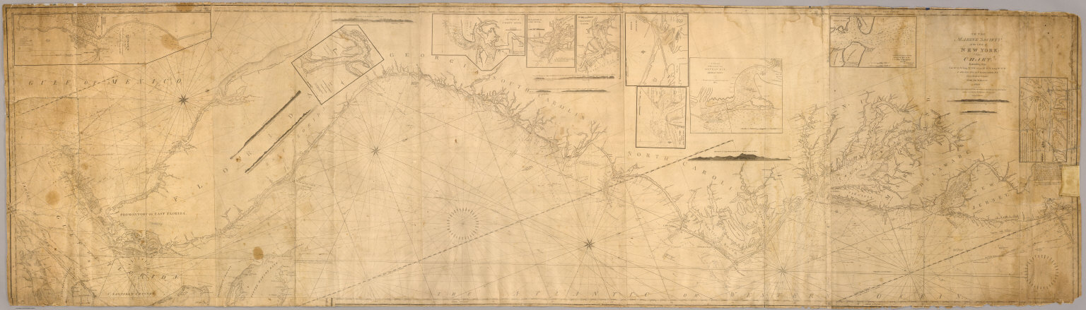
[Blunt, Edmund M. (Edmund March), 1770-1862, Hooker, William]
Full Title
To the Marine Society of the city of New York; this chart, extending from lat. 40¦15' N. long: 72¦15' W. to Lat. 22¦35" N. long: 80¦25' W. is respectfully dedicated, by their obedient servant, Edmund M. Blunt, 1820 ... Plans engraved by Hooker, N. York.
Publisher
Wm. Hooker.
Author
Dessiou, J. Foss
Full Title
A General Chart of the West Indies And Gulf Of Mexico, describing The Gulf and Windward Passages, Coast Of Florida, Louisiana And Mexico, Bay of Honduras and Musquito Shore; likewise the Coast Of The Spanish Main To The Mouths Of The Orinoco. Drawn from the Surveys taken by Mr. Geo. Gauld, and others, the New Spanish Charts, &c. and adjusted from recent Observations, By J. Foss Dessiou, Master of the Royal Navy. Approved by the Chart Committee of the Admiralty. London, Published by W. Faden ... Charing Cross, June 4, 1808. Engraved by J. Tyrer, Chapel St. Pentonville. (inset) Chart Of The Virgin Islands. (inset) Chart Of The Coast Of Biruquete, Panama & Veragua, From Point Solano To Point Burica.
Publisher
William Faden
Author
Berghaus, Henry
Full Title
To His Royal Highness William Adalbert Prince of Prussia, This Chart of the Approaches of Rio de Janeiro, constructed chiefly from observation, made on board of Ships of the Royal Prussian Mercantile Navy, also from Original Journals of some Hanseatic Navigators ... Henry Berghaus. (inset) Plan of the Bay of Rio de Janeiro. (inset) Port of Cape Frio by Lieut. H. Kellett R.B.N. 1831.
Publisher
School (Royal Society) of Geographical Art
Author
Imray, James and Son
Full Title
Coast of Labrador From the Strait of Belle Isle to Port Manvers...Corrected to 1891.
Publisher
James Imray and Son.
Author
[Blaskowitz, Charles, Faden, William, 1750?-1836]
Full Title
A Topographical Chart of the Bay of Narraganset in the Province of New England, with all the Isles contained therein, among which Rhode Island and Connonicut have been particularly Surveyed, Shewing the true position & bearings of the Banks, Shoals, Rocks &c. as likewise the Soundings: To which have been added the several Works & Batteries raised by the Americans. Taken by Order of the Principal Farmers on Rhode Island, By Charles Blaskowitz. Engraved & Printed for Wm. Faden, Charing Cross, as the Act directs, July 22d 1777. To the Right Honourable Hugh Earl Percy, Baron Percy, Lucy, Poinings, Fitz-Paine, Bryan & Latimer, Lieutenant General of His Majesty's Forces in Great Britain and America. This Plan is ... most humbly Inscribed, by ... Wm. Faden. (in manuscript) Hinck S.
Publisher
William Faden
Author
[Green, John, d d. 1757, Jefferys, Thomas]
Full Title
A chart of North and South America including the Atlantic and Pacific Oceans, with the nearest coasts of Europe, Africa and Asia (by John Green]. Publish'd according to Act of Parliament Feb. 19, 1753, by T. Jefferys, Geographer to his Royal Highness the Prince of Wales at the Corner of St. Martins Lane Charing Cross ...
Publisher
Thomas Jefferys
Author
Mackay, William
Full Title
Belcher's map of the Province of Nova Scotia, including the Island of Cape Breton, compiled from actual & recent surveys, & under the authority of the Provincial Legislature, by William Mackay, draughtsman. July 10, 1834. Second edition, corrected to 1855. Engraved by James Neele & Co., 3 Burleigh St., Strand. Published & sold by John Snow, 35 Patternoster Row, London; and C.H. Belcher, Halifax, Nova Scotia.
Publisher
[C.H. Belcher, John Snow]
Author
Blunt, E. & G.W.
Full Title
Chart Of The South Atlantic Ocean, From the Equator to 65º South Latitude According to the Latest Surveys & Observations. New York, Published by E. & G.W. Blunt, 154 Water St. Corner of Maiden Lane. 1834. Entered ... 1834 By Edmund & George W. Blunt ... New York. Engraved by W. Hooker. (with) seven inset maps listed in Notes.
Publisher
E. & G.W. Blunt
Author
Norie, J.W.
Full Title
A New Chart of The Pacific Ocean, Exhibiting The Western Coast of America, From Cape Horn To Beerings Strait, The Eastern Shores of Asia Including Japan, China and Australia, and all the numerous Islands and known Dangers Situated in Polynesia and Australasia, Correctly Drawn And Regulated according to the most Approved and Modern Surveys and Astronomical Observations By J.W. Norie, Hydrographer, &c.&c. Additions 1836. Stephenson, Engraver. London. Published ... October 1st 1825, by J.W. Norie & Co. (with) seven inset maps listed in Notes. (Northern Sheet)
Publisher
J.W. Norie & Co.
Author
Norie, J.W.
Full Title
A New Chart of The Pacific Ocean, Exhibiting The Western Coast of America, From Cape Horn To Beerings Strait, The Eastern Shores of Asia Including Japan, China and Australia, and all the numerous Islands and known Dangers Situated in Polynesia and Australasia, Correctly Drawn And Regulated according to the most Approved and Modern Surveys and Astronomical Observations By J.W. Norie, Hydrographer, &c.&c. Additions 1836. Stephenson, Engraver. London. Published ... October 1st 1825, by J.W. Norie & Co. (with) seven inset maps listed in Notes. (Southern Sheet)
Publisher
J.W. Norie & Co.
Author
Norie, J.W.
Full Title
(Composite of) A New Chart of The Pacific Ocean, Exhibiting The Western Coast of America, From Cape Horn To Beerings Strait, The Eastern Shores of Asia Including Japan, China and Australia, and all the numerous Islands and known Dangers Situated in Polynesia and Australasia, Correctly Drawn And Regulated according to the most Approved and Modern Surveys and Astronomical Observations By J.W. Norie, Hydrographer, &c.&c. Additions 1836. Stephenson, Engraver. London. Published ... October 1st 1825, by J.W. Norie & Co. (with) seven inset maps listed in Notes. (Northern and Southern Sheets)
Publisher
J.W. Norie & Co.
Author
[Wilkes, Charles, United States Exploring Expedition]
Full Title
Harbours in Admiralty Inlet, Oregon Territory by the U.S.Ex.Ex. 1841.
Publisher
C. Sherman
Author
[Wilkes, Charles, United States Exploring Expedition]
Full Title
Apolima, Samoan Group. Harbour of Oafonu (Afono), Isld. of Tutuila, North Side. Harbour of Aur, Isld. of Tutuila, North Side by U.S.Ex.Ex. 1839. Harbour of Fungasar, North Side, Island of Tutuila by the Ex.Ex. 1839.
Publisher
C. Sherman
|