|
Author
[Kartographia Winterthur, Conférence suisse des directeurs cantonaux de l'instruction publique]
Full Title
(Covers to) Atlas Scolaire Suisse pour l'Enseignement Secondaire. Publ. par la Conférence des Chefs des Départements Cant. de l'instruction publ. et Subventionné par la Confédération. 2me edition. Executé par l'Institut, Kartographia Winterthur S.A. 1921. Librairie Payot & Cie. Lausanne Geneve, 1, Rue de Bourg Pl. du Molard, 2.
Publisher
Librairie Payot
Author
Andriveau-Goujon, J.
Full Title
(Covers to) Atlas classique et universel de geographie ancienne et moderne, contenant les decouvertes et les divisions les plus nouvelles dans les cinq parties du monde pour servir a la lecture des voyages, des ouvrages historiques et des meilleurs traites de geographie. Publie par J. Andriveau-Goujon. Adopte par le Ministre de la Guerre pour les bibliotheques regimentaires. Nouvelle edition. A Paris, Chez l'Editeur, Rue du Bac, no. 21, pres le Pont Royal. 1850.
Publisher
J. Andriveau-Goujon
Author
Dussieux, L.
Full Title
(Covers to) Atlas General De Geographie Physique, Politique Et Historique Par L. Dussieux ... J.L. & C. Paris Jacques Lecoffre Et Comp., Libraires, Rue Du Vieux-Colombier, 29. (on opposite page) Paris. - Impremerie Simon Racon Et Comp., Rue D'Erfurth, 1.
Publisher
Jacques Lecoffre et Comp.
Author
Mitchell, Samuel Augustus
Full Title
(Covers to) A New Universal Atlas Containing Maps of the various Empires, Kingdoms, States and Republics Of The World. With a special map of each of the United States, Plans of Cities &c. Comprehended in seventy sheets and forming a series of One Hundred And Seventeen Maps, Plans And Sections ... Philadelphia, Published By S. Augustus Mitchell, N.E. corner of Market & 7th Streets. 1846. Entered ... 1846, by H.N. Burroughs ... Pennsylvania. (title page by) J. Knight Sc.
Publisher
S.A. Mitchell
Author
Lucas, Fielding Jr.
Full Title
(Covers to) A General Atlas Containing Distinct Maps Of all the Known Countries in the World, Constructed from the Latest Authority. Written and Engraved by Jos. Perkins, Philadelphia. Baltimore: Published by Fielding Lucas, Jun. No. 138, Market Street. Baltimore. Entered ... by F. Lucas Jr. of the State of Maryland June 3, 1823.
Publisher
Fielding Lucas Jr.
Author
Walker, J. & C.
Full Title
(Covers to) To Her Most Gracious Majesty Queen Victoria, This Map Of The World On Mercator's Projection, Is Most Respectfully Dedicated, By Her devoted Subjects, J. & C. Walker. Published by J. & C. Walker, No. 9 Castle Street Holborn. 1840. Published For The Proprietors, By J. And C. Walker, 9, Castle Street. (inset) The North Pole And The Adjacent Lands. (inset) The South Pole And The Lands Adjacent.
Publisher
Walker, J. & C.
Author
Monin, C.V.
Full Title
(Covers to) Atlas Classique De La Geographie Ancienne, Du Moyen Age Et Moderne, A l'Usage des Colleges et des Pensions, Pour Servir A L'Etude De La Geographie Et De L'Histoire, Par V. Monin, Ingenieur-Geographe, Membre De La Societe De Geographie. Nouvelle Edition, Augmentee D'Un Tableau Comparatif De La Hauteur Des Montagnes Et Du Cours Des Fleuves. Annee Scolaire 1838 Et 1839. Librairie Classique De Perisse Freres. Paris, Rue Du Pot - De - Fer - Saint - Sulpice, 8. Lyon, Grande Rue Merciere, 33. (on verso) ... Paris. - Impremerie De Decourchant, Rue D'Erfurth, 1.
Publisher
Librairie Classique
Author
[Dower, John Nicaragua, Teesdale, Henry]
Full Title
(Covers to) A New Chart of the World On Mercator's Projection With The Tracks Of The Most Celebrated & Recent Navigators. Engraved by John Dower, Pentonville. Published By Henry Teesdale & Co. 2, Brunswick Row, Queens Square, London 1844.
Publisher
Henry Teesdale & Co.
Author
Townsend, Dennis
Full Title
(Covers to) Townsend's Patent Folding Globe ... Publishers: George M. Smith & Co., 129 Washington Street, Boston, Mass. Dennis Townsend, Felchville, Windsor County Vt. Edward E. Rice & Co., Steam Job Printers, 5 Hawley Street, Boston, Mass. (On the cover of the folder holding the collapsed globe; on the globe itself: "Patented by Dennis Townsend Feb. 16, 1869").
Publisher
[Dennis Townsend, George M. Smith]
Author
Melish, John
Full Title
(Covers to) Melish's Universal School Atlas. Philadelphia, Published 1816. Improved to 1820. S. Harrison, Sc.
Publisher
John Melish
Author
Mitchell, Samuel Augustus
Full Title
(Covers to) Mitchell's School Atlas. Philadelphia: Thomas, Cowperthwait & Company. MDCCCXXXIX. Entered ... 1839, by S. Augustus Mitchell ... Connecticut.
Publisher
Thomas, Cowperthwait & Co.
Author
Smiley, Thomas T.
Full Title
(Covers to) Smiley's Atlas, For The Use Of Schools And Families. A New Atlas, Intended To Illustrate The Encyclopedia Of Geography. (On The Plan Of Murray's Encyclopedia Of Geography.) ... Exhibiting The Natural And Political Divisions Of The Different Countries On The Globe. By Thos. T. Smiley, A.M., M.D. Philadelphia. Hogan & Thompson. (1842?), 1839 ... Entered ... 1838, by Thos. T. Smiley ... Pennsylvania.
Publisher
Hogan & Thompson
Author
Mitchell, Samuel Augustus
Full Title
(Covers to) Mitchell's Atlas Of Outline Maps, Intended To Be Filled Up By Pupils Studying Mitchell's School Geography And Atlas ... Philadelphia: Thomas, Cowperthwait, And Company. MDCCCXXXIX. Entered ... 1839, by S. Augustus Mitchell ... Pennsylvania.
Publisher
Thomas, Cowperthwait & Co.
Author
Anonymous
Full Title
(Covers to) Drawing Teacher. Geography.
Publisher
No Publisher
Author
[Fremin, A.R., Gaultier, J., Logerot]
Full Title
(Covers to) Atlas Geographique.
Publisher
Mon. Logerot
Author
Global Map Company
Full Title
(Covers to) The Global Map. Pat. No. D136173, Other Patents Pending. The Global Map Co. Minneapolis, Minn. Copyright By The H.M. Gousha Company, Chicago, Ill. Lithographed In U.S.A.
Publisher
The Global Map Company
Author
Tanner, Henry S.
Full Title
(Covers to) A New American Atlas Containing Maps Of The Several States of the North American Union, Projected and drawn on a Uniform Scale from Documents found in the public Offices of the United States and State Governments, and other Original and Authentic Information, By Henry S. Tanner ... Philadelphia: Published By H.S. Tanner. 1823. (title page only) Writing Drawn and Engraved by Joseph Perkins. Barralet del. Humphrys sc.
Publisher
Henry Tanner
Author
Berghaus, Heinrich
Full Title
(Covers to Vol. 1) Dr. Heinrich Berghaus' Physikalischer Atlas oder Sammlung von Karten, auf denen die hauptsachlichsten Erscheinungen der anorganischen und organischen Natur nach ihrer geographischen Verbreitung und Vertheilung bildlich dargestellt sind ... 1845. Verlag von Justus Perthes in Gotha ... 1848 ...
Publisher
Justus Perthes
Author
[Bonne, Rigobert, 1727-1794, Lattre, Jean]
Full Title
(Covers to) Atlas moderne ou collection de cartes sur toutes les parties du globe terrestre ar plusieurs auteurs. Avec approbation & privilege du Roy. A Paris, Chez Lattre Graveur Ordinaire du Roy, de Mgr. Le Duc d'Orleans et de la Ville Rue St. Jacques No. 20. et Delalain Libraire, rue de la Comedie Francoise, (1791) (title page only) Monnet del. 1762. Prevost Sculp.
Publisher
Lattre & Delalain
Author
[McInnes, William, Dowling, D.B., Leach, W.W.]
Full Title
(Covers to) The Coal Resources Of The World. Atlas. Edited By William McInnes, B.S., F.R.S.C.; D.B. Dowling, B.A.Sc., F.R.S.C., And W.W. Leach, B.A.Sc.; Of The Geological Survey Of Canada. Morang & Co., Limited, Publishers: Toronto, Canada. (seal) Geologorum Conventus Mente Et Malleo. XII 1913 Canada.
Publisher
Morang & Co.
Author
Polish Army Topography Service
Full Title
(Covers) Pergamon World Atlas. Pergamon Press. Oxford, London, New York, Toronto, Sydney, Paris, Braunschweig, Tokyo. P.W.N. - Poland. Polish Scientific Publishers. Warszawa. 1968.
Publisher
Pergamon Press
Author
Society for the Diffusion of Useful Knowledge (Great Britain)
Full Title
(Covers to) Maps of the Society for the Diffusion of Useful Knowledge. Vol. 1. London: Chapman and Hall, 186, Strand, 1844.
Publisher
Chapman and Hall
Author
Colton, G.W.
Full Title
(Covers to) Colton's General Atlas, Containing One Hundred And Eighty Steel Plate Maps And Plans, On One Hundred And Nineteen Imperial Folio Sheets, Drawn By G. Woolworth Colton. Letter-Press Descriptions, Geographical, Statistical, And Historical, By Richard Swainson Fisher. New York: G.W. & C.B. Colton, No. 172 William Street. 1874. Entered ... 1863, by J.H. Colton ... New York.
Publisher
G. W & C. B. Colton & Co.
Author
[Brue, Adrien Hubert, 1786-1832, Levasseur, E.]
Full Title
(Covers to) Atlas Universel De Geographie Physique, Politique, Ancienne Et Moderne, Contenant Les Cartes Generales Et Particulieres De Toutes Les Parties Du Monde ... Dresse par A. Brue, Geographe. Nouvelle Edition Revue Par E. Levasseur ... Comprenant 66 Cartes Et 85 Cartouches Tenant Lieu D'Autant De Cartes. Intitut Geographique De Paris. Charles Delagrave, Editeur De La Societe De Geographie De Paris, 58, Rue Des Ecoles, 58. 1875 (on opposite) Paris. - J. Claye, Imprimeur, 7, Rue Saint-Benoit. - [1922]
Publisher
Institut Geographique de Paris
Author
[Andriveau-Goujon, J., Soulier, E.]
Full Title
(Covers to) Atlas Elementaire Simplifie De Geographie Ancienne Et Moderne, Par E. Soulier (De Sauve), Professeur, Et J. Andriveau-Goujon. Approuve par le Conseil royal de l'Universite de France ... Paris. Chez Andriveau-Goujon, Geographe-Editeur, Rue Du Bac, 17.
Publisher
Andriveau-Goujon
Author
Hammond, C.S.
Full Title
(Covers to) Hammond's New World Atlas. Containing New and Complete Historical, Economic, Political and Physical Maps of the Entire World in Full Colors with Complete Indexes and the Races of Mankind, Illustrated Gazetteer of the World, Illustrated Gazetteer of the United States and Territories. Garden City Publishing Company, Inc. Garden City, N.Y., U.S.A. 1948.
Publisher
Garden City Publishing Company, Inc.
Author
[Petermann, Augustus., Milner, Thomas]
Full Title
(Covers to) The Atlas Of Physical Geography: Constructed By Augustus Petermann, F.R.G.S. ... With Descriptive Letter-Press, Embracing A General View Of The Physical Phenomena Of The Globe. By The Rev. Thomas Milner, M.A., F.R.G.S. ... Illustrated by One Hundred and Thirty Vignettes on Wood. London: Wm. S. Orr And Co., Amen-Corner, Paternoster-Row. MDCCCL.
Publisher
William S. Orr & Co.
Author
Johnson, A.J.
Full Title
(Covers to) Johnson's New Illustrated (Steel Plate) Family Atlas, With Physical Geography, And With Descriptions Geographical, Statistical, And Historical Including the Latest Federal Census, A Geographical Index, and a Chronological History of the Civil War in America. By Richard Swainson Fisher, M.D. ... Maps Compiled, Drawn, And Engraved Under The Supervision Of J.H. Colton And A.J. Johnson... New York: Johnson And Ward, Successors To Johnson And Browning Who Were (Successors To J.H. Colton And Company,) No. 113 Fulton Street. 1865. Entered ... One Thousand Eight Hundred and Sixty-four, by A.J. Johnson ... New York.
Publisher
Johnson and Ward
Author
Rand McNally and Company
Full Title
(Covers to) Rand, McNally & Co.'s indexed atlas of the world containing large scale maps of every country and civil division upon the face of the globe, together with historical, descriptive, and statistical matter relative to each ... Accompanied by a new and original compilation forming a ready reference index ... Engraved, printed and published by Rand, McNally & Company, Chicago and New York, U.S.A., 1897. (Vol. 1) Foreign countries.
Publisher
Rand McNally
Author
Johnson, A.J.
Full Title
(Covers to) Johnson's New Illustrated Family Atlas Of The World ... With A Treatise On Physical Geography, By Prof. A. Guyot, LL.D., With Descriptions, Geographical, Statistical, And Historical. Revised By Hon. A.R. Spofford, LL.D., Librarian Of Congress. Also Including A Dictionary Of Religious Denominations, Sects, Parties, And Associations, Compiled By Professor Roswell D. Hitchcock, D.D., LL.D. ... New York: Alvin J. Johnson & Co., Publishers, 11 Great Jones Street (Near Broadway). MDCCCLXXXVI. Copyright, 1882, By A.J. Johnson.
Publisher
Alvin J. Johnson & Co.
Author
Rand McNally and Company
Full Title
(Covers to) Rand McNally Commercial Atlas Of America. Fifty-Fifth Edition ... Engraved, Printed, And Published By Rand McNally & Company, Chicago, U.S.A., 1924. (on verso) ... Copyright, 1924, by Rand, McNally & Co. Made In U.S.A.
Publisher
Rand McNally and Company
Author
Anville, Jean Baptiste Bourguignon d, 1697-1782
Full Title
(Covers to) (Atlas general) (Paris : Sr. D'Anville, 1771?)
Publisher
J.B.B. D'Anville.
Author
Finley, Anthony
Full Title
(Covers to) A New General Atlas Comprising a Complete Set of Maps, representing the Grand Divisions Of The Globe, ... Philadelphia: Published by Anthony Finley. 1831. (title page only) Written And Engraved By Jos. Perkins. (with) Atlas Classica; Or Select Maps Of Ancient Geography, Both Sacred and Profane ... Philadelphia: Published by Anthony Finley, At The North-East Corner Of Chestnut And Fourth Streets. Clark & Raser, Printers. 1831.
Publisher
Anthony Finley
Author
Tanner, Henry S.
Full Title
(Covers to) A New Universal Atlas Containing Maps of the various Empires, Kingdoms, States and Republics Of The World. With a special map of each of the United States, Plans of Cities &c. Comprehended in seventy sheets and forming a series of One Hundred And Seventeen Maps, Plans And Sections, By H.S. Tanner ... Philadelphia, Published By The Author. 1836. (title page by) J. Knight Sc.
Publisher
H.S. Tanner
Author
Carey, Mathew
Full Title
(Covers to) Carey's General Atlas, Improved And Enlarged; Being A Collection Of Maps Of The World And Quarters, Their Principal Empires, Kingdoms, &c. ... Philadelphia: Published By M. Carey. 1814. T.S. Manning, Printer, N.W. Corner of Sixth & Chestnut Streets.
Publisher
Mathew Carey
Author
Quin, Edward
Full Title
(Covers to) An Historical Atlas; In A Series Of Maps Of The World As Known At Different Periods; Constructed Upon An Uniform Scale, And Coloured According To The Political Changes Of Each Period: Accompanied By A Narrative Of The Leading Events Exhibited In The Maps: Forming Together A General View Of Universal History, From The Creation To A.D. 1828. By Edward Quin, M.A. ... The Maps Engraved By Sidney Hall. Printed For R.B. Seeley And W. Burnside; And Sold By L.B. Seeley & Sons, Fleet Street, London. MDCCCXXX.
Publisher
Seeley and Burnside
Author
Duval, Henri
Full Title
(Covers to) Atlas Universel d'Histoire et de Geographie anciennes et modernes, de Mythologie, des Religions, d'Astronomie, de Physique, de Geologie, de Histoire naturelle, de Grammaire, de Rhetorique &. Agree pour les Maisons Royales d'Education de l'Ordre de la Legion d'honneur. par Henry Duval ... Paris chez l'Auteur, Rue de la Chaussee d'Antin, 15. Johanneau, Libraire, Rue du Coq. S. Honore 8 bis. 1835. Impir. Lithog. et Autog. de L. Houbloup, Rue Dauphine, 24 a'Paris.
Publisher
L. Houbloup
Author
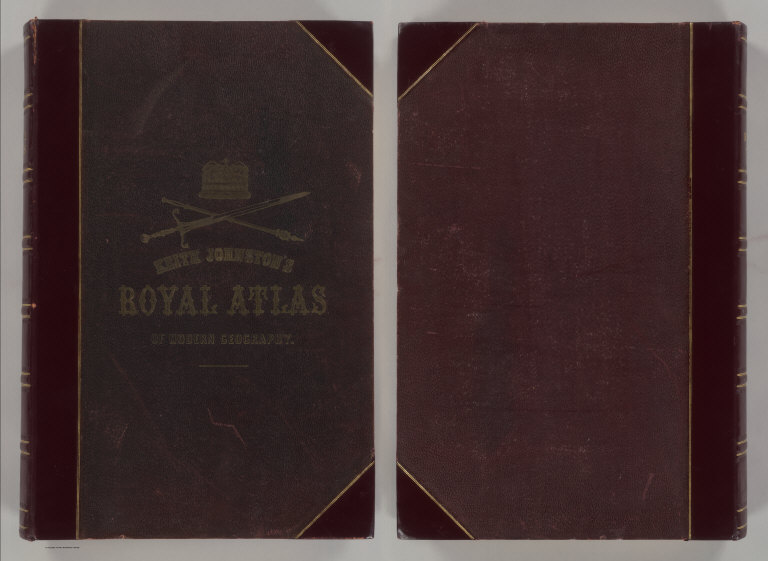
Johnston, Alexander Keith
Full Title
(Covers to) The Royal Atlas Of Modern Geography Exhibiting, In A Series Of Entirely Original And Authentic Maps, The Present Condition Of Geographical Discovery And Research In The Several Countries, Empires, And States Of The World By Alexander Keith Johnston ... With A Special Index To Each Map. A New Edition. W.& A.K. Johnston, Edinburgh And London, MDCCCLXXIX.
Publisher
W.& A.K. Johnston
Author
Moll, Herman, d. 1732
Full Title
(Covers to) Atlas minor: or a new and curious set of sixty-two maps, in which are shewn all the empires, kingdoms, countries, states, in all the known parts of the earth; with their bounds, divisions, chief cities & towns, the whole composed & laid down agreable to modern history. By Herman Moll, Geographer. (3rd ed.) London, Printed for Thos. Bowles in St. Pauls Church Yard & John Bowles at the Black Horse in Cornhill (1736?)
Publisher
Thos. Bowles and John Bowles
Author
Mitchell, Samuel Augustus Jr.
Full Title
(Covers to) Mitchell's New General Atlas, Containing Maps Of The Various Countries Of The World, Plans Of Cities, Etc., Embraced In Ninety-Three Quarto Maps, Forming A Series Of One Hundred and Forty-seven Maps and Plans, Together With Valuable Statistical Tables. Also, A List Of Post-Offices Of The United States And Territories, And Also Census Of 1880 For States, Territories And Counties, Also Of Cities Of Over 10,000 Inhabitants. Philadelphia: Published By Wm. M. Bradley & Bro., No. 1026 Arch Street. 1886. Entered ... 188_, by S. Augustus Mitchell ... Washington.
Publisher
Wm. M. Bradley & Bro.
Author
Rand McNally and Company
Full Title
(Covers to) Rand McNally & Co.'s Enlarged Business Atlas And Shippers' Guide ... Together With A Complete Reference Map Of The World ... Accompanied By A New and Original Compilation and Ready Reference Index, Showing In Detail The Entire Railroad System ... Engraved, Printed, And Published By Rand, McNally & Company, Chicago, U.S.A. 1889. (on verso) ... Copyright, 1889, by Rand, McNally & Co.
Publisher
Rand McNally
Author
[Schrader, Vivien St Martin, L.]
Full Title
(Covers to) Vivien de Saint-Martin & Schrader, Atlas Universel de Geographie. Dresse sous la Direction de F. Schrader d'apres the sources originales et les documents les plus recents. Nouvelle Edition. Cet Atlas Publie sous Auspices du Ministere de la Guerre comprend 80 Cartes Gravees sur Cuivre et Tirees en Lithographie et un Index Alphabetique des Noms Contenus dans l'Atlas. Librarie Hachette.
Publisher
Librairie Hachette
Author
Tanner, Henry S.
Full Title
(Covers to) A New Universal Atlas Containing Maps of the various Empires, Kingdoms, States and Republics Of The World. With a special map of each of the United States, Plans of Cities &c. Comprehended in seventy sheets and forming a series of One Hundred And Seventeen Maps, Plans And Sections, By H.S. Tanner ... Philadelphia, Published By Carey & Hart. 1844. Entered ... 1844, by Carey & Hart ... Pennsylvania.
Publisher
Carey and Hart
Author
Pinkerton, John, 1758-1826
Full Title
(Covers to) A modern atlas, from the latest and best authorities, exhibiting the various divisions of the world, with its chief empires, kingdoms and states, in sixty maps, carefully reduced from the largest and most authentic sources. Directed and superintended by John Pinkerton, author of Modern geography, &c. London: Printed by T. Bensley, Bolt Court, Fleet Street; for T. Cadell and W. Davies, Strand; and Longman, Hurst, Rees, Orme, And Brown, Paternoster Row. 1815.
Publisher
[Cadell and Davies, Longman, Hurst, Rees, Orme, and Brown]
Author
Johnston, Alexander Keith
Full Title
(Covers to) The Royal Atlas Of Modern Geography Exhibiting, In A Series Of Entirely Original And Authentic Maps, The Present Condition Of Geographical Discovery And Research In The Several Countries, Empires, And States Of The World. By The Late Alexander Keith Johnston ... With Additions And Corrections To The Present Date By T.B. Johnston ... With A Special Index To Each Map. A New Edition. W.& A.K. Johnston, Edinburgh And London, MDCCCXCIII.
Publisher
W.& A.K. Johnston
Author
Vivien de St Martin, L.
Full Title
(Covers to) Atlas Universel Pour servir a l'Etude De La Geographie Et De L'Histoire Anciennes et Modernes Dresse Par L. Vivien. Paris. Chez Menard Et Desenne, Editeurs, Rue Git-le-Coeur No. 8. 1827. (title page only) Mardelet sc.
Publisher
Vivien de St Martin, L.
Author
Tanner, Henry S.
Full Title
(Covers to) An Atlas of Ancient Geography: Comprehended in Sixteen Maps, Selected From The Most Approved Works, To Elucidate The Writings of the Ancient Authors, Both Sacred And Profane. Philadelphia: Published by H.S. Tanner, No. 177, Chesnut Street. 1826.
Publisher
H.S. Tanner
Author
Mitchell, Samuel Augustus
Full Title
(Covers to) Mitchell's new general atlas, containing maps of the various countries of the World, plans of cities, etc. Embraced in ninety-three quarto maps. Forming a series of one hundred and forty-seven maps and plans. Together with valuable statistical tables. Also a list of post-offices of the United States and territories, and also Census of 1880 for states, territories and counties, also of cities of over 10,000 inhabitants. Philadelphia: Wm. M. Bradley & Bro., No. 1026 Arch Street. 1886. Entered ... 188_, by S. Augustus Mitchell ... Washington.
Publisher
Wm. M. Bradley & Bro.
Author
Jouvet et Cie.
Full Title
(Covers to) Atlas Universel de Geographie Moderne. Physique, Politique, Historique, Industriel, Commercial et Militaire. Adopte par le Ministere de la Guerre pour L'Ecole de Saint-Cyr. Paris. Furne, Jouvet et Cie, Editeurs. Jouvet et Cie, Successeurs. 45 Rue Saint-Andre des Arts. MDCCCLXXXII. (1882)
Publisher
Jouvet et Cie
Author
[Lowry, J.W., Sharpe, J.]
Full Title
(Covers to) Sharpe's Corresponding Atlas, Comprising Fifty-Four Maps, Constructed Upon A System Of Scale And Proportion, From the most Recent Authorities. Engraved On Steel By Joseph Wilson Lowry. With A Copious Consulting Index. London: Chapman And Hall, 186 Strand. MDCCCXLIX.
Publisher
Chapman & Hall
|