|
Author
Ludwig, Pablo
Full Title
(Covers to) Ciudad de Buenos-Aires y Distrito Federal publicado por Pablo Ludwig, Cartografo Segun los datos oficiales y observaciones propias. 1892. Es propiedad del editor. Compilado, dibujado y grabado por Pablo Ludwig, Buenos Aires. Imp. Est. Grafico de Gunche, Wiebeck y Turtl. San Martin 315 Bs. A ... (with) Parque de Palermo. (with) Isla de Martin Garcia.
Publisher
Pablo Ludwig.
Author
Cary, John, ca. 1754-1835
Full Title
(Covers to) Cary's New Map of England And Wales, With Part Of Scotland. On Which Are Carefully Laid Down All the Direct and Principal Cross Roads, the Course of the Rivers And Navigable Canals ... Delineated from Actual Surveys: and materially assisted From Authentic Documents Liberally supplied by the Right Honourable the Post Masters General. London: Published Jun 11th 1794 by J. Cary, Engraver & Map-seller, No. 181 Strand.
Publisher
John Cary
Author
Melish, John
Full Title
(Covers to) The traveller's directory through the United States; containing, a description of all the principal roads through the United States ... The whole illustrated by appropriate maps. By John Melish. Philadelphia: Published by the Author. 1822. (on verso) ...on the eighteenth day of September ... 1821, John Melish ... has deposited ... a book ... Pennsylvania.
Publisher
John Melish
Author
Duval, Henri
Full Title
(Covers to) Atlas Universel d'Histoire et de Geographie anciennes et modernes, de Mythologie, des Religions, d'Astronomie, de Physique, de Geologie, de Histoire naturelle, de Grammaire, de Rhetorique &. Agree pour les Maisons Royales d'Education de l'Ordre de la Legion d'honneur. par Henry Duval ... Paris chez l'Auteur, Rue de la Chaussee d'Antin, 15. Johanneau, Libraire, Rue du Coq. S. Honore 8 bis. 1835. Impir. Lithog. et Autog. de L. Houbloup, Rue Dauphine, 24 a'Paris.
Publisher
L. Houbloup
Author
Melish, John
Full Title
(Covers to) Map of Pennsylvania, constructed from the county surveys authorized by the State; and other original documents by John Melish. Engraved by B. Tanner. Corrected and improved to 1826. Entered ... 7th day of June 1822, by John Melish ... Pennsylvania. Published by B. Tanner, Engraver, No. 74 South Eighth Street Philadelphia ... (illustration) Drawn by F. Kearny. Engraved by B. Tanner.
Publisher
B. Tanner.
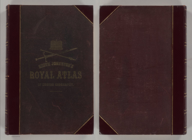
Author
Johnston, Alexander Keith
Full Title
(Covers to) The Royal Atlas Of Modern Geography Exhibiting, In A Series Of Entirely Original And Authentic Maps, The Present Condition Of Geographical Discovery And Research In The Several Countries, Empires, And States Of The World By Alexander Keith Johnston ... With A Special Index To Each Map. A New Edition. W.& A.K. Johnston, Edinburgh And London, MDCCCLXXIX.
Publisher
W.& A.K. Johnston
Author
Moll, Herman, d. 1732
Full Title
(Covers to) Atlas minor: or a new and curious set of sixty-two maps, in which are shewn all the empires, kingdoms, countries, states, in all the known parts of the earth; with their bounds, divisions, chief cities & towns, the whole composed & laid down agreable to modern history. By Herman Moll, Geographer. (3rd ed.) London, Printed for Thos. Bowles in St. Pauls Church Yard & John Bowles at the Black Horse in Cornhill (1736?)
Publisher
Thos. Bowles and John Bowles
Author
Mitchell, Samuel Augustus Jr.
Full Title
(Covers to) Mitchell's New General Atlas, Containing Maps Of The Various Countries Of The World, Plans Of Cities, Etc., Embraced In Ninety-Three Quarto Maps, Forming A Series Of One Hundred and Forty-seven Maps and Plans, Together With Valuable Statistical Tables. Also, A List Of Post-Offices Of The United States And Territories, And Also Census Of 1880 For States, Territories And Counties, Also Of Cities Of Over 10,000 Inhabitants. Philadelphia: Published By Wm. M. Bradley & Bro., No. 1026 Arch Street. 1886. Entered ... 188_, by S. Augustus Mitchell ... Washington.
Publisher
Wm. M. Bradley & Bro.
Author
Rand McNally and Company
Full Title
(Covers to) Rand McNally & Co.'s Enlarged Business Atlas And Shippers' Guide ... Together With A Complete Reference Map Of The World ... Accompanied By A New and Original Compilation and Ready Reference Index, Showing In Detail The Entire Railroad System ... Engraved, Printed, And Published By Rand, McNally & Company, Chicago, U.S.A. 1889. (on verso) ... Copyright, 1889, by Rand, McNally & Co.
Publisher
Rand McNally
Author
Mitchell, Samuel Augustus
Full Title
(Covers to) New Universal Atlas Containing Maps of the various Empires, Kingdoms, States and Republics Of The World. With a special map of each of the United States, Plans of Cities &c. Comprehended in eighty one sheets and forming a series of One Hundred And Forty Five Maps, Plans And Sections ... Baltimore, Cushings & Bailey, 262 Market Street. 1859. Entered ... 1856, by Charles Desilver ... Pennsylvania. (title page by) Barralet del. Humphreys, sc. J. Knight Sc.
Publisher
[Charles Desilver., Cushings & Bailey]
Author
[Schrader, Vivien St Martin, L.]
Full Title
(Covers to) Vivien de Saint-Martin & Schrader, Atlas Universel de Geographie. Dresse sous la Direction de F. Schrader d'apres the sources originales et les documents les plus recents. Nouvelle Edition. Cet Atlas Publie sous Auspices du Ministere de la Guerre comprend 80 Cartes Gravees sur Cuivre et Tirees en Lithographie et un Index Alphabetique des Noms Contenus dans l'Atlas. Librarie Hachette.
Publisher
Librairie Hachette
Author
Martenet, Simon J.
Full Title
(Covers to) Martenet's Map of Maryland, Atlas Edition, Under the Patronage of the Legislature.
Publisher
S.J. Martenet.
Author
Tanner, Henry S.
Full Title
(Covers to) A New Universal Atlas Containing Maps of the various Empires, Kingdoms, States and Republics Of The World. With a special map of each of the United States, Plans of Cities &c. Comprehended in seventy sheets and forming a series of One Hundred And Seventeen Maps, Plans And Sections, By H.S. Tanner ... Philadelphia, Published By Carey & Hart. 1844. Entered ... 1844, by Carey & Hart ... Pennsylvania.
Publisher
Carey and Hart
Author
Lange, Henry, 1821-1893.
Full Title
(Covers to) Atlas Von Nord-Amerika. Nach den neuesten Materialien ... in 18 Blattern mit erlauterndem Texte herausgegeben von Henry Lange ... Braunschweig, 1854. Verlag von George Westermann.
Publisher
George Westermann.
Author
International Boundary Commission
Full Title
(Covers to) Linea Divisoria Entre Mexico Y Los Estados Unidos Al Oeste Del Rio Grande Levantada Y Marcada, Bajo La Direccion Por Parte De Mexico Del Ingeniero Jacobo Blanco, Por La Comision Internacional De Limites Creada Por La Convencion De Julio 29 De 1882 Renovada Por La De Febrero 18 De 1889 ...
Publisher
J. Polhemus.
Author
Pinkerton, John, 1758-1826
Full Title
(Covers to) A modern atlas, from the latest and best authorities, exhibiting the various divisions of the world, with its chief empires, kingdoms and states, in sixty maps, carefully reduced from the largest and most authentic sources. Directed and superintended by John Pinkerton, author of Modern geography, &c. London: Printed by T. Bensley, Bolt Court, Fleet Street; for T. Cadell and W. Davies, Strand; and Longman, Hurst, Rees, Orme, And Brown, Paternoster Row. 1815.
Publisher
[Cadell and Davies, Longman, Hurst, Rees, Orme, and Brown]
Author
Johnston, Alexander Keith
Full Title
(Covers to) The Royal Atlas Of Modern Geography Exhibiting, In A Series Of Entirely Original And Authentic Maps, The Present Condition Of Geographical Discovery And Research In The Several Countries, Empires, And States Of The World. By The Late Alexander Keith Johnston ... With Additions And Corrections To The Present Date By T.B. Johnston ... With A Special Index To Each Map. A New Edition. W.& A.K. Johnston, Edinburgh And London, MDCCCXCIII.
Publisher
W.& A.K. Johnston
Author
Vivien de St Martin, L.
Full Title
(Covers to) Atlas Universel Pour servir a l'Etude De La Geographie Et De L'Histoire Anciennes et Modernes Dresse Par L. Vivien. Paris. Chez Menard Et Desenne, Editeurs, Rue Git-le-Coeur No. 8. 1827. (title page only) Mardelet sc.
Publisher
Vivien de St Martin, L.
Author
Wrigley, Henry E.
Full Title
(Covers to) Map of the Centre Oil Region From Oil City To Parkers Landing by Henry E. Wrigley. Publishing Rooms, Titusville, Pa., June 27th, 1871 ... Henry E. Wrigley, Civil Engineer, Office, 21 Spring Street, Publishing Rooms, 7 And 12 Smith & Wood Block, Titusville, Pa. Entered ... 1871 by Henry E. Wrigley ... Washington, D.C.
Publisher
Henry E. Wrigley
Author
Tanner, Henry S.
Full Title
(Covers to) An Atlas of Ancient Geography: Comprehended in Sixteen Maps, Selected From The Most Approved Works, To Elucidate The Writings of the Ancient Authors, Both Sacred And Profane. Philadelphia: Published by H.S. Tanner, No. 177, Chesnut Street. 1826.
Publisher
H.S. Tanner
Author
Mitchell, Samuel Augustus
Full Title
(Covers to) Mitchell's new general atlas, containing maps of the various countries of the World, plans of cities, etc. Embraced in ninety-three quarto maps. Forming a series of one hundred and forty-seven maps and plans. Together with valuable statistical tables. Also a list of post-offices of the United States and territories, and also Census of 1880 for states, territories and counties, also of cities of over 10,000 inhabitants. Philadelphia: Wm. M. Bradley & Bro., No. 1026 Arch Street. 1886. Entered ... 188_, by S. Augustus Mitchell ... Washington.
Publisher
Wm. M. Bradley & Bro.
Author
Jouvet et Cie.
Full Title
(Covers to) Atlas Universel de Geographie Moderne. Physique, Politique, Historique, Industriel, Commercial et Militaire. Adopte par le Ministere de la Guerre pour L'Ecole de Saint-Cyr. Paris. Furne, Jouvet et Cie, Editeurs. Jouvet et Cie, Successeurs. 45 Rue Saint-Andre des Arts. MDCCCLXXXII. (1882)
Publisher
Jouvet et Cie
Author
[Lowry, J.W., Sharpe, J.]
Full Title
(Covers to) Sharpe's Corresponding Atlas, Comprising Fifty-Four Maps, Constructed Upon A System Of Scale And Proportion, From the most Recent Authorities. Engraved On Steel By Joseph Wilson Lowry. With A Copious Consulting Index. London: Chapman And Hall, 186 Strand. MDCCCXLIX.
Publisher
Chapman & Hall
Author
[Black, Adam & Charles, Hall, Sidney, Hughes, William]
Full Title
(Covers to) General Atlas Of The World: Containing Upwards Of Seventy Maps. Engraved On Steel, In The First Style Of Art, By Sidney Hall, William Hughes, F.R.G.S., &c. New Edition. Embracing All The Latest Discoveries Obtained From Government Surveys And Expeditions, Books Of Recent Travel, And Other Sources, Including The North-West Passage Discovered By H.M. Ship Investigator. With Introductory Chapters On The Geography And Statistics Of The Various Countries Of The World, And A Complete Index Of 65,000 Names. Edinburgh: Adam And Charles Black, North Bridge. M.DCCC.LIV.
Publisher
Adam & Charles Black
Author
Viele, Egbert L.
Full Title
(Covers to) Topographical Atlas Of The City Of New York Including The Annexed Territory. Showing original water courses and made land. Prepared Under The Direction Of Egbert L. Viele, Civil and Topographical Engineer. 234 Broadway, N.Y. 1874. Eugene Quackenbush, C.E. Entered ... 1874, by Egbert L. Viele in the Office of the Librarian of Congress. Julius Bien, Photo Lith.
Publisher
E.L. Viele
Author
Johnston, W. & A.K.
Full Title
(Covers to) Johnston's Royal Atlas Of Modern Geography Exhibiting, In A Series Of Sixty Entirely Original And Authentic Maps, The Present Condition Of Geographical Discovery And Research In The Several Countries, Empires, And States Of The World With A Special Index To Each Map. W.& A.K. Johnston, Limited, Edinburgh And London, MCMXII.
Publisher
W.& A.K. Johnston
Author
Rand McNally and Company
Full Title
(Covers to) Rand McNally & Co.'s Enlarged Business Atlas And Shippers' Guide ... Showing In Detail The Entire Railroad System ... Accompanied By A New And Original Compilation And Ready Reference Index ...Together With Complete Reference Maps Of All Countries With New Marginal Index ... Engraved, Printed, And Published By Rand, McNally & Company, Chicago, U.S.A., 1903. (on verso) ... Copyright, 1903, by Rand, McNally & Co.
Publisher
Rand McNally and Company
Author
Monk, Jacob
Full Title
(Covers to) Monk's new map of Central America, Yucatan & Florida including Cuba, Jamaica and the Bahama Islands, exhibiting those portions of Alabama, Mississippi, Louisiana, Texas & Mexico bordering on the Gulf of Mexico. Compiled from the latest government maps and orther (sic) authentic sources. 1857. Baltimore, drawn, engraved and printed by A. Hoen & Co. and published by Jacob Monk. Entered ... 1856 by Jacob Monk ... Maryland. (with) Map of the World on Mercator's projection, exhibiting the continent of America in central position...
Publisher
Jacob Monk
Author
[Carey, H. C., Lea, I.]
Full Title
(Covers to) A Complete Historical, Chronological, And Geographical American Atlas, Being A Guide To The History Of North And South America, And The West Indies ... To The Year 1822. According To The Plan Of Le Sage's Atlas And Intended As A Companion To Lavoisne's Improvement Of That Celebrated Work. Philadelphia: H.C. Carey And I. Lea, Chestnut Street. 1822. (on verso) ... T.H. Palmer, Printer.
Publisher
H.C. Carey & I. Lea
Author
[Martin, R.M., Tallis, J. & F.]
Full Title
(Covers to) The Illustrated Atlas, And Modern History Of The World Geographical, Political, Commercial & Statistical, Edited By R. Montgomery Martin, Esq. ... The Maps Drawn & Engraved By J. Rapkin. H. Warren. J. Rogers. J. & F. Tallis, London & New York.
Publisher
J. & F. Tallis
Author
Melish, John
Full Title
(Covers to) A Military and Topographical Atlas of the United States; Including The British Possessions & Florida ... By John Melish. Philadelphia, Published By John Melish. G. Palmer Printer 1815. (on verso) District of Pennsylvania ... fourteenth day of March ... 1815 ... John Melish ... hath deposited ... a book.
Publisher
John Melish
Author
Popple, Henry
Full Title
(Covers to) A Map of the British Empire in America with the French and Spanish Settlements adjacent thereto. by Henry Popple. C. Lempriere inv. & del. B Baron Sculp. To the Queen's Most Excellent Majesty This Map is most humbly Inscribed by Your Majesty's most Dutiful, most Obedient, and most Humble Servant Henry Popple. London Engrav'd by Willm. Henry Toms & R.W. Seale, 1733. (index map) ... W.H. Toms Sculp.
Publisher
Willm. Henry Toms & R.W. Seale.
Author
Arrowsmith, Aaron
Full Title
(Covers to) A Map Exhibiting all the New Discoveries in the Interior Parts of North America Inscribed by Permission To the Honorable Governor And Company Of Adventurers Of England Trading Into Hudson Bay In testimony of their liberal Communications To their most Obedient and very Humble Servant, A. Arrowsmith, Hydrographer to H.R.H. the Prince of Wales. No. 10 Soho Square, January 1st 1795. Additions to 1811. Additions to 1814. London: Published Jan. 1, 1795 by A. Arrowsmith No. 10 Soho Square. Additions to 1802 ...
Publisher
A. Arrowsmith
Author
Clemens, Rev E.J.
Full Title
(Box Cover to) Clemens' Silent Teacher. Dissected Map of the United States and of Each State in Counties. Manufactured by Rev. E.J. Clemens, Clayville, N.Y.
Publisher
Rev. E.J. Clemens
Author
Arrowsmith, Aaron
Full Title
(Covers to) A New Map of Mexico and Adjacent Provinces Compiled from Original Documents by A. Arrowsmith. 1810. London. Published 5th October 1810 by A. Arrowsmith, 10 Soho Sque. Hydrographer to H.R.H. the Prince of Wales. Engraved by E. Jones. (with) three inset maps: Valley of Mexico, from Mr. Humboldt's Map; Veracruz; and Acapulco.
Publisher
A. Arrowsmith
Author
Arrowsmith, Aaron
Full Title
(Covers to) A Map Of The United States Of North America Drawn from a number of Critical Researches By A. Arrowsmith, Hydrographer to H.R.H. the Prince of Wales. No. 10 Soho Square. London. Published as the Act Directs by A. Arrowsmith, No. 10 Soho Square. Jan 1st, 1796. Additions to 1802.
Publisher
A. Arrowsmith
Author
French Geographical Game
Full Title
(Covers to) Jeux Instructifs Depose France Provinces & Departments Geographie.
Publisher
No Publisher
Author
Bromme, Traugott
Full Title
(Cover to) Wegweiser Fur Einwanderer Und Reisende In Den Vereinigten Staaten Von Nord-Amerika Und Den Canada's. Eine Genaue Zusammenstellung aller Eisenbahn-, Post- und Dampfboot-Routen. von Traugott Bromme. Mit einer Karte. Bayreuth. Verlag der Buchner'schen Buchhandlung. 1848.
Publisher
Buchner
Author
Darton, William
Full Title
(Covers to) A New Map of America, Dissected for the Instruction of Youth in Geography. (with) North America, from the Latest Authorities. Engraved by Willm. Darton. No. 58, Holborn Hill. Published Jany. 26, 1814 by Willm. Darton, London.
Publisher
William Darton
Author
[Abel, Henry J., Young, James H.]
Full Title
(Covers to) Traveller's & Emigrant's Guide to Wisconsin & Iowa. By Henry I. Abel. Accompanied With A New and Improved Map of those Territories. With The Addition of Parts of Illinois, Indiana, and Michigan.
Publisher
Henry J. Abel
Author
[Colton, G.W., Fisher, Richard Swainson]
Full Title
(Covers to) Colton's Illustrated Cabinet Atlas And Descriptive Geography. Maps By G. Woolworth Colton. Text By Richard Swainson Fisher. New York: Published By J.H. Colton, No. 172 William Street. 1859.
Publisher
J.H. Colton
Author
Popple, Henry
Full Title
(Covers to) A Map of the British Empire in America with the French and Spanish Settlements adjacent thereto. by Henry Popple. C. Lempriere inv. & del. B Baron Sculp. To the Queen's Most Excellent Majesty This Map is most humbly Inscribed by Your Majesty's most Dutiful, most Obedient, and most Humble Servant Henry Popple. London Engrav'd by Willm. Henry Toms & R.W. Seale, 1733. (index map) ... W.H. Toms Sculp.
Publisher
Willm. Henry Toms & R.W. Seale
Author
[Hoffmann, Charles F., Whitney, J.D., Geological Survey of California]
Full Title
(Covers to) State Geological Survey Of California. J.D. Whitney, State Geologist. Map Of The Region Adjacent To The Bay Of San Francisco. 1873. The Coast, Rancho, Township and Section Lines from Materials furnished by the U.S. Coast Survey and the U.S. Surveyor General's Office, the Topography chiefly from Original Surveys by C.F. Hoffman ... Julius Bien, Lith.
Publisher
Julius Bien
Author
Mitchell, Samuel Augustus
Full Title
(Covers to) Mitchell's New General Atlas, Containing Maps Of The Various Countries Of The World, Plans Of Cities, Etc. Embraced In Forty-Seven Quarto Maps, Forming A Series Of Seventy-Six Maps And Plans, Together With Valuable Statistical Tables. Philadelphia: Published By S. Augustus Mitchell, Jr. No. 31 South Sixth Street. 1860. Entered ... 1860, by S. Augustus Mitchell, Jr. ... Pennsylvania.
Publisher
S.A. Mitchell, Jr.
Author
La Perouse, Jean-Francois de Galaup, comte de, 1741-1788
Full Title
(Covers to) Atlas du voyage de La Perouse. (title page only) Dessine par J. M. Moreau le Jeune. Grave par Ph. Triere. L. Aubert scripsit.
Publisher
L'Imprimerie de la Republique
Author
Venezuela-British Guiana Boundary Commission
Full Title
(Covers to) Maps Of The Orinoco-Essequibo Region, South America. Compiled For The Commission Appointed By The President Of The United States "To Investigate And Report Upon The True Divisional Line Between The Republic Of Venezuela And British Guiana". Commissioners, David J. Brewer, President, Richard H. Alvey, Frederic R. Coudert, Andrew D. White, Daniel C. Gilman, Severo Mallet-Prevost, Secretary. Washington. February, 1897.
Publisher
United States of America
Author
Carey, Mathew
Full Title
(Covers to) Carey's General Atlas, Improved And Enlarged; Being A Collection Of Maps Of The World And Quarters, Their Principal Empires, Kingdoms, &c. Containing...[List of Maps]. Philadelphia: Published By M. Carey And Son, 1818.
Publisher
M. Carey and Son
Author
Rand McNally and Company
Full Title
(Covers to) Rand, McNally & Co.'s indexed atlas of the world containing large scale maps of every country and civil division upon the face of the globe, together with historical, descriptive, and statistical matter relative to each ... Accompanied by a new and original compilation forming a ready reference index ... Engraved, printed and published by Rand, McNally & Company, Chicago and New York, U.S.A., 1897. (vol. 2) United States.
Publisher
Rand McNally
Author
Gray, Ormando Willis
Full Title
(Covers to) The National Atlas. Containing Elaborate Topographical Maps Of The United States And The Dominion of Canada, With Plans Of Cities And General Maps Of The World. Also, Descriptions and Tables, Historical and Statistical ... Accompanied By Special, Railway, And Scientific Maps And Articles. Philadelphia: O.W. Gray & Son, No. 10 North Fifth Street. 1878. (on verso) Entered ... 1876, by O.W. Gray & Son ... Washington.
Publisher
O.W. Gray & Son
|