Who What Where WhenREMOVE |
Author
[Walker, G.H., Walker, O.W.]
Full Title
Index Map Massachusetts 1891.
Publisher
Geo.H. Walker & Co.
Author
[Walker, G.H., Walker, O.W.]
Full Title
Index Map (of Boston). Part of the Metropolitan District.
Publisher
Geo.H. Walker & Co.
Author
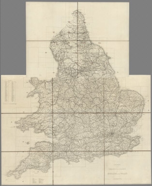
[Great Britain, Ordnance Survey, Ordnance Survey Office]
Full Title
(Index Map to) Ordnance Survey of England and Wales. Popular Edition One-Inch Map.
Publisher
Ordnance Survey Office
Author
[Barbie du Bocage, J.G., Dufour, H.]
Full Title
(Table of Contents) Noms des 48 Cartes Composant L'Atlas Illustre.
Publisher
Maison Basset
Author
Edwards, John P.
Full Title
(Index Page) Table of Contents.
Publisher
John P. Edwards
Author
Ogle, George A. & Co.
Full Title
(Index Map) Index Map of Douglas County, Washington.
Publisher
Geo. A. Ogle & Co.
Author
Hopkins, H.W.
Full Title
(Index Map) Outline and Index Map of City of Halifax N.S.
Publisher
Provincial Surveying & Pub Co.
Author
[Ordnance Survey of Scotland, Farquharson, J.]
Full Title
(Index Map to) Index to the Ordnance Survey of Scotland, Scale 1 inch to a mile. Price 2D. Edward Stanford, 12,13 & 14, Long Acre, W.C. Geographer to the Queen. London agent for the sale of the Ordnance Survey maps ... Agent for the Admiralty charts, the Indian Government Maps &c. (to accompany) Ordnance Survey of Scotland, Scale 1 inch to a mile, Volume I.
Publisher
[Ordnance survey Office, Edward Stanford]
Author
[Ordnance Survey of Scotland, Farquharson, J.]
Full Title
(Index Map to) Index to the Ordnance Survey of Scotland, Scale 1 inch to a mile. Price 2D. Edward Stanford, 12,13 & 14, Long Acre, W.C. Geographer to the Queen. London agent for the sale of the Ordnance Survey maps ... Agent for the Admiralty charts, the Indian Government Maps &c. (to accompany) Ordnance Survey of Scotland, Scale 1 inch to a mile, Volume II.
Publisher
[Edward Stanford, Ordnance survey Office]
Author
[Ordnance Survey of Scotland, Farquharson, J.]
Full Title
(Index Map to) Index to the Ordnance Survey of Scotland, Scale 1 inch to a mile. Price 2D. Edward Stanford, 12,13 & 14, Long Acre, W.C. Geographer to the Queen. London agent for the sale of the Ordnance Survey maps ... Agent for the Admiralty charts, the Indian Government Maps &c. (to accompany) Ordnance Survey of Scotland, Scale 1 inch to a mile, Volume III.
Publisher
[Edward Stanford, Ordnance survey Office]
Author
[Great Britain. Ordnance Survey, Mudge, William (1762-1820), Colby, Thomas, Baker, Benjamin, Great Britain. Board of Ordnance]
Full Title
(Index Map) Index to the Ordnance Survey of England and Wales.
Publisher
[W. Mudge; Ordnance Survey, Thomas Colby (1784-1852)]
Author
[Great Britain. Ordnance Survey, Mudge, William (1762-1820), Colby, Thomas, Baker, Benjamin, Great Britain. Board of Ordnance]
Full Title
(Index Map) Index to the Ordnance Survey of England and Wales, Published in Sheets on a Scale of one inch to a Mile.
Publisher
[W. Mudge; Ordnance Survey, Thomas Colby (1784-1852)]
Author
Baist, G.W.
Full Title
(Text Page) Index to Tracts Additions & Subdivisions. (Index Map) Index Map.
Publisher
G. W. Baist
Author
Schubert, Friedrich Theodor
Full Title
(Index Map to) Squelette der Kriegsstrassenkarte von Russland. Titel und Zeichenerklärung. (to accompany) Kriegsstrassen Karte eines Theiles von Russland und der angraenzenden laender; nach der unter der Leitung des Russ. kaiserlichen Generalstabes vom General Major Schubert im Masstabe von 1:1680000 im Jahre 1829 herausgegebenen Karte auf das Mass von 1:1400000 vergrossert, von dem k.k. osterr. Generalquartiermeisterstabe herausgegeben im Jahre 1837. "Berichtigungen im Jahr 1854 u. 1856 ... )
Publisher
Generalquartiermeisterstab
Author
Schubert, Friedrich Theodor
Full Title
(Index Map to) Squelette der Kriegsstrassenkarte von Russland. (to accompany) Kriegsstrassen Karte eines Theiles von Russland und der angraenzenden laender; nach der unter der Leitung des Russ.
Publisher
Generalquartiermeisterstab
Author
Great Britain. Ordnance Survey
Full Title
(Covers to) Sheet 1. The Border. (Index Map for Sheets 1-6).
Publisher
Ordnance Survey Office
Author
Great Britain. Ordnance Survey
Full Title
(Covers to) Sheet 2. England North West. (Index Map for Sheets 1-6).
Publisher
Ordnance Survey Office
Author
Great Britain. Ordnance Survey
Full Title
(Covers to) Sheet 3. England North East. (Index Map for Sheets 1-6).
Publisher
Ordnance Survey Office
Author
Great Britain. Ordnance Survey
Full Title
(Covers to) Sheet 4. North Wales. (Index Map for Sheets 1-6).
Publisher
Ordnance Survey Office
Author
Great Britain. Ordnance Survey
Full Title
(Covers to) Sheet 5. Midlands (N). (Index Map for Sheets 1-6).
Publisher
Ordnance Survey Office
Author
Great Britain. Ordnance Survey
Full Title
(Covers to) Sheet 6. Eastern Counties (N). (Index Map for Sheets 1-6).
Publisher
Ordnance Survey Office
Author
Great Britain. Ordnance Survey
Full Title
(Covers to) Sheet 7. South Wales. (Index Map for Sheets 7-12).
Publisher
Ordnance Survey Office
Author
Great Britain. Ordnance Survey
Full Title
(Covers to) Sheet 8. Midlands (S). (Index Map for Sheets 7-12).
Publisher
Ordnance Survey Office
Author
Great Britain. Ordnance Survey
Full Title
(Covers to) Sheet 9. Eastern Counties (S). (Index Map for Sheets 7-12).
Publisher
Ordnance Survey Office
Author
Great Britain. Ordnance Survey
Full Title
(Covers to) Sheet 10. South-West England. (Index Map for Sheets 7-12).
Publisher
Ordnance Survey Office
Author
Great Britain. Ordnance Survey
Full Title
(Covers to) Sheet 11. England South. (Index Map for Sheets 7-12).
Publisher
Ordnance Survey Office
Author
Great Britain. Ordnance Survey
Full Title
(Covers to) Sheet 12. England South-East & London. (Index Map for Sheets 7-12).
Publisher
Ordnance Survey Office
Author
Ireland. Ordnance Survey.
Full Title
(Covers to) (Box for) Ordnance Survey Ireland Quarter-inch Series.
Publisher
Ordnance Survey of Ireland
Author
Ireland. Ordnance Survey.
Full Title
(Covers to) Sheet 1.
Publisher
Ordnance Survey of Ireland
Author
Ireland. Ordnance Survey.
Full Title
(Covers to) Sheet 2.
Publisher
Ordnance Survey of Ireland
Author
Ireland. Ordnance Survey.
Full Title
(Covers to) Sheet 3.
Publisher
Ordnance Survey of Ireland
Author
Ireland. Ordnance Survey.
Full Title
(Covers to) Sheet 4.
Publisher
Ordnance Survey of Ireland
Author
Ireland. Ordnance Survey.
Full Title
(Covers to) Sheet 5.
Publisher
Ordnance Survey of Ireland
Author
Ireland. Ordnance Survey.
Full Title
(Covers to) Sheet 6.
Publisher
Ordnance Survey of Ireland
Author
Ireland. Ordnance Survey.
Full Title
(Covers to) Sheet 7.
Publisher
Ordnance Survey of Ireland
Author
Ireland. Ordnance Survey.
Full Title
(Covers to) Sheet 8.
Publisher
Ordnance Survey of Ireland
Author
Ireland. Ordnance Survey.
Full Title
(Covers to) Sheet 9.
Publisher
Ordnance Survey of Ireland
Author
Ireland. Ordnance Survey.
Full Title
(Covers to) Sheet 10.
Publisher
Ordnance Survey of Ireland
Author
Ireland. Ordnance Survey.
Full Title
(Covers to) Sheet 11.
Publisher
Ordnance Survey of Ireland
Author
Ireland. Ordnance Survey.
Full Title
(Covers to) Sheet 12.
Publisher
Ordnance Survey of Ireland
Author
Ireland. Ordnance Survey.
Full Title
(Covers to) Sheet 13.
Publisher
Ordnance Survey of Ireland
Author
Ireland. Ordnance Survey.
Full Title
(Covers to) Sheet 14.
Publisher
Ordnance Survey of Ireland
Author
Ireland. Ordnance Survey.
Full Title
(Covers to) Sheet 15.
Publisher
Ordnance Survey of Ireland
Author
Ireland. Ordnance Survey.
Full Title
(Covers to) Sheet 16.
Publisher
Ordnance Survey of Ireland
Author
John Bartholomew and Son
Full Title
(Covers to) Bartholomew's 4 Miles to the Inch Road Map of England & Wales in Twelve Sheets.
Publisher
John Bartholomew and Son, Ltd.
Author
John Bartholomew and Son
Full Title
(Covers to) Sheet 1. Northumberland, Cumberland, Durham, &c.
Publisher
John Bartholomew and Son, Ltd.
Author
John Bartholomew and Son
Full Title
(Covers to) Sheet 2. Lancashire & Isle of Man. New Series.
Publisher
John Bartholomew and Son, Ltd.
Author
John Bartholomew and Son
Full Title
(Covers to) Sheet 3. Yorkshire.
Publisher
John Bartholomew and Son, Ltd.
Author
John Bartholomew and Son
Full Title
(Covers to) Sheet 4. North Wales.
Publisher
John Bartholomew and Son, Ltd.
|