Who What Where WhenREMOVEWHEREShow More |
Author
[Paullin, Charles O., Wright, John K.]
Full Title
Plate 35. Indians. Indian Reservations, 1840. Indian Reservations, 1875.
Publisher
[Carnegie Institution of Washington, American Geographical Society of New York]
Author
[Paullin, Charles O., Wright, John K.]
Full Title
Plate 36. Indians. Indian Reservations, 1900. Indian Reservations, 1930.
Publisher
[Carnegie Institution of Washington, American Geographical Society of New York]
Author
[Paullin, Charles O., Wright, John K.]
Full Title
Plate 37. Indians. Indian Missions, 1567-1861.
Publisher
[Carnegie Institution of Washington, American Geographical Society of New York]
Author
[Paullin, Charles O., Wright, John K.]
Full Title
Plate 38. Explorations. Spanish Explorations in the Southwest 1535-1706.
Publisher
[Carnegie Institution of Washington, American Geographical Society of New York]
Author
[Paullin, Charles O., Wright, John K.]
Full Title
Plate 39. Explorers. French Explorations in the West, 1673-1743 (1794). American Explorations in the West, 1803-1852.
Publisher
[Carnegie Institution of Washington, American Geographical Society of New York]
Author
[Paullin, Charles O., Wright, John K.]
Full Title
Plate 40. Lands. Divisions of Land near Philadelphia, about 1730. (Facsimile).
Publisher
[Carnegie Institution of Washington, American Geographical Society of New York]
Author
[Paullin, Charles O., Wright, John K.]
Full Title
Plate 41. Lands. Possessions of European States in Eastern North America after the Treaty of Paris, 1763. Plat of ... the United States N.W. of the River Ohio (Facsimile). Colonies or States Proposed or Organized by Settlers West of the Allegheny Mountains,1775-1785. A Colonial Town: Wethersfield, Connecticut, 1641 (Facsimile). Specimen Surveys in the Virginia Military Reserve, Ross County, Ohio, 1799-1825 (Facsimile).
Publisher
[Carnegie Institution of Washington, American Geographical Society of New York]
Author
[Paullin, Charles O., Wright, John K.]
Full Title
Plate 42. Lands. Colonial Grants, 1703-1732 (Facsimile).
Publisher
[Carnegie Institution of Washington, American Geographical Society of New York]
Author
[Paullin, Charles O., Wright, John K.]
Full Title
Plate 43. Lands. Colonial Grants, 1603-1732. Allotments of Land, Dorchester, Massachusetts, 1660 (Facsimile).
Publisher
[Carnegie Institution of Washington, American Geographical Society of New York]
Author
[Paullin, Charles O., Wright, John K.]
Full Title
Plate 44. Lands. Divisions of Land in Maine, 1795. Farm of Governor John Endicott, 1668. Grants in Maine to Plymouth Colony, Lake and Others, 1753. Meredith, New Hampshire, 1770. (Facsimiles).
Publisher
[Carnegie Institution of Washington, American Geographical Society of New York]
Author
[Paullin, Charles O., Wright, John K.]
Full Title
Plate 45. Lands. Grants of Western Lands by Georgia to Land Companies, 1789. 1875. Military Reserves, 1778 - 1816.
Publisher
[Carnegie Institution of Washington, American Geographical Society of New York]
Author
[Paullin, Charles O., Wright, John K.]
Full Title
Plate 46. Lands. British Possessions after the Quebec Act, 1774. Proposed States According to Ordinance of 1784. Territorial Acquisitions 1783-1853.
Publisher
[Carnegie Institution of Washington, American Geographical Society of New York]
Author
[Paullin, Charles O., Wright, John K.]
Full Title
Plate 47. Lands. Indian Cessions 1750-1890. Claims and Cessions of Western Lands, 1776-1803 Connecticut and South Carolina. Claims and Cessions of Western Lands, 1776-1802, New York. Claims and Cessions of Western Lands, 1776-1802, Virginia and Georgia. Claims and Cessions of Western Lands, 1776-1802, Massachusetts and North Carolina.
Publisher
[Carnegie Institution of Washington, American Geographical Society of New York]
Author
[Paullin, Charles O., Wright, John K.]
Full Title
Plate 48. Lands. System of Survey of Public Lands under Act of 1796. Plan of Lystra, in Nelson County, Kentucky (Facsimile).
Publisher
[Carnegie Institution of Washington, American Geographical Society of New York]
Author
[Paullin, Charles O., Wright, John K.]
Full Title
Plate 49. Lands. Territorial Claims and Limits on the Northwest Coast of America, 1790 - 1846.
Publisher
[Carnegie Institution of Washington, American Geographical Society of New York]
Author
[Paullin, Charles O., Wright, John K.]
Full Title
Plate 50. Lands. Lands Granted to States for Educational and Other Purposes, 1785 - 1919. Land of the Ohio Company about 1787. George Rogers Clark Grant about 1785. Lands Granted in 1828 for Construction of Columbus and Sandusky Turnpike (Facsimiles).
Publisher
[Carnegie Institution of Washington, American Geographical Society of New York]
Author
[Paullin, Charles O., Wright, John K.]
Full Title
Plate 51. Lands. Survey of Fairfax Lands, 1736-1737. Grant to Washington for Military Services, 1774 (Facsimiles).
Publisher
[Carnegie Institution of Washington, American Geographical Society of New York]
Author
[Paullin, Charles O., Wright, John K.]
Full Title
Plate 52. Lands. A French Settlement, Kaskaskia, Illinois ... Plan of Settlement 1807; Specimen of Common Fields about 1809 (Facsimiles).
Publisher
[Carnegie Institution of Washington, American Geographical Society of New York]
Author
[Paullin, Charles O., Wright, John K.]
Full Title
Plate 53. Lands. Southern Plantation, Mount Vernon, Virginia: Mansion House Grounds, 1787; The Farm, 1793. A Colonial Manor, Livingston Manor, New York: The Manor, 1714; Distribution of Tenants, 1798 (Facsimiles).
Publisher
[Carnegie Institution of Washington, American Geographical Society of New York]
Author
[Paullin, Charles O., Wright, John K.]
Full Title
Plate 54. Lands. A Modern City, Springfield, Illinois, 1915 (Facsimile).
Publisher
[Carnegie Institution of Washington, American Geographical Society of New York]
Author
[Paullin, Charles O., Wright, John K.]
Full Title
Plate 55. Lands. A Modern City, Springfield, Illinois, 1914: Ward Map; Specimen Blocks. Large Land Holdings in Southwestern Washington, 1914. Donation Lands under Act of 1850 (Facsimiles).
Publisher
[Carnegie Institution of Washington, American Geographical Society of New York]
Author
[Paullin, Charles O., Wright, John K.]
Full Title
Plate 56. Lands. A Western Town: Carroll, Nebraska, 1918. A Western Township Pilot Knob, Harper County, Kansas, 1919. Specimen Private Land Claims, 1835. Federal Land Grants for the Construction of Railroads and Wagon Roads, 1823-1871. Oil Land Withdrawals in California, 1915 (Facsimiles).
Publisher
[Carnegie Institution of Washington, American Geographical Society of New York]
Author
[Paullin, Charles O., Wright, John K.]
Full Title
Plate 57. Public Lands. Public Lands of United States, 1790. Public Lands of United States, 1810.
Publisher
[Carnegie Institution of Washington, American Geographical Society of New York]
Author
[Paullin, Charles O., Wright, John K.]
Full Title
Plate 58. Public Lands. Public Lands of United States, 1830. Public Lands of United States, 1850. Public Lands of United States, 1870. Public Lands of United States, 1890.
Publisher
[Carnegie Institution of Washington, American Geographical Society of New York]
Author
[Paullin, Charles O., Wright, John K.]
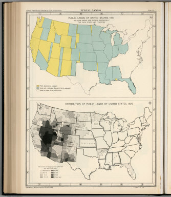
Full Title
Plate 59. Public Lands. Public Lands of United States, 1910. Distribution of Public Lands of United States, 1929.
Publisher
[Carnegie Institution of Washington, American Geographical Society of New York]
Author
[Paullin, Charles O., Wright, John K.]
Full Title
Plate 60. Settlement and Population, 1660-1790. Settled Areas and Population, 1660. Settled Areas and Population, 1770. Settled Areas, 1760, and Population, 1750. Settled Areas and Population, 1775. Settled Areas and Population, 1790.
Publisher
[Carnegie Institution of Washington, American Geographical Society of New York]
Author
[Paullin, Charles O., Wright, John K.]
Full Title
Plate 61. Colonial Towns, States, Territories, and Cities. Colonial Towns, 1650. Colonial Towns, 1700. Colonial Towns, 1750. Colonial Towns, 1775. States, Territories and Cities, 1790. States, Territories and Cities, 1800. States, Territories and Cities, 1810.
Publisher
[Carnegie Institution of Washington, American Geographical Society of New York]
Author
[Paullin, Charles O., Wright, John K.]
Full Title
Plate 62. States, Territories and Cities. States, Territories and Cities, 1820. States, Territories and Cities, 1830.
Publisher
[Carnegie Institution of Washington, American Geographical Society of New York]
Author
[Paullin, Charles O., Wright, John K.]
Full Title
Plate 63. States, Territories and Cities. States, Territories and Cities, 1840. States, Territories and Cities, 1850.
Publisher
[Carnegie Institution of Washington, American Geographical Society of New York]
Author
[Paullin, Charles O., Wright, John K.]
Full Title
Plate 64. States, Territories and Cities. States, Territories and Cities, 1860. States, Territories and Cities, 1870. States and Territories (Additional Maps 1845-1868). States, Territories and Cities, 1880.
Publisher
[Carnegie Institution of Washington, American Geographical Society of New York]
Author
[Paullin, Charles O., Wright, John K.]
Full Title
Plate 65. States, Territories and Cities. States, Territories and Cities, 1890. States, Territories and Cities, 1900.
Publisher
[Carnegie Institution of Washington, American Geographical Society of New York]
Author
[Paullin, Charles O., Wright, John K.]
Full Title
Plate 66. States, Territories and Cities. States, Territories and Cities, 1910. States, Territories and Cities, 1920.
Publisher
[Carnegie Institution of Washington, American Geographical Society of New York]
Author
[Paullin, Charles O., Wright, John K.]
Full Title
Plate 67. States and Cities: Population. States and Cities, 1930. Slaves, 1790. Slaves, 1800. Slaves, 1810. Slaves, 1820. Slaves, 1830. Slaves, 1840.
Publisher
[Carnegie Institution of Washington, American Geographical Society of New York]
Author
[Paullin, Charles O., Wright, John K.]
Full Title
Plate 68. Population. Slaves, 1850. Slaves, 1860. Free Negroes, 1810.
Publisher
[Carnegie Institution of Washington, American Geographical Society of New York]
Author
[Paullin, Charles O., Wright, John K.]
Full Title
Plate 69. Population. Free Negroes, 1860. Colored Population, 1880.
Publisher
[Carnegie Institution of Washington, American Geographical Society of New York]
Author
[Paullin, Charles O., Wright, John K.]
Full Title
Plate 70. Population: Emigration to the United States. Colored Population, 1900. Colored Population, 1930. Sources of Emigration to the United States (by decade),
Publisher
[Carnegie Institution of Washington, American Geographical Society of New York]
Author
[Paullin, Charles O., Wright, John K.]
Full Title
Plate 71. Population. Foreign-Born Population, 1860. Foreign-Born Population, 1880.
Publisher
[Carnegie Institution of Washington, American Geographical Society of New York]
Author
[Paullin, Charles O., Wright, John K.]
Full Title
Plate 72. Population. Foreign-Born Population, 1900. Foreign-Born White Population, 1930.
Publisher
[Carnegie Institution of Washington, American Geographical Society of New York]
Author
[Paullin, Charles O., Wright, John K.]
Full Title
Plate 73. Population. Foreign-Born Population, German, 1880. Foreign-Born Population, German, 1900. Foreign-Born Population, German, 1930. Foreign-Born Population, Irish, 1880.
Publisher
[Carnegie Institution of Washington, American Geographical Society of New York]
Author
[Paullin, Charles O., Wright, John K.]
Full Title
Plate 74. Population. Foreign-Born Population, Irish, 1900. Foreign-Born Population, Irish, 1930.
Publisher
[Carnegie Institution of Washington, American Geographical Society of New York]
Author
[Paullin, Charles O., Wright, John K.]
Full Title
Plate 75. Population. Foreign-Born Population, Swedish and Norwegian, 1880. Foreign-Born Population, Swedish and Norwegian, 1900.
Publisher
[Carnegie Institution of Washington, American Geographical Society of New York]
Author
[Paullin, Charles O., Wright, John K.]
Full Title
Plate 76. Population. Foreign-Born Population, Swedish and Norwegian, 1790. Density of Population, 1800. Density of Population, 1810. Density of Population, 1820. Density of Population, 1830. Density of Population, 1840.
Publisher
[Carnegie Institution of Washington, American Geographical Society of New York]
Author
[Paullin, Charles O., Wright, John K.]
Full Title
Plate 77. Population. Density of Population, 1850. Density of Population, 1860. Density of Population, 1870.
Publisher
[Carnegie Institution of Washington, American Geographical Society of New York]
Author
[Paullin, Charles O., Wright, John K.]
Full Title
Plate 78. Population. Density of Population, 1880. Density of Population, 1890.
Publisher
[Carnegie Institution of Washington, American Geographical Society of New York]
Author
[Paullin, Charles O., Wright, John K.]
Full Title
Plate 79. Density of Population. Density of Population, 1900. Density of Population, 1910. Density of Population, 1920. Density of Population, 1930.
Publisher
[Carnegie Institution of Washington, American Geographical Society of New York]
Author
[Paullin, Charles O., Wright, John K.]
Full Title
Plate 80. Population: Colleges and Universities. Centers of Population. Colleges and Universities, 1775. Colleges and Universities, 1800. Colleges and Universities, 1830.
Publisher
[Carnegie Institution of Washington, American Geographical Society of New York]
Author
[Paullin, Charles O., Wright, John K.]
Full Title
Plate 81. Colleges and Universities. Colleges and Universities, 1860. Colleges and Universities, 1890.
Publisher
[Carnegie Institution of Washington, American Geographical Society of New York]
Author
[Paullin, Charles O., Wright, John K.]
Full Title
Plate 82. Churches. Congregationalist, 1775-1776. Presbyterian, 1775-1776. Protestant-Episcopal, 1775-1776. Baptist, 1775-1776. Friends, 1775-1776. German Reformed, 1776-1776. Lutheran, 1775-1776. Dutch Reformed, 1775-1776. Methodist, 1775-1776. Catholic, 1775-1776. Minor Denominations, 1775-1776. Minor Denominations, 1775-1776.
Publisher
[Carnegie Institution of Washington, American Geographical Society of New York]
Author
[Paullin, Charles O., Wright, John K.]
Full Title
Plate 83. Churches. Methodist, 1860. Baptist, 1860.
Publisher
[Carnegie Institution of Washington, American Geographical Society of New York]
Author
[Paullin, Charles O., Wright, John K.]
Full Title
Plate 84. Churches. Congregational, 1860. Protestant-Episcopal, 1860. Lutheran, 1860. "Christian," 1860. Reformed, 1860. Friends, 1860. Presbyterian, 1860.
Publisher
[Carnegie Institution of Washington, American Geographical Society of New York]
|