|
Author
Hartsinck, J.J.
Full Title
(Facsimile) Hartsinck - 1770. S Doc 91 55 2. 50. Caart van Guiana. Part of a Map of Guiana by J.J. Hartsinck, Amsterdam, 1770. Reproduced from Original (in his Beschrvving van Guiana, Amsterdam, 1770, Vo. I, p. I,) in Library of Congress, Washington, D.C. Photo. Lith. by A. Hoen & Co., Baltimore, MD.
Publisher
United States of America
Author
Mannert, Conrad
Full Title
(Facsimile) Mannert - 1803. S Doc 91 55 2. 55. Part of a Map of South America by Conrad Mannert, Nurnberg, 1803. Reproduced from Original (Marked 4580/3) in Library of Harvard College, Cambridge, Mass. Photo. Lith. by A. Hoen & Co., Baltimore, MD.
Publisher
United States of America
Author
Gumilla, Joseph
Full Title
(Facsimile) Gumilla - 1741. 56. Mapa de la Provincia y Missiones de la Compania de IHS del Nuevo Reyno de Granada. Map of the Jesuit Missions of New granda, by Father Joseph Gumilla, S.J., Madrid, 1741. Reproduced from Original in El Orinoco Ilustrado, Madrid, 1741, p. I, in Library of Congress, Washington, D.C. Photo. Lith. by A. Hoen & Co., Baltimore, MD.
Publisher
United States of America
Author
Anonymous
Full Title
(Facsimile) Van Petten? - [1598?]. S Doc 91 55 2. 57. Sketch of the Island of Cayenne and of the Coast between the Caw and Macuria Rivers in Eastern Guiana, [1598?] Reproduced from a Tracing of the Original Manuscript in the Rijksarchief at the Hague, No. 675 of the Catalogue. Photo. Lith. by A. Hoen & Co., Baltimore, MD.
Publisher
United States of America
Author
Anonymous
Full Title
Van Petten - 1598. S Doc 91 55 2. 58. Sketch of the Gulf of Paria, with Part of the Coast of Trinidad and of the Orinoco Delta, 1598. Reproduced from a Tracing of the Original Manuscript in the Rijksarchief at the Hague, No. 578 of the Catalogue. Photo. Lith. by A. Hoen & Co., Baltimore, MD.
Publisher
United States of America
Author
Maass, Abraham
Full Title
Maas - [1706.] S Doc 91 55 2. 59. Map of the Essequibo Colony; Made for the West India Company by Land-Surveyor Abraham Maass, [1706.]. Reproduced from Original Manuscript in the Rijksarchief at the Hague, No. 1528 of Catalogue. Photo. Lith. by A. Hoen & Co., Baltimore, MD.
Publisher
United States of America
Author
Van's Gravesande, Storm
Full Title
Storm Van's Gravesande - 1748. S 91 55 2. 60. Map of the Essequuibo Colony made for the West India Company by Governor Storm Van's Gravesande, 1748. Reprodcued from a Certified Tracing (Furnished by the Republic of Venezuela) of the Copy in the Colonial Library , at Paramaribo, Surinam. Photo. Lith. by A. Hoen & Co., Baltimore, MD.
Publisher
United States of America
Author
Van's Gravesande, Storm
Full Title
Storm Van's Gravesande - 1750. S 91 55 2. 60. Map of the Orinico - Essequibo Region, Handed to the West India Company by Governor Storm Van's Gravesande, June 22, 1750. Reproduced fromm the Manuscript Copy on Parchment in the Rijksarchief at te Hague, No. 1496 of the Catalogue. Photo. Lith. by A. Hoen & Co., Baltimore, MD.
Publisher
United States of America
Author
[Anville, Jean Baptiste Bourguignon d, 1697-1782, van Bercheyck, L.L.]
Full Title
D'Anville inset in Bercheyck - [1761?]. S Doc 91 55 2. 62. Part of D'Anville's Map South America Reproduced as an Inset in the Map of Demerara by L.L. c, 1759, as rinted at Amsterdam [1761?]. Reproduced from a Copy Furnished by the Dutch Historian Gen. P.M. Netscher. Photo. Lith. by A. Hoen & Co., Baltimore, MD.
Publisher
United States of America
Author
Heneman, J.C. v.
Full Title
Heneman - 1772. S. Doc. 91 55 2. 63. Kaart van de Vall Akaiou, in Rio Cajouny .... Map of the Cuyuni River from its Mouth to the First Fall, by the Engineer J.C. v. Heneman 1772. Reproduced from Autograph Manuscript in the Rijksarchief at the Hague, No. 1536 of the Catalogue. Photo. Lith. by A. Hoen & Co., Baltimore, MD.
Publisher
United States of America
Author
Heneman, J.C. v.
Full Title
Heneman - 1775. Map of the Colonies of Demerara and Essequibo, Made by the Engineer J.C. v. Heneman, for the West India Company, 1773 - 1775. Reproduced from the Original Manuscript in the Rijksarchief at the Hague, No. 1488 of the Catalogue. Photo. Lith. by A. Hoen & Co., Baltimore, MD.
Publisher
United States of America
Author
Heneman, J.C. v.
Full Title
Heneman - [1776?]. S Doc 91 55 2. 65. Schets Kaart ... Map of the Boundary between Spanish and Dutch Guiana, by the Engineer J.C. v. Heneman. Reproduced from the Manuscript Original in the Library of the Department of the Colonies at the Hague, No. 438 of the Catalogue. Photo. Lith. by A. Hoen & Co., Baltimore, MD.
Publisher
United States of America
Author
Siraut - Destouches, A.
Full Title
Siraut - Destouches - 1779. Schets - Kaart van de Coloni van Rio - Essequebo ... S Doc 91 55 2. 66. Map of the Essequibo Colony, in 1779; by A. Siraut - Destouches, Colonial Surveyor. Reproduced from Manuscript Copy Made in 1801 by Ivan van de Burght, Colonial Surveyor; Bought in 1896, in Holland, for the Commission. Photo. Lith. by A. Hoen & Co., Baltimore, MD.
Publisher
United States of America
Author
Siraut - Destouches, A.
Full Title
Siraut - Destouches - [1780?]. Kaart van de Rivier en Colonie Essequebo ... S Doc 91 55 2. 67. Map of the Essequibo Colony, 1779 or 1780; Probably by A. Siraut - Destouches, Colonial Surveyor. Reproduced from the Original Manuscript, Bought, in 1898, in Holland for the Commission. Photo. Lith. by A. Hoen & Co., Baltimore, MD.
Publisher
United States of America
Author
Chollet, L.
Full Title
Chollet? - 1791 or earlier. S Doc 91 55 2. 68. Map of the Coast Region of the Essequibo Colony; Probably Identical with that Transmitted to the West India Company by L. Chollet, Colonial Surveyor, 1791. Reproduced from the Original Manuscript Bought, in 1896, in Holland, for the Commission. Photo. Lith. by A. Hoen & Co., Baltimore, MD.
Publisher
United States of America
Author
Chollet, L.
Full Title
Chollet - 1794. S Doc 91 55 2. 69. Map of the Pomeroon Coast Region, Surveyed for the Dutch Government by the Colonial Surveyors van de Burght and Chollet, and Charted by the Latter, 1794. Reproduced from the Autograph Original in the Rijksarchief at the Hague, (No. 1545 of Catalogue). Photo. Lith. by A. Hoen & Co., Baltimore, MD.
Publisher
United States of America
Author
Bouchenroeder, F. Von
Full Title
Bouchenroeder - 1796. S Doc 91 55 2. 70. Generaale en Speciaale Kaart der Colonien van de Republicq de Vereenigde Nederlanden Geleegen in Guayana .... Map of the Colonies of Essequibo and Demerara; by Major F. v. Bouchenroeder, 1796. Reproduced from the Autograph Manuscript in the Rijksarchief at the Hague, No. 1489 of the Catalogue. Photo. Lith. by A. Hoen & Co., Baltimore, MD.
Publisher
United States of America
Author
Surville, Luis de
Full Title
Surville - 1778. S Doc 91 55 2. 71. Mapa Cooro-Grafico de la Nueva Andalucia ... 1778. Map of the Spanish Province of Nueva Andalucia made at the Order of the Head of the Spanish Archive of the Indies by Luis de Surville, Assistant Archivist, 1778. Reproduced from teh Original in Caulin's Historia de la Nueva Andalucia, Madrid, 1779. Photo. Lith. by A. Hoen & Co., Baltimore, MD.
Publisher
United States of America
Author
Anonymous
Full Title
Anonymous - [1735?]. S Doc 91 55 2. 72. Sketch Map of the Capuchin Missions in the Province of Guayana about 1765. Map I. Reproduced by Photo-lithography from the Original in the Capuchin Archives in Rome. Sketch Map of the Missions of the Catalonian Capuchins in the Spanish Province of Guayana, about 1735 (Rather than 1765). Reproduced from a Photolithographic Facsimile of the Manuscript Original in the Archives of the Capuchin Order at Rome given by Father Joseph Strickland, S.J., in his Documents nad Maps on the Boundary Question between Venzuela and British Guyana, Rome, 1898. Photo. Lith. by A. Hoen & Co., Baltimore, MD.
Publisher
United States of America
Author
Strickland, Joseph
Full Title
Fr. Carlos de Barcelona - 1771. S Doc 91 55 2. 73. Sketch Map of the Carpuchiin Missions in the Province of Guyana about 1771. Map II. Sketch Map of the Missions of the Catalonian Capuchins iin the Spanish Province of Guayana, 1771. Reproduced from a Photolithographic Facsimile of the Manuscript Original in the Archives of the Capuchin Order at Rome given by Father Joseph Strickland, S.J., in his Documents and Maps on the Boundary Question between Venezuela and British Guayana, Rome, 1898. Photo. Lith. by A. Hoen & Co., Baltimore, MD.
Publisher
United States of America
Author
Barcelona, Carlos de
Full Title
Fr. Carlos de Barcelona - [1779?]. S Doc 91 55 2. 74. Sketch Map of the Capuchin Missions in Guayana about 1779. Map III. Sketch Map of the Missions of the Catalonia Capuchins in the Spanish Province of Guayana, [1779?]. Reproduced from a Photolithographic Facsimile of the Manuscript Original in the Archives of the Capuchin Order at Rome given by Father Joseph Strickland, S.J., in his Documents and Maps on the Boundary Question between Venezuela and British Guayana, Rome, 1898. Photo. Lith. by A. Hoen & Co., Baltimore, MD.
Publisher
United States of America
Author
Strickland, Joseph
Full Title
Anonymous - [1789?]. S Doc 91 55 2. 75. Sketch Map of the Capuchin Missions in the Province of Guayana about 1789. Map IV. Sketch Map of the Missions of the Catalonia Capuchins in the Spanish Province of Guayana, about 1789. Reproduced from a Photolithographic Facsimile of the Original Manuscript in the Archives of the Capuchin Order at Rome given by Father Joseph Strickland, S.J., in his Documents and Maps on the Boundary Question between Venezuela and British Guayana, Rome, 1898. Photo. Lith. by A. Hoen & Co., Baltimore, MD.
Publisher
United States of America
Author
Anonymous
Full Title
Anonymous [15--]. S Doc 91 55 2. 76. Mapa de los Rios Amazonas, Esequiyo o Dulche y Orinoca y de las Comarcas Adyacentes. Reproducido por la lit. del Instituto Geografico y Estadistico Ano de 1877. Early Spanish Map of Guiana, Reproduced from Lithographic Facsimile of the Manuscript Original in the Spanish Archives, Published by the Spanish Government in Cartes de Indias (Madrid, 187).
Publisher
United States of America
Author
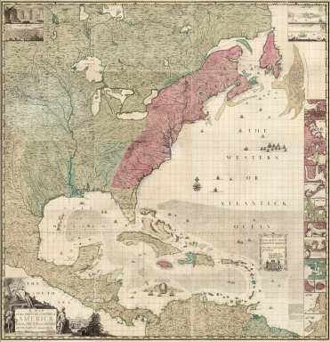
Popple, Henry
Full Title
(Composite Map of) A Map of the British Empire in America with the French and Spanish Settlements adjacent thereto. by Henry Popple.
Publisher
Willm. Henry Toms & R.W. Seale
Author
Martin de Moussy, V. (Victor), 1810-1869
Full Title
(Covers to) Description geographique et statistique de la Confederation Argentine par V. Martin de Moussy ... Deuxieme edition atlas. Paris Librairie de Firmin Didot Freres, Fils et Cie. Imprimeurs de l'Institut, Rue Jacob, 56. 1873. Imprimerie Adolphe Laine, Rue des Saints-Peres, 19.
Publisher
Firmin Didot Freres.
Author
Martin de Moussy, V. (Victor), 1810-1869
Full Title
(Half Title Page to) Description geographique et statistique de la Confederation Argentine par V. Martin de Moussy ... Deuxieme edition atlas. Paris Librairie de Firmin Didot Freres, Fils et Cie. Imprimeurs de l'Institut, Rue Jacob, 56. 1873. Imprimerie Adolphe Laine, Rue des Saints-Peres, 19.
Publisher
Firmin Didot Freres.
Author
Martin de Moussy, V. (Victor), 1810-1869
Full Title
(Title Page to) Description geographique et statistique de la Confederation Argentine par V. Martin de Moussy ... Deuxieme edition atlas. Paris Librairie de Firmin Didot Freres, Fils et Cie. Imprimeurs de l'Institut, Rue Jacob, 56. 1873. Imprimerie Adolphe Laine, Rue des Saints-Peres, 19.
Publisher
Firmin Didot Freres.
Author
Martin de Moussy, V. (Victor), 1810-1869
Full Title
(Contents to) Description geographique et statistique de la Confederation Argentine par V. Martin de Moussy ... Deuxieme edition atlas. Paris Librairie de Firmin Didot Freres, Fils et Cie. Imprimeurs de l'Institut, Rue Jacob, 56. 1873. Imprimerie Adolphe Laine, Rue des Saints-Peres, 19.
Publisher
Firmin Didot Freres.
Author
Martin de Moussy, V. (Victor), 1810-1869
Full Title
Carte de l'Empire Espagnol dans les deux Ameriques en 1776 a l'epoque de la fondation de la Vice Royaute de la Plata. Par le Dr. V. Martin de Moussy 1867. Grave par L. Kautz, r. Bonaparte 82 Paris. Paris Imp. Lemercier, r. de Seine 57. (Paris Librairie de Firmin Didot Freres, Fils et Cie., 1873)
Publisher
Firmin Didot Freres.
Author
Martin de Moussy, V. (Victor), 1810-1869
Full Title
Carte de l'Amerique du Sud divisee en ses differents etats. Par le Dr. V. Martin de Moussy 1867. Grave par Kautz, r. Bonaparte 82 Paris. Paris Imp. Lemercier, r. de Seine 57. (Paris Librairie de Firmin Didot Freres, Fils et Cie., 1873)
Publisher
Firmin Didot Freres.
Author
[Martin de Moussy, V. (Victor), 1810-1869, Petroschi, Giovanni]
Full Title
Paraquariae Provinciae Soc. Jesu cum adiacentib. novissima descriptio. Post iteratas peregrinationes, & plures observationes Patrum Missionariorum erusdem Soc. tum huius Provinciae, cum & Peruanae accuratissime delineata, & emendata ann. 1732. Admodum r. in Chto. Patri Suo P. Francisco Retz ... Ioannes Petroschi sculp. Romae sup. perm. ... Fac-simile d'une carte du Bassin de La Plata dressee par les Missionaires de la Compagnie de Jesus de la province du Paraguay. Publiee a Rome en 1732 et dediee au General de la dite Compagnie le R.P. Francois Retz. Gravee par Jean Petroschi. Paris - 1867. Grave par Kautz. Editee par le Dr. V. Martin de Moussy ... Paris - Imp. Lemercier, r. de Seine 57. (Paris Librairie de Firmin Didot Freres, Fils et Cie., 1873)
Publisher
Firmin Didot Freres.
Author
Martin de Moussy, V. (Victor), 1810-1869
Full Title
Carte de la Confederation Argentine divisee en ses differentes provinces et territoires et des pays voisins: Etat Oriental de l'Uruguay, Paraguay, partie du Bresil et de la Bolivie, Chili. Par le Dr. V. Martin de Moussy 1867. Grave par L. Kautz, r. Bonaparte 82 Paris. Paris - Imp. Lemercier, r. de Seine 57. (Paris Librairie de Firmin Didot Freres, Fils et Cie., 1873)
Publisher
Firmin Didot Freres.
Author
Martin de Moussy, V. (Victor), 1810-1869
Full Title
Carte historique de la Province des Missions et des etablissements des Jesuites sur le Parana et l'Uruguay de 1575 a 1768. Par le Dr. V. Martin de Moussy 1865. Grave par L. Kautz, r. Bonaparte 82 - Paris. Paris - Imp. Lemercier, r. de Seine 57. (Paris Librairie de Firmin Didot Freres, Fils et Cie., 1873)
Publisher
Firmin Didot Freres.
Author
Martin de Moussy, V. (Victor), 1810-1869
Full Title
Carte de la Province de Corrientes, du Territoire des Missions et des pays adjacents. Par le Dr. V. Martin de Moussy 1865. Grave par Kautz, r. Bonaparte 82 - Paris. Paris - Imp. Lemercier, r. de Seine 57. (Paris Librairie de Firmin Didot Freres, Fils et Cie., 1873)
Publisher
Firmin Didot Freres.
Author
Martin de Moussy, V. (Victor), 1810-1869
Full Title
Carte des provinces d'Entre-Rios, de Santa-Fe et de la Bande Orientale. Par le Dr. V. Martin de Moussy 1865. Grave par L. Kautz, r. Bonaparte 82 - Paris. Paris, Imp. Lemercier, r. de Seine 57. (Paris Librairie de Firmin Didot Freres, Fils et Cie., 1873)
Publisher
Firmin Didot Freres.
Author
Martin de Moussy, V. (Victor), 1810-1869
Full Title
Carte de la Province de Buenos-Ayres et des regions voisines. Par le Dr. V. Martin de Moussy 1866. Grave par L. Kautz, r. Bonaparte 82 - Paris. Paris - Imp. Lemercier, r. de Seine 57. (Paris Librairie de Firmin Didot Freres, Fils et Cie., 1873)
Publisher
Firmin Didot Freres.
Author
Martin de Moussy, V. (Victor), 1810-1869
Full Title
Carte du Territoire Indien du Sud et de la Region des Pampas. Par le Dr. V. Martin de Moussy 1865. Grave par L. Kautz, r. Bonaparte 82, Paris. Paris, Imp. Lemercier, r. de Seine 57. (Paris Librairie de Firmin Didot Freres, Fils et Cie., 1873)
Publisher
Firmin Didot Freres.
Author
Martin de Moussy, V. (Victor), 1810-1869
Full Title
Carte de la Patagonie et des archipels de la Terre de Feu, des Malouines et des cotes occidentales jusqu'au Golfe de Reloncavi. Par le Dr. V. Martin de Moussy 1865. Grave par L. Kautz, r. Bonaparte 82 - Paris. Paris, Imp. Lemercier, r. de Seine 57. (Paris Librairie de Firmin Didot Freres, Fils et Cie., 1873)
Publisher
Firmin Didot Freres.
Author
Martin de Moussy, V. (Victor), 1810-1869
Full Title
Carte des provinces de Cordova et San Luis et des regions voisines. Par le Dr. V. Martin de Moussy 1865. Grave par L. Kautz, r. Bonaparte 82 - Paris. Paris - Imp. Lemercier, r. de Seine 57. (Paris Librairie de Firmin Didot Freres, Fils et Cie., 1873)
Publisher
Firmin Didot Freres.
Author
Restrepo, Jose Manuel, 1781-1863
Full Title
Carta del Departamento de Cundinamarca. Gravado en Paris por Darmet, 1827. Escrito por Hacq. (Por Jose Manuel Restrepo. Paris, Libreria Americana, 1827)
Publisher
Libreria Americana
|