Who What Where WhenREMOVEWHEREShow More |
REFINE
Browse All : Pictorial map and Covers
1-43 of 43
Author
Chevalier, August
Full Title
(Covers to) The "Chevalier" Commercial, Pictorial and Tourist Map of San Francisco From Latest U.S. Gov. and Official Surveys. Designed-Engraved And Copyrighted By Aug. Chevalier, Lithographer Publisher, 507 Mission St. San Francisco ... The Exposition City 1915. Copyrighted 1912 By Aug. Chevalier ... (on verso) An index to the street and text.
Publisher
August Chevalier
Author
Maduro Jr., I.L.
Full Title
(Covers to) Bird's Eye View of the Panama Canal and Map of Panama. I.L. Maduro Jr, Panama.
Publisher
I.L. Maduro Jr.,
Author
New Mexico State Tourist Bureau
Full Title
(Covers to) Recreational map of New Mexico land of enchantment. (on verso) Recreational map of New Mexico : the land of enchantment. Printed ... distributed by the New Mexico State Tourist Bureau a division of the State Highway Department, State Capitol, Santa Fe. Copyright 1946, New Mexico State Tourist Bureau, Santa Fe, New Mexico. Litho. in U.S.
Publisher
New Mexico State Tourist Bureau a division of the State Highway Department
Author
New Mexico. State Tourist Bureau
Full Title
(Covers to) Historical trails through New Mexico : the land of enchantment (on verso pictorial map of) Historical trails through New Mexico : the land of enchantment ; prepared for free distribution by the New Mexico State Tourist Bureau, a Division of the State Highway Department, Santa Fe, New Mexico. Litho. by Johnson Printing Inc., Eau. Claire Wis. Copyright 1951, New Mexico State Tourist Bureau, Santa Fe, New Mexico.
Publisher
[New Mexico State Tourist Bureau, Johnson Printing Inc.]
Author
[Aaron Blake Publishers, Zeleznik, John, Lewis, Susan]
Full Title
The Ian Fleming Thriller Map.
Publisher
Aaron Blake Publishers
Author
Chevalier, August
Full Title
(Covers to) The commercial, pictorial and tourist map of San Francisco. Copyrighted by Aug. Chevalier, Publisher, 331 Kearny Street. 1st edition 1904.
Publisher
Aug. Chevalier
Author
[United Air Lines, White, Ruth Taylor]
Full Title
(Covers to) United Air Lines. A Gay Geography of the Main Line Airway. The Main Line Mid-Continental Airway.
Publisher
United Air Lines
Author
Gill, Leslie MacDonald, 1884-1947
Full Title
(Covers to) The Wonderground Map of London Town. Drawn by MacDonald Gill. Printed and Published by the Westminster Press, 11 Henrietta Street, Covent Garden, London, W.C.
Publisher
Westminster Press
Author
Goff, Errol W.
Full Title
(Covers to) A Picture Map of Cape Ann and the North Shore.
Publisher
Houghton Mifflin Co.
Author
Petersen, C.C.
Full Title
(Covers to) Your Dated War Map. Dated Events War Map.
Publisher
Shaw-Barton
Author
Petersen, C.C.
Full Title
Your Dated War Map. Dated Events War Map.
Publisher
Shaw-Barton
Author
Suchy, Arthur B.
Full Title
(Covers to) The heart of Cleveland, Ohio. Forest City. Cleveland, Ohio. 1928. (Copyright) by Arthur B. Suchy. The Du Bois Press, Rochester, N.Y. "Scale street layout 13 1/2 inches to 1 mile. buildings, figures and the rest have no scale".
Publisher
The Du Bois Press
Author
Standard Oil
Full Title
(Covers to) Pictorial Map of the Americas featuring the Pan American Highway.
Publisher
Standard Oil
Author
Alcoa Map Department, Aluminum Company of America
Full Title
(Covers to) Global Map for Global War and Global Peace. Vacations for All.
Publisher
Aluminum Company of America (Alcoa)
Author
Rand McNally & Co.
Full Title
(Covers to) Map of United States Military Posts.
Publisher
Rand McNally & Co.
Author
[Lane, John J., New England Street Railway Club]
Full Title
(Covers to)Trolley Wayfinder : birds eye view of trolley routes in New England. Published by the New England street Railway Club. ... John J. Lane Editor of "Trolley Wayfinder" and Trolley Wayfinder birds eye view of trolley routes. 12 Paerl St. Boston. Copyright 1904, 1905, 1906 & 1907 by the New England Street Railway Club.Price 10 Cents. (with) Trolley Wayfinder : birds eye view of trolley routes in New England. New England street Railway Club ... Geo. H. Walker & Co. Boston. (with 7 insets).
Publisher
[New England Street Railway Club, Geo. H. Walker & Co.]
Author
[Young, Arthur S., Chichester, Francis]
Full Title
(Covers to) London to Paris : This passenger - amusement map has been specially produced and published for British European Airways by Francis Chichester, 9 St. James's Place, London, S.W. 1. Arthist- Arthur S. Young. Printed by Harrison & Sons, Ltd., London and High Wycombe. (on lower left margin) BEA 311 (100M). (Cover title) Keyline Maps : BEA London - Paris British European Airways : Picture map; The key to Europe.
Publisher
Harrison & Sons Ltd.
Author
Lingren, Jolly
Full Title
(Covers to) A Hysterical Map of Death Valley National Monument and It's Lookin' Mighty Low.
Publisher
Lindgren Brothers
Author
[Lites, Arthur, (Palo Alto) Chamber of Commerce]
Full Title
(Covers to) A Pictorial Map of Palo Alto and San Francisco Peninsula by Arthur Lites. Palo Alto, California. A Pictorial Map. Home of Stanford University.
Publisher
City of Palo Alto
Author
Eddy, Gerald A.
Full Title
(Covers to) Lake Tahoe - Sierra Association. California -- Nevada.
Publisher
Lake Tahoe Sierra Association
Author
Atwood, Mary Hall (1894-1950)
Full Title
(Covers to) The Tenth Olympic Games Los Angeles, California, July 30 - Aug. 14 '32. Designed and Illustrated by Mary Hall Atwood. A Complete Map of Los Angeles Area and Guide to Olympic Games.
Publisher
Union Oil Company
Author
[Lites, Arthur, (Palo Alto) Chamber of Commerce]
Full Title
(Covers to) A Pictorial Map of Palo Alto and San Francisco Peninsula by Arthur Lites. Palo Alto, California. A Pictorial Map. Home of Stanford University.
Publisher
City of Palo Alto
Author
[Lites, Arthur, (Palo Alto) Chamber of Commerce]
Full Title
(Covers to) A Pictorial Map of Palo Alto and San Francisco Peninsula by Arthur Lites. Palo Alto, California. A Pictorial Map. Home of Stanford University.
Publisher
City of Palo Alto
Author
[Montenegro, Roberto, Ludkins, Fred, Terry, T. Philip, Martinez, Judith]
Full Title
(Covers to) A Map of Mexico.
Publisher
Southern Pacific Company
Author
[Putnam, Claude G., Woodward, Arthur]
Full Title
(Covers to) Ride the roads to romance along the Golden Coast and thru the sunshine empire of Southern California. Copyright, 1963 by Southern California Tourist Ass'n. Inc. San Bernardino, California. Lithographed in U.S.A. (on verso) Historic road to romance : Cartography, Claude G. Putnam - Research, Arthur Woodward. Copyright 1963 by Southern California Tourist Ass'n., Inc. ... San Bernardino, California. (cover title) Southern California : sunshine empire and Golden Coast.
Publisher
Roads to Romance Association
Author
General Drafting Company
Full Title
(Covers to) Guia turistica de America del Sur. Este mapa se obtiene Gratuitamente en los servicentros Esso. Celebrate April 14th. Pan American Day. Impreso en E.U.A.
Publisher
General Drafting Co.
Author
Covarrubias, Miguel (1904-1957)
Full Title
(Covers to) Pageant of the Pacific.
Publisher
Pacific House
Author
Schmidt Litho. Co.
Full Title
(Covers to) Pictorial Map of Fresno County and Mid-California's Garden of the Sun. Schmidt Litho. Co. Fresno & S.F. (on verso: cover title and) Automobile Road Map of Fresno County, Yosemite Valley, Huntington Lake, General Grant National Park, Sequoia National Park. Map of Fresno County : Showing principal automobile roads. Routes and Map Bureau , California State Automobile Association. 1678 Van Ness Ave. San Francisco. Published by Fresno County Chamber of Commerce. Fresno, California. Schmidt Litho. Co. Fresno & S.F.
Publisher
Fresno County Chamber of Commerce
Author
Eddy, Gerald A.
Full Title
(Covers to) Panoramic perspective of the area adjacent to Boulder Dam as it will appear when lake is filled : Served exclusively by tge Union Pacific System. "The boulder Dam Route". copyright, 1935, for Union Pacific System. Gerald A Eddy, L.A. Calif. Printed in U.S.A. By Poole Bros., Inc. Chicago. "50M 10-35". (Cover title on verso) Boulder Dam : Union Pacific, the Boulder Dam Route.
Publisher
Poole Bros., Inc.
Author
Mora, Jo (1876-1947)
Full Title
(Covers to) Yosemite. (Drawn by) Jo Mora. Copyright 1931. The Jo Mora Maps, Carmel California.
Publisher
The Jo Mora Maps
Author
Cressy, Mike
Full Title
(Covers to) The Literary Map of Latin America.
Publisher
Aaron Blake Publishers
Author
[Bank of America, California State Fair]
Full Title
(Covers to) '49ers guide to the Mother Lode, Mariposa to Downieville : with map ; profusely illustrated. A souvenir of the California State Fair, with complements of Bank of America National Trust and Savings Association. copyright 1949, bank of America Nt & SA. Photographs from Otheto Weston's Mother Lode Album, Stanford University Press. (on verso map of) The Mother Lode of California.
Publisher
Bank of America National Trust and Savings Association
Author
Chase, Ernest Dudley, 1878-1966
Full Title
(Covers to) Total War, Battle Map. Designed and Drawn by Ernest Dudley Chase of Winchester, Massachusetts, U.S.A. Certain Victory Will be Ours.
Publisher
Ernest Dudley Chase
Author
[Witta, Jr. Fred, Golden Chain Council of the Mother Lode.]
Full Title
(Covers to) California's Golden Chain : the Mother Load Highway (State Highway 49). Ledger Press, Jackson. (on verso map) California's Golden Chain : the Mother Lode. Designed by Fred Witta, Jr. Amador County. Art work by Pope Studio, Sacramento. (printed by) Sacramento Lithograph Co. Copyright.
Publisher
[Ledger Press, Sacramento Lithograph Co.]
Author
[Butler, Lowell, Newbro, William H., Robinson, William W.]
Full Title
(Covers to) A map of the missions, presidios, pueblos, and some of the more interesting ranchos of Spanish California : together with the routes of the principal land explorations therein. Published by Westways. (copyright) 1956 by the Automobile Club of Southern California. (on opposite page) A note of Explanation (by) Phil Townsend Hanna
Publisher
[Westways, Automobile Club of Southern California]
Author
[Butler, Lowell, Webb, William, Hanna, Phil Townsend, 1896-1957]
Full Title
(Covers to) Outdoor play places of California : a cartographic map of some of the outstanding recreational areas of the Golden State : Published by Westways ; Copyright 1954 by the Automobile Club of Southern California. (on opposite page) A note of Explanation (by) Phil Townsend Hanna.
Publisher
[Westways, Automobile Club of Southern California]
Author
[Butler, Lowell, Webb, William, Hanna, Phil Townsend, 1896-1957]
Full Title
(Covers to) A Map of the Marked Historical Sites of California : Compiled from the official registrations of the California State Department of Natural Resources: Published by Westways ; Copyright 1952 by the Automobile Club of Southern California. (on opposite page) A note of Explanation (by) Phil Townsend Hanna.
Publisher
[Westways, Automobile Club of Southern California]
Author
[Randall, Neil, Downs, Timothy Edwards]
Full Title
(Covers to) Road Map to the Best Free Stuff on the Interest.
Publisher
P.C. Computing
Author
[Taylor, Frank J., White, Ruth Taylor]
Full Title
(Covers to) Our U.S.A. A Gay Geography. Text by Frank J. Taylor. Maps by Ruth Taylor. Boston - Little, Brown, and Company - 1935.
Publisher
Little, Brown, and Company
Author
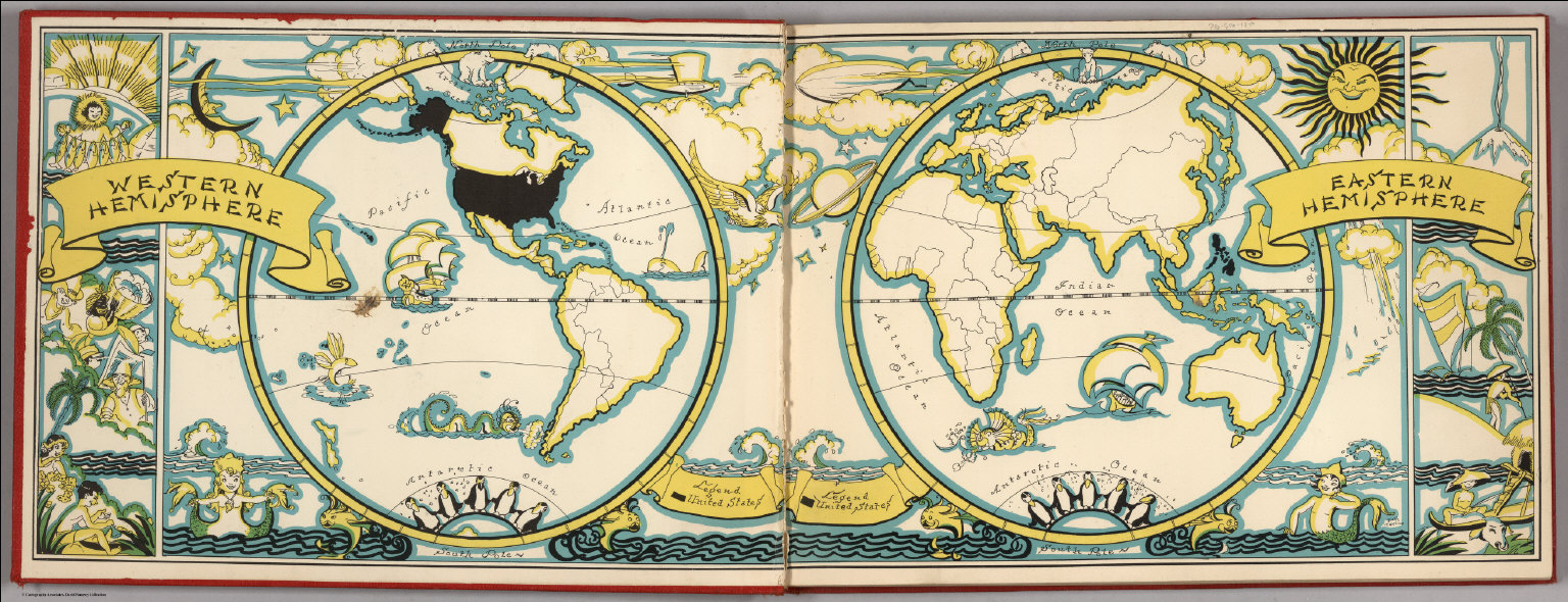
[Taylor, Frank J., White, Ruth Taylor]
Full Title
(Liners of Front and Back Covers) (The Earth in Hemispheres).
Publisher
Little, Brown, and Company
Author
Chase, Ernest Dudley, 1878-1966
Full Title
(Covers to) A world of fun and relaxation, Massachusetts, the historic vacationland : a travel map to help you feel at home in the Bay State. "Form 97-150M-7-57-920616 Publication of the document approved by George J. Cronin, Staff purchasing agent". (on verso) Historic Massachusetts : a travel map to help you feel at home in the Bay State. Massachusetts. Department of Commerce, 334 Boylston St. Boston, 16 Mass. Designed and drawn by Ernest Dudley Chase.
Publisher
Dept. of Commerce
Author
Forest Lawn Memorial-Park Association
Full Title
(Covers to) Pictorial map of Forest Lawn Memorial-Park, Glendale, California. Copyrighted 1945 by Forest Lawn Memorial-Park Assn., Inc. (on verso) Pictorial map of Forest Lawn Memorial - Park, showing the location of interment sections, buildings and art treasures.
Publisher
Forest Lawn Assn., Inc.
1-43 of 43
|