Who What Where WhenREMOVEWHO
WHEN
|
Author
G.W. & C.B. Colton & Co.
Full Title
Colton's driving & wheeling map of the country twenty five miles north of the city of New York. (with) New York City north of Central Park. G.W. & C.B. Colton & Co. 312 Broadway, New York. Entered ... 1892 by G.W. & C.B. Colton & Co. ... Washington.
Publisher
G.W. & C.B. Colton
Author
[Bouve, Crawford & Co., Good, Charles E.]
Full Title
Correct map of Boston Harbor giving route and official summer time-table of the Nantasket Beach Steamboat Co. Compliments of Bouve, Crawford & Co., Boston, makers of the celebrated Craword Shoe and proprietors of twenty Crawford shoe stores. Office: 611 Washington St, Boston. Published by Bouve, Crawford & Co. ... Copyrighted by Bouve, Crawford & Co., June 7th, 1890.
Publisher
Bouve, Crawford & Co.
Author
White Pass & Yukon Route
Full Title
Map Of White Pass & Yukon Route And Connections. White Pass & Yukon Route ... Copyright, 1917, by White Pass & Yukon Route. (inset) Map of Atlin Lake District. Poole Bros. Chicago. (Ed. of) 4-10-'22.
Publisher
White Pass & Yukon Route
Author
[Searl, A.D., Whitman, E.B.]
Full Title
Map Of Eastern Kansas By E.B. Whitman & A.D. Searl, General Land Agents Lawrence, Kansas 1856. Boston, Published by J.P Jewett and Co. Entered ... 1856 by E.B. Whitman & A.D. Searl ... Mass. L.H. Bradford & Co.'s Lith, Boston. (inset map of Ft. Riley) The Geographical Centre of U.S. Possessions.
Publisher
J.P. Jewett and Co.
Author
Colton, G.W. & C.B.
Full Title
Colton's Brazil And Guayana. Published By G.W. And C.B. Colton & Co. No. 172 William St. New York. Entered ... 1855 by J.H. Colton & Co. ... New York. (inset) Rio De Janeiro. (inset) Pernambuco.
Publisher
G.W. & C.B. Colton & Co.
Author
Colton, G.W. & C.B.
Full Title
Colton's New Township Map of the State of Pennsylvania. Published by G.W. & C.B. Colton & Co. New York. 1874.
Publisher
G.W. & C.B. Colton & Co.
Author
Burr, David H., 1803-1875
Full Title
Ohio. Drawn & Published by David H. Burr. New York. Entered ... Nov. 11th in the year 1831 by David H. Burr ... New York.
Publisher
David H. Burr.
Author
Wilber, C.D.
Full Title
Wilber's Miniature Map Of Illinois Showing Railroads, Stations, Counties, Townships, Sections and Rivers. Diamond Edition. 1864. Engraved & printed by Chas. Shober Corner of Lake & Clark Streets Chicago.
Publisher
Chas. Shober
Author
Burr, David H., 1803-1875
Full Title
United States. By David H. Burr. Published By Stone & Clark, Ithaca. N.Y. 1841. (with 7 inset maps.)
Publisher
Stone & Clark
Author
[Blanchard, Rufus, Morse, Charles W.]
Full Title
Morse's Cerographic Map Of Wisconsin. Published By Rufus Blanchard, 52 La Salle St., Chicago, Ill. Entered ... 1855, by Charles W. Morse ... New York.
Publisher
Rufus Blanchard
Author
Lucas, Fielding Jr.
Full Title
Massachusetts. Drawn and Published by F. Lucas Jr. Baltimore.
Publisher
Fielding Lucas Jr.
Author
[Morse, Charles W., Ranney, Adolphus.]
Full Title
Morse's Railroad And Township Map Of Vermont And New Hampshire. Published By A. Ranney, 195 Broadway, New York. Entered ... 1856, by Adolphus Ranney, ... New York.
Publisher
A. Ranney
Author
Mendenhall, Edward
Full Title
A New Map Of Illinois, Exhibiting The Counties, Townships, Cities, Villages & Post Offices, the Railroads, Canals, Common Roads, and all other Internal Improvements. Published by E. Mendenhall Cincinnati 1866. Middleton, Strobridge & Co. Lith Cin. O. Entered ... 1855, by E. Mendenhall ... Ohio.
Publisher
Edward, Mendenhall
Author
Mendenhall, Edward
Full Title
Map Of Cincinnati, Newport and Covington. Published By E. Mendenhall At His Map Establishment College Hall. Walnut Street Cincinnati 1860. Middleton Wallace & Co. Lithogrs. Cincinnati. 1860.
Publisher
E. Mendenhall
Author
Wyld, James, 1812-1887
Full Title
Wyld's Military Map Of The United States, The Northern States, And The Southern Confederate States: With The Forts, Harbours, Arsenals And Military Positions. James Wyld, 457 Strand; Charing Cross East And 2, Royal Exchange London. London, Published By James Wyld, Geographer To The Queen & H.R.H. The Prince Consort ... (with 4 inset maps).
Publisher
James Wyld
Author
Rice, G. Jay
Full Title
Rice's Sectional Map Of Dakota. Published by the St. Paul Lithog. & Eng. Co. 1878. St. Paul, Minnesota. Copyright 1875 by G. Jay Rice.
Publisher
St. Paul Lithog & Eng. Co.
Author
Goldthwait, J.H.
Full Title
Railroad Map Of New England & Eastern New York, Compiled from the most authentic sources. By J.H. Goldthwait. 1849. Boston. Redding & Co. 8 State St. New York. Clark, Austin & Co. 205 Broadway. Entered ... 1849, by J.H. Goldthwait ... New York. (inset) Boston & Vicinity, Showing the Grand Junction R.R.
Publisher
Redding & Co.
Author
Colton, J.H.
Full Title
Colton's Railroad & Township Map Of The State Of Maine With Portions Of New Hampshire, New Brunswick & Canada. Published By J.H. Colton And Co. No. 172 William St. New York, And C.C. Hall, Portland, Maine. 1855. Entered ... 1855 by J.H. Colton ... New York.
Publisher
[J.H. Colton, C.C. Hall]
Author
[Raynolds,W.F., Maynadier, H.E., Gillespie,G.]
Full Title
Western Sheet. Map Of The Yellowstone And Missouri Rivers. From Capt. Raynolds exploration 1859-60, with additions by Major Gillespie. Published by authority of the Hon. the Secretary Of War...
Publisher
U.S.
Author
[Bancroft, H.H., (Knight, W.H.)]
Full Title
Bancroft's Map Of California And Nevada. Published By H.H. Bancroft & Co. Booksellers & Stationers San Francisco Cal. 1868. Entered ... 1868 by H.H. Bancroft & Company ... California.
Publisher
H.H. Bancroft & Co.
Author
[Colton, J.H., Burr, David H.]
Full Title
Ohio. By David H. Burr. Published By J.H. Colton & Co. New-York. 1836. 4 Spruce Street. Entered ... 1833 by J.H. Colton & Co ... New York. Engraved & Printed by S. Stiles & Co. (inset) Cincinnati. (with) Portsmouth on the Ohio River. P. Desobry's Lithy. 171 B. Way N. York.
Publisher
J.H. Colton & Co.
Author
[Colton, J.H., Burr, David H.]
Full Title
Portsmouth on the Ohio River. P. Desobry's Lithy. 171 B. Way N. York. (with) Ohio. By David H. Burr. Published By J.H. Colton & Co. New-York. 1836. 4 Spruce Street. Entered ... 1833 by J.H. Colton & Co ... New York. Engraved & Printed by S. Stiles & Co. (inset) Cincinnati.
Publisher
J.H. Colton & Co.
Author
Fort Dearborn Publishing Co.
Full Title
Official Map Of Cuba. The Fort Dearborn Publishing Co. Map Engravers and Publishers, Chicago, Ill. (inset) City Of Habana. (on verso) Map Of The World, On Mercator's Projection.
Publisher
Fort Dearborn Publishing Co.
Author
Fort Dearborn Publishing Co.
Full Title
Map Of The World, On Mercator's Projection. (on verso) Official Map Of Cuba. The Fort Dearborn Publishing Co. Map Engravers and Publishers, Chicago, Ill. (inset) City Of Habana.
Publisher
Fort Dearborn Publishing Co.
Author
Free House Renting Bureau (Sterling Furniture company, Bunster & Saxe).
Full Title
(untitled view map of San Francisco). (on verso) Free Map of San Francisco. Free House Renting Bureau ... Sterling Furniture Company Bunster & Saxe 1049 Market St., Opposite Granada Theater.
Publisher
Free House Renting Bureau
Author
[Amerine, C.H., Lowman & Hanford]
Full Title
Lowman & Hanford's Sectional Map Of Puget Sound And Grays Harbor Country. Compiled From the Latest Official Data and Other Sources by C.H. Amerine. Published By The Lowman & Hanford Stationary & Printing Co. Seattle, Wash. 1891. Copyrighted 1891 by C.H. Amerine, Tacoma, Wash. Lith. Britton & Rey S.F.
Publisher
Lowman & Hanford Stationary & Printing Co.
Author
Fiala, John T.
Full Title
New Map of the State of Missouri. Compiled and constructed from United States Surveys and other authentic Sources by John T. Fiala, Civil Engineer. Published & sold by Jas. M. Crawford, Books and Stationery No. 54, North 4th Street, St. Louis, Mo. 1865. Lith. By Thos. Mackenzie. No. 51 Chestnut St. Corner Of 3d.
Publisher
Jas. M. Crawford.
Author
Rice, G. Jay.
Full Title
Rice's New Sectional Map of the State of Minnesota. 1882. Published By St. Paul Lithographing & Publishing Co. St. Paul, Minn. Oct. Edition 1882. Copyright 1880 by G. Jay Rice. (inset) Map Of St. Paul, Minneapolis & Vicinity.
Publisher
St. Paul Lithographing & Publishing Co.
Author
Farmer, John
Full Title
An Improved Edition Of A Map of the Surveyed Part Of The Territory Of Michigan By John Farmer. 1836. Engraved by J. Farmer. Entered ... by John Farmer on the 4th day of July A.D. 1835. (inset) Map of the Straits of Michillimackinac, from Actual Survey ... By John Farmer. 1835. (inset) Map of Pte. Ste. Ignace. (inset) Map of the most important part of the Lead Mine District near the Mississippi River... by John Farmer. 1835. (inset) Map of the Private Claims at Green Bay, from Actual Survey. (inset) Map of Michillimackinac Isle.
Publisher
John Farmer
Author
Ensign, Bridgman & Fanning
Full Title
Fanning's Map of New-York City, Published By Ensign, Bridgman & Fanning, 156 William Street, Corner of Ann. New York. 1855. Entered ... 1853, by Horace Thayer & Co. ... N. York. (with index titled) A Map Of The City And County Of New York, With The Adjacent Cities Of Brooklyn And Jersey City, And The Village Of Williamsburg: With A Street Directory Of The City Of New York. New York: Thayer, Bridgman & Fanning ... 1854. (on page 1) Corrected October 20, 1849. Entered ... 1849, by H. Wilson ... New-York.
Publisher
Ensign, Bridgman & Fanning.
Author
Mitchell, Samuel Augustus
Full Title
Map Of The State Of New York Compiled From The Latest Authorities. Philadelphia Published By S. Augustus Mitchell 1832. (inset) Map of the Hudson River from New York To Albany. (four additional inset maps).
Publisher
Samuel Augustus Mitchell
Author
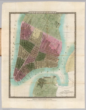
Burr, David H., 1803-1875
Full Title
City Of New-York. Published by David H. Burr, 217 Broadway. Entered ... 1832 by David H. Burr ... New York. Engraved & Printed by Illman & Pilbrow, N.Y.
Publisher
David H. Burr.
Author
Thayer, H.L.
Full Title
Thayer's Map Of New Mexico. Published By H.L. Thayer, Denver, Col. From Surveys of the General Land Office, used by permission, revised & corrected to date by the Publisher. Photo lith & print by Julius Bien & Co. 16 & 18 Park Place N.Y.
Publisher
H.L. Thayer.
Author
Dearborn, Nathaniel
Full Title
New Map Of Massachusetts Compiled from The latest and best Authorities And Corrected by Permission From the Survey ordered by the Legislature. Carefully Revised And Additions Made In 1848. Boston. 3d. Edition Published By Nathl. Dearborn. Engraver & Printer, 104 Washington St. (inset) Boston. (4 additional inset maps).
Publisher
N. Dearborn
Author
[Page, H.R. & Co., Brewster, Charles]
Full Title
Map of Nebraska. Compiled from Official Records in the Surveyor General's Office And Other Authentic Sources By Charles Brewster C.E. Published by H.R. Page & Co. Chicago, Ill. 1882. Copyright 1879 by H.R. Page & Co.
Publisher
H.R. Page & Co.
Author
Farmer, John
Full Title
Map Of The State Of Michigan And the Surrounding Country Exhibiting the Sections and the latest surveys. Compiled From Authentic Sources By John Farmer. Detroit. 1853. 23rd edition. Entered ... 1844 by John Farmer of Detroit. (inset) Plat of the Copper District on L. Superior. Engd. by J. Farmer.
Publisher
John Farmer.
Author
Clason Map Company
Full Title
Approved Mineral Surveys Of The Principal Mining Districts In Boulder County Colorado. 1916. Published By The Clason Map Co. 1515 Tremont Place, Denver, Colo. Copyrighted 1916 by The Clason Map Co. Denver, Colo.
Publisher
Clason Map Company
Author
Dripps, Matthew
Full Title
Map Of The City Of New York And Vicinity. Published By M. Dripps 103 Fulton St. N.Y. 1877. Ed. W. Welcke & Bro. Photo-Lith. 176 William St. N.Y. (inset) City Of Yonkers.
Publisher
M. Dripps
Author
Ensign, Bridgman & Fanning
Full Title
Map Of Minnesota And Part Of Wisconsin. Ensign, Bridgman & Fanning, 156 William Street, New York. 1856. Entered ... 1855, by Ensign, Bridgman & Fanning ... N.Y.
Publisher
Ensign, Bridgman & Fanning
Author
Robbins, Safford & Co.
Full Title
Map Of The Fort Dodge Land District, Iowa. Compiled from Government Surveys and Personal Reconnoissance By Robbins, Safford & Co. Civil Engineers. 1857. S.M Robbins. W.C. Safford. Egbert Bagg. Robbins, Safford & Co. Land Agents and Surveyors. Fort Dodge, Iowa.
Publisher
Robbins, Safford & Co.
Author
[Mitchell, Samuel Augustus, Young, J.H.]
Full Title
The Tourist's Pocket Map Of Michigan Exhibiting Its Internal Improvements Roads Distances &c. by J.H. Young. Philadelphia: Published By S. Augustus Mitchell. 1835. Sold By Mitchell & Hinman No. 6 North Fifth Street. Entered ... 1834 by S. Augustus Mitchell ... Pennsylvania. Engraved by J.H. Young.
Publisher
S. Augustus Mitchell
Author
Mitchell, Samuel Augustus
Full Title
Mitchell's Map Of The United States; Showing the Principal Travelling, Turnpike and Common Roads; on which are given the Distances in Miles from One Place to Another; Also, The Courses Of The Canals & Rail Roads Throughout the Country, Carefully Compiled from the Best Authorities. Philadelphia: Published By S. Augustus Mitchell. 1839. Sold By Thomas, Cowperthwait & Co. No. 253 Market Street. Entered ... 1835, by S. Augustus Mitchell ... Pennsylvania. (with 8 inset maps and table of distances).
Publisher
Samuel Augustus Mitchell
Author
Strong, Ezra
Full Title
The States Of Ohio Indiana & Illinois And Michigan Territory From the Latest Authorities. Published by Ezra Strong New York 1834.
Publisher
Ezra Strong.
Author
Dutton, E.P.
Full Title
New Map Of Massachusetts Compiled from The latest and best Authorities. Published At The Boston Map Store, E.P. Dutton & Co. 135 Washington Street, Boston, 1869. Entered ... 1863 by E.P Dutton & Co ... Massachusetts. (inset) Salem. (inset) Springfield. (inset) Worchester. (inset) Lowell. (inset) Boston.
Publisher
E.P. Dutton
Author
Mills & Co.
Full Title
Mills & Co.'s New Railroad Post Office And Sectional Map Of Iowa Published by Mills & Co. Des Moines Iowa 1882.
Publisher
Mills & Co.
Author
Rice, G. Jay
Full Title
Rice's Map Of St. Paul. 1887. Copyright 1887, By G. Jay Rice.
Publisher
St. Paul Litho. Eng. and Publishing Co.
Author
Cram, George
Full Title
Cram's Rail Road & Township Map of Minnesota. Published By Geo. F. Cram. Proprietor Of The Western Map Depot. 262-264. Wabash, Ave. Chicago, Ills. Entered ... 1878 by G.F. Cram ... Washington, D.C.
Publisher
George Cram
Author
Kenyon Company
Full Title
Map Of The State Of Oklahoma With Latest Official Census Copyrighted 1914. The Kenyon Company, Map Makers, Des Moines, Iowa. Chief Auto Roads Shown in Green. (on verso) Index Of Oklahoma With latest Census, and Shipping and Postal Guide.
Publisher
Kenyon Company
Author
Brown & Gross
Full Title
Map Of Connecticut. From Actual Survey. Published by Brown & Gross, Hartford, Conn. Engraved by Daggett & Ely New Haven. (inset) Plan of the City of New Haven. (inset) Plan of the City of Hartford. (inset) New England States.
Publisher
Brown & Gross
Author
Brown & Parsons
Full Title
Map of Connecticut. From Actual Survey. Published by Brown & Parsons, Hartford, Conn. Engraved by Daggett & Ely New Haven. (inset) Plan of the City of New Haven. (inset) Plan of the City of Hartford. (inset) New England States.
Publisher
Brown & Parsons
|