Who What Where WhenREMOVEWHO
WHEN
|
Author
[State Journal Company, Hirschfeld, F.]
Full Title
(Covers to) Map Of Nebraska. Published by the State Journal Co. Lincoln, Neb. Compiled from the Official Records of the Government and Rail Road Offices. F. Hirschfeld, C.E.
Publisher
State Journal Co.
Author
Buxton & Skinner Stationery Company
Full Title
(Covers to) Ground Plan Of The Louisiana Purchase Exposition St. Louis, Mo. 1904. Buxton & Skinner Stationery Co. Publishers, Fourth & Olive St. St. Louis, Mo. Copyright, 1904 By Parker Eng. Co.
Publisher
Buxton & Skinner
Author
Buxton & Skinner Stationery Company
Full Title
(Text Page to) Ground Plan Of The Louisiana Purchase Exposition St. Louis, Mo. 1904. Buxton & Skinner Stationery Co. Publishers, Fourth & Olive St. St. Louis, Mo. Copyright, 1904 By Parker Eng. Co.
Publisher
Buxton & Skinner
Author
[Langtree, C., Reed, Edwin O., Colton, J.H.]
Full Title
(Covers to) Langtree's New Sectional Map Of The State Of Arkansas ... Drawn And Published by C. Langtree, Draughtsman, Surveyors Office Little Rock, Arks. 1859. Engraved by Edwin O. Reed, Cincinnati, O. Printed by J.H. Colton & Co. N.Y. Copy right transferred to Geo. Thompson & Co. Entered ... 1849 ... Arkansas, by C. Langtree.
Publisher
C. Langtree
Author
Colton, J.H.
Full Title
(Covers to) Colton's Traveler's Map Of The United States, Showing the Counties, Rail Roads &c. Published By G.W. & C.B. Colton & Co. No. 172 William St. New York. 1866. Entered ... 1864 by J.H. Colton ... New York. McLellan Bros. Lith. 26 Spruce St. N.Y. (inset) United States Of America. (inset) West Indies.
Publisher
J.H. Colton & Co.
Author
Colton, G.W. & C.B.
Full Title
(Covers to) Colton's New Rail Road & County Map Of The United States, The Canadas &c. Published By G.W. And C.B. Colton, 172 William St. New York. (inset) Colton's Map Of The United States showing the Proposed Railroad Routes To The Pacific Ocean. (inset) Southern Part Of Florida.
Publisher
G.W. & C.B. Colton.
Author
Colton, G. Woolworth
Full Title
G. Woolworth Colton's New Guide Map Of The United States & Canada, With Railroads, Counties, etc. Drawn, Engraved & Published by G. Woolworth Colton 18 Beekman St. New York, Rufus Blanchard, Chicago, Ill. 1862. Entered ... 1861 by G. Woolworth Colton ... New York. (inset) Western Portion Of The United States. (inset) Plan of The Southern Portion Of Florida.
Publisher
[G.Woolworth Colton, Rufus Blanchard]
Author
[Fisher, Richard Swainson, Dinsmore & Co.]
Full Title
(Covers to) Dinsmore's Complete Map Of The Railroads & Canals In The United States & Canada Carefully Compiled from Authentic Sources by Richard S. Fisher, Editor Of The American Rail Road & Steam Navigator Guide. New-York. Published By Dinsmore & Company, No. 9 Spruce St. Engraved In Relief For Power Press Printing by Schonberg & Co. Acrographers, 75 Nassau Street New York 1856. Entered ... 1856 by Dinsmore & Co. ... New York.
Publisher
Dinsmore & Company
Author
[Bancroft, H.H., Knight, W.H.]
Full Title
(Covers to) Bancroft's Map Of California, Nevada, Utah And Arizona. Published By H.H. Bancroft, & Compy. Booksellers & Stationers San Francisco Cal. 1864. Entered ... 1863 by H.H. Bancroft & Company ... California.
Publisher
H.H. Bancroft & Company
Author
[Blanchard, Rufus, Walling, H. F.]
Full Title
(Covers to) Sectional Map of Illinois Showing the Botany, Topography & Geology of the State. Drawn by Prof. Walling. Compiled And Published By Rufus Blanchard. Chicago, 146 Lake St. Illinois. 1869. Entered ... 1869, by R. Blanchard ... Illinois. (inset) Geological Map Of Illinois. (inset) Illinois Geological Survey Longitudinal Section of the Mississippi River Bluffs, from Dunleith to Cairo.
Publisher
Rufus Blanchard
Author
[Mathewson, A. J., Messinger, John, Peck, J. M.]
Full Title
(Covers to) New Sectional Map Of the State of Illinois. Compiled From The United States Surveys. Also exhibiting the Internal Improvements, distances between Towns, Villages & Post Offices, the outlines of Prairies, Woodlands, Marshes & the lands donated to the State by the Gen. Govt. for the purpose of Internal Improvements. By J.M. Peck, John Messinger, And A.J. Mathewson. Published by J.H. Colton & Co. New-York. 1854. Engraved by S. Stiles & Co., N. York. Entered ... 1853 by J.H. Colton & Co. ... New York. (inset) Vicinity of Alton & St. Louis. (inset) Vicinity Of Galena, The Lead Region And Part Of Wisconsin And Iowa.
Publisher
J.H. Colton & Co.
Author
[Messinger, John, Peck, J. M., Colton, J.H., Mathewson, A.J.]
Full Title
(Covers to) Colton's New Sectional Map Of the State of Illinois. Compiled From The United States Surveys. Also exhibiting the Internal Improvements, distances between Towns, Villages & Post Offices, the outlines of Prairies, Woodlands, Marshes & the lands donated to the State by the Gen. Govt. for the purpose of Internal Improvements. By J.M. Peck, John Messinger, And A.J. Mathewson. Published by J.H. Colton, No. 172 William Street, New York. 1860. Entered ... 1836 by J.H. Colton & Co. ... New York. (inset) The City Of Chicago Illinois. (inset) The City Of St. Louis Missouri.
Publisher
J.H. Colton & Co.
Author
[Colton, G. W. & C. B., Messinger, John, Peck, J. M., Mathewson, A.J.]
Full Title
(Covers to) Colton's Sectional Map Of the State of Illinois. Compiled From The United States Surveys. Also exhibiting the Internal Improvements, distances between Towns, Villages & Post Offices, the outlines of Prairies, Woodlands, Marshes & the lands donated to the State by the Gen. Govt. for the purpose of Internal Improvements. By J.M. Peck, John Messinger, And A.J. Mathewson. Published by G.W. And C.B. Colton, & Co., No. 172 William St., New York. 1867. Entered ... 1836 by J.H. Colton & Co ... New York. (inset) The City Of Chicago Illinois. (inset) The City Of St. Louis Missouri.
Publisher
G.W. & C.B. Colton & Co.
Author
[Mitchell, Samuel Augustus, Young, James H.]
Full Title
(Covers to) The Tourist's Pocket Map Of The State Of Tennessee Exhibiting Its Internal Improvements Roads Distances &c. by J.H. Young. Philadelphia: Published By S. Augustus Mitchell. 1839. Sold by Thomas, Cowperthwait & Co. No. 253 Market Street. Entered ... 1834 by S. Augustus Mitchell ... Pennsylvania. Engraved by J.H. Young. (inset) Vicinity Of Nashville. (inset) Vicinity Of Knoxville.
Publisher
S. Augustus Mitchell
Author
[Mitchell, Samuel Augustus, Young, James H.]
Full Title
The Tourist's Pocket Map Of The State Of Tennessee Exhibiting Its Internal Improvements Roads Distances &c. by J.H. Young. Philadelphia: Published By S. Augustus Mitchell. 1839. Sold by Thomas, Cowperthwait & Co. No. 253 Market Street. Entered ... 1834 by S. Augustus Mitchell ... Pennsylvania. Engraved by J.H. Young. (inset) Vicinity Of Nashville. (inset) Vicinity Of Knoxville.
Publisher
S. Augustus Mitchell
Author
Wells, John G.
Full Title
(Covers to) Wells' New Sectional Map Of Nebraska From the last Government Survey. J.G. Wells 11 Beekman St. New York. J.B. Snow, Land Agent, Otoe Nebraska. Lith. V. Keil 181 William St. N.Y. Entered ... 1857, J.G. Wells ... New York.
Publisher
J.G. Wells
Author
Tracy, J.L.
Full Title
Map Of The State Of Missouri ... To illustrate Tracy's "Missouri Guide" and "Missouri Gazetteer" ... Published by The R.P. Studley Co. ... St. Louis 1871. Lith. by R.P. Studley & Co. St. Louis. (with) Map Of The City Of St. Louis For Tracy's Guide To Missouri. Drawn & Lithd. By Juls. Hutawa 313 Chestnut St. (with) Map Of The Missouri Pacific And Atlantic & Pacific Railroads, And Connections. National Railway Publication Co. Philadelphia.
Publisher
St. Louis:
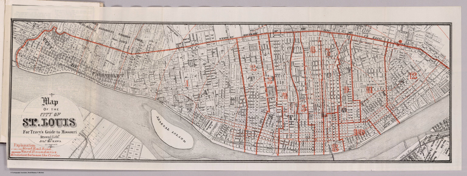
Author
Tracy, J.L.
Full Title
Map Of The City Of St. Louis For Tracy's Guide To Missouri. Drawn & Lithd. By Juls. Hutawa 313 Chestnut St. (with) Map Of The State Of Missouri ... To illustrate Tracy's "Missouri Guide" and "Missouri Gazetteer" ... Published by The R.P. Studley Co. ... St. Louis 1871. Lith. by R.P. Studley & Co. St. Louis. (with) Map Of The Missouri Pacific And Atlantic & Pacific Railroads, And Connections. National Railway Publication Co. Philadelphia.
Publisher
St. Louis:
Author
Tracy, J.L.
Full Title
Map Of The Missouri Pacific And Atlantic & Pacific Railroads, And Connections. National Railway Publication Co. Philadelphia. (with) Map Of The City Of St. Louis For Tracy's Guide To Missouri. Drawn & Lithd. By Juls. Hutawa 313 Chestnut St. (with) Map Of The State Of Missouri ... To illustrate Tracy's "Missouri Guide" and "Missouri Gazetteer" ... Published by The R.P. Studley Co. ... St. Louis 1871. Lith. by R.P. Studley & Co. St. Louis.
Publisher
St. Louis:
Author
Mitchell, Samuel Augustus
Full Title
(Covers to) A Route-Book, Adapted To Mitchell's National Map Of The American Republic; Comprising Tables Of The Principal Rail-Road, Steam-Boat And Stage Routes, Throughout The United States. Philadelphia: S. Augustus Mitchell, N.E. Cor. Market And Seventh Sts. 1847. (on verso) Entered ... 1846, by S. Augustus Mitchell ... Pennsylvania. Stereotyped by J. Fagan. Printed by Kay & Brother. (with) Mitchell's National Map of the American Republic Or United States Of North America ... 1846. Drawn by J.H. Young. Engraved by J.H. Brightly. Entered ... 1846, by S. Augustus Mitchell ... Pennsylvania. (with 4 inset maps).
Publisher
S. Augustus Mitchell
Author
Mitchell, Samuel Augustus
Full Title
(Title Page to) A Route-Book, Adapted To Mitchell's National Map Of The American Republic; Comprising Tables Of The Principal Rail-Road, Steam-Boat And Stage Routes, Throughout The United States. Philadelphia: S. Augustus Mitchell, N.E. Cor. Market And Seventh Sts. 1847. (on verso) Entered ... 1846, by S. Augustus Mitchell ... Pennsylvania. Stereotyped by J. Fagan. Printed by Kay & Brother. (with) Mitchell's National Map of the American Republic Or United States Of North America ... 1846. Drawn by J.H. Young. Engraved by J.H. Brightly. Entered ... 1846, by S. Augustus Mitchell ... Pennsylvania. (with 4 inset maps).
Publisher
S. Augustus Mitchell
Author
Rand McNally and Company
Full Title
(Covers to) Rand, McNally & Co.'s Cycling & Wagon Road Map Of South Eastern Wisconsin. Copyrighted By Rand, McNally & Co. (ink stamped) Copyrighted 1895, Rand, McNally & Co.
Publisher
Rand McNally & Co.
Author
Punnett Brothers
Full Title
(Covers to) Map Of The State Of California. Compiled And Published By Punnett Bros. 625 Mission St., S.F., Cal. 1897. Copyrighted. B.H.C. Sandy, Sole Agent. 316 Battery St. S.F. (inset) San Joaquin Valley. (inset) Yosemite Valley And Vicinity.
Publisher
Punnett Brothers, and B.H.C. Sandy
Author
[Mitchell, Samuel Augustus, Young, James H.]
Full Title
Mitchell's Traveller's Guide Through The United States. A Map Of The Roads, Distances, Steam Boat & Canal Routes &c. By J.H. Young. Philadelphia. Published by S. Augustus Mitchell. 1835. Engraved On Steel By J.H. Young And D. Haines. Entered ... 1834 by S. Augustus Mitchell ... Pennsylvania. (with 9 inset maps). (with folded sheet) Index. Steam-boat And Canal Routes ...
Publisher
S.Augustus Mitchell
Author
Finley, Anthony
Full Title
(Covers to) Pennsylvania. Philada. Published by A. Finley, 1832. J.H. Young Sc.
Publisher
Anthony Finley
Author
Finley, Anthony
Full Title
(Covers to) New Jersey. Philadelphia Published by A. Finley 1834 Engraved by J.H. Young.
Publisher
Anthony finley
Author
Mitchell, Samuel Augustus
Full Title
(Covers to) Map Of Pennsylvania New Jersey And Delaware Compiled From the Latest Authorities. Philadelphia Published by S. Augustus Mitchell. 1832. (inset) Vicinity Of Pittsburgh. (inset) Lehigh And Schuylkill. Coal Regions. (inset) Vicinity Of Philadelphia. (inset) Vicinity Of Lancaster.
Publisher
S. Augustus Mitchell
Author
Mitchell, Samuel Augustus
Full Title
Map Of Pennsylvania New Jersey And Delaware Compiled From the Latest Authorities. Philadelphia Published by S. Augustus Mitchell. 1832. (inset) Vicinity Of Pittsburgh. (inset) Lehigh And Schuylkill. Coal Regions. (inset) Vicinity Of Philadelphia. (inset) Vicinity Of Lancaster.
Publisher
S. Augustus Mitchell
Author
Blanchard, Rufus
Full Title
(Covers to) Blanchard's Map Of The North Western States. Showing the Counties, Towns, Railroads, Stations, Steam Boat Landing etc. Compiled From The Most Authentic Sources. Published by Rufus Blanchard, 148 Lake Street, Chicago, Ill. 1866. Lith. Chas. Shober, Chicago. Entered ... 1865, by R. Blanchard ... Illinois.
Publisher
Rufus Blanchard
Author
Ensign, Bridgman & Fanning
Full Title
(Covers to) Map of Missouri. Published By Ensign, Bridgman & Fanning, 156 William St. New York 1857. Entered ... 1856, by Ensign, Bridgman & Fanning ... New York.
Publisher
Ensign, Bridgman & Fanning
Author
Clason Map Company
Full Title
Clason's Map Of California Published By The Clason Map Co., Denver, Colo. Copyrighted 1910 By The Clason Map Co., Denver, Col. (inset) Enlarged Section Of San Francisco And Vicinity. (inset) Enlarged Section Of Los Angeles And Vicinity.
Publisher
Clason Map Company
Author
[Perris, Fred T., Levet, Benj. F.]
Full Title
(Covers to) Perris' Miners Map Of The Desert Region Of Southern California Embracing The Counties Of San Bernardino, Riverside and Orange, and Portions Of The Adjacent Counties, Showing Mining Districts, Forest Reserves, Indian Reservations, and County Boundaries. Compiled And Drawn In The Office Of The Chief Engineer Of The Southern California Railway, By Benj. F. Levet, From Data Acquired By Fred T. Perris, Chief Engineer, From All Authentic Sources, 1896. Approved By Boards of Supervisors of Los Angeles, San Bernardino, and Riverside Counties. Copyright, 1896, By Fred T. Perris. Assigned To Rand, McNally & Co. Map Publishers, Chicago.
Publisher
Rand, McNally & Co.
Author
The Holden Drug Co.
Full Title
(Covers to) Map Of The City of Stockton, California Copyrighted March 18, 1897. Published By The Holden Drug Co. Corner Main and El Dorado Streets Stockton, California.
Publisher
The Holden Drug Co.
Author
[Bancroft, A.L., Knight, W.H.]
Full Title
(Covers to) Bancroft's Map Of California, Nevada, Utah And Arizona. Published By A.L. Bancroft, & Compy. Booksellers & Stationers San Francisco Cal. 1876. Entered ... by A.L. Bancroft & Company ... Washington, D.C.
Publisher
A.L. Bancroft & Co.
Author
Rand McNally and Company
Full Title
(Covers to) Rand McNally Junior Road Map California and Nevada. Copyright By Rand McNally & Co. Chicago Ill. Made In U.S.A. ... (1926)
Publisher
Rand McNally
Author
[Burr, David H., 1803-1875, Colton, J. H.]
Full Title
(Covers to ) New-York. By David H. Burr. Published by J.H. Colton & Co. 9 Wall Street New-York. 1833. Entered ... 1833 by J.H. Colton & Co. ... New York. Engraved & Printed by S. Stiles & Co. No. 9 Wall St. N. York. (with 5 inset maps)
Publisher
J.H. Colton & Co.
Author
Colton, G.W. & C.B.
Full Title
(Covers to) Colton's Map Of The States And Territories West Of The Mississippi River To The Pacific Ocean Showing The Overland Routes, Projected Rail Road Lines &c. Published by G.W. And C.B. Colton, & Co. 172 William St. New York. 1868. Entered ... 1867 by G.W. & C.B. Colton & Co ... New York.
Publisher
G.W. & C.B. Colton.
Author
Colton, G.W. & C.B.
Full Title
(Covers to) Colton's New Railroad Map Of The United States & Canada, Published by G.W. And C.B. Colton, & Co. 172 William St. New York. 1869. Entered ... 1861, by J.H. Goldthwait ... New York. (inset) Map Of The Great Railroad Routes from the Middle Atlantic Ports To The Mississippi River. (inset) Map Of The Railroads Of New England And Eastern N. York. (inset) The Northern Hemisphere On A Polar Projection, Showing the time on each meridian as compared with Washington noon, and the longest day for different latitudes.
Publisher
G.W. & C.B. Colton.
Author
Colton, G.W. & C.B.
Full Title
(Covers to) Colton's New Rail Road & County Map Of The United States, The Canadas &c. 1871. Published By G.W. And C.B. Colton, 172 William St. New York. Entered ... 1869 by G.W. & C.B. Colton & Co ... New York. (inset) Colton's Map Of The United States showing the Proposed Railroad Routes To The Pacific Ocean. (inset) Southern Part Of Florida.
Publisher
G.W. & C.B. Colton & Co.
Author
Colton, J.H.
Full Title
(Covers to) Colton's Map Of The United States, The Canadas &c. Showing The Rail Roads, Canals & Stage Roads: With Distances from Place to Place. Published by J.H. Colton No. 86 Cedar St., New York, 1852. (inset) Map Of New England And Eastern New York. (inset) Map Of The United States, Central America &c. (inset) The Isthmus Of Panama Showing the Routes Of Travel Between Chagres & Panama.
Publisher
J.H. Colton.
Author
Colton, J. H.
Full Title
(Covers to) Colton's New Map Of Indiana. Reduced from his Large Map Exhibiting the Boundaries of Counties, Township Surveys, Location of Cities, Towns, Villages, Post Offices, Canals, Rail Roads & other Internal Improvements. New-York, Published by J.H. Colton. 1853.
Publisher
J. H. Colton.
Author
Colton, J. H.
Full Title
(Covers to) Illinois. Published By J.H. Colton No. 86 Cedar St. New York. 1854. Entered ... 1853, by J.H. Colton ... New York. (inset) Vicinity of Chicago.
Publisher
J. H. Colton.
Author
Colton, J. H.
Full Title
(Covers to) Colton's New Map Of Indiana. Reduced from his Large Map Exhibiting the Boundaries of Counties, Township Surveys, Location of Cities, Towns, Villages, Post Offices, Canals, Rail Roads & other Internal Improvements. New-York, Published by J.H. Colton & Co. 1854. Entered ... 1854, by J.H. Colton ... New York.
Publisher
J.H. Colton & Co.
Author
[Colton, J. H., Colton, G. Woolworth]
Full Title
(Covers to) Colton's Township Map Of The State Of Iowa Compiled from the United States Surveys, & other Authentic Sources. Published By J.H. Colton And Co. No. 172 William St. New York. 1855. Entered ... 1851, by J.H. Colton ... New York. Drawn by Geo W. Colton. Engraved by J.M. Atwood.
Publisher
J.H. Colton & Co.
Author
Cram, George Franklin
Full Title
(Covers to) Cram's Township & Rail Road Map Of The North Western States. Geo. F. Cram & Co. ... Proprietors Of The Western Map Depot. 148 Lake Street, Chicago Ills. 1870.
Publisher
George F. Cram
Author
Cram, George Franklin
Full Title
Cram's Township & Rail Road Map Of The North Western States. Geo. F. Cram & Co. ... Proprietors Of The Western Map Depot. 148 Lake Street, Chicago Ills. 1870.
Publisher
George F. Cram
Author
Cram, George Franklin
Full Title
(Cover to) New Sectional Map Of The State Of Missouri. Engraved from Official Draughts of each County. Published by George F. Cram & Co. Proprietor Of The Western Map Depot. 148. Lake Street, Chicago, Ill. 1871. Entered ... 1869, by George F. Cram ... Illinois.
Publisher
George F. Cram
Author
Edwards, R.M.
Full Title
(Covers to) Railroad Map Of The City Of San Francisco, California. Published by R.M. Edwards, Late D.E. Appleton & Co., Publisher & Bookseller, 508 & 510 Montgomery Street, San Francisco.
Publisher
R.M. Edwards
Author
Finley, Anthony
Full Title
(Covers to) Map of Kentucky And Tennessee Compiled from the Latest Authorities. Philadelphia Published by A. Finley. D.H. Vance Del. J.H. Young Sculp.
Publisher
Anthony Finley
|