Browse All

1873 Jersey City - Plate G. [County Atlas, State Atlas] Jersey City - Plate G. |

1873 Jersey City - Plate H. [County Atlas, State Atlas] Jersey City - Plate H. |

1873 Jersey City - Plate I. [County Atlas, State Atlas] Jersey City - Plate I. |

1873 Jersey City - Plate J. [County Atlas, State Atlas] Jersey City - Plate J. |

1873 Jersey City - Plate K. [County Atlas, State Atlas] Jersey City - Plate K. |

1873 Jersey City - Plate L. [County Atlas, State Atlas] Jersey City - Plate L. |

1873 Jersey City - Plate M. [County Atlas, State Atlas] Jersey City - Plate M. |

1873 Jersey City - Plate N. [County Atlas, State Atlas] Jersey City - Plate N. |

1873 Jersey City - Plate O. [County Atlas, State Atlas] Jersey City - Plate O. |

1873 Jersey City - Plate P. [County Atlas, State Atlas] Jersey City - Plate P. |

1873 Jersey City - Plate Q. [County Atlas, State Atlas] Jersey City - Plate Q. |

1873 Jersey City - Plate R. [County Atlas, State Atlas] Jersey City - Plate R. |

1873 Jersey City - Plate S. [County Atlas, State Atlas] Jersey City - Plate S. |

1873 Jersey City - Plate T. [County Atlas, State Atlas] Jersey City - Plate T. |

1873 Hoboken - Plate A. [County Atlas, State Atlas] Hoboken - Plate A. |

1873 Hoboken - Plate B. [County Atlas, State Atlas] Hoboken - Plate B. |

1873 Hoboken - Plate C. [County Atlas, State Atlas] Hoboken - Plate C. |

1873 Hoboken - Plate D. Sub-Plan to Jersey Ci … [County Atlas, State Atlas] Hoboken - Plate D. Sub-Plan to Jersey Ci … |

1873 Hoboken - Plate E. [County Atlas, State Atlas] Hoboken - Plate E. |

1873 Southern Part of West Hoboken - Plate A. [County Atlas, State Atlas] Southern Part of West Hoboken - Plate A. |
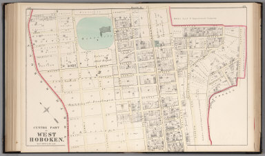
1873 Centre Part of West Hoboken - Plate B. [County Atlas, State Atlas] Centre Part of West Hoboken - Plate B. |

1873 West Hoboken - Plate C. [County Atlas, State Atlas] West Hoboken - Plate C. |

1873 Northern Part of the Town of Union - Pla … [County Atlas, State Atlas] Northern Part of the Town of Union - Pla … |

1873 Southern Part of the Town of Union. [County Atlas, State Atlas] Southern Part of the Town of Union. |

1873 Northern Part of the Union Township - Pl … [County Atlas, State Atlas] Northern Part of the Union Township - Pl … |

1873 Southern Part of the Town of Union - Pla … [County Atlas, State Atlas] Southern Part of the Town of Union - Pla … |

1873 Plan of Weehawken Township. [County Atlas, State Atlas] Plan of Weehawken Township. |

1873 North Bergen Township. [County Atlas, State Atlas] North Bergen Township. |

1873 Part of Plan of North Bergen Township. [County Atlas, State Atlas] Part of Plan of North Bergen Township. |

1873 Part of North Bergen Township. [County Atlas, State Atlas] Part of North Bergen Township. |

1873 Part of Kearney Township. [County Atlas, State Atlas] Part of Kearney Township. |

1873 Part of Harrison East Newark - Plate A. [County Atlas, State Atlas] Part of Harrison East Newark - Plate A. |

1873 Part of Harrison, East Newark - Plate B. [County Atlas, State Atlas] Part of Harrison, East Newark - Plate B. |

1873 Formerly Greenville, now Part of Sixth D … [County Atlas, State Atlas] Formerly Greenville, now Part of Sixth D … |

1873 City of Bayonne. [County Atlas, State Atlas] City of Bayonne. |

1915 Parts of Townships 20 N., Range 22 E.; T … County Atlas East Wenatchee Land Co's. Plats. Part of … |

1915 Township 22 N., Ranges 20 and 21 E., Dou … County Atlas Map of Township 22 N., Ranges 20 and 21 … |

1915 Township 22 N., Range 22 E., Douglas Cou … County Atlas Part of Township 22 N., Range 22 E. |

1915 Township 22 N., Range 23 E., Douglas Cou … County Atlas Map of Part of Township 22 N., Range 23 … |

1915 Township 22 N., Range 32 E. and Part of … County Atlas Map of Township 22 N., Range 32 E. and P … |

1915 Township 23 N., Range 22 E., Douglas Cou … County Atlas Map of Township 23 N., Range 22 E. |

1915 Township 23 N., Range 23 E., Douglas Cou … County Atlas Map of Township 23 N., Range 23 E. |

1915 Township 23 N., Range 24 E., Douglas Cou … County Atlas Map of Township 23 N., Range 24 E. |

1915 Township 23 N., Range 25 E., Douglas Cou … County Atlas Map of Township 23 N., Range 25 E. |

1915 Part of Township 23 N., Range 26 E., Dou … County Atlas Map of Part of Township 23 N., Range 26 … |

1915 Part of Township 24 N., Ranges 20 and 21 … County Atlas Map of Part of Township 24 N., Ranges 20 … |

1915 Township 24 N., Range 22 E., Douglas Cou … County Atlas Map of Township 24 N., Range 22 E. |

1915 Township 24 N., Range 23 E., Douglas Cou … County Atlas Map of Township 24 N., Range 23 E. |

1915 Township 24 N., Range 24 E., Douglas Cou … County Atlas Map of Township 24 N., Range 24 E. |

1915 Township 24 N., Range 25 E., Douglas Cou … County Atlas Map of Township 24 N., Range 25 E. |