|
Author
American Atlas Company
Full Title
Map of Farmington.
Publisher
American Atlas Company
Author
American Atlas Company
Full Title
Map of Mesopotamia.
Publisher
American Atlas Company
Author
American Atlas Company
Full Title
Outline Map of Niles City. Outline Map of Warren City.
Publisher
American Atlas Company
Author
American Atlas Company
Full Title
Map of North Part of the City of Warren.
Publisher
American Atlas Company
Author
American Atlas Company
Full Title
Map of West Part of the City of Niles.
Publisher
American Atlas Company
Author
American Atlas Company
Full Title
Map of Girard Village.
Publisher
American Atlas Company
Author
American Atlas Company
Full Title
Map of Mineral Ridge Village.
Publisher
American Atlas Company
Author
American Atlas Company
Full Title
Map of Cortland Village.
Publisher
American Atlas Company
Author
American Atlas Company
Full Title
Map of Newton Falls Village.
Publisher
American Atlas Company
Author
American Atlas Company
Full Title
Map of Kinsman P.O.
Publisher
American Atlas Company
Author
American Atlas Company
Full Title
West Farmington Village. Deforest P.O.
Publisher
American Atlas Company
Author
American Atlas Company
Full Title
Plats East of Vienna Center. Map of Leavittsburg P.O. or West Warren. Map of Johnston Center, Johnstonville P.O.
Publisher
American Atlas Company
Author
American Atlas Company
Full Title
Map of Brookfield Center. (Other areas in Trumbull Conty).
Publisher
American Atlas Company
Author
American Atlas Company
Full Title
Map of Orangeville Village. Map of Hartford Centre. Map of Vienna Center. Map of Burghill P.O. Kinsman Station, Farmdale P.O.
Publisher
American Atlas Company
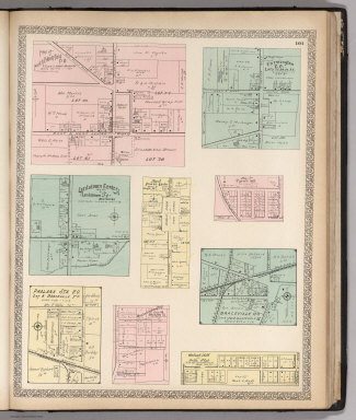
Author
American Atlas Company
Full Title
Map of North Bloomfield P.O. Farmington P.O. Lordstown Center. Map of Fowler Center. Map of Tyrrell Mill. Phalanx Sta. P.O. Otis Coa Company Plat. Braceville P.O. Walnut Hill ot Bell's Plat.
Publisher
American Atlas Company
Author
American Atlas Company
Full Title
Map of West Metts P.O. Mesopotamia P.O. Map of Bristolville P.O. Bowmansville, Delightful P.O. Map of Dilworth P.O. Map of Gustavus Center. Map of Spokane P.O. Map of Mecca P.O. Map of Bristol P.O. Map of North Bristol.
Publisher
American Atlas Company
Author
American Atlas Company
Full Title
Map of Church Hill P.O. Map of Ohlton, Meander P.O. Mahoning Coal Co's Plat. Map of Coalburg P.O. Moorefield. Hanna Plat. Germantown. Longsville.
Publisher
American Atlas Company
Author
American Atlas Company
Full Title
(Text Page) Public Lands of Ohio.
Publisher
American Atlas Company
Author
American Atlas Company
Full Title
Alaska (insets) Cook Inlet and Vicinity. Birch Creek and Tributaries. Klondike District.
Publisher
American Atlas Company
Author
American Atlas Company
Full Title
Map of South Part of the City of Warren.
Publisher
American Atlas Company
Author
American Atlas Company
Full Title
(Composite Map) Warren.
Publisher
American Atlas Company
Author
American Atlas Company
Full Title
Map of East Part of the City of Niles.
Publisher
American Atlas Company
Author
American Atlas Company
Full Title
(Composite Map) City of Niles.
Publisher
American Atlas Company
Author
American Atlas Company
Full Title
Map of Hubbard Village.
Publisher
American Atlas Company
Author
[Dripps, M., Butler, Jason]
Full Title
Map of Sing-Sing, Westchester County, N.Y. Showing every House and Property From an Original Survey published by M. Dripps, 105 Fulton St., New York. 1852. Surveyed by Jas. Butler.
Publisher
M. Dripps
Author
Gray, Ormando Willis
Full Title
Map of Richmond, Henrico County, Virginia. (inset continuation of main map).
Publisher
O.W. Gray & Son
Author
Gray, Ormando Willis
Full Title
Edinburg, Shenandoah County, Virginia.
Publisher
O.W. Gray & Son
Author
Gray, Ormando Willis
Full Title
Woodstock, Shenandoah County, Virginia.
Publisher
O.W. Gray & Son
Author
Gray, Ormando Willis
Full Title
Mt. Jackson, Shenandoah County, Virginia. New Market, Shenandoah County, Virginia.
Publisher
O.W. Gray & Son
Author
Gray, Ormando Willis
Full Title
Gray's New Map of Lexington, Rockingham County, Virginia. Drawn from Special Surveys, 1877. Drawn, Engraved, and Published by O.W. Gray & Son, Geographers, Manufacturers of Maps and Atlases, 10 North Fifth Street, Philadelphia. Jacob Chace, Topographical Engineer, Manager of Local Surveys.
Publisher
O.W. Gray & Son
Author
Gray, Ormando Willis
Full Title
Luray, Page County, Virginia.
Publisher
O.W. Gray & Son
Author
Gray, Ormando Willis
Full Title
Newtown, (Newtown-Stephenburgh P.O.), Frederick County, Virginia.
Publisher
O.W. Gray & Son
Author
Gray, Ormando Willis
Full Title
Gray's New Map of Leesburg, Loudoun Co., Virginia. Drawn from Special Surveys, 1878. Drawn, Engraved, and Published by O.W. Gray & Son, Geographers, Manufacturers of Maps and Atlases, 10 North Fifth Street, Philadelphia. Jacob Chace, Topographical Engineer, Manager of Local Surveys. George Chace, Assistant Engineer. (inset a continuation of main map).
Publisher
O.W. Gray & Son
Author
Gray, Ormando Willis
Full Title
Strasburg, Shenandoah County, Virginia.
Publisher
O.W. Gray & Son
Author
Gray, Ormando Willis
Full Title
Gray's New Map of Charlottesville, Albemarle County, Virginia. Drawn from Special Surveys, 1877. Drawn, Engraved, and Published by O.W. Gray & Son, Geographers, Manufacturers of Maps and Atlases, 10 North Fifth Street, Philadelphia. Jacob Chace, Topographical Engineer, Manager of Local Surveys. (inset) (Vicinity of) Charlottesville.
Publisher
O.W. Gray & Son
Author
Gray, Ormando Willis
Full Title
Map of Orange Court House, Orange County, Virginia. Philadelphia: O.W. Gray & Son.
Publisher
O.W. Gray & Son
Author
Gray, Ormando Willis
Full Title
Gray's New Map of Culpepper, Culpepper County, Virginia. Drawn from Special Surveys, 1878. Drawn, Engraved, and Published by O.W. Gray & Son, Geographers, Manufacturers of Maps and Atlases, 10 North Fifth Street, Philadelphia. Jacob Chace, Topographical Engineer, Manager of Local Surveys. George Chace, Assistant Engineer.
Publisher
O.W. Gray & Son
Author
Gray, Ormando Willis
Full Title
Gray's New Map of Gordonsville, Orange County, Virginia. Drawn from Special Surveys, 1878. Philadelphia: O.W. Gray & Son. Gray's New Map of Harrisonburg (Outline), Rockingham County, Virginia. Drawn from Special Surveys, 1877. Philadelphia: O.W. Gray & Son.
Publisher
O.W. Gray & Son
Author
Gray, Ormando Willis
Full Title
Gray's New Map of Harrisonburg, Rockingham Co., Virginia. Drawn from Special Surveys, 1877. Drawn, Engraved, and Published by O.W. Gray & Son, Geographers, Manufacturers of Maps and Atlases, 10 North Fifth Street, Philadelphia. Jacob Chace, Topographical Engineer, Manager of Local Surveys.
Publisher
O.W. Gray & Son
Author
Gray, Ormando Willis
Full Title
Gray's New Map of Bridgewater, Rockingham County, Virginia. Drawn from Special Surveys, 1877. Philadelphia: O.W. Gray & Son.
Publisher
O.W. Gray & Son
Author
Gray, Ormando Willis
Full Title
(Text Page) The National Atlas. Professional Directory of Patrons. Virginia.
Publisher
O.W. Gray & Son
Author
Gray, Ormando Willis
Full Title
(Text Page) The National Atlas. Professional Directory of Patrons - Continued.
Publisher
O.W. Gray & Son
|