|
Author
[Howe, Samuel Gridley, Ruggles, Samuel P.]
Full Title
Map of Pennsylvania.
Publisher
New England Institution for the Education of the Blind
Author
[Howe, Samuel Gridley, Ruggles, Samuel P.]
Full Title
(Text Page) Pennsylvania: Explanation.
Publisher
New England Institution for the Education of the Blind
Author
[Howe, Samuel Gridley, Ruggles, Samuel P.]
Full Title
Map of New Jersey.
Publisher
New England Institution for the Education of the Blind
Author
[Howe, Samuel Gridley, Ruggles, Samuel P.]
Full Title
(Text Page) New Jersey: Explanation.
Publisher
New England Institution for the Education of the Blind
Author
[Howe, Samuel Gridley, Ruggles, Samuel P.]
Full Title
Map of Maryland and Delaware.
Publisher
New England Institution for the Education of the Blind
Author
[Howe, Samuel Gridley, Ruggles, Samuel P.]
Full Title
(Text Page) Maryland (and Delaware): Explanation.
Publisher
New England Institution for the Education of the Blind
Author
[Howe, Samuel Gridley, Ruggles, Samuel P.]
Full Title
Virginia and Maryland
Publisher
New England Institution for the Education of the Blind
Author
[Howe, Samuel Gridley, Ruggles, Samuel P.]
Full Title
(Text Page) Virginia and Maryland Explanation
Publisher
New England Institution for the Education of the Blind
Author
[Howe, Samuel Gridley, Ruggles, Samuel P.]
Full Title
Map of the District of Columbia.
Publisher
New England Institution for the Education of the Blind
Author
[Howe, Samuel Gridley, Ruggles, Samuel P.]
Full Title
(Text Page) District of Columbia: Explanation.
Publisher
New England Institution for the Education of the Blind
Author
[Howe, Samuel Gridley, Ruggles, Samuel P.]
Full Title
Map of North & South Carolina.
Publisher
New England Institution for the Education of the Blind
Author
[Howe, Samuel Gridley, Ruggles, Samuel P.]
Full Title
(Text Page) North & South Carolina: Explanation.
Publisher
New England Institution for the Education of the Blind
Author
[Howe, Samuel Gridley, Ruggles, Samuel P.]
Full Title
Map of South Carolina and Georgia.
Publisher
New England Institution for the Education of the Blind
Author
[Howe, Samuel Gridley, Ruggles, Samuel P.]
Full Title
(Text Page) South Carolina & Georgia Explanation.
Publisher
New England Institution for the Education of the Blind
Author
[Howe, Samuel Gridley, Ruggles, Samuel P.]
Full Title
Map of Florida.
Publisher
New England Institution for the Education of the Blind
Author
[Howe, Samuel Gridley, Ruggles, Samuel P.]
Full Title
(Text Page) Explanation: Florida.
Publisher
New England Institution for the Education of the Blind
Author
[Howe, Samuel Gridley, Ruggles, Samuel P.]
Full Title
Map of Mississippi.
Publisher
New England Institution for the Education of the Blind
Author
[Howe, Samuel Gridley, Ruggles, Samuel P.]
Full Title
(Text Page) Mississippi Explanation.
Publisher
New England Institution for the Education of the Blind
Author
[Howe, Samuel Gridley, Ruggles, Samuel P.]
Full Title
Alabama.
Publisher
New England Institution for the Education of the Blind
Author
[Howe, Samuel Gridley, Ruggles, Samuel P.]
Full Title
(Text Page) Alabama. Explanation.
Publisher
New England Institution for the Education of the Blind
Author
[Howe, Samuel Gridley, Ruggles, Samuel P.]
Full Title
Map of Louisiana.
Publisher
New England Institution for the Education of the Blind
Author
[Howe, Samuel Gridley, Ruggles, Samuel P.]
Full Title
(Text Page) Louisiana Explanation.
Publisher
New England Institution for the Education of the Blind
Author
[Howe, Samuel Gridley, Ruggles, Samuel P.]
Full Title
Map of Kentucky & Tennessee.
Publisher
New England Institution for the Education of the Blind
Author
[Howe, Samuel Gridley, Ruggles, Samuel P.]
Full Title
(Text Page) Kentucky & Tennessee Explanation.
Publisher
New England Institution for the Education of the Blind
Author
[Howe, Samuel Gridley, Ruggles, Samuel P.]
Full Title
Map of Missouri.
Publisher
New England Institution for the Education of the Blind
Author
[Howe, Samuel Gridley, Ruggles, Samuel P.]
Full Title
(Text Page) Missouri. Explanation.
Publisher
New England Institution for the Education of the Blind
Author
[Howe, Samuel Gridley, Ruggles, Samuel P.]
Full Title
Map of Illinois.
Publisher
New England Institution for the Education of the Blind
Author
[Howe, Samuel Gridley, Ruggles, Samuel P.]
Full Title
(Text Page) Illinois. Explanation.
Publisher
New England Institution for the Education of the Blind
Author
[Howe, Samuel Gridley, Ruggles, Samuel P.]
Full Title
Map of Ohio.
Publisher
New England Institution for the Education of the Blind
Author
[Howe, Samuel Gridley, Ruggles, Samuel P.]
Full Title
(Text Page) Ohio Explanation.
Publisher
New England Institution for the Education of the Blind
Author
[Howe, Samuel Gridley, Ruggles, Samuel P.]
Full Title
Map of Indiana.
Publisher
New England Institution for the Education of the Blind
Author
[Howe, Samuel Gridley, Ruggles, Samuel P.]
Full Title
(Text Page) Indiana Explanation.
Publisher
New England Institution for the Education of the Blind
Author
[Howe, Samuel Gridley, Ruggles, Samuel P.]
Full Title
(Map of Michigan).
Publisher
New England Institution for the Education of the Blind
Author
[Howe, Samuel Gridley, Ruggles, Samuel P.]
Full Title
(Text Page) Michigan Explanation.
Publisher
New England Institution for the Education of the Blind
Author
Melish, John
Full Title
(Covers to) A New Juvenile Atlas, And Familiar Introduction To The Use Of Maps: With A Comprehensive View Of The Present State Of The Earth ... First American From The Latest London Edition, Corrected And Improved, By John Melish. Philadelphia, Printed For John Melish, John Vallance, And H.S. Tanner, No. 209, Chestnut-Street, By G. Palmer. 1814.
Publisher
G. Palmer
Author
Melish, John
Full Title
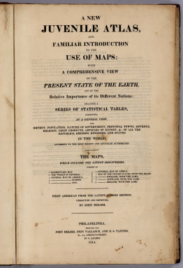
(Title Page to) A New Juvenile Atlas, And Familiar Introduction To The Use Of Maps: With A Comprehensive View Of The Present State Of The Earth ... First American From The Latest London Edition, Corrected And Improved, By John Melish. Philadelphia, Printed For John Melish, John Vallance, And H.S. Tanner, No. 209, Chestnut-Street, By G. Palmer. 1814.
Publisher
G. Palmer
Author
Melish, John
Full Title
(Advertisement to) A New Juvenile Atlas, And Familiar Introduction To The Use Of Maps: With A Comprehensive View Of The Present State Of The Earth ... First American From The Latest London Edition, Corrected And Improved, By John Melish. Philadelphia, Printed For John Melish, John Vallance, And H.S. Tanner, No. 209, Chestnut-Street, By G. Palmer. 1814.
Publisher
G. Palmer
Author
Melish, John
Full Title
Elementary Map. (engraved by) H.S. Tanner. Sc. Published ... 1814 by J. Melish. J. Vallance & H.S. Tanner. Philadelphia. (to accompany) A New Juvenile Atlas, And Familiar Introduction To The Use Of Maps: With A Comprehensive View Of The Present State Of The Earth ... First American From The Latest London Edition, Corrected And Improved, By John Melish. Philadelphia, Printed For John Melish, John Vallance, And H.S. Tanner, No. 209, Chestnut-Street, By G. Palmer. 1814.
Publisher
G. Palmer
Author
Melish, John
Full Title
(Text Page to) Elementary Definitions, &c. (accompany to) Elementary Map. (engraved by) H.S. Tanner. Sc. Published ... 1814 by J. Melish. J. Vallance & H.S. Tanner. Philadelphia. (to accompany) A New Juvenile Atlas, And Familiar Introduction To The Use Of Maps: With A Comprehensive View Of The Present State Of The Earth ... First American From The Latest London Edition, Corrected And Improved, By John Melish. Philadelphia, Printed For John Melish, John Vallance, And H.S. Tanner, No. 209, Chestnut-Street, By G. Palmer. 1814.
Publisher
G. Palmer
Author
Melish, John
Full Title
(Text Page to) Description Of Maps. Of Maps In General. (to accompany) A New Juvenile Atlas, And Familiar Introduction To The Use Of Maps: With A Comprehensive View Of The Present State Of The Earth ... First American From The Latest London Edition, Corrected And Improved, By John Melish. Philadelphia, Printed For John Melish, John Vallance, And H.S. Tanner, No. 209, Chestnut-Street, By G. Palmer. 1814.
Publisher
G. Palmer
Author
Melish, John
Full Title
The World. On Mercator's Projection; With All The Latest Discoveries. (engraved by) H.S. Tanner. Sc. Published ... 1814 by J. Melish. J. Vallance & H.S. Tanner. Philadelphia. Map showing: "To find the Distance Of One Place From another." (to accompany) A New Juvenile Atlas, And Familiar Introduction To The Use Of Maps: With A Comprehensive View Of The Present State Of The Earth ... First American From The Latest London Edition, Corrected And Improved, By John Melish. Philadelphia, Printed For John Melish, John Vallance, And H.S. Tanner, No. 209, Chestnut-Street, By G. Palmer. 1814.
Publisher
G. Palmer
Author
Melish, John
Full Title
(Text Page to) Of The World In General. (to accompany) A New Juvenile Atlas, And Familiar Introduction To The Use Of Maps: With A Comprehensive View Of The Present State Of The Earth ... First American From The Latest London Edition, Corrected And Improved, By John Melish. Philadelphia, Printed For John Melish, John Vallance, And H.S. Tanner, No. 209, Chestnut-Street, By G. Palmer. 1814.
Publisher
G. Palmer
Author
Melish, John
Full Title
America. Published ... 1814 by J. Melish. J. Vallance & H.S. Tanner. Philadelphia. (to accompany) A New Juvenile Atlas, And Familiar Introduction To The Use Of Maps: With A Comprehensive View Of The Present State Of The Earth ... First American From The Latest London Edition, Corrected And Improved, By John Melish. Philadelphia, Printed For John Melish, John Vallance, And H.S. Tanner, No. 209, Chestnut-Street, By G. Palmer. 1814.
Publisher
G. Palmer
Author
Melish, John
Full Title
(Text Page to) Of America. (to accompany) A New Juvenile Atlas, And Familiar Introduction To The Use Of Maps: With A Comprehensive View Of The Present State Of The Earth ... First American From The Latest London Edition, Corrected And Improved, By John Melish. Philadelphia, Printed For John Melish, John Vallance, And H.S. Tanner, No. 209, Chestnut-Street, By G. Palmer. 1814.
Publisher
G. Palmer
Author
Melish, John
Full Title
(Text Page to) Of America. (and) Of Europe. (to accompany) A New Juvenile Atlas, And Familiar Introduction To The Use Of Maps: With A Comprehensive View Of The Present State Of The Earth ... First American From The Latest London Edition, Corrected And Improved, By John Melish. Philadelphia, Printed For John Melish, John Vallance, And H.S. Tanner, No. 209, Chestnut-Street, By G. Palmer. 1814.
Publisher
G. Palmer
Author
Melish, John
Full Title
Europe. Published ... 1814 by J. Melish. J. Vallance & H.S. Tanner. Philadelphia. (to accompany) A New Juvenile Atlas, And Familiar Introduction To The Use Of Maps: With A Comprehensive View Of The Present State Of The Earth ... First American From The Latest London Edition, Corrected And Improved, By John Melish. Philadelphia, Printed For John Melish, John Vallance, And H.S. Tanner, No. 209, Chestnut-Street, By G. Palmer. 1814.
Publisher
G. Palmer
Author
Melish, John
Full Title
(Text page to) Of Europe. (to accompany) A New Juvenile Atlas, And Familiar Introduction To The Use Of Maps: With A Comprehensive View Of The Present State Of The Earth ... First American From The Latest London Edition, Corrected And Improved, By John Melish. Philadelphia, Printed For John Melish, John Vallance, And H.S. Tanner, No. 209, Chestnut-Street, By G. Palmer. 1814.
Publisher
G. Palmer
|