Browse All

1823 Maine. [Manuscript Map, National Atlas] Maine. |

1823 New Hampshire. [Manuscript Map, National Atlas] New Hampshire. |

1823 Vermont. [Manuscript Map, National Atlas] Vermont. |

1823 Massachusetts. [Manuscript Map, National Atlas] Massachusetts. |

1823 Connecticut. [Manuscript Map, National Atlas] Connecticut. |

1823 Rhode Island. [Manuscript Map, National Atlas] Rhode Island. |

1823 New York. [Manuscript Map, National Atlas] New York. |

1823 New Jersey. [Manuscript Map, National Atlas] New Jersey. |

1823 Pensylvania. [Manuscript Map, National Atlas] Pensylvania. |

1823 Maryland. [Manuscript Map, National Atlas] Maryland. |

1823 Delaware. [Manuscript Map, National Atlas] Delaware. |

1823 Virginia. [Manuscript Map, National Atlas] Virginia. |

1823 North Carolina. [Manuscript Map, National Atlas] North Carolina. |

1823 South Carolina. [Manuscript Map, National Atlas] South Carolina. |
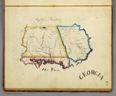
1823 Georgia. [Manuscript Map, National Atlas] Georgia. |

1823 Tennessee. [Manuscript Map, National Atlas] Tennessee. |

1823 Kentucky. [Manuscript Map, National Atlas] Kentucky. |

1823 Ohio. [Manuscript Map, National Atlas] Ohio. |

1823 Indiana. [Manuscript Map, National Atlas] Indiana. |

1844 Carte de l' Europe. 7 October, 1844 [Manuscript Map, World Atlas] Carte de l' Europe. 7 October, 1844. (to … |

1844 Map of Europe [Manuscript Map, World Atlas] (Europe). (to accompany) Cours de Geogra … |

1844 Asie Physique [Manuscript Map, World Atlas] (Asie). (to accompany) Cours de Geograph … |

1844 Asie Politique [Manuscript Map, World Atlas] Asie Politique. (to accompany) Cours de … |

1844 Afrique physique [Manuscript Map, World Atlas] Afrique Physique. (to accompany) Cours d … |

1844 Afrique Politique [Manuscript Map, World Atlas] Afrique Politique. (to accompany) Cours … |

1844 Amerique Physique [Manuscript Map, World Atlas] Amerique Physique. (to accompany) Cours … |

1844 Amerique Politique [Manuscript Map, World Atlas] Amerique Politique. (to accompany) Cours … |

1844 L'Oceanie [Manuscript Map, World Atlas] L'Oceanie. (to accompany) Cours de Geogr … |

1845 Carte des Iles Britanniques 1845 [Manuscript Map, World Atlas] Carte des Iles Britanniques 1845. (to ac … |

1845 Iles Britanniques : Politiques [Manuscript Map, World Atlas] (Iles Britanniques : Politiques). (to ac … |

1850 W. Hemisphere, E. Hemisphere. School Atlas Western Hemisphere ... Eastern Hemispher … |

1850 United States. School Atlas United States. Drawn by (to be filled in … |

1850 North America. School Atlas North America. Drawn by (to be filled in … |

1850 (New York) School Atlas State of (to be filled in). Drawn by (to … |

1850 Mexico, Guatimala. School Atlas Mexico and Guatimala. Drawn by (to be fi … |

1850 South America. School Atlas South America. Drawn by (to be filled in … |

1850 Europe. School Atlas Europe. Drawn by (to be filled in. By Ge … |

1850 Southern Europe. School Atlas Southern Europe. Drawn by (to be filled … |

1850 British Islands. School Atlas British Islands. Drawn by (to be filled … |

1850 Germany. School Atlas Germany. Drawn by (to be filled in. By G … |

1850 Africa. School Atlas Africa. Drawn by (to be filled in. By Ge … |

1850 Asia. School Atlas Asia. Drawn by (to be filled in. By Geor … |

1693 Planisfere, division du globe. [Manuscript Map, World Atlas] Planisfere ou Mapemonde. Ce que c'est qu … |

1693 Planisfere (outline) [Manuscript Map, World Atlas] Planisfere ou Mapemonde. (1693) |

1693 Planisfere en 4 parties. [Manuscript Map, World Atlas] Planisfere ou Mapemonde. Division de la … |

1693 Planisfere (outline) [Manuscript Map, World Atlas] Planisfere ou Mapemonde. (1693) |

1693 Planisfere, cours du Soleil, points card … [Manuscript Map, World Atlas] Planisfere ou Mapemonde. Du cours du Sol … |

1693 Planisfere (outline) [Manuscript Map, World Atlas] Planisfere ou Mapemonde. (1693) |

1693 Planisfere en 5 zones. [Manuscript Map, World Atlas] Planisfere ou Mapemonde divisee en cinq … |

1693 Planisfere en 5 zones (outline) [Manuscript Map, World Atlas] Planisfere ou Mapemonde (divisee en cinq … |