Who What Where WhenREMOVE |
REFINE
Browse All : Separate Map of North America
1-18 of 18
Author
British North America-U.S. Boundary
Full Title
A Map Of The Frontier Of British North America, And The United States, Describing The Boundary Line as fixed by the Treaty of 1783, which has never been respected by the American Government. Likewise the New Line of Demarcation as now proposed to be established between those States, and the British Provinces intended to secure the Independence of the Indians.
Publisher
N.P.
Author
[Disturnell, John, Colton, J.H.]
Full Title
Map Of North America From The Latest Authorities Showing the Proposed Railroad Routes from the Atlantic to the Pacific Oceans. J.H. Colton & Co. New York, 1854, for J. Disturnell. Entered ... 1849, by J.H. Colton ... New York.
Publisher
J.H. Colton & Co. for J. Disturnell
Author
Wilkinson, Robert
Full Title
North America, Published the 12th of August 1824. By R. Wilkinson, No.125, Fenchurch Street, London. Republished, by William Darton; 58, Holborn Hill, 3. Jany. 1826. E. Bourne, Sculp.
Publisher
William Darton
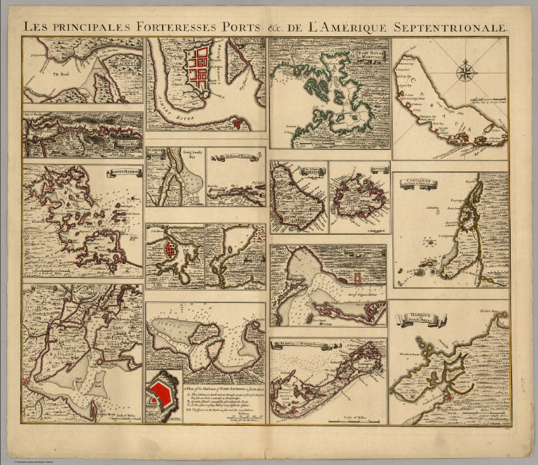
Author
[Covens, Jean, Mortier, Corneille, (Popple, Henry)]
Full Title
Les Principales Forteresses Ports &c. De L'Amerique Septentrionale. I.K.S.
Publisher
Covens & Mortier
Author
[Liechtenstern, Joseph Marx von, Hartl, Martin]
Full Title
Nord America mit Benuzung der neuesten und zuverlaessigsten Quellen und Hulfsmittel nach dem Entwurfe des Herrn Ios. Marx Freiherrn von Liechtenstern gezeichnet von Martin Hartl. Wien, Im. Verlage des Kunst und Industrie Comptoirs. 1805.
Publisher
Kunst und Industrie Comptoirs
Author
Andriveau-Goujon, Eugène
Full Title
Amerique Du Nord. Paris 1877. E. Andriveau-Goujon, Editeur, Ru du Bac, 4. Imp. Lemercier; Paris. Grave chez L. Wuhrer, R. Gay-Lussac, 52; Paris. (with untitled inset map of Aleutian Islands).
Publisher
Lemercier
Author
San Francisco Examiner
Full Title
Second Third of the Map Story of the War. (with) Allied Occupation Zones. July 3, 1945. Third Section of the Map Story of the War. (with) Okinawa. July 4, 1945. First Third of a 45-Inch Map Story of the War. (with) inset map of Luzon, Philippines. July 2, 1945. (accompanied by) History of the War. July 4, 1945. San Francisco Examiner.
Publisher
San Francisco Examiner
Author
Colton, J. H.
Full Title
Map of North America from the latest authorities. Published by J.H. Colton. No. 86 Cedar St., New York. 1852. Drawn & Engraved by J.M. Atwood, New York. (with) Map of the Gold Region. California.
Publisher
J.H. Colton
Author
Chase, Ernest Dudley, 1878-1966
Full Title
A pictorial map of North America : designed, drawn and published by Ernest Dudley Chase, Winchester, Massachusetts, U.S.A. Copyright 1945, Ernest Dudley Chase, Winchester, Mass. Printed in U.S.A.
Publisher
Ernest Dudley Chase
Author
[Bemis, Waldo Edmund (1891-1951), DeFao, Charles (1892-1978)]
Full Title
The Game Fish Cyclopedia. Miss Francesca LaMonte, author of "North American Game Fishes"; Dr. Lionel A. Walford, author of "Game Fishes of the Pacific Coast from Alaska to the Equator"; Mr. Ted Trueblood, fishing editor of "Field and Stream". Designed for the Sportsmen of America by the House of Seagram, Fine Whisky since 1857.
Publisher
Seagram-Distillers Corporation
Author
[Godfrey Jr., Joe, Ertz, Gordon (1891-?)]
Full Title
Big Game Fish, Complete Map Illustrated, Fresh and Salt Water Fishing.
Publisher
Joe Godfrey, Jr.
Author
Mora, Jo (1876-1947)
Full Title
Indians of North America. (Drawn by) Jo Mora. Copyright MCMXXXVI (1936). Jo Mora Publications, Monterey, California.
Publisher
Jo Mora Publications
Author
Gallatin, Albert
Full Title
Carte des Tribus Indiennnes de l'Amerique du Nord : vers 1600 A.D. ;e long de l'Atlantique ; et vers 1800 A.D. a l'Ouest. D'apres un dessin Mr. Gallatin.
Publisher
No Publisher
Author
Bibliographische Institut
Full Title
Map of North America. Karte von Nordamerika. HAPAG. Bibliographische Institut AG. Leipzig. Printed in Germany.
Publisher
Bibliographische Institut AG,
Author
Wilkinson, Robert
Full Title
North America, published the 12th of August 1804. By R. Wilkinson, No.58, Cornhill, London. E. Bourne Sculp.
Publisher
Robert Wilkinson
Author
[Tardieu, P.F., Tardieu, P. (Pierre Antoine), 1784-1869]
Full Title
A Map of Louisiana and Mexico (northern portion). Carte de la Louisiane et du Mexique, Dressee par P. Tardieu fils aine, Gravee par P.A.F. Tardieu pere. Paris 1820. A Paris, chez: P.A.F. Tardieu, Place de l'Estrapade No. 34. C. Piequet, Geographe Graveur, Quai Conti No. 17. J. Goujon, Marchand de Cartes Geographiques, Rue du Bac No. 6. New York. Anthy. Girard , Mercht. Agent for the Author. Ecrit par Richomme.
Publisher
J. (Jean) Goujon, 1793-1826
Author
[Tardieu, P.F., Tardieu, P. (Pierre Antoine), 1784-1869]
Full Title
A Map of Louisiana and Mexico (southern portion). Carte de la Louisiane et du Mexique, Dressee par P. Tardieu fils aine, Gravee par P.A.F. Tardieu pere. Paris 1820. A Paris, chez: P.A.F. Tardieu, Place de l'Estrapade No. 34. C. Piequet, Geographe Graveur, Quai Conti No. 17. J. Goujon, Marchand de Cartes Geographiques, Rue du Bac No. 6. New York. Anthy. Girard , Mercht. Agent for the Author. Ecrit par Richomme.
Publisher
J. (Jean) Goujon, 1793-1826
Author
[Tardieu, P.F., Tardieu, P. (Pierre Antoine), 1784-1869]
Full Title
(Composite of) A Map of Louisiana and Mexico. Carte de la Louisiane et du Mexique, Dressee par P. Tardieu fils aine, Gravee par P.A.F. Tardieu pere. Paris 1820. A Paris, chez: P.A.F. Tardieu, Place de l'Estrapade No. 34. C. Piequet, Geographe Graveur, Quai Conti No. 17. J. Goujon, Marchand de Cartes Geographiques, Rue du Bac No. 6. New York. Anthy. Girard , Mercht. Agent for the Author. Ecrit par Richomme.
Publisher
J. (Jean) Goujon, 1793-1826
1-18 of 18
|