Who What Where WhenREMOVEWHEREShow More |
Author
Renault, Jn. F.
Full Title
Plan of York Town In Virginia And Adjacent Country. Exhibiting the operations of the American French & English armies, during the siege at that place in Oct. 1781. Surveyed from the 22nd to the 28th Octr. Drawn by Jn. F. Renault, with a Crow-pen and presented to the Marques De La Fayette. Engraved by B. Tanner.
Publisher
No Publisher
Author
Richardson, C.S.
Full Title
Richardson's Map Of West Virginia Showing the principal Creeks, Rivers and Line of Internal Improvements. Designed for the use of Oil, Coal, Land & Mining Companies. Sold by John Olcott, 36 Pine St. New York. Second Edition. Richardson & Son, Civil ad Mining Engineers, Mineral Surveyors &c. 36 Pine St. N.Y. and Charleston West Va. A. Brown & Co. 47 Nassau St. N.Y. Entered ... 1864, by C.S. Richardson ... New York.
Publisher
Richardson & Son.
Author
Ruger, Edward
Full Title
Map Prepared to exhibit the Campaigns in which the Army Of The Cumberland Took part during the War of the Rebellion. By order of Maj. Genl. Geo. H. Thomas. U.S.A. Compiled under the direction of Bvt. Major Genl. Z.B. Tower Chief Engr. Military Div. of the Tenn. by Ed. Ruger, Supt. Topl. Engr. Office at Nashville. Assistants. Capt. A. Kilp & Lieut. R. Flach 3rd U.S.C.A. (Heavy) & Asst. Top. Engrs. ... Photolith. by the N.Y. Lithg. Engrg. & Prtg. Co. 16 & 18 Park Place.
Publisher
N.Y. Litho & Engr.
Author
Hood, Washington
Full Title
Map Of The Seat Of War In Florida. Compiled By Order Of The Hon. Joel R. Poinsett, Secretary Of War, under the Direction of Col J.J. Abert U.S. Topt. Engineer, from the reconnoissances of the Officers of the U.S. Army, by Wash: Hood. Bureau of U.S. Topographical Engineers Washington City 1838. W.J. Stone Sc. Washn. City.
Publisher
U.S. Topographical Engineers
Author
U.S. General Land Office
Full Title
Department Of The Interior General Land Office J.A. Williamson, Commissioner. Territory Of New Mexico. 1879. Compiled from the official Records of the General Land Office and other sources by C. Roeser, Principal Draughtsman G.L.O. Photo lith & print by Julius Bien 16 & 18 Park Place N.Y.
Publisher
Julius Bien
Author
U.S. General Land Office
Full Title
Department Of The Interior General Land Office J.A. Williamson, Commissioner. Territory Of Dakota. 1879. Compiled from the official Records of the General Land Office and other sources by C. Roeser, Principal Draughtsman G.L.O. Photo lith & print by Julius Bien 16 & 18 Park Place N.Y.
Publisher
Julius Bien
Author
U.S. General Land Office
Full Title
Department Of The Interior General Land Office J.A. Williamson, Commissioner. Territory Of Arizona. 1879. Compiled from the official Records of the General Land Office and other sources by C. Roeser, Principal Draughtsman G.L.O. Photo lith & print by Julius Bien 16 & 18 Park Place N.Y.
Publisher
Julius Bien
Author
U.S. General Land Office
Full Title
Department Of The Interior General Land Office J.A. Williamson, Commissioner. Territory of Utah. 1879. Compiled from the official Records of the General Land Office and other sources by C. Roeser, Principal Draughtsman G.L.O. Photo lith & print by Julius Bien 16 & 18 Park Place N.Y.
Publisher
Julius Bien
Author
U.S. General Land Office
Full Title
Department Of The Interior General Land Office J.A. Williamson, Commissioner. State Of Nebraska. 1879. Compiled from the official Records of the General Land Office and other sources by C. Roeser, Principal Draughtsman G.L.O. Photo lith & print by Julius Bien 16 & 18 Park Place N.Y.
Publisher
Julius Bien
Author
U.S. General Land Office
Full Title
Department Of The Interior General Land Office J.A. Williamson, Commissioner. State Of Oregon. 1879. Compiled from the official Records of the General Land Office and other sources by C. Roeser, Principal Draughtsman G.L.O. Photo lith & print by Julius Bien 16 & 18 Park Place N.Y.
Publisher
Julius Bien
Author
Brue, Adrien Hubert, 1786-1832
Full Title
Nouvelle Carte du Mexique, Du Texas Et D'Une Partie Des Provinces Unies De L'Amerique Centrale. Dediee a l'Academie Royale des Sciences de l Institut de France. Par A.H. Brue, Geographe du Roi, Membre de la common. centrale de la societe de Geographie de Paris, membre-honoraire de celle de Londres, &a. Revue et augmentee par Ch. Picquet, Geographe du Roi et du Due d'Orleans, Proprietaire des Cartes et Atlas de Brue, Quai Conti No. 17, pres de l'Institut. Paris, 1840. Publiee en 1834; Revue en 1837, 1839, 1840 ... (with 2 inset maps).
Publisher
Charles Picquet
Author
United States. Congress
Full Title
Map Of The San Joaquin, Sacramento And Tulare Valleys, State Of California, prepared under the direction of the Board Of Commissioners On Irrigation appointed under the Act of Congress approved March 3rd 1873, showing the country that may be irrigated and a Provisional System Of Irrigation Compiled from the Maps of the Geological Survey Of California and from Special Surveys and Examinations. 1873. Published by authority of the Hon. Secretary of War in the Office of the Chief of Engineers U.S. Army.
Publisher
U.S.
Author
G.W. & C.B. Colton & Co.
Full Title
Maps showing the Indiana & Illinois Central Railway. And Its Connections. Prepared By G.W. & C.B. Colton & Co. 172 William Street New York. Entered ... 1872 by G.W. & C.B. Colton & Co. ... Washington. (with) Untitled inset map of railway connections from the Eastern Seaboard to Colorado and Wyoming.
Publisher
G.W. & C.B. Colton
Author
Grand Trunk Pacific Railway
Full Title
Map Of The Grand Trunk Pacific Railway In British Columbia Showing Terminus At Prince Rupert. 3-28-'10. Copyright, 1907, Poole Bros., Chicago. (inset) Map Of Price Rupert And Vicinity. (inset) Latitude Map.
Publisher
Poole Bros.
Author
Reid, John
Full Title
Plan of the City of Washington in the Territory of Columbia ceded by the States of Virginia And Maryland to the United States of America and by them established as the Seat of their Government, after the Year 1800. Rollinson sculp. N. York. Published by J. Reid L. Wayland and C. Smith 1795.
Publisher
J. Reid, L. Wayland and C. Smith
Author
Ellicott, Joseph & B.
Full Title
Map of Morris's Purchase or West Geneseo In the State of New York. Exhibiting Part of the Lakes Erie and Ontario, the Straights of Niagara, Chautauque Lake and all the principal Waters, the Boundary lines of the several Tracts of Land purchase by the Holland Land Company, William and John Willink and others ... by Joseph & B. Ellicott 1800. To The Holland Land company their General Agents Theophilus Cazenove & Paul Bush Esquires, This Map Is respectfully inscribed by the Authors. 1804.
Publisher
No Publisher
Author
United States. War Dept. Engineer Bureau
Full Title
Central Virginia showing Lieut Gen'l U.S. Grant's Campaign and Marches of the Armies under his Command in 1864-5. Engineer Bureau War Dept. Prepared by Order of the Secretary of War For the Officers of the U.S. Army under the command of Lieut. Gen. U.S. Grant.
Publisher
War Department
Author
United States. War Dept. Engineer Bureau
Full Title
Region embraced in the Operations of the Armies against Richmond and Petersburg. Engraved at the Engineer Bureau, War Dep. 1865. Authorities. North of James & Appomattox from Photograph Map Captured from the Enemy and Surveys of Maj. P.S. Michie Corps Of Engineers. South of Do. from Surveys of Col. N. Michler Corps Of Engineers.
Publisher
U.S.
Author
[Hagaman and Markham, Peabody, M.M.]
Full Title
Map Of The Village Of Auburn. Published By Hagaman & Markham 1837. Engraved by M.M. Peabody for the Publishers. (inset) Profile of the Grand Erie Canal.
Publisher
Hagaman & Markham
Author
Fremont, J.C.
Full Title
Las Mariposas Estate Mariposas County California. Containing 44,386 83/100 Acres Or 70 Square Miles. Lith of Sarony, Major & Knapp, 449 Broadway, N.Y. Max Strobel Engineer.
Publisher
Sarony, Major & Knapp
Author
Harper's Weekly
Full Title
Map Of The Southern States, Including Rail Roads, County Towns, State Capitals, County Roads, The Southern Coast ... To Texas, Showing The Harbors, Inlets, Forts And Position Of Blockading Ships. Prepared For Harper's Weekly November 1861. (untitled inset map of Washington D.C. and vicinity).
Publisher
Harper's Weekly
Author
Keenan, William
Full Title
Plan of the City And Neck of Charleston, S.C. Reduced From Authentic Documents & Engraved By W. Keenan. Pub. Septr. 1844.
Publisher
W. Keenan
Author
Emory, William H.
Full Title
Map Of Texas And The Countries Adjacent: Compiled In The Bureau Of The Corps Of Topographical Engineers, Fom The Best Authorities, For the State Department, Under the direction of Colonel J.J. Abert, Chief of the Corps; by W.H. Emory, 1st Lieut. T.E. War Department 1844. W.J. Stone Sc. Washn. Published by order of the U.S. Senate.
Publisher
U.S.
Author
Hunt, John P.
Full Title
Hunt's Improved Map of Venango County Oil Regions. Published by John P. Hunt, 59 Fifth St. Masonic Hall, Pittsburgh. 1865. Entered ... 1864, by John P. Hunt ... Pennsylvania ...
Publisher
John P. Hunt
Author
[Desilver, Charles, Richardson, W. & D.]
Full Title
Richardson's New Map Of The State Of Texas Including Part of Mexico Compiled From Government Surveys And Other Authentic Documents. Published By Charles Desilver No. 714 Chestnut Street Philadelphia. Engraved Expressly For The Texas Almanac. Corrected By H. Wickland. 1861. Entered ... 1861 by Charles Desilver ... Pennsylvania. (inset) Map Showing The Proposed Route Of The Aransas (sic) Railroad (And Its) Connections With The Eastern Roads.
Publisher
Charles Desilver
Author
Kalama
Full Title
Na Mokupuni O Hawaii Nei. Kulanui Lahainaluna Maui Maraki 9 1837. He 26 mau la ka hana ana. Na Kalama i kakau.
Publisher
Mission Press
Author
Farwell, Willard B.
Full Title
Official Map of Chinatown in San Francisco.
Publisher
A.L. Bancroft
Author
Sanborn Map Company.
Full Title
Golden Gate International Exposition (1939 World's Fair). Treasure Island. San Francisco, Calif. Scale 1" = 100'. Made by Sanborn Map Company. San Francisco, Calif. ... June 1938 ... Copyright 1938 by the Sanborn Map Co. Corrected May 1940. (inset) (Vicinity map of Treasure Island). Includes diagram of water system valve control assembly by the main gate.
Publisher
Sanborn Map Company.
Author
Rand McNally and Company
Full Title
Map of Dakota. Drawn From Official Plats Of Public Surveys, And Published In The Interest Of Immigration By The Chicago, Milwaukee & St. Paul Railway Co. Copyright, 1882, by Rand, McNally & Co., Map Publishers, Chicago, Ill. Rand, McNally & Co., Engr's Chicago ...
Publisher
Rand McNally
Author
Rand McNally and Company
Full Title
Rand, McNally & Co.'s Large Scale County and Railroad Map Of Texas. Compiled from the Latest and Most Accurate Surveys. Rand, McNally & Co., Map Publishers And Engravers, Chicago. 1891. Copyright, 1888, by Rand, McNally & Co. ...
Publisher
Rand McNally
Author
New Orleans Industrial and Cotton Centennial Exposition
Full Title
The World's Industrial And Cotton Centennial Exposition, New Orleans, La., U.S.A. Department of Installation. Plan No. 2 Map Of The City Of New Orleans Showing Location Of Exposition Grounds And All Approaches Thereto By Land & Water. C.A. Burke, Director General. Sam Mullen, Chief Of Department. Southern Lithc. Co. 38 Natchez St. N.O. (with 6 inset views and maps). (1885?)
Publisher
Southern Lithographic Co.
Author
[Bancroft & Thayer, Hancock, Henry, Hansen, George, Ord, E.O.C.]
Full Title
Map Of The City Of Los Angeles Showing the Confirmed Limits Surveyed in August 1857 by Henry Hancock U.S. Dep. Sury. Plan de la Ciudad De Los Angeles. Surveyed by E.O.C. Ord, Lt. U.S.A. and Wm. R. Hutton, Assistant, August 29, 1849. Donation Lots Surveyed by H. Hancock in August and April 1853, Geo. Hanson, Asst. Published By Bancroft & Thayer, Real Estate Brokers 21 Spring St. And W.H.J. Brooks Searcher Of Records Los Angeles, Cal. A.L. Bancroft & Co. Lith.
Publisher
Bancroft & Thayer and W.H.J. Brooks.
Author
Parry Mfg. Co.
Full Title
(Map of Illinois). Compliments Of Parry M'F'G. Co. Indianapolis, Ind. Wm. B. Burford, Lith., Indianapolis ...
Publisher
Wm. B. Burford
Author
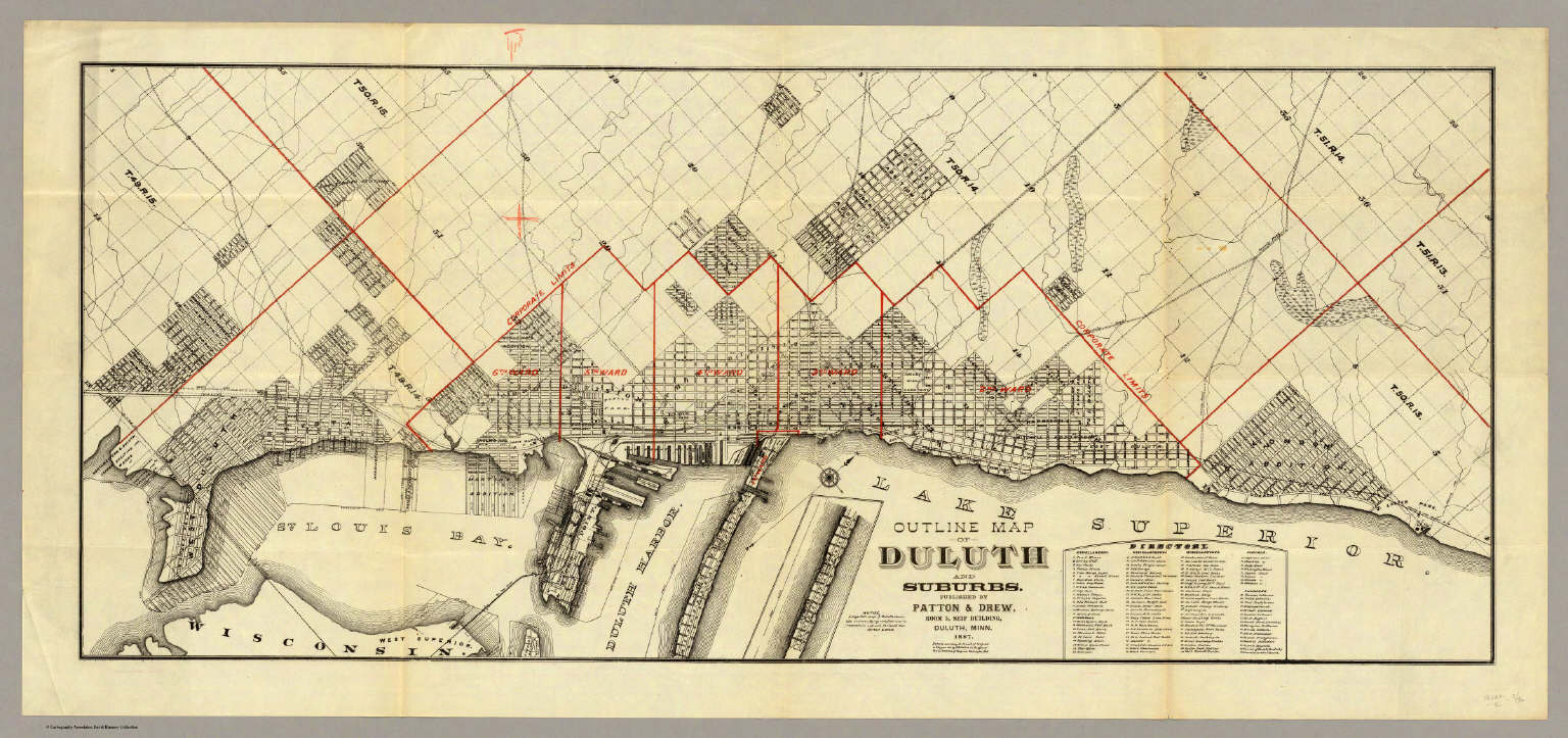
Patton & Drew
Full Title
Outline Map Of Duluth And Suburbs. Published By Patton & Drew, Room 5, Seip Building, Duluth, Minn. 1887. Entered ... 1887 by W.B. Patton ... Washington, D.C.
Publisher
Patton & Drew
Author
San Francisco Board of Supervisors
Full Title
Map Of The Outside Lands Of The City And County Of San Francisco Showing Reservations Selected for Public Purposes, under the Provisions of Order No. 800 ... Litho. Britton & Rey.
Publisher
Britton & Rey
Author
San Francisco Board of Supervisors
Full Title
Map Of The Outside Lands Of The City And County Of San Francisco Showing Reservations Selected for Public Purposes, under the Provisions of Order No. 800 ... Litho. Britton & Rey.
Publisher
Britton & Rey
Author
Peseux, M.
Full Title
Battlefields In Front Of Nashville where the United States Forces commanded by Major General Geo. H. Thomas defeated and routed the Rebel Army under General Hood December 15th and 16th 1864. Reduced and Engraved in the Engineer Bureau. Surveyed and drawn under the direction of Gen. Tower by M. Peseux. 39th Cong. 1st. Sess. - Report of the Chief Engineer U.S.A.
Publisher
U.S.
Author
U.S. General Land Office
Full Title
Department Of The Interior General Land Office N.C. McFarland, Commissioner. Territory Of Dakota. 1882. Compiled from the official Records of the General Land Office and other sources by C. Roeser, Principal Draughtsman G.L.O. Photo lith & print by Julius Bien & Co. 16 & 18 Park Place N.Y.
Publisher
Julius Bien & Co.
Author
U.S. General Land Office
Full Title
Department Of The Interior General Land Office N.C. McFarland Commissioner. Territory Of Arizona. 1883. Compiled from the official Records of the General Land Office and other sources under the supervision of G.P. Strum, Principal Draughtsman G.L.O. Photo lith & print by Julius Bien & Co. 139 Duane St. N.Y.
Publisher
Julius Bien & Co.
Author
Lecount, Josiah J.
Full Title
Official Map Of The City Of San Francisco, California. Published by Josiah J. Lecount, Manufacturer & Importer Of Stationery & Miscellaneous Books, Montgomery St., San Francisco. Approved By Geo. R. Turner, City & County Surveyor, 1859. Lithy. Of Britton & Co. S.F.
Publisher
Josiah J. Lecount
Author
Madison, Rev. James
Full Title
A Map Of Virginia (upper left sheet) Formed from Actual Surveys, and the Latest as well as most accurate observations, By James Madison, D.D. President of Wm. & Mary College. Drawn by Wm. Davis. Copy Right Secured. Richmond Published 4th March 1807 By the Proprietors. To The General Assembly Of Virginia, This Map is Respectfully Inscribed, by their Fellow Citizens, James Madison, William Prentis, William Davis, Proprietors. Engraved by Fred. Bossler, Richmd. (inset map) Ohio. (4 sheets of 6; 2 editions).
Publisher
Frederick Bossler
Author
Madison, Rev. James
Full Title
A Map Of Virginia (upper right sheets) Formed from Actual Surveys, and the Latest as well as most accurate observations, By James Madison, D.D. President of Wm. & Mary College. Drawn by Wm. Davis. Copy Right Secured. Richmond Published 4th March 1807 By the Proprietors. To The General Assembly Of Virginia, This Map is Respectfully Inscribed, by their Fellow Citizens, James Madison, William Prentis, William Davis, Proprietors. Engraved by Fred. Bossler, Richmd. (inset map) Ohio. (inset) View of Richmond, Metropolis of Virginia. (4 sheets of 6; 2 editions).
Publisher
Frederick Bossler
Author
U.S. General Land Office
Full Title
Department Of The Interior General Land Office J.A. Williamson, Commissioner. State of Colorado. 1879. Compiled from the official Records of the General Land Office and other sources by C. Roeser, Principal Draughtsman G.L.O. Photo lith & print by Julius Bien 16 & 18 Park Place N.Y.
Publisher
Julius Bien
Author
Madison, Rev. James
Full Title
A Map Of Virginia (lower left sheet) Formed from Actual Surveys, and the Latest as well as most accurate observations, By James Madison, D.D. President of Wm. & Mary College. Drawn by Wm. Davis. Copy Right Secured. Richmond Published 4th March 1807 By the Proprietors. To The General Assembly Of Virginia, This Map is Respectfully Inscribed, by their Fellow Citizens, James Madison, William Prentis, William Davis, Proprietors. Engraved by Fred. Bossler, Richmd. (inset map) Ohio. (4 sheets of 6; 2 editions).
Publisher
Frederick Bossler
Author
Madison, Rev. James
Full Title
A Map Of Virginia (lower right sheet) Formed from Actual Surveys, and the Latest as well as most accurate observations, By James Madison, D.D. President of Wm. & Mary College. Drawn by Wm. Davis. Copy Right Secured. Richmond Published 4th March 1807 By the Proprietors. To The General Assembly Of Virginia, This Map is Respectfully Inscribed, by their Fellow Citizens, James Madison, William Prentis, William Davis, Proprietors. Engraved by Fred. Bossler, Richmd. (inset map) Ohio. (4 sheets of 6; 2 editions).
Publisher
Frederick Bossler
Author
Madison, Rev. James
Full Title
A Map Of Virginia (upper left sheet) Formed from Actual Surveys, and the Latest as well as most accurate observations, By James Madison, D.D. President of Wm. & Mary College. Drawn by Wm. Davis. Copy Right Secured. Richmond Published 4th March 1807 By the Proprietors. To The General Assembly Of Virginia, This Map is Respectfully Inscribed, by their Fellow Citizens, James Madison, William Prentis, William Davis, Proprietors. Engraved by Fred. Bossler, Richmd. (inset map) Ohio. (4 sheets of 6; 2 editions).
Publisher
Frederick Bossler
Author
Madison, Rev. James
Full Title
A Map Of Virginia (lower left sheet)Formed from Actual Surveys, and the Latest as well as most accurate observations, By James Madison, D.D. President of Wm. & Mary College. Drawn by Wm. Davis. Copy Right Secured. Richmond Published 4th March 1807 By the Proprietors. To The General Assembly Of Virginia, This Map is Respectfully Inscribed, by their Fellow Citizens, James Madison, William Prentis, William Davis, Proprietors. Engraved by Fred. Bossler, Richmd. (inset map) Ohio. (4 sheets of 6; 2 editions).
Publisher
Frederick Bossler
Author
Madison, Rev. James
Full Title
A Map Of Virginia (lower right sheet)Formed from Actual Surveys, and the Latest as well as most accurate observations, By James Madison, D.D. President of Wm. & Mary College. Drawn by Wm. Davis. Copy Right Secured. Richmond Published 4th March 1807 By the Proprietors. To The General Assembly Of Virginia, This Map is Respectfully Inscribed, by their Fellow Citizens, James Madison, William Prentis, William Davis, Proprietors. Engraved by Fred. Bossler, Richmd. (inset map) Ohio. (4 sheets of 6; 2 editions).
Publisher
Frederick Bossler
Author
Madison, Rev. James
Full Title
(Composite of) A Map Of Virginia (lower right sheet)Formed from Actual Surveys, and the Latest as well as most accurate observations, By James Madison, D.D. President of Wm. & Mary College. Drawn by Wm. Davis. Copy Right Secured. Richmond Published 4th March 1807 By the Proprietors. To The General Assembly Of Virginia, This Map is Respectfully Inscribed, by their Fellow Citizens, James Madison, William Prentis, William Davis, Proprietors. Engraved by Fred. Bossler, Richmd. (inset map) Ohio. (4 sheets of 6; 2 editions).
Publisher
Frederick Bossler
|