Who What Where WhenREMOVEWHEREShow MoreWHO
WHEN
|
Author
Greyhound Lines
Full Title
Map of the Greyhound Lines and Principal Connecting Carriers in the United States, Canada and Mexico. The Greyhound Lines. (copyright) Greyhound Lines, July, 1935. Litho. In U.S.A. - Commercial, Akron, O.
Publisher
Commercial Litho.
Author
[Stucchi, Achille, Bordiga, F.]
Full Title
America Settentrionale E Meridionale Nuovamente corretta ed accresciuta. 1856. F. Bordiga inc. Milano presso Achille Stucchi Piazza di S. Gio. in Era No. 412. Casa Picinini. (with two inset maps).
Publisher
Presso Achille Stucchi
Author
House & Brown
Full Title
Map Of Mexico, Texas, Old And New California, And Yucatan. Showing the principal Cities and Towns, Travelling Routes &c. Hartford: Published By House & Brown. 1849. Entered ... 1847 by House & Brown ... (inset map) Plan Of Operations At The Battle Of Monterey On The 21st, 22nd, & 23rd Sept. 1846. (inset) Map Of Vera Cruz And San Juan De Ulloa. (Lith. Of E.B.) & E.C. Kellogg, Hartford, Conn.
Publisher
House & Brown
Author
[Mitchell, Samuel Augustus, Dorby & Miller]
Full Title
Map Of Mexico, Including Yucatan & Upper California, exhibiting The Chief Cities And Towns, The Principal Travelling Routes &c. Philadelphia. Published by Dorby & Miller. Auburn, New York. 1850. Entered ... 1847 by S. Augustus Mitchell ... Pennsylva. (inset map) Battle Field Of Monterey.
Publisher
Dorby & Miller
Author
Mitchell, Samuel Augustus
Full Title
Map Of The Seat Of War Gen. Taylor's Field Of Operations In Mexico. Philadelphia. Pubd. by S. Augustus Mitchell, N.E. Corr. of Market & 7th Sts. ... (inset map) The Late Battlefield. (inset) Map of the Seat Of War.
Publisher
S.A. Mitchell
Author
U.S. General Land Office
Full Title
Department Of The Interior General Land Office J.A. Williamson, Commissioner. State of Arkansas. 1878. Compiled from the official Records of the General Land Office and other sources by C. Roeser, Principal Draughtsman G.L.O. Photo lith & print by Julius Bien 16 & 18 Park Place N.Y.
Publisher
Julius Bien
Author
Colton, J.H.
Full Title
Map Of The United States The British Provinces Mexico &c. Showing the Routes of the U.S. Mail Steam Packets to California, and a Plan of the Gold Region. Published By J.H. Colton, 86 Cedar St. New York. 1849. Drawn & Engraved by J.M. Atwood. New York. Entered ... 1849, by J.H. Colton ... New York. (inset) Map Of The Gold Region. California. (untitled inset of South America; From New York to San Francisco via Cape Horn...).
Publisher
J.H. Colton
Author
Andriveau-Goujon, E.
Full Title
Carte Generale Des Etats - Unis Et Du Mexique, Comprenant L'Amerique Centrale Et Les Antilles. E. Andriveau-Goujon, Editeur. Paris, Rue Du Bac, 21. Nouvelle Edition. 1870. (with four inset maps).
Publisher
Andriveau-Goujon
Author
Andriveau-Goujon, E.
Full Title
Carte Generale Des Etats - Unis Et Du Mexique, Comprenant L'Amerique Centrale Et Les Antilles. E. Andriveau-Goujon, Editeur. Paris, Rue Du Bac, 4. Nouvelle Edition. 1876. (with four inset maps).
Publisher
Andriveau-Goujon
Author
[U.S. Geological and Geographical Survey of the Territories, Hayden,Ferdinand Vandeveer]
Full Title
Parts of Western Wyoming and Southeastern Idaho. U.S. Geological and Geographical Survey of the Territories ; F.V. Hayden, U.S. Geologist in Charge. O. St. John, Geological Assistant. Gustavus R Bechler; Fred A Clark; Topographical Assistants. Surveyed in 1877 & 78.
Publisher
U.S. Geological and Geographical Survey of the Territories
Author
[U.S. Geological and Geographical Survey of the Territories, Hayden,Ferdinand Vandeveer]
Full Title
Parts of Western Wyoming, Southeastern Idaho and Northeastern Utah. U.S. Geological and Geographical Survey of the Territories ; F.V. Hayden, U.S. Geologist in Charge. Henry Gannett, M.E. Topographical Assistant. Surveyed in 1877.
Publisher
U.S. Geological and Geographical Survey of the Territories
Author
[U.S. Geological and Geographical Survey of the Territories, Hayden,Ferdinand Vandeveer]
Full Title
Parts of Western Wyoming and Southeastern Idaho. U.S. Geological and Geographical Survey of the Territories ; F.V. Hayden, U.S. Geologist in Charge. Gustavus R Bechler; Fred A Clark; Topographical Assistants. Surveyed in 1877 & 78.
Publisher
U.S. Geological and Geographical Survey of the Territories
Author
[U.S. Geological and Geographical Survey of the Territories, Hayden,Ferdinand Vandeveer]
Full Title
Preliminary Geological Map of the Yellowstone National Park. Department of the Interior, U.S. Geological and Geographical Survey of the Territories ; F.V. Hayden, U.S. Geologist in Charge ; W.H. Holmes, Geological Assistant ; Primary Triangulation by A.D. Wilson ; Secondary Triangulation and Topography by Henry Gannett. Surveyed in 1878. Julius Bien, Lith.
Publisher
Department of the Interior, U.S. Geological and Geographical Survey of the Territories
Author
[U.S. Geological and Geographical Survey of the Territories, Hayden,Ferdinand Vandeveer]
Full Title
Geological Map of Portions of Wyoming, Idaho and Utah. Department of the Interior, U.S. Geological and Geographical Survey of the Territories ; F.V. Hayden, U.S. Geologist in Charge ; Geology by A C Peale; Orestes St John; F.M. Endlich. Julius Bien, Lith., N.Y.
Publisher
Department of the Interior, U.S. Geological and Geographical Survey of the Territories
Author
U.S. General Land Office
Full Title
Department Of The Interior General Land Office J.A. Williamson, Commissioner. State of Michigan. 1878. Compiled from the official Records of the General Land Office and other sources by C. Roeser, Principal Draughtsman G.L.O. Photo lith & print by Julius Bien 16 & 18 Park Place N.Y.
Publisher
Julius Bien
Author
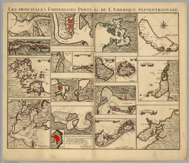
[Covens, Jean, Mortier, Corneille, (Popple, Henry)]
Full Title
Les Principales Forteresses Ports &c. De L'Amerique Septentrionale. I.K.S.
Publisher
Covens & Mortier
Author
California: Office of State Engineer
Full Title
(Composite of ) ( Sheets 1 - 9 State Engineer's Map of Northern California).
Publisher
California: Office of State Engineer
Author
U.S. General Land Office
Full Title
Department Of The Interior General Land Office J.A. Williamson, Commissioner. State Of California. 1879. Compiled from the official Records of the General Land Office and other sources by C. Roeser, Principal Draughtsman G.L.O. Photo lith & print by Julius Bien 16 & 18 Park Place N.Y.
Publisher
Julius Bien
Author
Williamson, R.S.
Full Title
Military Map of the South Eastern Part of Oregon, South Western Part of Idaho, North Eastern Part of California, and Northern Part of Nevada. North Eastern Part of California & South Eastern Part of Oregon Made from actual Surveys by Lt. Col. Drew and Lt. Col. Williamson, the other parts compiled from other reliable sources. 1866.
Publisher
No Publisher
Author
Realty Union
Full Title
Map Of Oakland And Vicinity. Published By The Realty Union, First National Bank Building, San Francisco, California. Copyrighted in 1912. Compiled From Official And Other Data By T.J. Allan, C.E. T.R. Morcom, Draughtsman. Schmidt Lithograph Co. S.F.
Publisher
Realty Union
Author
Swann, James G.
Full Title
Map of the Western Portion of Washington Territory. Compiled by J.G. Swan.
Publisher
J.G. Swann
Author
Rand McNally and Company
Full Title
(Denver and Rio Grande Railroad System). Rand, McNally & Co., Engravers, Chicago. (view) Alabaster Hall. (untitled inset map of the Western States).
Publisher
Rand McNally and Company
Author
Rand McNally and Company
Full Title
Denver and Rio Grande Railroad System. Denver & Rio Grande R.R. Scenic Line Of The World. (untitled inset map of the Western States).
Publisher
Rand McNally
Author
Hutawa, Julius
Full Title
Map Of The State Of Missouri. Showing different Railroad Routes surveyed by the Pacific Railroad Compy. as reported to the Legislature of the State of Missouri in December 1852. Julius Hutawa Lithographer, Second Street, betw. Olive & Pine, St. Louis, Mo.
Publisher
Julius Hutawa
Author
[Bancroft, H.H., Clarke, Charles R.]
Full Title
(NE Sheet) Outline Map Of The Pacific States. Designed To Accompany Clarke's Series Of Geographies And Being No.IV Of Bancroft's Geographical And Historical Series. Published by H.H. Bancroft & Co. Booksellers and Stationers, San Francisco, Cal. 1866. Entered ... 1866 by H.H. Bancroft & Company ... California.
Publisher
H.H. Bancroft & Co.
Author
[Bourne, A., Kilbourne, J., Reed, Abner]
Full Title
Map Of The State Of Ohio. Drawn by A. Bourne. Including the Indian Reservations, Purchased and laid out into Counties and Townships in 1820, Drawn by J. Kilbourne. Engraved by A. Reed.
Publisher
American Antiquarian Society
Author
[Macomb, J.N, Warner, W.H.]
Full Title
Chart Of Detroit River, From Lake Erie To Lake St. Slair. Surveyed In 1840, '41, & '42, By Lieutenants J.N. Macomb And W.H. Warner, Corps Of Topl. Engineers; Under The Direction Of Captain W.G. Williams,. Corps T. Engs.
Publisher
Secretary of War
Author
U.S. General Land Office
Full Title
Department Of The Interior General Land Office J.A. Williamson, Commissioner. Washington Territory. 1879. Compiled from the official Records of the General Land Office and other sources by C. Roeser, Principal Draughtsman G.L.O. Photo lith & print by Julius Bien 16 & 18 Park Place N.Y.
Publisher
Julius Bien
Author
Burr, David H.
Full Title
Ohio. By David H. Burr. Published By J.H. Matheer & Co. Hartford. 1846. Entered ... 1833 by J.H. Colton & Co. ... New York. Engraved & Printed by S. Stiles & Co. (inset) Cincinnati.
Publisher
J.H. Mather & Co.
Author
Ellet, Charles
Full Title
Map Of The Western Railroads Tributary To Philadelphia, With Their Rival Lines. Prepared under the direction of Charles Ellet Jr. Civil Engineer, by W. Williams, Map Engraver 5th St. below Chesnut Philaa.
Publisher
W. Williams
Author
[Bancroft, H.H., Clarke, Charles R.]
Full Title
(NW Sheet) Outline Map Of The Pacific States. Designed To Accompany Clarke's Series Of Geographies And Being No.IV Of Bancroft's Geographical And Historical Series. Published by H.H. Bancroft & Co. Booksellers and Stationers, San Francisco, Cal. 1866. Entered ... 1866 by H.H. Bancroft & Company ... California.
Publisher
H.H. Bancroft & Co.
Author
[Bancroft, H.H., Clarke, Charles R.]
Full Title
(SW Sheet) Outline Map Of The Pacific States. Designed To Accompany Clarke's Series Of Geographies And Being No.IV Of Bancroft's Geographical And Historical Series. Published by H.H. Bancroft & Co. Booksellers and Stationers, San Francisco, Cal. 1866. Entered ... 1866 by H.H. Bancroft & Company ... California.
Publisher
H.H. Bancroft & Co.
Author
[Bancroft, H.H., Clarke, Charles R.]
Full Title
(SE Sheet) Outline Map Of The Pacific States. Designed To Accompany Clarke's Series Of Geographies And Being No.IV Of Bancroft's Geographical And Historical Series. Published by H.H. Bancroft & Co. Booksellers and Stationers, San Francisco, Cal. 1866. Entered ... 1866 by H.H. Bancroft & Company ... California.
Publisher
H.H. Bancroft & Co.
Author
[Bancroft, H.H., Clarke, Charles R.]
Full Title
(Composite of) Outline Map Of The Pacific States. Designed To Accompany Clarke's Series Of Geographies And Being No.IV Of Bancroft's Geographical And Historical Series. Published by H.H. Bancroft & Co. Booksellers and Stationers, San Francisco, Cal. 1866. Entered ... 1866 by H.H. Bancroft & Company ... California.
Publisher
H.H. Bancroft & Co.
Author
U.S. General Land Office
Full Title
Department Of The Interior General Land Office J.A. Williamson, Commissioner. Territory Of Wyoming. 1879. Compiled from the official Records of the General Land Office and other sources by C. Roeser, Principal Draughtsman G.L.O. Photo lith & print by Julius Bien 16 & 18 Park Place N.Y.
Publisher
Julius Bien
Author
U.S. General Land Office
Full Title
Department Of The Interior General Land Office J.A. Williamson, Commissioner. Territory Of Idaho. 1879. Compiled from the official Records of the General Land Office and other sources by C. Roeser, Principal Draughtsman G.L.O. Photo lith & print by Julius Bien 16 & 18 Park Place N.Y.
Publisher
Julius Bien
Author
U.S. General Land Office
Full Title
Department Of The Interior General Land Office J.A. Williamson, Commissioner. State Of Nevada. 1879. Compiled from the official Records of the General Land Office and other sources by C. Roeser, Principal Draughtsman G.L.O. Photo lith & print by Julius Bien 16 & 18 Park Place N.Y.
Publisher
Julius Bien
Author
Williamson, R.S.
Full Title
Map of Parts of California, Nevada, Oregon And Idaho Territory, Showing the Routes to the Humboldt And Reese River Mines, Surproise Valley, Owyhee Mines, Idaho, etc. etc. Compiled from the latest Information and comprising the Results of Explorations ... By Bvt. Lieut. Col. R.S. Williamson, U.S.A. Maj. Of Engrs. John D. Hoffmann, C.E. & Topographer, In 1865, Lieut. W.H. Heuer, U.S. Engr. In 1866, U.S. Engineers Office, San Francisco, 1866. Published with Official Consent by Britton & Rey, San Francisco. ... (Reproduction).
Publisher
Britton & Rey
Author
Warren, G.K.
Full Title
Map Of The Military Dep't Of Oregon. Office Explns. And Surveys. War Dep't. Being a Section of the Map of the Territory of the U.S. from the Mississippi River to the Pacific Ocean, compiled from all the reliable data. By Lt. G.K. Warren, T.E. under the direction of Capt. A.A. Humphreys, T.E. 1858.
Publisher
U.S.
Author
U.S. General Land Office
Full Title
Department Of The Interior General Land Office N.C. McFarland, Commissioner. Territory Of Idaho. 1883. Compiled from the official Records of the General Land Office and other sources by G.P. Strum, Principal Draughtsman G.L.O. Photo lith & print by Julius Bien & Co. 16 & 18 Park Place N.Y.
Publisher
Julius Bien & Co.
Author
U.S. General Land Office
Full Title
Department Of The Interior General Land Office N.C. McFarland, Commissioner. State Of Colorado. 1881. Compiled from the official Records of the General Land Office and other sources by C. Roeser, Principal Draughtsman G.L.O. Photo lith & print by Julius Bien 16 & 18 Park Place N.Y.
Publisher
Julius Bien
Author
U.S. General Land Office
Full Title
Department Of The Interior General Land Office N.C. McFarland, Commissioner. Territory Of New Mexico. 1882. Compiled from the official Records of the General Land Office and other sources by C. Roeser, Principal Draughtsman G.L.O. Photo lith & print by Julius Bien & Co. 16 & 18 Park Place N.Y.
Publisher
New York: Julius Bien
Author
South San Francisco Land & Improvement Co.
Full Title
South San Francisco Issued By The South San Francisco Land & Improvement Co. San Francisco, Cal. Plat Of South San Francisco. Rand, McNally & Co., Engravers, Chicago. Earnshaw & Punshon, Surveyors and Landscape Engineers, Cincinnati, Ohio.
Publisher
Rand McNally
Author
Semple, E.A.
Full Title
A Plan Of The Property Of The Hampton Normal And Agricultural Institute At Hampton Virginia. Surveyed by E.A. Semple, C.S. American Photo-Lithographic Company, N.Y. (Osborne's Process). S.C.A. Del. Mih. 1876.
Publisher
American Photo-Lithographic Company
Author
[U.S. General Land Office, Hawes, J.H.]
Full Title
Map of the Public Land States And Territories constructed from The Public Surveys and other official sources in the General Land Office. Drawn by J.H. Hawes, Principal Draughtsman. T. Franks, Assistant. 1864. Engraved by D. McClelland Washn. D.C.
Publisher
U.S.
Author
[Clason, George, S., Patrick Investment Co.]
Full Title
Sketch Map Of Nevada And The Southeastern Portion Of California. Compliments of The Patrick Investment Co. 402-403-404-405 Empire Bldg. Phone Main 4245. Denver, Colorado. Published By The Clason Map Company, Denver, Colorado. Copyrighted, 1906 By George S. Clason, Denver, Colorado.
Publisher
Clason Map Company
Author
Rand McNally and Company
Full Title
New Official Railroad Map Of The United States And Canada. Engraved And Printed By Rand, McNally & Co., Chicago ... 148 To 154 Monroe Street, Chicago. Copyright, 1883, by Rand, McNally & Co., Chicago. (inset) Map Of Atlantic Coast States Engraved On Enlarged Scale. (with 8 additional inset maps).
Publisher
Rand McNally and Company
Author
[Avery, Gus D., Clapp, Charles H., Tamalpais Land and Water Co.]
Full Title
Tamalpais Land and Water Co. Map no. 3 showing subdivisions of farming and grazing lands Sausalito Ranch. Surveyed by Chas. H. Clapp, C.E. 1892. Gus D. Avery, draughtsman.
Publisher
Tamalpais Land and Water Co.
Author
San Francisco Call Company
Full Title
Die Wochentliche Call. Karte Von California und Nevada. Herausgegeben Von Der Wochentlichen Call. Copyrighted 1882. Address, San Francisco Call Company, 525 Montgomery Street, San Francisco, Cal. Lith. M. Schmidt & Co. 411 Clay St. San Francisco.
Publisher
M. Schmidt & Co.
Author
Colton, G.W. & C.B.
Full Title
Map showing the Route of the Duluth & Winnipeg Railroad And Its Connections. Prepared By G.W. & C.B. Colton & Co. 182 William Street New York. Entered ... 1881 by G.W. & C.B. Colton & Co. ... Washington.
Publisher
G.W. & C.B. colton & Co.
|