Who What Where WhenREMOVEWHAT
WHEREShow More |
Author
Mora, Jo (1876-1947)
Full Title
Yosemite. (Drawn by) Jo Mora. Copyright 1931. The Jo Mora Maps, Carmel California.
Publisher
The Jo Mora Maps
Author
Mora, Jo (1876-1947)
Full Title
Grand Canyon. (Drawn by) Jo Mora. Copyright 1931. The Jo Mora Maps, Carmel California.
Publisher
The Jo Mora Maps
Author
Mora, Jo (1876-1947)
Full Title
Grand Canyon. (Drawn by) Jo Mora. Copyright 1931. Jo Mora Publications, Monterey, California.
Publisher
Jo Mora Publications
Author
Mora, Jo (1876-1947)
Full Title
Indians of North America. (Drawn by) Jo Mora. Copyright MCMXXXVI (1936). Jo Mora Publications, Monterey, California.
Publisher
Jo Mora Publications
Author
Mora, Jo (1876-1947)
Full Title
Yellowstone. C(opyright) Jo. Mora 1931. The Jo Mora Maps, Carmel, California.
Publisher
The Jo Mora Maps
Author
Mora, Jo (1876-1947)
Full Title
Map of Los Angeles Historical and Recreational.
Publisher
The Marston Copany
Author
Mora, Jo (1876-1947)
Full Title
Map of Los Angeles Historical and Recreational.
Publisher
The Marston Copany
Author
Mora, Jo (1876-1947)
Full Title
(Monterey Peninsula and Del Monte Properties). Jo Mora FECIT.
Publisher
Del Monte Properties
Author
Mora, Jo (1876-1947)
Full Title
The Seventeen Mile Drive.
Publisher
Del Monte Properties
Author
Mora, Jo (1876-1947)
Full Title
(Evolution of the Cowboy). Copyrighted 1933 by Jo Mora. The Jo Mora Maps - Carmel, Calif.
Publisher
The Jo Mora Maps
Author
Mora, Jo (1876-1947)
Full Title
Ye Olde Spanish Main. Designed and executed by Jo Mora. Copyrighted 1933 by Grace Line.
Publisher
Grace Line Company
Author
Mora, Jo (1876-1947)
Full Title
Santa Catalina. First Printing - November 2007. Numbered edition 30/40.
Publisher
Jo Mora Trust
Author
Boucher, Lucien (1889-1971)
Full Title
Air France. Sur Les Ailes D'Air France Decouvrez Le Monde A Votre Tour. Boucher, Lucien. Printed in France - Perceval, Paris. (Reference) 382/P/1-50. (with inset).
Publisher
Perceval
Author
Boucher, Lucien (1889-1971)
Full Title
Air France. Sur Les Ailes D'Air France Decouvrez Le Monde A Votre Tour. Boucher, Lucien. Printed in France - Perceval, Paris. (Reference) 382/P/7-52. (with inset).
Publisher
Perceval
Author
Boucher, Lucien (1889-1971)
Full Title
Air France, Le Plus Grand Reseau ou Monde. Ref.21.433/P//9.59. Printed in France. Perceval - Paris.
Publisher
Air France
Author
Boucher, Lucien (1889-1971)
Full Title
Air France, "Nova Et Vetera" Sur La Vieille Des Chemins Nouveaux. Il a Ete Tire de ce Planisphere 150 Exemplaires sure Velin D'Arches Numerotes de 1 a 150. 522 C6 AF - Printed in France. Perceval Paris.
Publisher
Air France
Author
Boucher, Lucien (1889-1971)
Full Title
Air France, Air France, Reseau Aerien Mondial. Il a Ete Tire de ce Planisphere 250 Exemplaires sure Velin D'Arches Numerotes de 1 a 250 et 350 Exemplaires Sur Velin Canson et Montgolfier Numerotes de 251 a 600. 291 C6 AF - Printed in France. Perceval Paris.
Publisher
Air France
Author
Boucher, Lucien (1889-1971)
Full Title
Air France, Air France, Reseau Aerien Mondial. 163/P/10-47 Printed in France. Perceval - Paris.
Publisher
Air France
Author
Boucher, Lucien (1889-1971)
Full Title
Air France, Air France, Reseau Aerien Mondial.
Publisher
Air France
Author
Boucher, Lucien (1889-1971)
Full Title
Air France, Air France, Reseau Aerien Mondial.
Publisher
Air France
Author
Boucher, Lucien (1889-1971)
Full Title
Air France. Sur Les Ailes D'Air France Decouvrez Le Monde A Votre Tour. Boucher, Lucien. Printed in France - Perceval, Paris. (Reference) 381/P/7-52. (with inset).
Publisher
Perceval
Author
Gill, Leslie MacDonald, 1884-1947
Full Title
New Zealand : her natural and industrial resources. [Drawn by] MacDonald Gill, 1943. Printed in England by Fosh & Cross Ltd. 51-9874.
Publisher
Fosh & Cross Ltd.
Author
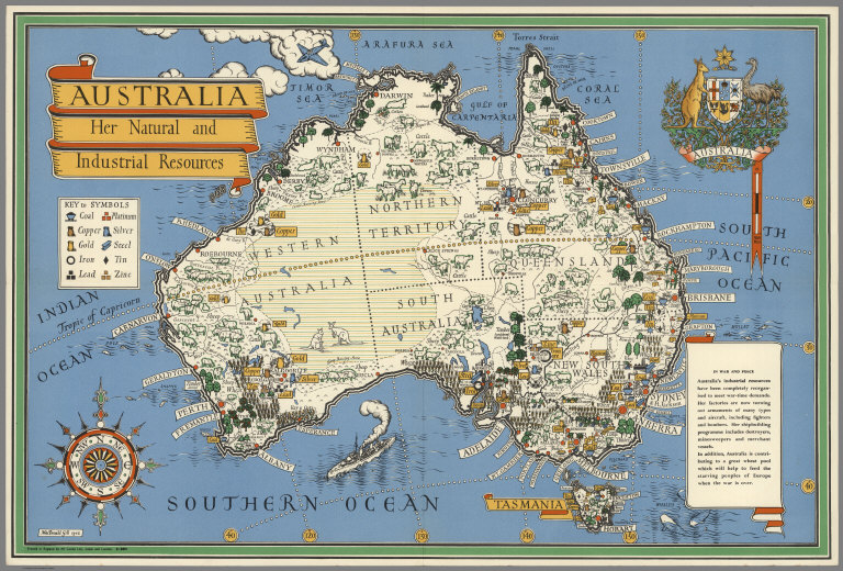
Gill, Leslie MacDonald, 1884-1947
Full Title
Australia: her natural and industrial resources. [Drawn by] MacDonald Gill, 1943. Printed in England by Alf Cooke, Ltd., Leeds and London. 51-9871.
Publisher
Alf Cooke, Ltd.
Author
Gill, Leslie MacDonald, 1884-1947
Full Title
Canada and Newfoundland : Their natural and industrial resources. [Drawn by] MacDonald Gill, 1942. Printed in England by A.C., Ltd. 51-9322. O.P.D. 39/219/5.
Publisher
A.C. Ltd.
Author
Alf Cooke, Ltd.
Full Title
India. Printed in England by Alf Cooke Ltd., Leeds and London. 51-9254. O.P.D. 39/219/7.
Publisher
Alf Cooke, Ltd.
Author
Thomas Forman and Sons Ltd.
Full Title
Union of South Africa. Printed in England by Thos. Forman & Sons Ltd. Nottingham. 51-4925. G.P.D. 39/219/8. (inset: Map of Africa).
Publisher
Thos. Forman & Sons Ltd.
Author
Freyhold, Edward; Warren, Gouverneur Kemble, 1830-1882
Full Title
(NW Sheet to) Territory Of The United States From The Mississippi River To The Pacific Ocean; Originally prepared to accompany the Reports of the Explorations For A Pacific Railroad Route ... Compiled from authorized explorations and other reliable data by Lieut. G.K. Warren, Top'l. Eng'rs. In the Office of Pacific R.R. Surveys, War Dept. under the direction of Bvt. Maj. W.H. Emory, Top'l. Eng'rs. in 1854. Capt. A.A. Humphreys, Top'l. Eng'rs. in 1854-58. Recompiled and redrawn under the direction of the Chief of Corps of Engineers By Edward Freyhold 1865-66-67-68. Head Quarters Corp Of Engineers, War Department. Engraved & printed by Julius Bien, N.Y. (inset) Territory Of Alaska Ceded By Russia To The United States 1868.
Publisher
Julius Bien
Author
Freyhold, Edward; Warren, Gouverneur Kemble, 1830-1882
Full Title
(SW Sheet to) Territory Of The United States From The Mississippi River To The Pacific Ocean; Originally prepared to accompany the Reports of the Explorations For A Pacific Railroad Route ... Compiled from authorized explorations and other reliable data by Lieut. G.K. Warren, Top'l. Eng'rs. In the Office of Pacific R.R. Surveys, War Dept. under the direction of Bvt. Maj. W.H. Emory, Top'l. Eng'rs. in 1854. Capt. A.A. Humphreys, Top'l. Eng'rs. in 1854-58. Recompiled and redrawn under the direction of the Chief of Corps of Engineers By Edward Freyhold 1865-66-67-68. Head Quarters Corp Of Engineers, War Department. Engraved & printed by Julius Bien, N.Y. (inset) Territory Of Alaska Ceded By Russia To The United States 1868.
Publisher
Julius Bien
Author
Freyhold, Edward; Warren, Gouverneur Kemble, 1830-1882
Full Title
(SE Sheet to) Territory Of The United States From The Mississippi River To The Pacific Ocean; Originally prepared to accompany the Reports of the Explorations For A Pacific Railroad Route ... Compiled from authorized explorations and other reliable data by Lieut. G.K. Warren, Top'l. Eng'rs. In the Office of Pacific R.R. Surveys, War Dept. under the direction of Bvt. Maj. W.H. Emory, Top'l. Eng'rs. in 1854. Capt. A.A. Humphreys, Top'l. Eng'rs. in 1854-58. Recompiled and redrawn under the direction of the Chief of Corps of Engineers By Edward Freyhold 1865-66-67-68. Head Quarters Corp Of Engineers, War Department. Engraved & printed by Julius Bien, N.Y. (inset) Territory Of Alaska Ceded By Russia To The United States 1868.
Publisher
Julius Bien
Author
Freyhold, Edward; Warren, Gouverneur Kemble, 1830-1882
Full Title
(NE Sheet to) Territory Of The United States From The Mississippi River To The Pacific Ocean; Originally prepared to accompany the Reports of the Explorations For A Pacific Railroad Route ... Compiled from authorized explorations and other reliable data by Lieut. G.K. Warren, Top'l. Eng'rs. In the Office of Pacific R.R. Surveys, War Dept. under the direction of Bvt. Maj. W.H. Emory, Top'l. Eng'rs. in 1854. Capt. A.A. Humphreys, Top'l. Eng'rs. in 1854-58. Recompiled and redrawn under the direction of the Chief of Corps of Engineers By Edward Freyhold 1865-66-67-68. Head Quarters Corp Of Engineers, War Department. Engraved & printed by Julius Bien, N.Y. (inset) Territory Of Alaska Ceded By Russia To The United States 1868.
Publisher
Julius Bien
Author
Reginald W. Mannings
Full Title
Reg Mannning's Cartoon Map of Arizona.
Publisher
Reginald W. Manning
Author
Kartographia Winterthur
Full Title
Geologische Karte der Urirotstockgruppe.
Publisher
Kartographia Winterthur
Author
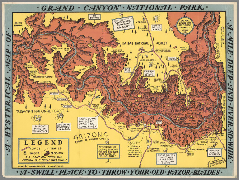
Lindgren Brothers
Full Title
A Hysterical Map of the Grand Canyon National Park.
Publisher
Lindgren Brothers
Author
[Barnard, E.C., U.S. Geological Survey (USGS), Goode, R.U.]
Full Title
Map of Alaska. (insets) Aleutian Islands. (Areas of Geologic Mapping by the U.S.G.S.). Compiled under the Direction of R.U. Goode, Geographer, by E.C. Barnard and others. 1904. Contour Interval 1000 feet. U.S. Geological Survey. Professional Paper No. 45, Plate XXXIV.
Publisher
U.S. Geological Survey (USGS)
Author
Bloodgood, Don
Full Title
A Pic-Tour Map. Honolulu, Waikiki and 'Round the Isle of Oahu. Waikiki Beach. (inset) Hawaiian Islands.
Publisher
Ray Helbig's Hawaiian Service
Author
Bloodgood, Don
Full Title
A Pic-Tour Map. Honolulu, Waikiki and 'Round the Isle of Oahu. Waikiki Beach. (inset) Hawaiian Islands.
Publisher
Ray Helbig's Hawaiian Service
Author
Pacific Stars and Stripes
Full Title
Pacific Stars and Stripes Map of the (Korean) War. (inset) 38th Parallel.
Publisher
Pacific Stars and Stripes
Author
[Martin, George W., Pargeter, Richard A.]
Full Title
The North Central Cascades. A Pictorial Relief Map by George W. Martin and Richard A. Pargeter.
Author
[Martin, George W., Pargeter, Richard A.]
Full Title
The North Central Cascades. A Pictorial Relief Map by George W. Martin and Richard A. Pargeter.
Author
Atwood, Mary Hall
Full Title
Long Beach, Southern California, Los Angeles County.
Publisher
(Long Beach) Chamber of Commerce
Author
Atwood, Mary Hall
Full Title
Make Long Beach Your Vacation Headquarters.
Publisher
(Long Beach) Chamber of Commerce
Author
Atwood, Mary Hall
Full Title
Los Angeles County. Long Beach.
Publisher
(Long Beach) Chamber of Commerce
Author
[Lites, Arthur, (Palo Alto) Chamber of Commerce]
Full Title
Palo Alto, California. A Pictorial Map.
Publisher
City of Palo Alto
Author
[Lites, Arthur, (Palo Alto) Chamber of Commerce]
Full Title
Palo Alto, Ideal Home and Recreational Center.
Publisher
City of Palo Alto
Author
[Lites, Arthur, (Palo Alto) Chamber of Commerce]
Full Title
A Pictorial Map of Palo Alto and the San Francisco Peninsula. Palo Alto, A Pictorial Map Drawn from the View Point (Birdseye) of One Aboard a Coastwise Air Liner.
Publisher
City of Palo Alto
Author
Cressy, Mike
Full Title
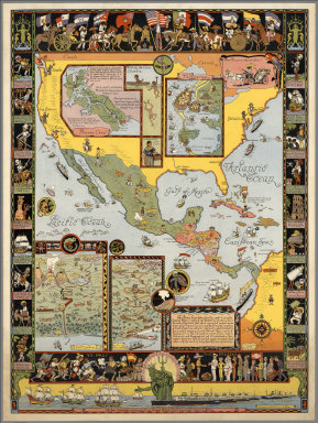
The Literary Map of Latin America.
Publisher
Aaron Blake Publishers
Author
Lloyd, James T.
Full Title
Lloyd's American railroad map of the United States, showing the three proposed roads and the overland mail route to the Pacific 1859. Drawn and engraved by Rae Smith, 71 Nassau St. N.Y. From materials furnished to the 36th Congress, March 1859 by G.K. Warren, Lt. U.S. Top. Eng. for the passage of the Pacific Railroad Bill. Entered ... 1859, by J.T. Lloyd ... Pensylvania.
Publisher
J.T. Lloyd
Author
[Lindgren Brothers, Lindgren, Jolly]
Full Title
A Hysterical Map of the Grand Coulee Dam.
Publisher
Lindgren Brothers
|