Who What Where WhenREMOVEWHAT
WHEREShow More |
REFINE
Browse All : Title Page from 1878
1-23 of 23
Author
Rand McNally and Company
Full Title
(Title Page to) Rand, McNally & Co.'s Quebec. (untitled inset of Gulf of St. Lawrence region). (with 24 page index) Rand, McNally & Co.'s Indexed Map Of The Province Of Quebec, Canada ... Chicago: Rand, McNally & Co., Printers And Engravers, 77 and 79 Madison Street. (on verso) Entered ... 1878, by Rand, McNally & Co. ... Washington.
Publisher
Rand McNally & Co.
Author
Rand McNally and Company
Full Title
(Title Page to) (California and Nevada). (with index titled) Rand McNally & Co.'s Indexed Maps Of California And Nevada ... Chicago: Rand, McNally & Co., Printers And Engravers, 77 and 79 Madison Street. (on verso) Entered ... 1878, by Rand, McNally & Co. ... Washington.
Publisher
Rand McNally & Co.
Author
Thompson & West
Full Title
(Title Page to) Historical atlas map of Solano County, California. Compiled, drawn and published from personal examinations and surveys by Thompson & West. San Francisco, Cala. 1878. Thos. Hunter, Pr. Phila. N. Friend, Engr. Philad. C.L. Smith, Del.
Publisher
Thompson & West
Author
Rand McNally and Company
Full Title
(Title Page to) Rand, McNally & Co.'s Montana. (with 5 page index) Rand McNally & Co.'s Indexed Map Of Montana Showing The Stage Lines, Counties, Lakes & Rivers ... Chicago: Rand, McNally & Co., Printers And Engravers, 77 and 79 Madison Street. (on verso) Entered ... 1878, by Rand, McNally & Co. ... Washington.
Publisher
Rand McNally & Co.
Author
Rand McNally and Company
Full Title
(Title page to) Rand McNally & Co.'s Washington. (with index) Rand McNally & Co.'s Indexed Map Of Washington Territory Showing The Railroads, And the Express Company doing business over each ... Chicago: Rand, McNally & Co., Printers And Engravers, 77 and 79 Madison Street. (on verso) Entered ... 1878, by Rand, McNally & Co. ... Washington.
Publisher
Rand McNally & Co.
Author
Rand McNally and Company
Full Title
(Title Page to) Rand, McNally & Co.'s Illinois. Rand, McNally & Co., Relief Plate Map Engravers, Chicago. (inset) Vicinity Of Davenport & Rock Island. (inset) Chicago And Vicinity. (with 57 page index) Rand, McNally & Co.'s Indexed Map of Illinois ... Chicago: Rand, McNally & Co. ... 77 and 79 Madison Street. (on verso) Entered ... 1878, by Rand, McNally & Co. ... Washington.
Publisher
Rand McNally & Co.
Author
Thompson & West
Full Title
(Title Page to) Official and historical atlas map of Alameda County, California. Compiled, drawn and published from personal examinations and surveys by Thompson & West. Oakland, Cala. 1878. Thos. Hunter Pr. Phila. N. Friend, Engr. Philad. C.L. Smith, Del.
Publisher
Thompson & West
Author
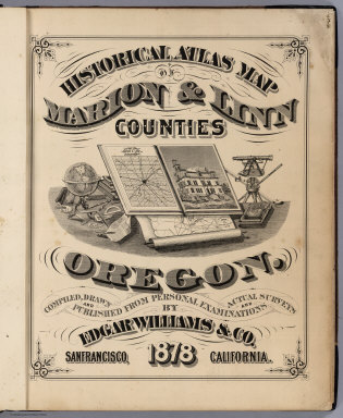
Williams, Edgar.
Full Title
(Title Page) Historical Atlas Map Of Marion & Linn Counties Oregon. Compiled, Drawn And Published From Personal Examinations And Actual Surveys By Edgar Williams & Co. San Francisco, California. 1878.
Publisher
Edgar Williams & Co.
Author
[Hitchcock, Charles H. (Charles Henry), 1836-1919, New Hampshire. Geological Survey]
Full Title
(Title Page to) Atlas accompanying the report on the geology of New Hampshire. C.H. Hitchcock, State Geologist. 1878. Julius Bien, New York.
Publisher
Julius Bien
Author
Missouri Publishing Company
Full Title
(Title Page) Atlas Map Of Leavenworth County Kansas. Published By Missouri Publishing Company, 1878.
Publisher
Missouri Publishing Company
Author
Roe Brothers (Firm)
Full Title
(Title Page to) Atlas of the Maritime Provinces of the Dominion of Canada, with historical and geological descriptions. Drawn on the Rectangular polyconic projection, from the British Admiralty charts, the National Boundary Survey, official plans, railway surveys, latest and most reliable maps, and new surveys made by the authors. Drawn and published by Roe Brothers, (A.D. & W.B. Roe). St. John, N.B. 1878. Eng. by Worley & Bracher, 27 South Sixth Street, Philada. Printed by F. Bourquin, 31 South Sixth St., Philada.
Publisher
Roe Brothers
Author
[Howden, J.A., Odbert, A.]
Full Title
(Title Page) Howden & Odbert's Atlas Of Warren County, Pennsylvania. From Actual Surveys & Records by & under the directions of J.A. Howden & A.O. Odbert, Publishers, Washington, Pa. 1878. Assisted by J.J. Power, T.M.D. McCloy, F.G. Longdon, Capt. W.H. Horn. Artists, Wilson Porter, F. Robejohn, E. Bott, & M.B. Leisser. Engraved, Lithographed & Printed By Otto Krebs, Pittsburgh, Pa.
Publisher
J.A. Howden & A. Odbert
Author
[U.S. Northern Boundary Commission, Campbell, A.]
Full Title
(Title Page) Joint Maps Of The Northern Boundary Of The United States, From The Lake Of The Woods To The Summit Of The Rocky Mountains. United States Northern Boundary Commission, Archibald Campbell Esq. Commissioner. W.J. Twining, Capt. of Engrs, U.S.A. Chief Astronomer. Her Majesty's North American Boundary Commission, D.R. Cameron, Maj. Royal Art. Commissioner. S. Anderson, Capt. Royal Engrs. Chief Astronomer.
Publisher
U.S.
Author
[Price, T. T., Rose, Theodore F., Woolman, H. C.]
Full Title
(Title Page to) Historical and biographical atlas of the New Jersey coast. Proposed, arranged and illustrated by T.F. Rose. Surveys by H.C. Woolman. History and statistics by T.T. Price, M.D. Philadelphia, Woolman & Rose, 1878.
Publisher
Woolman & Rose
Author
[U.S. Northern Boundary Commission, Campbell, Archibald, Twining, W.J.]
Full Title
(Title Page) Reports upon the Survey of the Boundary Between the Territory of the United States and the Possessions of Great Britain from the Lake of the Woods to the Summit of the Rocky Mountains, authorized by an Act of Congress Approved March 19, 1872. Archibald Campbell, Esq., (and) Captain W.J. Twining ... Published in accordance with an Act of Congress Approved March 3, 1877. Washington: Government Printing Office. 1878.
Publisher
Government Printing Office
Author
Hopkins, H.W.
Full Title
(Title Page) City Atlas Of Halifax, Nova Scotia. From Actual Surveys And Records. By And Under The Supervision Of H.W. Hopkins, Civil Engineer. Provincial Surveying and Pub. Co. G.B. Vandervoort, Manager. 1878.
Publisher
Provincial Surveying & Pub Co.
Author
Cram, George Franklin
Full Title
(Title Page) Cram's Standard American Atlas Of The United States, Compiled from the very latest sources, showing Railroads, Rivers, Counties, Towns, Villages, Post Offices, Population, &c., to date. A Complete Guide For Business Men. Scale, 19 Miles to an Inch. Published By George F. Cram, Proprietor Of The Western Map Depot, 66 Lake Street, Chicago, Ill. 1878.
Publisher
George F. Cram
Author
Gray, Ormando Willis
Full Title
(Title Page to) The National Atlas. Containing Elaborate Topographical Maps Of The United States And The Dominion of Canada, With Plans Of Cities And General Maps Of The World. Also, Descriptions and Tables, Historical and Statistical ... Accompanied By Special, Railway, And Scientific Maps And Articles. Philadelphia: O.W. Gray & Son, No. 10 North Fifth Street. 1878.
Publisher
O.W. Gray & Son
Author
Gray, Ormando Willis
Full Title
(Title Page verso) Entered ... 1876, by O.W. Gray & Son ... Washington.
Publisher
O.W. Gray & Son
Author
Snyder, Van Vechten & Co.
Full Title
(Title Page to) Historical atlas of Wisconsin embracing complete state and county maps, city & village plats, together with separate state and county histories; also special articles on the geology, education, agriculture, and other important interests of the state. Illustrated. Compiled and published by Snyder, Van Vechten & Co., Milwaukee. 1878. (on verso of title page) Entered ... 1878, by Snyder, Van Vechten & Co. ... Washington.
Publisher
Snyder, Van Vechten & Co.
Author
Rand McNally and Company
Full Title
(Title Page to) Rand McNally & Co's Historical Description And Guide Map Of Chicago ... Chicago: Rand, McNally & Co., Printers And Engravers, 77 and 79 Madison Street. (on verso) Entered ... 1879, by Rand, McNally & Co. ... Washington. (with) Map Showing The Boulevards And Park System And Twelve Miles of Lake Frontage Of The City Of Chicago. Engraved By Rand, McNally & Co. ... Entered ... 1879, by Rand, McNally & Co. ... Washington, D.C. ...
Publisher
Rand McNally & Co.
Author
Rand McNally and Company
Full Title
(Title Page to) Rand, McNally & Co.'s Massachusetts. Copyright, 1879, by Rand, McNally & Co., Chicago, Ill. Rand, McNally & Co., Relief Plate Map Engr's Chicago. (inset) Vicinity Of Boston. (untitled inset map of City Hall area in Boston). (with 27 page index) Rand, McNally & Co.'s Indexed Map Of Massachusetts ... Chicago: Rand, McNally & Co. ... 77 and 79 Madison Street. (on verso) Entered ... 1879, by Rand, McNally & Co. ... Washington.
Publisher
Rand McNally & Co.
Author
Wheeler, G.M.
Full Title
(Title Page to) Report upon United States Geographical Surveys West of the One Hundredth Meridian, in charge of Capt. Geo. M. Wheeler, Corps of Engineers, U.S. Army ... In seven volumes and one supplement, accompanied by one topographic and one geologic atlas. Vol. VI--Botany. Washington: Government Printing Office, 1878.
Publisher
U.S.
1-23 of 23
|