Who What Where WhenREMOVE |
Author
Tanner, Henry S.
Full Title
(Title Page to) An Atlas of Ancient Geography: Comprehended in Sixteen Maps, Selected From The Most Approved Works, To Elucidate The Writings of the Ancient Authors, Both Sacred And Profane. Philadelphia: Published by H.S. Tanner, No. 177, Chesnut Street. 1826.
Publisher
H.S. Tanner
Author
Mitchell, Samuel Augustus
Full Title
(Title Page with business card to) Mitchell's new general atlas, containing maps of the various countries of the World, plans of cities, etc. Embraced in ninety-three quarto maps. Forming a series of one hundred and forty-seven maps and plans. Together with valuable statistical tables. Also a list of post-offices of the United States and territories, and also Census of 1880 for states, territories and counties, also of cities of over 10,000 inhabitants. Philadelphia: Wm. M. Bradley & Bro., No. 1026 Arch Street. 1886. Entered ... 188_, by S. Augustus Mitchell ... Washington.
Publisher
Wm. M. Bradley & Bro.
Author
Jouvet et Cie.
Full Title
(Title Page to) Atlas Universel de Geographie Moderne. Physique, Politique, Historique, Industriel, Commercial et Militaire. Adopte par le Ministere de la Guerre pour L'Ecole de Saint-Cyr. Paris. Furne, Jouvet et Cie, Editeurs. Jouvet et Cie, Successeurs. 45 Rue Saint-Andre des Arts. MDCCCLXXXII. (1882)
Publisher
Jouvet et Cie
Author
[Lowry, J.W., Sharpe, J.]
Full Title
(Title Page to) Sharpe's Corresponding Atlas, Comprising Fifty-Four Maps, Constructed Upon A System Of Scale And Proportion, From the most Recent Authorities. Engraved On Steel By Joseph Wilson Lowry. With A Copious Consulting Index. London: Chapman And Hall, 186 Strand. MDCCCXLIX.
Publisher
Chapman & Hall
Author
[Black, Adam & Charles, Hall, Sidney, Hughes, William]
Full Title
(Title Page to) General Atlas Of The World: Containing Upwards Of Seventy Maps. Engraved On Steel, In The First Style Of Art, By Sidney Hall, William Hughes, F.R.G.S., &c. New Edition. Embracing All The Latest Discoveries Obtained From Government Surveys And Expeditions, Books Of Recent Travel, And Other Sources, Including The North-West Passage Discovered By H.M. Ship Investigator. With Introductory Chapters On The Geography And Statistics Of The Various Countries Of The World, And A Complete Index Of 65,000 Names. Edinburgh: Adam And Charles Black, North Bridge. M.DCCC.LIV.
Publisher
Adam & Charles Black
Author
Johnston, W. & A.K.
Full Title
(Title Page to) Johnston's Royal Atlas Of Modern Geography Exhibiting, In A Series Of Sixty Entirely Original And Authentic Maps, The Present Condition Of Geographical Discovery And Research In The Several Countries, Empires, And States Of The World With A Special Index To Each Map. W.& A.K. Johnston, Limited, Edinburgh And London, MCMXII.
Publisher
W.& A.K. Johnston
Author
Rand McNally and Company
Full Title
(Title Page to) Rand McNally & Co.'s Enlarged Business Atlas And Shippers' Guide ... Showing In Detail The Entire Railroad System ... Accompanied By A New And Original Compilation And Ready Reference Index ...Together With Complete Reference Maps Of All Countries With New Marginal Index ... Engraved, Printed, And Published By Rand, McNally & Company, Chicago, U.S.A., 1903. (on verso) ... Copyright, 1903, by Rand, McNally & Co.
Publisher
Rand McNally and Company
Author
Espinosa y Tello, J.
Full Title
(Title Page to) Atlas para el Viage de las Goletas Sutil y Mexicana al reconocimiento del Estrecho de Juan de Fuca en 1792, Publicado en 1802.
Publisher
Imprenta Real
Author
[Carey, H. C., Lea, I.]
Full Title
(Title Page to) A Complete Historical, Chronological, And Geographical American Atlas, Being A Guide To The History Of North And South America, And The West Indies ... To The Year 1822. According To The Plan Of Le Sage's Atlas And Intended As A Companion To Lavoisne's Improvement Of That Celebrated Work. Philadelphia: H.C. Carey And I. Lea, Chestnut Street. 1822. (on verso) ... T.H. Palmer, Printer.
Publisher
H.C. Carey & I. Lea
Author
[Martin, R.M., Tallis, J. & F.]
Full Title
(Title Page to) The Illustrated Atlas, And Modern History Of The World Geographical, Political, Commercial & Statistical, Edited By R. Montgomery Martin, Esq. ... The Maps Drawn & Engraved By J. Rapkin. H. Warren. J. Rogers. J. & F. Tallis, London & New York.
Publisher
J. & F. Tallis
Author
Holdredge, Sterling M.
Full Title
(Illustrated Title Page to) State, Territorial and Ocean Guide Book of the Pacific: Containing The Time and Distance Tables ... on or Connecting with the Pacific Coast and the Interior ... To Which Are Added Nine Large and Reliable Maps Showing Principal Towns, Routes of Communication, etc. San Francisco: Published Semi-Annually by Sterling M. Holdredge. ... 1866.
Publisher
S.M. Holdredge
Author
Holdredge, Sterling M.
Full Title
(Title Page to) State, Territorial and Ocean Guide Book of the Pacific: Containing The Time and Distance Tables ... on or Connecting with the Pacific Coast and the Interior ... To Which Are Added Nine Large and Reliable Maps Showing Principal Towns, Routes of Communication, etc. San Francisco: Published Semi-Annually by Sterling M. Holdredge. ... 1866.
Publisher
S.M. Holdredge
Author
Melish, John
Full Title
(Title Page to) A Military and Topographical Atlas of the United States; Including The British Possessions & Florida ... By John Melish. Philadelphia, Published By John Melish. G. Palmer Printer 1815. (on verso) District of Pennsylvania ... fourteenth day of March ... 1815 ... John Melish ... hath deposited ... a book.
Publisher
John Melish
Author
Carver, Jonathan
Full Title
(Title Page to)Travels Through The Interior Parts Of North America, In The Years 1766, 1767, And 1768. By J. Carver, Esq. Captain Of A Company Of Provincial Troops During The Late War With France. Illustrated With Copper Plates, Coloured. The Third Edition. To which is added, Some Account Of The Author, And A Copious Index. London: Printed for C. Dilly, in the Poultry; H. Payne, in Pall-mall; and J. Phillips, in George-Yard, Lombard-Street. MDCCLXXXI. (with 2 maps).
Publisher
C. Dilly
Author
[James, Edwin, Long, Stephen H.]
Full Title
(Title Page to) Account of An Expedition From Pittsburgh to the Rocky Mountains, Performed in the Years 1819 and 1820 ... Maps and Plates. Philadelphia: H.C. Carey and I. Lea, Chesnut Street. 1822. (Accompaniment to) Account of An Expedition From Pittsburgh to the Rocky Mountains, Performed in the Years 1819 and 1820...Under the Command of Major Stephen H. Long. From the Notes of Major Long, Mr. T. Say, and Other Gentlemen of the Exploring Party. Compiled by Edwin James ... In Two Volumes. - With An Atlas. Philadelphia: H.C. Carey & I. Lea, Chestnut St. 1823.
Publisher
Carey and Lea
Author
[Allen, Paul, Biddle, Nicholas, Clark, William, Lewis, Meriwether]
Full Title
Travels to the Source of the Missouri River and Across the American Continent to the Pacific Ocean. Performed by Order of The Government of the United States, In the Years 1804, 1805, and 1806. By Captains Lewis and Clarke. Published From the Official Report, And Illustrated by a Map of the Route, and Other Maps. A New Edition, In Three Volumes. London: Printed For Longman, Hurst, Rees, Orme, And Brown, Paternoster-Row. 1815.
Publisher
Longman, Hurst, Rees etc.
Author
Pike, Zebulon Montgomery
Full Title
(Title Page to) An Account of Expeditions to the Sources of the Mississippi, and Through the Western Parts of Louisiana, to the Sources of the Arkansaw, Kans, La Platte, and Pierre Jaun, Rivers; ... During the Years 1805, 1806, and 1807. And a Tour Through the Interior Parts of New Spain, When Conducted Through These Provinces, by order of The Captain-General, in the year 1807. By Major Z.M. Pike. Illustrated by Maps and Charts. Philadelphia: Published by C. & A. Conrad & Co. No. 30, Chesnut Street. Somervell & Conrad, Petersburgh. Bonsal, Conrad, & Co. Norfolk, and Fielding Lucas, Jr. Baltimore. John Binns, Printer....1810.
Publisher
C. & A. Conrad
Author
Sage, Rufus B.
Full Title
(Title Page to) Scenes in the Rocky Mountains, and in Oregon, California, New Mexico, Texas, and the Grand Prairies; or Notes by the Way, During An Excursion Of Three Years, with a Description of the Countries Passed Through, including their Geography, Geology, Resources, Present Condition, and The Different Nations Inhabiting Them. By A New Englander. Philadelphia: Published By Carey & Hart. 1846. (on verso) Entered ... 1846, by Rufus B. Sage ... New-York.
Publisher
Carey & Hart
Author
Melish, John
Full Title
(Title Page to) Travels in the United States of America, in the years 1806 & 1807, and 1809, 1810 & 1811 ... Illustrated by eight maps. By John Melish. In two volumes. Philadelphia, printed for the author, and for sale by the different booksellers in the United States, and by Thomas & George Palmer, agents for the author. 1812. T. & G. Palmer, printers.
Publisher
Palmer, Thomas & George
Author
Gregg, Josiah, 1806-1850
Full Title
(Title Page to) Commerce of the Prairies: Or the Journal of a Santa Fe Trader, During Eight Expeditions Across The Great Western Prairies, and a residence of nearly nine years in Northern Mexico. Illustrated with Maps and Engravings. By Josiah Gregg. In two volumes. New York: Henry G. Langley, 8 Astor House. London: Wiley and Putnam, 6 Waterloo Place. M DCCC XLIV. (on verso) Entered ... 1844, by Henry G. Langley ... New-York.
Publisher
[Henry G. Langley, Wiley and Putnam.]
Author
[Birkbeck, Morris, Melish, John]
Full Title
(Title Page to) Letters From Illinois By Morris Birkbeck ... Illustrated by a Map of the United States, Shewing Mr. Birkbeck's Journey From Norfolk To Illinois And a Map of English Prairie and the Adjacent Country, by John Melish. Philadelphia: Published By M. Carey & Son, 126, Chestnut Street. 1818.
Publisher
M. Carey & Son
Author
Maclure, William
Full Title
(Title Page to) Observations on the Geology of the United States, explanatory of a Geological Map. By William Maclure. Read January 20th, 1809. (In) Transactions of the American Philosophical Society, Held at Philadelphia, for promoting Useful Knowledge. Volume VI. Published by C. and A. Conrad and Co. Philadelphia. ... Jane Aitken, Printer. 1809.
Publisher
C. & A. Conrad
Author
Imlay, Gilbert
Full Title
(Title Page to) A Topographical Description of the Western Territory of North America ... By Gilbert Imlay ... Illustrated with correct Maps of the Western Territory of North America; of the State of Kentucky, as divided into Counties, from actual Surveys by Elihu Barker; a Map of the Tenasee Government; and a Plan of the Rapids of the Ohio. The Third Edition With Great Additions. London: Printed For J. Debrett, Opposite Burlington House, Piccadilly. 1797.
Publisher
J. Debrett
Author
Morse, Jedidiah
Full Title
(Title Page to) The American Geography; or, A View of the Present Situation of the United States of America ... Illustrated with two Sheet Maps-One of the Southern, the other of the Northern States, neatly and elegantly engraved, and more correct than any that have hitherto been published ... By Jedidiah Morse. Elizabeth Town: Printed by Shepard Kollock, for the Author. M,DCC,LXXXIX.
Publisher
Shepard Kollock
Author
Gallatin, Albert
Full Title
(Title Page to) A Synopsis of the Indian Tribes Within the United States East of the Rocky Mountains, and in the British and Russian Possessions in North America. By the Hon. Albert Gallatin. (In: Archaeologia Americana. Transactions and Collections of the American Antiquarian Society. Vol II. Cambridge: Printed For The Society, At The University Press. 1836).
Publisher
The University Press
Author
[Allen, Paul, Biddle, Nicholas, Clark, William, Lewis, Meriwether]
Full Title
(Title Page to) History Of The Expedition Under The Command Of Captains Lewis And Clark, To The Sources Of The Missouri, Thence Across The Rocky Mountains And Down The River Columbia To The Pacific Ocean. Performed During The Years 1804-5-6. By order of the Government Of The United States. Prepared For The Press By Paul Allen, Esquire. In Two Volumes. Vol. I. Philadelphia: Published By Bradford And Inskeep, New York. J. Maxwell, Printer. 1814 ... Vol. II.
Publisher
Bradford and Inskeep
Author
Maclure, William
Full Title
(Title Page to) Transactions of the American Philosophical Society. New Series. No. I. Observations on the Geology of the United States of North America; with Remarks on the probable Effects that may be produced by the Decomposition of the different Classes of Rocks on the Nature and Fertility of Soils: applied to the different States of the Union, agreeably to the accompanying geological Map. With two Copper Plates. By William Maclure. Read May 16th, 1817.
Publisher
A. Small
Author
Maclure, William
Full Title
(Title Page to) Observations on the Geology of the United States of America; With Some Remarks on the Effect Produced on the Nature and Fertility of Soils, By the Decomposition of the Different Classes of Rocks; And An Application to the Fertility of Every State in the Union, In Reference to the Accompanying Geological Map. With Two Plates. By William Maclure. ... Philadelphia: Printed for the Author, by Abraham Small ... 1817. (with) Essay On The Formation of Rocks, Or An Inquiry Into the Probable Origin of Their Present Form and Structure. By William Maclure. ... Philadelphia, Printed by John Wilbank ... 1838.
Publisher
A. Small
Author
[Churchman, Joseph and James, Moore, I.W.]
Full Title
(Title Page to) Rudiments of National Knowledge, Presented To The Youth Of The United States, And To Enquiring Foreigners. By A Citizen Of Pennsylvania. Philadelphia: Published by E.L. Carey & A. Hart. ... 1833.
Publisher
E.L. Carey & A. Hart
Author
Hutchins, Thomas
Full Title
(Title Page to) A Topographical Description Of Virginia, Pennsylvania, Maryland, And North Carolina, Comprehending The Rivers Ohio, Kenhawa, Sioto, Cherokee, Wabash, Illinois, Mississippi, &c ... Published by Thomas Hutchins ... With A Plan of the Rapids of the Ohio, A Plan of the several Villages in the Illinois Country, A table of the Distances between Fort Pitt and the Mouth of the Ohio, all Engraved upon Copper ... London: Printed for the Author, and Sold by J. Almon, opposite Burlington House, in Piccadilly. MDCCLXXVIII.
Publisher
J. Almon
Author
[Colton, G.W., Fisher, Richard Swainson]
Full Title
(Title Page to) Colton's Illustrated Cabinet Atlas And Descriptive Geography. Maps By G. Woolworth Colton. Text By Richard Swainson Fisher. New York: Published By J.H. Colton, No. 172 William Street. 1859.
Publisher
J.H. Colton
Author
[Glover, E. S., Hicks-Judd Company]
Full Title
(Title Page to) The illustrated directory; a magazine of American cities, comprising views of business blocks, with reference to owners, occupants, professions and trades, public buildings and private residences. Vol. 1, no. 11, (December, 1895) Published by the Hicks-Judd Co. Copyrighted 1895, by Eli S. Glover. Steuart, Spear, Main, Beale, Fremont, First, Second streets, San Francisco.
Publisher
The Hicks Judd Company
Author
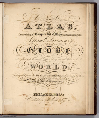
Finley, Anthony
Full Title
(Title Page to) A New General Atlas Comprising a Complete Set of Maps, representing the Grand Divisions Of The Globe, Together with the several Empires, Kingdoms, and States in the World; Compiled from the Best Authorities, and corrected by the Most Recent Discoveries. Philadelphia: Published by Anthony Finley. 1824. (title page only) Written And Engraved By Jos. Perkins.
Publisher
Anthony Finley
Author
La Perouse, Jean-Francois de Galaup, comte de, 1741-1788
Full Title
(Title Page to) Atlas du voyage de La Perouse. Dessine par J. M. Moreau le Jeune. Grave par Ph. Triere. L. Aubert scripsit.
Publisher
L'Imprimerie de la Republique
Author
Mitchell, Samuel Augustus
Full Title
(Title Page to) Mitchell's New General Atlas, Containing Maps Of The Various Countries Of The World, Plans Of Cities, Etc. Embraced In Forty-Seven Quarto Maps, Forming A Series Of Seventy-Six Maps And Plans, Together With Valuable Statistical Tables. Philadelphia: Published By S. Augustus Mitchell, Jr. No. 31 South Sixth Street. 1860. Entered ... 1860, by S. Augustus Mitchell, Jr. ... Pennsylvania.
Publisher
S.A. Mitchell, Jr.
Author
Venezuela-British Guiana Boundary Commission
Full Title
(Title Page to) Maps Of The Orinoco-Essequibo Region, South America. Compiled For The Commission Appointed By The President Of The United States "To Investigate And Report Upon The True Divisional Line Between The Republic Of Venezuela And British Guiana". Commissioners, David J. Brewer, President, Richard H. Alvey, Frederic R. Coudert, Andrew D. White, Daniel C. Gilman, Severo Mallet-Prevost, Secretary. Washington. February, 1897.
Publisher
United States of America
Author
Carey, Mathew
Full Title
(Title Page to) Carey's General Atlas, Improved And Enlarged; Being A Collection Of Maps Of The World And Quarters, Their Principal Empires, Kingdoms, &c. Containing...[Sequential List of Maps]. Philadelphia: Published By M. Carey And Son, 1818.
Publisher
M. Carey and Son
Author
Rand McNally and Company
Full Title
(Title Page to) Rand, McNally & Co.'s indexed atlas of the world containing large scale maps of every country and civil division upon the face of the globe, together with historical, descriptive, and statistical matter relative to each ... Accompanied by a new and original compilation forming a ready reference index ... Engraved, printed and published by Rand, McNally & Company, Chicago and New York, U.S.A., 1897. (Vol. 2 United States)
Publisher
Rand McNally
Author
Rand McNally and Company
Full Title
(Title Page Verso to) Rand, McNally & Co.'s indexed atlas of the world containing large scale maps of every country and civil division upon the face of the globe, together with historical, descriptive, and statistical matter relative to each ... Accompanied by a new and original compilation forming a ready reference index ... Engraved, printed and published by Rand, McNally & Company, Chicago and New York, U.S.A., 1897. (verso) Copyright, 1894, by Rand, McNally & Co., Chicago. (vol. 2 United States)
Publisher
Rand McNally
Author
Brue, Adrien Hubert, 1786-1832
Full Title
(Title Page to) Mappe Monde en deux Hemispheres presentant L'Etat Acuel de La Geographie Par A.H. Brue, Geographe de S.H.R. Monsieur a Paris. Chez: l'Auteur, Rue des Macons-Sorbonne No. 9. CH les Simonneau, Rue de la Paix, No. 6. Juin 1820. Dediee a Monsieur Le baron G. Cuvier, Conseiller d'Stat ordinaire, L'Un des Quarante de L'Academie Francaise, Secretaire Perpetuel de celle des Sciences, &,&. Hommage Respectueux de l'Auteur. A' Londres, chez Cary Md. de Cartes Geog. A' Milan, chez Betailli et Compie. A' Vienne, chez Artaria Md. d'Estampes. A' Berlin, chez Simon Schropp et Compie. A' Manheim, chez Artaria. A' Vienne, chez Riedl, Bureau d'Idustrie.
Publisher
Charles Simonneau
Author
Gray, Ormando Willis
Full Title
(Title Page to) The National Atlas. Containing Elaborate Topographical Maps Of The United States And The Dominion of Canada, With Plans Of Cities And General Maps Of The World. Also, Descriptions and Tables, Historical and Statistical ... Accompanied By Special, Railway, And Scientific Maps And Articles. Philadelphia: O.W. Gray & Son, No. 10 North Fifth Street. 1878.
Publisher
O.W. Gray & Son
Author
Gray, Ormando Willis
Full Title
(Title Page verso) Entered ... 1876, by O.W. Gray & Son ... Washington.
Publisher
O.W. Gray & Son
Author
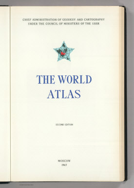
USSR (Union of Soviet Socialist Republics).
Full Title
(Title Page) Chief Administration of Geodesy and Cartography under the Council of Ministers of the USSR. The World Atlas. Second Edition. Moscow. 1967.
Publisher
USSR
Author
USSR (Union of Soviet Socialist Republics).
Full Title
(Title Page verso) (A black and white rendering of the USSR Coat of Arms).
Publisher
USSR
Author
Rand McNally and Company
Full Title
(Title Page to) Rand, McNally & Co.'s Business Atlas Containing Large Scale Maps of Each State and Territory of the United States, The Provinces Of Canada, West India Islands, Etc., Etc. Together with a Complete Reference Map of the World ... Accompanied by a New and Original Compilation and Ready Reference Index, Showing in Detail the Entire Railroad System of North America ... Chicago: Rand, McNally & Co., Printers, Engravers And Publishers. 1878-9. (on verso) Entered ... 1878, by Rand, McNally & Co. ... Washington, D.C.
Publisher
Rand McNally
Author
Robert de Vaugondy, Gilles, 1688-1766
Full Title
(Title Page to) Atlas Universel, Par M. Robert Geographe ordinaire du Roy, et Par M. Robert De Vaugondy son fils Geographe ord. du Roy, et de S. M. Polonoise, Duc de Lorraine et de Bar, et Associe de L'Academie Royale des Sciences et belles Lettres de Nancy, Avec Privilege Du Roy, 1757. A Paris, Chez Les Auteurs ,Quay de l'Horloge du Palais, Boudet Libraire Imprimeur du Roi, rue St. Jacques. Grave par Ch. Baquoy. J. Oger Scripsit.
Publisher
[Boudet, Les Auteurs]
Author
Lucas, Fielding Jr.
Full Title
(Title Page to) A General Atlas Containing Distinct Maps Of all the Known Countries in the World, Constructed from the Latest Authority. Written and Engraved by Jos. Perkins, Philadelphia. Baltimore: Published by Fielding Lucas, Jun. No. 138, Market Street. Baltimore. Entered ... by F. Lucas Jr. of the State of Maryland June 3, 1823.
Publisher
Fielding Lucas Jr.
Author
Snyder, Van Vechten & Co.
Full Title
(Title Page to) Historical atlas of Wisconsin embracing complete state and county maps, city & village plats, together with separate state and county histories; also special articles on the geology, education, agriculture, and other important interests of the state. Illustrated. Compiled and published by Snyder, Van Vechten & Co., Milwaukee. 1878. (on verso of title page) Entered ... 1878, by Snyder, Van Vechten & Co. ... Washington.
Publisher
Snyder, Van Vechten & Co.
Author
Tanner, Henry S.
Full Title
(Covers and Title Page to) United States of America: by H.S. Tanner, 1839. Philadelphia, Published by Henry S. Tanner. Entered ... 1838, by H.S. Tanner ... Pennsylvania. Engraved by H.S. Tanner, assisted by E.B. Dawson, W. Allen & J. Knight. (title by) J.W. Steel Sc. (with 17 inset maps and 1 profile). (with index) An alphabetical index to the four sheet map of the United States by H. S. Tanner. Philadelphia: Rackliff and Jones, Printers, South-West Corner of George and Swanwick streets.
Publisher
H.S. Tanner
|