Who What Where WhenREMOVE |
REFINE
Browse All : U.S. Public Survey of United States
1-39 of 39
Author
[U.S. General Land Office, Hawes, J.H.]
Full Title
Map of the Public Land States And Territories constructed from The Public Surveys and other official sources in the General Land Office. Drawn by J.H. Hawes, Principal Draughtsman. T. Franks, Assistant. 1864. Engraved by D. McClelland Washn. D.C.
Publisher
U.S.
Author
U.S. General Land Office
Full Title
(Title Page to) Report of the Commissioner of General Land Office, for the Year 1867. Abridged and published by order of the Senate of the United States. Washington: Government Printing Office. 1867.
Publisher
Government Printing Office
Author
U.S. General Land Office
Full Title
Map of the United States and Territories, Showing the extent of Public Surveys and other details. Constructed From the Plats and official sources of the General Land Office, Under the direction of the Hon. Jos. S. Wilson, Commissioner, by Joseph Gorlinski, Draughtsman, 1867. Julius Bien, N.Y. Department of the Interior General Land Office Oct. 15th 1867. Jos. S. Wilson, Commissioner.
Publisher
Government Printing Office
Author
U.S. General Land Office
Full Title
(Covers to) Centennial Map Of The United States and Territories Showing the Extent of Public Surveys, Indian and Military Reservations...& Other Details.
Publisher
Julius Bien
Author
U.S. General Land Office
Full Title
Index to the Centennial Map Of The United States and Territories.
Publisher
Julius Bien
Author
U.S. General Land Office
Full Title
(Map 1 - Florida) (portion of title block shown reads:) of the United States and Territories showing the extent of Public Surveys, Indian and Military Reservations, Land Grants R.R., Rail Roads, Canals, Cities, Towns & other Details. Compiled from the Official Surveys of the General Land Office, and other authentic Sources, under the Direction of the Committee of Public Lands, House of Representatives, by W.L. Woods, Clerk of the Committee ... C. Roeser, Chief Draughtsman. Revised and Corrected to 1878. Copyright 1878 by W.L. Woods.
Publisher
Julius Bien
Author
U.S. General Land Office
Full Title
(Map 2 - North Carolina, South Carolina, Georgia) (portion of title block shown reads:) 1876 Centennial Map.
Publisher
Julius Bien
Author
U.S. General Land Office
Full Title
(Map 3 - Virginia, West Virginia, Ohio, Pennsylvania, Maryland, Delaware, New Jersey, New York, Rhode Island, Massachusetts, Connecticut).
Publisher
Julius Bien
Author
U.S. General Land Office
Full Title
(Map 4 - Maine, New Hampshire, Vermont, New York).
Publisher
Julius Bien
Author
U.S. General Land Office
Full Title
(Map 5 - Texas, Lousiana).
Publisher
Julius Bien
Author
U.S. General Land Office
Full Title
(Map 6 - Indian Territory, Arkansas, Mississippi, Alabama, Tennessee, Missouri, Kentucky, Louisiana).
Publisher
Julius Bien
Author
U.S. General Land Office
Full Title
(Map 7 - Iowa, Indiana, Illinois, Michigan, Wisconsin, Minnesota, Missouri).
Publisher
Julius Bien
Author
U.S. General Land Office
Full Title
(Map 8 - Minnesota, Wisconsin, Michigan).
Publisher
Julius Bien
Author
U.S. General Land Office
Full Title
(Map 9 - Texas).
Publisher
Julius Bien
Author
U.S. General Land Office
Full Title
(Map 10 - Texas, New Mexico, Indian Territories, Utah).
Publisher
Julius Bien
Author
U.S. General Land Office
Full Title
(Map 11 - Wyoming, Nebraska, Colorado, Kansas, South Dakota).
Publisher
Julius Bien
Author
U.S. General Land Office
Full Title
(Map 12 - Montana, North Dakota).
Publisher
Julius Bien
Author
U.S. General Land Office
Full Title
(Map 13 - Alaska).
Publisher
Julius Bien
Author
U.S. General Land Office
Full Title
(Map 14 - California, Arizona, Nevada).
Publisher
Julius Bien
Author
U.S. General Land Office
Full Title
(Map 15 - California, Nevada, Utah, Idaho).
Publisher
Julius Bien
Author
U.S. General Land Office
Full Title
(Map 16 - Washington, Oregon, Montana, Idaho).
Publisher
Julius Bien
Author
U.S. General Land Office
Full Title
(Composite of) Centennial Map Of The United States and Territories Showing the Extent of Public Surveys, Indian and Military Reservations...& Other Details.
Publisher
Julius Bien
Author
U.S. General Land Office
Full Title
Map of the United States and Territories, Showing the extent of Public Surveys and other details. Constructed From the Plats and official sources of the General Land Office, Under the direction of the Hon. Jos. S. Wilson, Commissioner, by Joseph Gorlinski, Draughtsman, 1868. Ferd. Mayer & Sons, Mammoth Print, 96 & 98 Fulton St. New York. Department of the Interior General Land Office Nov. 1, 1869. Jos. S. Wilson, Commissioner.
Publisher
General Land Office
Author
[United States. Army. Corps of Engineers, Wheeler, G.M.]
Full Title
Sketch indicating the advancement of the surveys of the public lands and the military topographical and geographical surveys west of the Mississippi. Prepared under the direction of 1st. Lieut. Geo. M. Wheeler, Corps of Engineers U.S. Army. 1879. (1889)
Publisher
U.S.
Author
[United States. Army. Corps of Engineers, Wheeler, G.M.]
Full Title
Sketch indicating a distribution of the territorial domain of the United States into districts favorable to the operations of parties prosecuting general government surveys. Prepared under the direction of 1st. Lieut. Geo. M. Wheeler, Corps of Engineers, U.S. Army. 1879. Originally devised January 1st 1875. U.S. Geographical Surveys West of the 100th Meridian. (1889)
Publisher
U.S.
Author
U.S. General Land Office
Full Title
Map of the United States and territories, with adjacent parts of Canada and Mexico also part of the West India islands, showing the extent of public surveys, Indian, military, and forest reservations, rail roads, canals, national parks and other details, compiled from official surveys of the General Land Office and other authentic sources. Under the direction of the Hon. Lewis A. Groff, Commissioner. A.F. Dinsmore, Chief, Draughting Division. 1890. Isaac Friedenwald, Photo. Litho. Balto. Md. (inset) Territory of Alaska.
Publisher
Isaac Friedenwald Photo Litho.
Author
[Paullin, Charles O., Wright, John K.]
Full Title
Plate 57. Public Lands. Public Lands of United States, 1790. Public Lands of United States, 1810.
Publisher
[Carnegie Institution of Washington, American Geographical Society of New York]
Author
[Paullin, Charles O., Wright, John K.]
Full Title
Plate 58. Public Lands. Public Lands of United States, 1830. Public Lands of United States, 1850. Public Lands of United States, 1870. Public Lands of United States, 1890.
Publisher
[Carnegie Institution of Washington, American Geographical Society of New York]
Author
[Paullin, Charles O., Wright, John K.]
Full Title
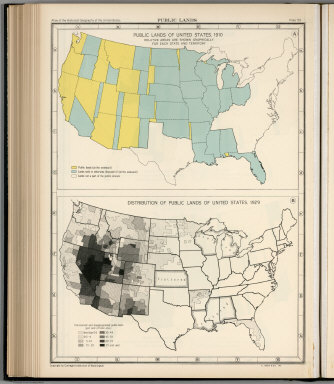
Plate 59. Public Lands. Public Lands of United States, 1910. Distribution of Public Lands of United States, 1929.
Publisher
[Carnegie Institution of Washington, American Geographical Society of New York]
Author
[Paullin, Charles O., Wright, John K.]
Full Title
Plate 61. Colonial Towns, States, Territories, and Cities. Colonial Towns, 1650. Colonial Towns, 1700. Colonial Towns, 1750. Colonial Towns, 1775. States, Territories and Cities, 1790. States, Territories and Cities, 1800. States, Territories and Cities, 1810.
Publisher
[Carnegie Institution of Washington, American Geographical Society of New York]
Author
[Paullin, Charles O., Wright, John K.]
Full Title
Plate 62. States, Territories and Cities. States, Territories and Cities, 1820. States, Territories and Cities, 1830.
Publisher
[Carnegie Institution of Washington, American Geographical Society of New York]
Author
[Paullin, Charles O., Wright, John K.]
Full Title
Plate 63. States, Territories and Cities. States, Territories and Cities, 1840. States, Territories and Cities, 1850.
Publisher
[Carnegie Institution of Washington, American Geographical Society of New York]
Author
[Paullin, Charles O., Wright, John K.]
Full Title
Plate 64. States, Territories and Cities. States, Territories and Cities, 1860. States, Territories and Cities, 1870. States and Territories (Additional Maps 1845-1868). States, Territories and Cities, 1880.
Publisher
[Carnegie Institution of Washington, American Geographical Society of New York]
Author
[Paullin, Charles O., Wright, John K.]
Full Title
Plate 65. States, Territories and Cities. States, Territories and Cities, 1890. States, Territories and Cities, 1900.
Publisher
[Carnegie Institution of Washington, American Geographical Society of New York]
Author
[Paullin, Charles O., Wright, John K.]
Full Title
Plate 66. States, Territories and Cities. States, Territories and Cities, 1910. States, Territories and Cities, 1920.
Publisher
[Carnegie Institution of Washington, American Geographical Society of New York]
Author
[Paullin, Charles O., Wright, John K.]
Full Title
Plate 67. States and Cities: Population. States and Cities, 1930. Slaves, 1790. Slaves, 1800. Slaves, 1810. Slaves, 1820. Slaves, 1830. Slaves, 1840.
Publisher
[Carnegie Institution of Washington, American Geographical Society of New York]
Author
U.S. General Land Office
Full Title
(Covers to) Maps accompanying Report of the commissioner of the General Land Office.
Publisher
U.S.
Author
U.S. General Land Office
Full Title
(Contents to) Maps accompanying Report of the commissioner of the General Land Office.
Publisher
U.S.
Author
U.S. General Land Office
Full Title
Map of the United States and Territories. Shewing the extent of the Public Surveys and other details Constructed From the Plats and official sources of the General Land Office Under the direction of the Hon. Jos. S. Wilson, Commissioner, by Theodore Franks, Draughtsman. 1866. Department of the Interior, General Land Office, October 2nd 1866. Jo. S. Wilson, Commissioner. Engraved by D. McClelland, Washn. D.C.
Publisher
U.S.
1-39 of 39
|