Browse All

1926 United States and Alaska. Wall Map Excelsior Series Map of United States an … |

1921 Entire World in One Hemisphere. Portrait … Wall Map (Map of the Entire World in One Hemisphe … |

1852 Sing-Sing, Westchester County, New York. Wall Map Map of Sing-Sing, Westchester County, N. … |

1892 Official Map Of Marin County, California … Wall Map Official Map Of Marin County, California … |

1888 Colton's New Map Of Long Island. Wall Map Colton's New Map Of Long Island. Publish … |

1846 Mitchell's Reference & Distance Map Of T … Wall Map Mitchell's Reference & Distance Map of t … |

1873 Marin County. Wall Map Map Of Marin County, California, Compile … |

1846 State Of Maine With The Province Of New … Wall Map Map Of The State Of Maine With The Provi … |

1857 New Map Of The Union. Wall Map A New Map Of The Union, With The Adjacen … |

1853 Map Of Morris County, New Jersey. Wall Map Map Of Morris County, New Jersey. From O … |

1860 State of New York. Wall Map The State of New York. From New And Orig … |

1846 Chapin's Ornamental Map Of The United St … Wall Map Chapin's Ornamental Map Of The United St … |

1862 Naval And Military Map Of The United Sta … Wall Map The New Naval And Military Map Of The Un … |

1828 New Jersey. Wall Map A Map of the State of New Jersey With Pa … |

1853 Madison County, New York. Wall Map Topographical Map Of Madison County, New … |

1845 United States. Wall Map A New And Embellished Map of the United … |

1894 Trinity County, California. Wall Map Official Map Of Trinity County, Californ … |

1844 State Of Maine With The Province Of New … Wall Map Map Of The State Of Maine With The Provi … |

1862 Washington Map of the United States. Wall Map The Washington Map of the United States … |

1862 Washington Map of the United States. Wall Map The Washington Map Of The United States. … |
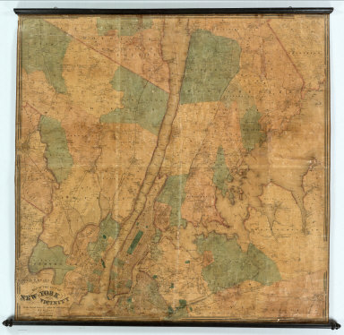
1863 New York City and Vicinity. Wall Map Map of the City of New-York and Its Vici … |

1853 Chapin's Ornamental Map Of The United St … Wall Map Chapin's Ornamental Map Of The United St … |

1861 Washington Map of the United States. Wall Map The Washington Map Of The United States. … |

1843 Mitchell's National Map of the United St … Wall Map Mitchell's National Map of the American … |

1910 Lines Of The Bell Telephone Companies. U … Wall Map Lines Of The Bell Telephone Companies. U … |

1866 Chart From Cape Cod To Belle Isle. Wall Map Eldridge's Chart From Cape Cod To Belle … |

1874 Railroad Map Of The United States And Of … Wall Map Watson's New County And Railroad Map Of … |

1874 County And Railroad Map Of The Western S … Wall Map Watson's County And Railroad Map Of The … |

1833 Map of the United States. Wall Map Map of the United States. Compiled From … |

1862 Continental Map Of North America. Wall Map The Continental Map Of North America. Co … |

1859 Standard American Map. Wall Map Monk's Standard American Map Exhibiting … |

1912 California and Nevada. Wall Map The Rand-McNally New County and Railroad … |

1845 United States. Wall Map Map of the United States With The Recent … |

1816 United States Of North America. Wall Map A New and correct Map of The United Stat … |

1831 United States. Wall Map Map of the United States Compiled from t … |

1859 Our Country Present And Prospective. Wall Map A New Map Of Our Country Present And Pro … |

1849 Map Of Pennsylvania. Wall Map Map Of Pennsylvania, constructed from th … |

1821 Connecticut. Wall Map Lucy M. Barker's Map Of Connecticut. |

1863 New Jersey. Wall Map Colton's Map of New Jersey. Prepared for … |

1812 America. Wall Map Map of America by A. Arrowsmith. Philade … |

1856 Our Country, Present & Prospective. Wall Map A New Map of Our Country, Present & Pros … |

1871 California and Nevada. Wall Map Map of the States of California and Neva … |

1883 Lunenburg County Nova Scotia. Wall Map Topographical Township Map Of Lunenburg … |

1822 Map Of Pennsylvania. Wall Map Map of Pennsylvania. Constructed from th … |

1854 United States. Wall Map Colton's Map Of The United States Of Ame … |

1832 United States. Wall Map Lay's Map of the United States. Compiled … |

1849 Vermont & New Hampshire. Wall Map Map of Vermont & New Hampshire. Publishe … |

1847 Pictorial Map Of The United States. Wall Map Pictorial Map Of The United States. 1847 … |

1832 United States. Wall Map Map of the United States By Chas. Varle, … |

1856 The Cottage Ornament. Wall Map The Cottage Ornament Published By Ensign … |