Who What Where WhenREMOVE |
Author
Vandermaelen, Philippe, 1795-1869
Full Title
Partie de l'Angleterre. Europe no. 12. (Dresse par Ph. Vandermaelen, lithographie par H. Ode. Premier partie. - Europe. Bruxelles. 1827)
Publisher
Ph. Vandermaelen
Author
Lothian, John
Full Title
Great Britain and Ireland.
Publisher
James MacLeod and Francis Orr & Sons
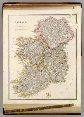
Author
Lothian, John
Full Title
Ireland.
Publisher
James MacLeod and Francis Orr & Sons
Author
Mitchell, Samuel Augustus
Full Title
Ireland.
Publisher
Thomas, Cowperthwait & Co.
Author
Society for the Diffusion of Useful Knowledge (Great Britain)
Full Title
Ireland, North Sheet.
Publisher
Edward Stanford
Author
Society for the Diffusion of Useful Knowledge (Great Britain)
Full Title
Ireland, (South) Sheet.
Publisher
Edward Stanford
Author
Mitchell, Samuel Augustus
Full Title
Ireland. Entered ... 1856 by Charles Desilver ... Pennsylvania.
Publisher
Charles DeSilver
Author
[Raynal, G.T., Bonne, R.]
Full Title
Carte des Isles Britanniques : contenant les Royaumes d'Angleterre, d'Ecosse et d'Irlande. Par M. Bonne, Ingenieur, Hdrographe de la Marine. (on upper margin) Liv. III IV X XIV XVI et XVII : No. 17 bis. &18. (to accompany) Histoire Philosophique et Politique Des Establissements et Du Commerce Des Europeens Dans Les Deux Indes.
Publisher
Jean-Leonard Pellet
Author
Johnson, A.J.
Full Title
Johnson's Ireland by Johnson & Browning. (with) Johnson's Scotland (with) two inset maps: Orkney Isles and Shetland Isles. No. 62-63.
Publisher
Johnson and Browning
Author
[Tardieu, Ambroise, Vuillemin, A., Duvotenay, Erhard, Testarode, E.]
Full Title
Iles Britanniques.
Publisher
Furne Et Cie
Author
Mitchell, Samuel Augustus Jr.
Full Title
County Map Of Scotland. (with inset map) Shetland Islands. (and) Ireland In Provinces And Counties. Entered ... 1876 by S. Augustus Mitchell, . ... Washington.
Publisher
S.A. Mitchell Jr.
Author
[Marks, A. F. (Firm), Petri, Eduard Iulevic, 1854-1899, Shokalskago,Iu. M.]
Full Title
No.39. Velikobritaniia i Irlandiia. Izdanie i sobstven, tva. A.F. Marks V. Peterburgi. Pechat. v kartogr. art. zav. A. F. Marksa. (to accompany) Bolshoi vsemirnyi nastolny atlas Marksa. Depechatka 1916 goda. (with 3 insets).
Publisher
Izd. A.F. Marksa
Author
Mitchell, Samuel Augustus Jr.
Full Title
County map of Scotland. (inset map) 72. Shetland Islands. 73. Ireland in Provinces and Counties. Entered ... 1867 by S. Augustus Mitchell, Jr. ... Pennsylvania.
Publisher
S.A. Mitchell Jr.
Author
Delamarche, Felix.
Full Title
Carte des Iles Britanniques ... 1838.
Publisher
F. Delamarche
Author
[Dower, John, Higgins, W.M.]
Full Title
British Isles.
Publisher
[W.S. Orr, Chambers, W. & R.]
Author
[Dower, John, Higgins, W.M.]
Full Title
Ireland.
Publisher
[W.S. Orr, Chambers, W. & R.]
Author
Stein, C.G.D.
Full Title
Neue karte von Gross-Britannien von Irland : mit einer histor, statist, politischen und militairischen Tabelle, nebst Erlauterungen, Herausgegeben und verlegt von J.C. Hinrichs in Leipzig 1826. Sitt v. Bruchner. Schrift gest. v. Leuteman. (to accompany) Neuer Atlas Der Ganzen Welt.
Publisher
J.C. Hinrichs
Author
Arrowsmith, John
Full Title
Ireland, By J. Arrowsmith. (Map) 7. London, Pubd. 15 Feby. 1842, by J. Arrowsmith, 10 Soho Square.
Publisher
John Arrowsmith
Author
Thomson, John
Full Title
Ireland. Neale (i.e. Neele) sculpt., Strand, London. Drawn & engraved for Thomson's New general atlas Feby. 1815.
Publisher
[Baldwin, Cradock, and Joy, John Cumming, John Thomson]
Author
[Lapie, Alexandre Emile, Lapie, M. (Pierre), 1779-1850]
Full Title
Carte des Iles Britanniques comprenant l'Angleterre, l'Ecosse et l'Irlande. Dressee par M. Lapie, 1er. Geographe du Roi et M. Lapie Fils, Lieut. Ingr. Geoge. Paris, 1829. Chez Eymery Fruger et Cie., Rue Mazarine No. 30. La gravure dirigee et gravee par Lallemand.
Publisher
Eymery Fruger et Cie
Author
[Bartholomew, J. G. (John George), 1860-1920, John Bartholomew & Co.]
Full Title
British Isles - railways & industrial. (with) Distribution of land under cultivation. (with) Distribution of land under pasture. The Edinburgh Geographical Institute, John Bartholomew & Co. "The Times" atlas. (London: The Times, 1922)
Publisher
The Times
Author
[Bartholomew, J. G. (John George), 1860-1920, John Bartholomew & Co.]
Full Title
British Isles - political. (with) Industrial sketch map. (with) Density of population. The Edinburgh Geographical Institute, John Bartholomew & Co. "The Times" atlas. (London: The Times, 1922)
Publisher
The Times
Author
[Bartholomew, J. G. (John George), 1860-1920, John Bartholomew & Co.]
Full Title
Ireland - northern section. The Edinburgh Geographical Institute, John Bartholomew & Co. "The Times" atlas. (London: The Times, 1922)
Publisher
The Times
Author
[Bartholomew, J. G. (John George), 1860-1920, John Bartholomew & Co.]
Full Title
Ireland - southern section. The Edinburgh Geographical Institute, John Bartholomew & Co. "The Times" atlas. (London: The Times, 1922)
Publisher
The Times
Author
[Covens et Mortier, Lisle, Guillaume de, 1675-1726]
Full Title
Les Isles Britanniques ou sont le Royaumes d'Angleterre tire de Speed, celuy d'Ecosse tire de de Th. Pont et celuy d'Irlande tire de Petti. Le tout rectifie par diverses observations. Par G. de l'Isle, Geographe de l'Academie Royale des Sciences. A Amsterdam, Chez J. Covens & C. Mortier, avec privil. (Title in upper margin): Magnae Britanniae tabula, comprehendens Angliae, Scotiae, ac Hiberniae Regna, ad usum serenissimi Burgundiae Ducis. (1742?)
Publisher
Covens & Mortier
Author
Lizars, Daniel
Full Title
Ireland. Published by D. Lizars, Edinburgh. (1831?)
Publisher
[John Hamilton, W. Curry, Jun. & Co., Whittaker, Treacher & Co.]
Author
Lizars, Daniel
Full Title
Ireland, southern sheet. Published by D. Lizars, Edinburgh. (1831?)
Publisher
[John Hamilton, W. Curry, Jun. & Co., Whittaker, Treacher & Co.]
Author
Letts, Son & Co.
Full Title
Railway & statistical map of Ireland. Letts's popular atlas. Letts, Son & Co. Limited, London. (1883)
Publisher
Letts, Son & Co.
Author
Letts, Son & Co.
Full Title
Statistical map of Ireland. No. 1. Letts's popular atlas. Letts, Son & Co. Limited, London. (1883)
Publisher
Letts, Son & Co.
Author
Letts, Son & Co.
Full Title
Statistical map of Ireland. No. 2. Letts's popular atlas. Letts, Son & Co. Limited, London. (1883)
Publisher
Letts, Son & Co.
Author
Letts, Son & Co.
Full Title
Statistical map of Ireland. No. 3. Letts's popular atlas. Letts, Son & Co. Limited, London. (1883)
Publisher
Letts, Son & Co.
Author
Letts, Son & Co.
Full Title
Statistical map of Ireland. No. 4. Letts's popular atlas. Letts, Son & Co. Limited, London. (1883)
Publisher
Letts, Son & Co.
Author
Letts, Son & Co.
Full Title
Plan of the city of Dublin. Letts's popular atlas. Letts, Son & Co. Limited, London. (1883)
Publisher
Letts, Son & Co.
Author
Letts, Son & Co.
Full Title
Geological map of the environs of Dublin. Letts's popular atlas. Letts, Son & Co. Limited, London. (1883)
Publisher
Letts, Son & Co.
Author
[Enouy, Joseph Christopher, Robert Laurie & James Whittle]
Full Title
The invasions of England and Ireland with all their civil wars since the conquest. Compiled & drawn by J. Enouy, Geographer. London, Published by Laurie & Whittle, Fleet Street, 15th Septr. 1797. 2d edition, Augt. 12th, 1801. S. Neele sculpt.
Publisher
Laurie & Whittle
Author
[Kitchin, Thomas, Rocque, John]
Full Title
A map of the Kingdom of Ireland divided into provinces, counties and baronies. (North half). Showing the archbishopricks, bishopricks, cities, boroughs, market towns, villages, barracks, mountains, lakes, bogs, rivers, bridges, ferries, passes; also the Great, the Branch & the By post roads, together with the inland navigation &c. by J. Rocque, Chorographer to His Majesty. (Published 12th May 1794 by Laurie & Whittle, 53 Fleet Street, London)
Publisher
Laurie & Whittle
Author
Robert Laurie & James Whittle
Full Title
(A map of the Kingdom of Ireland divided into provinces, counties and baronies. South half. (with) The seacoasts of Great Britain and Ireland. Showing the archbishopricks, bishopricks, cities, boroughs, market towns, villages, barracks, mountains, lakes, bogs, rivers, bridges, ferries, passes; also the Great, the Branch & the By post roads, together with the inland navigation &c. by J. Rocque, Chorographer to His Majesty). Published 12th May 1794 by Laurie & Whittle, 53 Fleet Street, London.
Publisher
Laurie & Whittle
Author
Arrowsmith, Aaron
Full Title
United Kingdoms of Great Britain and Ireland. From Arrowsmith's map of the British Isles. Hooker sc. (Published by John Conrad & Co., Philadelphia. 1804)
Publisher
J. Conrad
Full Title
Ireland. From various surveys of Ireland. Kneass sc. (Published by John Conrad & Co., Philadelphia. 1804)
Publisher
J. Conrad
Author
Arrowsmith, Aaron
Full Title
United Kingdoms of Great Britain and Ireland. From Arrowsmith's map of the British Isles. Hooker sc. (Boston: Published by Thomas & Andrews. 1812)
Publisher
Thomas & Andrews
Author
Touring club italiano
Full Title
Gran Bretagna, Great Britain. Propr. Artistico-letteraria del T.C.I. Ufficio cartografico del T.C.I. (1929)
Publisher
Touring club italiano
Author
Touring club italiano
Full Title
Irlandia, Ireland, Eirin. Scozia, Scotland. Propr. Artistico-letteraria del T.C.I. Ufficio cartografico del T.C.I. (1929)
Publisher
Touring club italiano
Author
Goodrich, S.G.
Full Title
Pacific Ocean. British Islands. G. Boynton Sc. Entered ... by S.G. Goodrich of Massachusetts. (Boston: Gray & Bowen ... 1831)
Publisher
Gray & Bowen
Author
Mitchell, Samuel Augustus
Full Title
Ireland in provinces and counties. County map of Scotland. (with) Shetland Islands. Entered ... 1879 by S. Augustus Mitchell ... Washington. (1880)
Publisher
S.A. Mitchell
Full Title
Ireland in provinces and counties. County map of Scotland. (with) Shetland Islands. Copyright 1887 by Wm. M. Bradley & Bro. (1890)
Publisher
John Y. Huber & Co.
Full Title
British Isles. (with) The Channel Islands. (with) The Shetland Islands. (Published at the office of "The Times," London, 1895)
Publisher
The Times
Full Title
Ireland. (Published at the office of "The Times," London, 1895)
Publisher
The Times
Author
[Bartholomew, J. G. (John George), 1860-1920, John Bartholomew & Co.]
Full Title
British Isles -- bathy-orographical. The Edinburgh Geographical Institute, John Bartholomew & Co. "The Times" atlas. (London: The Times, 1922)
Publisher
The Times
Author
[Bartholomew, J. G. (John George), 1860-1920, John Bartholomew & Co.]
Full Title
British Isles - vegetation & climate. The Edinburgh Geographical Institute, John Bartholomew & Co. "The Times" atlas. (London: The Times, 1922)
Publisher
The Times
Full Title
Grossbritannien und Irland. (with) Die Canal Inseln. (with) Die Shetland Inseln. (Richard Andree. Herausgegeben von der Geographischen Anstalt von Velhagen & Klasing in Leipzig. 1881)
Publisher
Velhagen & Klasing
|