Who What Where WhenREMOVE |
Author
Hammond, C.S.
Full Title
(Covers to) Hammond's New World Atlas. Containing New and Complete Historical, Economic, Political and Physical Maps of the Entire World in Full Colors with Complete Indexes and the Races of Mankind, Illustrated Gazetteer of the World, Illustrated Gazetteer of the United States and Territories. Garden City Publishing Company, Inc. Garden City, N.Y., U.S.A. 1948.
Publisher
Garden City Publishing Company, Inc.
Author
Johnson, A.J.
Full Title
(Covers to) Johnson's New Illustrated (Steel Plate) Family Atlas, With Physical Geography, And With Descriptions Geographical, Statistical, And Historical Including the Latest Federal Census, A Geographical Index, and a Chronological History of the Civil War in America. By Richard Swainson Fisher, M.D. ... Maps Compiled, Drawn, And Engraved Under The Supervision Of J.H. Colton And A.J. Johnson... New York: Johnson And Ward, Successors To Johnson And Browning Who Were (Successors To J.H. Colton And Company,) No. 113 Fulton Street. 1865. Entered ... One Thousand Eight Hundred and Sixty-four, by A.J. Johnson ... New York.
Publisher
Johnson and Ward
Author
Rand McNally and Company
Full Title
(Covers to) Rand, McNally & Co.'s indexed atlas of the world containing large scale maps of every country and civil division upon the face of the globe, together with historical, descriptive, and statistical matter relative to each ... Accompanied by a new and original compilation forming a ready reference index ... Engraved, printed and published by Rand, McNally & Company, Chicago and New York, U.S.A., 1897. (Vol. 1) Foreign countries.
Publisher
Rand McNally
Author
Johnson, A.J.
Full Title
(Covers to) Johnson's New Illustrated Family Atlas Of The World ... With A Treatise On Physical Geography, By Prof. A. Guyot, LL.D., With Descriptions, Geographical, Statistical, And Historical. Revised By Hon. A.R. Spofford, LL.D., Librarian Of Congress. Also Including A Dictionary Of Religious Denominations, Sects, Parties, And Associations, Compiled By Professor Roswell D. Hitchcock, D.D., LL.D. ... New York: Alvin J. Johnson & Co., Publishers, 11 Great Jones Street (Near Broadway). MDCCCLXXXVI. Copyright, 1882, By A.J. Johnson.
Publisher
Alvin J. Johnson & Co.
Author
Anville, Jean Baptiste Bourguignon d, 1697-1782
Full Title
(Covers to) (Atlas general) (Paris : Sr. D'Anville, 1771?)
Publisher
J.B.B. D'Anville.
Author
Finley, Anthony
Full Title
(Covers to) A New General Atlas Comprising a Complete Set of Maps, representing the Grand Divisions Of The Globe, ... Philadelphia: Published by Anthony Finley. 1831. (title page only) Written And Engraved By Jos. Perkins. (with) Atlas Classica; Or Select Maps Of Ancient Geography, Both Sacred and Profane ... Philadelphia: Published by Anthony Finley, At The North-East Corner Of Chestnut And Fourth Streets. Clark & Raser, Printers. 1831.
Publisher
Anthony Finley
Author
Tanner, Henry S.
Full Title
(Covers to) A New Universal Atlas Containing Maps of the various Empires, Kingdoms, States and Republics Of The World. With a special map of each of the United States, Plans of Cities &c. Comprehended in seventy sheets and forming a series of One Hundred And Seventeen Maps, Plans And Sections, By H.S. Tanner ... Philadelphia, Published By The Author. 1836. (title page by) J. Knight Sc.
Publisher
H.S. Tanner
Author
Carey, Mathew
Full Title
(Covers to) Carey's General Atlas, Improved And Enlarged; Being A Collection Of Maps Of The World And Quarters, Their Principal Empires, Kingdoms, &c. ... Philadelphia: Published By M. Carey. 1814. T.S. Manning, Printer, N.W. Corner of Sixth & Chestnut Streets.
Publisher
Mathew Carey
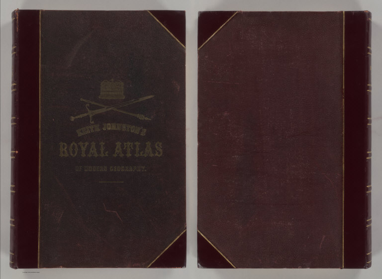
Author
Johnston, Alexander Keith
Full Title
(Covers to) The Royal Atlas Of Modern Geography Exhibiting, In A Series Of Entirely Original And Authentic Maps, The Present Condition Of Geographical Discovery And Research In The Several Countries, Empires, And States Of The World By Alexander Keith Johnston ... With A Special Index To Each Map. A New Edition. W.& A.K. Johnston, Edinburgh And London, MDCCCLXXIX.
Publisher
W.& A.K. Johnston
Author
Moll, Herman, d. 1732
Full Title
(Covers to) Atlas minor: or a new and curious set of sixty-two maps, in which are shewn all the empires, kingdoms, countries, states, in all the known parts of the earth; with their bounds, divisions, chief cities & towns, the whole composed & laid down agreable to modern history. By Herman Moll, Geographer. (3rd ed.) London, Printed for Thos. Bowles in St. Pauls Church Yard & John Bowles at the Black Horse in Cornhill (1736?)
Publisher
Thos. Bowles and John Bowles
Author
Mitchell, Samuel Augustus Jr.
Full Title
(Covers to) Mitchell's New General Atlas, Containing Maps Of The Various Countries Of The World, Plans Of Cities, Etc., Embraced In Ninety-Three Quarto Maps, Forming A Series Of One Hundred and Forty-seven Maps and Plans, Together With Valuable Statistical Tables. Also, A List Of Post-Offices Of The United States And Territories, And Also Census Of 1880 For States, Territories And Counties, Also Of Cities Of Over 10,000 Inhabitants. Philadelphia: Published By Wm. M. Bradley & Bro., No. 1026 Arch Street. 1886. Entered ... 188_, by S. Augustus Mitchell ... Washington.
Publisher
Wm. M. Bradley & Bro.
Author
[Schrader, Vivien St Martin, L.]
Full Title
(Covers to) Vivien de Saint-Martin & Schrader, Atlas Universel de Geographie. Dresse sous la Direction de F. Schrader d'apres the sources originales et les documents les plus recents. Nouvelle Edition. Cet Atlas Publie sous Auspices du Ministere de la Guerre comprend 80 Cartes Gravees sur Cuivre et Tirees en Lithographie et un Index Alphabetique des Noms Contenus dans l'Atlas. Librarie Hachette.
Publisher
Librairie Hachette
Author
Tanner, Henry S.
Full Title
(Covers to) A New Universal Atlas Containing Maps of the various Empires, Kingdoms, States and Republics Of The World. With a special map of each of the United States, Plans of Cities &c. Comprehended in seventy sheets and forming a series of One Hundred And Seventeen Maps, Plans And Sections, By H.S. Tanner ... Philadelphia, Published By Carey & Hart. 1844. Entered ... 1844, by Carey & Hart ... Pennsylvania.
Publisher
Carey and Hart
Author
Pinkerton, John, 1758-1826
Full Title
(Covers to) A modern atlas, from the latest and best authorities, exhibiting the various divisions of the world, with its chief empires, kingdoms and states, in sixty maps, carefully reduced from the largest and most authentic sources. Directed and superintended by John Pinkerton, author of Modern geography, &c. London: Printed by T. Bensley, Bolt Court, Fleet Street; for T. Cadell and W. Davies, Strand; and Longman, Hurst, Rees, Orme, And Brown, Paternoster Row. 1815.
Publisher
[Cadell and Davies, Longman, Hurst, Rees, Orme, and Brown]
Author
Johnston, Alexander Keith
Full Title
(Covers to) The Royal Atlas Of Modern Geography Exhibiting, In A Series Of Entirely Original And Authentic Maps, The Present Condition Of Geographical Discovery And Research In The Several Countries, Empires, And States Of The World. By The Late Alexander Keith Johnston ... With Additions And Corrections To The Present Date By T.B. Johnston ... With A Special Index To Each Map. A New Edition. W.& A.K. Johnston, Edinburgh And London, MDCCCXCIII.
Publisher
W.& A.K. Johnston
Author
Vivien de St Martin, L.
Full Title
(Covers to) Atlas Universel Pour servir a l'Etude De La Geographie Et De L'Histoire Anciennes et Modernes Dresse Par L. Vivien. Paris. Chez Menard Et Desenne, Editeurs, Rue Git-le-Coeur No. 8. 1827. (title page only) Mardelet sc.
Publisher
Vivien de St Martin, L.
Author
Mitchell, Samuel Augustus
Full Title
(Covers to) Mitchell's new general atlas, containing maps of the various countries of the World, plans of cities, etc. Embraced in ninety-three quarto maps. Forming a series of one hundred and forty-seven maps and plans. Together with valuable statistical tables. Also a list of post-offices of the United States and territories, and also Census of 1880 for states, territories and counties, also of cities of over 10,000 inhabitants. Philadelphia: Wm. M. Bradley & Bro., No. 1026 Arch Street. 1886. Entered ... 188_, by S. Augustus Mitchell ... Washington.
Publisher
Wm. M. Bradley & Bro.
Author
Jouvet et Cie.
Full Title
(Covers to) Atlas Universel de Geographie Moderne. Physique, Politique, Historique, Industriel, Commercial et Militaire. Adopte par le Ministere de la Guerre pour L'Ecole de Saint-Cyr. Paris. Furne, Jouvet et Cie, Editeurs. Jouvet et Cie, Successeurs. 45 Rue Saint-Andre des Arts. MDCCCLXXXII. (1882)
Publisher
Jouvet et Cie
Author
[Lowry, J.W., Sharpe, J.]
Full Title
(Covers to) Sharpe's Corresponding Atlas, Comprising Fifty-Four Maps, Constructed Upon A System Of Scale And Proportion, From the most Recent Authorities. Engraved On Steel By Joseph Wilson Lowry. With A Copious Consulting Index. London: Chapman And Hall, 186 Strand. MDCCCXLIX.
Publisher
Chapman & Hall
Author
[Black, Adam & Charles, Hall, Sidney, Hughes, William]
Full Title
(Covers to) General Atlas Of The World: Containing Upwards Of Seventy Maps. Engraved On Steel, In The First Style Of Art, By Sidney Hall, William Hughes, F.R.G.S., &c. New Edition. Embracing All The Latest Discoveries Obtained From Government Surveys And Expeditions, Books Of Recent Travel, And Other Sources, Including The North-West Passage Discovered By H.M. Ship Investigator. With Introductory Chapters On The Geography And Statistics Of The Various Countries Of The World, And A Complete Index Of 65,000 Names. Edinburgh: Adam And Charles Black, North Bridge. M.DCCC.LIV.
Publisher
Adam & Charles Black
Author
Johnston, W. & A.K.
Full Title
(Covers to) Johnston's Royal Atlas Of Modern Geography Exhibiting, In A Series Of Sixty Entirely Original And Authentic Maps, The Present Condition Of Geographical Discovery And Research In The Several Countries, Empires, And States Of The World With A Special Index To Each Map. W.& A.K. Johnston, Limited, Edinburgh And London, MCMXII.
Publisher
W.& A.K. Johnston
Author
[Martin, R.M., Tallis, J. & F.]
Full Title
(Covers to) The Illustrated Atlas, And Modern History Of The World Geographical, Political, Commercial & Statistical, Edited By R. Montgomery Martin, Esq. ... The Maps Drawn & Engraved By J. Rapkin. H. Warren. J. Rogers. J. & F. Tallis, London & New York.
Publisher
J. & F. Tallis
Author
[Colton, G.W., Fisher, Richard Swainson]
Full Title
(Covers to) Colton's Illustrated Cabinet Atlas And Descriptive Geography. Maps By G. Woolworth Colton. Text By Richard Swainson Fisher. New York: Published By J.H. Colton, No. 172 William Street. 1859.
Publisher
J.H. Colton
Author
Mitchell, Samuel Augustus
Full Title
(Covers to) Mitchell's New General Atlas, Containing Maps Of The Various Countries Of The World, Plans Of Cities, Etc. Embraced In Forty-Seven Quarto Maps, Forming A Series Of Seventy-Six Maps And Plans, Together With Valuable Statistical Tables. Philadelphia: Published By S. Augustus Mitchell, Jr. No. 31 South Sixth Street. 1860. Entered ... 1860, by S. Augustus Mitchell, Jr. ... Pennsylvania.
Publisher
S.A. Mitchell, Jr.
Author
La Perouse, Jean-Francois de Galaup, comte de, 1741-1788
Full Title
(Covers to) Atlas du voyage de La Perouse. (title page only) Dessine par J. M. Moreau le Jeune. Grave par Ph. Triere. L. Aubert scripsit.
Publisher
L'Imprimerie de la Republique
Author
Carey, Mathew
Full Title
(Covers to) Carey's General Atlas, Improved And Enlarged; Being A Collection Of Maps Of The World And Quarters, Their Principal Empires, Kingdoms, &c. Containing...[List of Maps]. Philadelphia: Published By M. Carey And Son, 1818.
Publisher
M. Carey and Son
Author
Gray, Ormando Willis
Full Title
(Covers to) The National Atlas. Containing Elaborate Topographical Maps Of The United States And The Dominion of Canada, With Plans Of Cities And General Maps Of The World. Also, Descriptions and Tables, Historical and Statistical ... Accompanied By Special, Railway, And Scientific Maps And Articles. Philadelphia: O.W. Gray & Son, No. 10 North Fifth Street. 1878. (on verso) Entered ... 1876, by O.W. Gray & Son ... Washington.
Publisher
O.W. Gray & Son
Author
USSR (Union of Soviet Socialist Republics).
Full Title
(Covers to) Chief Administration of Geodesy and Cartography under the Council of Ministers of the USSR. The World Atlas. Second Edition. Moscow. 1967.
Publisher
USSR
Author
Robert de Vaugondy, Gilles, 1688-1766
Full Title
(Covers to) Atlas Universel, Par M. Robert Geographe ordinaire du Roy, et Par M. Robert De Vaugondy son fils Geographe ord. du Roy, et de S. M. Polonoise, Duc de Lorraine et de Bar, et Associe de L'Academie Royale des Sciences et belles Lettres de Nancy, Avec Privilege Du Roy, 1757. A Paris, Chez Les Auteurs ,Quay de l'Horloge du Palais, Boudet Libraire Imprimeur du Roi, rue St. Jacques. Grave par Ch. Baquoy. J. Oger Scripsit.
Publisher
[Boudet, Les Auteurs]
|