Who What Where WhenREMOVE |
Author
[Marks, A. F. (Firm), Petri, Eduard Iulevic, 1854-1899, Shokalskago,Iu. M.]
Full Title
(Covers to) No.60. Yuzhnaya Amerika. Izdanie i sobstven, A.F. Marks V. Peterburgi. Pechat. v kartogr. art. zav. A. F. Marksa. (to accompany) Bolshoi vsemirnyi nastolny atlas Marksa. Depechatka 1916 goda. (with 3 insets).
Publisher
Izd. A.F. Marksa
Author
Brue, Adrien Hubert, 1786-1832
Full Title
(Covers to) Grand atlas universel, ou collection de cartes encyprotypes, generales et detaillees des cinq parties du monde; dediees a monsieur, par H. Brue, Ingenieur-Geographe de S.A. Royale. A Paris, Chez Desray, Libraire-Editeur, rue Hautefeuille, no. 4. M DCCC XVI.
Publisher
Desray, Libraire-Editeur
Author
[Dower, John, Higgins, W.M.]
Full Title
(Covers to) A General Descriptive Atlas Of The Earth, Containing Separate Maps Of The Various Countries And States, From Original Drawings. With A Short Account Of Each Country, Descriptive Of Its Geographical Features, Chief Towns And Cities, Population, And General Statistics. By W.M. Higgins ... London: Published By W.S. Orr & Co., Paternoster Row; And W. And R. Chambers, Waterloo Place, Edinburgh. (on verso) London: Bradbury And Evans, Printers, Whitefriars.
Publisher
[W.S. Orr, Chambers, W. & R.]
Author
[Dower, John, Higgins, W.M.]
Full Title
(Liner of Front Cover) (Handwritten Provenance) Wm. Sawry Gilpin, Digby, Nova Scotia, 1883.
Publisher
[W.S. Orr, Chambers, W. & R.]
Author
Stein, C.G.D.
Full Title
(Covers to) Neuer Atlas Der Ganzen Welt nach den neuesten Bestimmungen fur Zeitungsleser Kauf und Geschastsleute jeder Art, Gymnasien und Schulen, mit besonderer Rucksicht Auf Die Geographischen Werke von D. C.G.D. Stein ... Achte vermehrte und verbesserte Auglage. In 19 Charten, nebst 7 neuen historischen und statistischen Tabellen und Erlauterungen. Leipzig, 1827. J.C. Hinrichssche Buch - und Landchartenhandlung. (Preis 3 Rthlr. 16 gr. oder 6 Fl. 36 xr. rheil.)
Publisher
J.C. Hinrichs
Author
Mitchell, Samuel Augustus Jr.
Full Title
(Covers to) Mitchell's New General Atlas, Containing Maps Of The Various Countries Of The World, Plans Of Cities, Etc., Embraced In Fifty-Eight Quarto Maps, Forming A Series Of Ninety-Two Maps And Plans, Together With Valuable Statistical Tables. Philadelphia: Published By S. Augustus Mitchell, Jr. No. 31 South Sixth Street. 1868. Entered ... 1867, by S. Augustus Mitchell, Jr. ... Pennsylvania.
Publisher
S.A. Mitchell Jr.
Author
[Bradford, Thomas G., Goodrich, S.G.]
Full Title
(Covers to) A General Atlas Of The World, With A Separate Map Of Each Of The United States Of America. Edited By S.G. Goodrich. Boston, C.D. Strong. Entered ... 1841 by C.D. Strong ... Massachusetts. B.W. Thayer & Co.'s Lithogy., Boston.
Publisher
C.D. Strong
Author
Arrowsmith, John
Full Title
(Covers to) The London Atlas of Universal Geography, Exhibiting the Physical & Political Divisions of the Various Countries of the World, Constructed from Original Materials. Is most respectfully dedicated to his venerable Friend John Middleton Esqr. As a testimony of Gratitude and Esteem, By his much Obliged & Humble Servant, John Arrowsmith, F.R.G.S & R.A.S. 40 Soho Square, London. London, Pubd. by J. Arrowsmith, 10 Soho Square 1842.
Publisher
John Arrowsmith
Author
Thomson, John
Full Title
(Covers to) A new general atlas, consisting of a series of geographical designs, on various projections, exhibiting the form and component parts of the globe; and a collection of maps and charts, delineating the natural and political divisions of the empires, kingdoms, and states in the World. Constructed from the best systematic works, and the most authentic voyages and travels. With a memoir of the progress of geography, a summary of physical geography, and a consulting index to facilitate the finding out of places. Edinburgh: Printed by George Ramsay and Company, for John Thomson and Company, Edinburgh; Baldwin, Cradock, and Joy, London; and John Cumming, Dublin. 1817.
Publisher
[Baldwin, Cradock, and Joy, John Cumming, John Thomson]
Author
[Lapie, Alexandre Emile, Lapie, M. (Pierre), 1779-1850]
Full Title
(Covers to) Atlas universel de geographie ancienne et moderne, precede d'un abrege de geographie physique et historique. Par M. Lapie ... et M. Lapie fils. Dedie au Roi. Paris. Emery, Fruger et Cie, Libraires-Editeurs, rue Mazarine, no. 30. 1829. (1833)
Publisher
Eymery Fruger et Cie
Author
[Covens et Mortier, Lisle, Guillaume de, 1675-1726]
Full Title
(Covers to) Atlas nouveau, contenant toutes les parties su Monde, ou sont exactement remarquees les empires, monarchies, royaumes, etats, republiques, &c. Par Guillaume de l'Isle. Premier Geographe de sa Majeste. A Amsterdam, Chez Jean Covens & Corneille Mortier, sur le Vygendam. (illus. on title page) Socio ditata labore ... J. Wandelaar del. et fecit. (bound with) Inleidinge tot de Geographie ... Door den Heer Sanson d'Abbeville, Ordinaris Geographist des Konings. Te Amsterdam, By Johannes Covens en Cornelis Mortier, Boekverkopers op den Vygendam. Met Privilelgie der Heeren Staaten van Holland en West-Vriesland.
Publisher
Covens & Mortier
Author
Lizars, Daniel
Full Title
(Covers to) The Edinburgh geographical and historical atlas, comprehending a sketch of the history of geography ... and history of each continent, state, and kingdom, delineated. And a tabular view of the principal mountain chains in the World. Engraved on sixty-nine copperplates, and compiled from materials drawn from the newest and most authentic sources. Edinburgh: Published by John Hamilton, 15, South St. Andrew Street, successor to Daniel Lizars; Whittaker, Treacher, & Co., Ave-Maria Lane, London; and W. Curry, Jun. & Co., Dublin. (1831?)
Publisher
[John Hamilton, W. Curry, Jun. & Co., Whittaker, Treacher & Co.]
Author
Letts, Son & Co.
Full Title
(Covers to) Letts's popular atlas, being a series of maps delineating the whole surface of the globe, with many special and original features; and a copious index of 23,000 names. Complete edition. Letts, Son & Co. Limited, 33, King William Street, London Bridge, E.C. Factory and works at New Cross, S.E. 1883.
Publisher
Letts, Son & Co.
Author
[Kitchin, Thomas, Robert Laurie & James Whittle]
Full Title
(Covers to) (A new universal atlas, exhibiting all the empires, kingdoms, states, republics, &c. &c. in the whole World; being a complete collection of the most approved maps extant; corrected with the greatest care, and augmented from the last edition of D'Anville and Robert (de Vaugondy) with many improvements by Major James Rennel, and other eminent geographers, including all the tracks and new discoveries of the British circumnavigators, Biron, Wallis, Carteret, Captain James Cook, Vancouver, Perouse, &c. &c. 6th Ed. ... London, R. Laurie & J. Whittle, 1804)
Publisher
Laurie & Whittle
Author
[Arrowsmith, Aaron, Lewis, Samuel]
Full Title
(Covers to) A new and elegant general atlas, comprising all the new discoveries, to the present time. Containing sixty-three maps, drawn by Arrowsmith and Lewis. Published by John Conrad & Co., Philadelphia; M. & J. Conrad & Co., Baltimore; Rapin, Conrad & Co., Washington City; Somervell & Conrad, Petersburg; Bonsal, Conrad & Co., Norfolk. 1804.
Publisher
J. Conrad
Author
[Arrowsmith, Aaron, Lewis, Samuel]
Full Title
(Covers to) A new and elegant general atlas, comprising all the new discoveries, to the present time. Containing sixty-three maps, drawn by Arrowsmith and Lewis. Intended to accompany the new improved edition of Morse's Geography, but equally well calculated to be used with his Gazetteer, or any other geographical work. Boston: Published by Thomas & Andrews. Sold at their bookstore, no. 45, Newbury-Street, and by the principal booksellers in the United States. May, 1812.
Publisher
Thomas & Andrews
Author
Touring club italiano
Full Title
(Covers to) Atlante internazionale del Touring club italiano. (3. ed.). Centosettanta tavole principali, centrotrenta carte parziali e di suiluppo. Opera redatta ed eseguita nell'Ufficio cartografico del T.C.I. sotto la direzione di L.V. Bertarelli, O. Marinelli, P. Corbellini. Milano: Touring club italiano. MDCCCCXXIX/VII.
Publisher
Touring club italiano
Author
Goodrich, S.G.
Full Title
(Covers to) An economical atlas. For the use of families and young persons, containing thirty-four maps ... Boston: Gray & Bowen -- Philadelphia, Key & Meilke -- Baltimore, Charles Carter -- New York, Pendleton & Hill; Cincinnati, Morgan & Sanxay; New Orleans, E. Johns, & Co. (verso) Entered ... 1831 by S.G. Goodrich ... Massachusetts.
Publisher
Gray & Bowen
Author
[Bartholomew, J. G. (John George), 1860-1920, John Bartholomew & Co.]
Full Title
(Covers to) Times survey atlas of the world. London: The Times, 1922.
Publisher
The Times
Author
Mitchell, Samuel Augustus
Full Title
(Covers to) Mitchell's new general atlas, containing maps of the various countries of the World, plans of cities, etc. Embraced in ninety-three quarto maps. Forming a series of one hundred and forty-seven maps and plans. Together with valuable statistical tables. Also a list of post-offices of the United States and territories, and also Census of 1880 for states, territories and counties, also of cities of over 10,000 inhabitants. John Y. Huber Company, Publishers, Philadelphia and St. Louis. 1890.
Publisher
John Y. Huber & Co.
Author
[Andree, Richard, Times (London, England)]
Full Title
(Covers to) The Times atlas. Containing 117 pages of maps, and comprising 173 maps and an alphabetical index to 130,000 names. Published at the office of "The Times," Printing House Square, London, E.C. 1895.
Publisher
The Times
Author
Andree, Richard
Full Title
(Covers to) Richard Andree's Allgemeiner Handatlas in sechsundachtzig Karten mit erlauterndem Text. Herausgegeben von der Geographischen Anstalt von Velhagen & Klasing in Leipzig. Bielefeld und Leipzig, Verlag Von Velhagen & Klasing 1881.
Publisher
Velhagen & Klasing
Author
Lisle, Guillaume de, 1675-1726
Full Title
(Covers to) (Atlas de Geographie)
Publisher
Guillaume DeLisle, Quai de l'Horloge
Author
Seaman, James V.
Full Title
(Covers to) A new general atlas, chiefly intended for the use of schools and private libraries; also calculated to accompany modern geographies and gazetteers. Containing twenty-six maps. New-York: Published by James V. Seaman, No. 296 Pearl-Street. 1821.
Publisher
James V. Seaman
Author
Dangeau, abbe de, 1643-1723
Full Title
(Covers to) Nouvelle metode pour aprende facilement et sans maitre la geografie, et les premers principes du Blazon ... Compose par M. L'abbe de Dangeau, l'un des quarante de l'academie Francoise. 1693. (On cover) Cette geographie de la France par l'Abbe de Dangeau est le manuscript de l'auteur.
Publisher
Manuscript
Author
[Campbell, R.A., Mitchell, Samuel Augustus, Walling, H. F.]
Full Title
(Covers to) Mitchell's new general atlas, containing maps of the various countries of the World, plans of cities, etc., embraced in sixty-three quarto maps, forming a series of one hundred maps and plans, together with valuable statistical tables. Philadelphia: published by S. Augustus Mitchell, Jr., No. 31 South Sixth Street. 1870. Entered ... 1870, by S. Augustus Mitchell, Jr. ... Pennsylvania. (with) Campbell's new atlas of the state of Illinois ... Maps drawn by R.A. Campbell, C.E., and Prof. H.F. Walling ... Chicago: R.A. Campbell, 131 South Clark Street. Philadelphia: S. Augustus Mitchell, Jr. 1870. Entered ... 1870 by R.A. Campbell ... Illinois.
Publisher
[R.A. Campbell, S.A. Mitchell, Jr.]
Author
Mitchell, Samuel Augustus
Full Title
(Covers to) Mitchell's new general atlas, containing maps of the various countries of the World, plans of cities, etc., embraced in ninety-three quarto maps. Forming a series of one hundred and forty-seven maps and plans. Together with valuable statistical tables. Also, a list of post-offices of the United States and territories, and census of 1860 and 1870. Philadelphia: Published by S. Augustus Mitchell, No. 815 Arch Street. 1880. Entered ... 1879, by S. Augustus Mitchell ... Washington.
Publisher
S.A. Mitchell
Author
[Fenner, Rest., Thomas, Joseph, publisher]
Full Title
(Covers to) Thomas's library atlas, embodying a complete set of maps, illustrative of modern & ancient geography ... London, Joseph Thomas, 1, Finch Lane, 1835. Sold by Simpkin & Marshall, Stationers Court.
Publisher
Joseph Thomas
Author
Greenleaf, Jeremiah
Full Title
(Covers to) A New Universal Atlas; Comprising Separate Maps Of all the Principal Empires, Kingdoms & States Throughout the World: and forming a distinct Atlas Of The United States. Carefully Compiled from the best Authorities Extant by Jeremiah Greenleaf. a new edition revised and corrected to the present time. 1840. Printed by G.R. French Brattleboro Vt.
Publisher
G.R. French
Author
Carey, Mathew
Full Title
(Covers to) Carey's General Atlas ... Philadelphia: Published By M. Carey. April, 1811. (Price Ten Dollars Plain - Twelve Dollars Coloured.) N.B. The maps marked with a star, are not in any London Atlas.
Publisher
M. Carey
Author
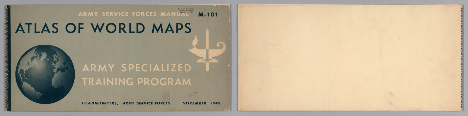
United States Army Service Forces
Full Title
(Covers to) Atlas of World Maps for the Study of Geography in the Army Specialized Training Program. Army Services Forces Manual. M-101. Headquarters, Army Service Forces. November, 1943.
Publisher
United States Army Service Forces
Author
Stieler, Adolf
Full Title
(Covers to) Hand - Atlas Uber Alle Theile Der Erde nach dem neuesten Zustande Und Uber Das Weltgebaude. Herausgegebenn von Adolf Stieler, berbeitet von Demselben, so wie von F.v. Stulpnagel, H. Berghaus u. I.C. Bar. Gotha bei Justus Perthes. (title page only) gez. v. Bar. gest. v. Edler in Gotha.
Publisher
Justus Perthes
Author
Tanner, Henry S.
Full Title
(Covers to) A New American Atlas Containing Maps Of The Several States of the North American Union, Projected and drawn on a Uniform Scale from Documents found in the public Offices of the United States and State Governments, and other Original and Authentic Information, By Henry S. Tanner ... Philadelphia: Published By H.S. Tanner. 1823. (title page only) Writing Drawn and Engraved by Joseph Perkins. Barralet del. Humphrys sc.
Publisher
Henry Tanner
Author
Tanner, Henry S.
Full Title
(Covers to) A New American Atlas Containing Maps Of The Several States of the North American Union, Projected and drawn on a Uniform Scale from Documents found in the public Offices of the United States and State Governments, and other Original and Authentic Information, By Henry S. Tanner ... Philadelphia: Published By H.S. Tanner. 1825. (title page only). Barralet del. Humphrys sc. Joseph Perkins, Philadelphia.
Publisher
Henry Tanner
Author
Carey, Mathew
Full Title
(Covers to) The General Atlas For Carey's Edition Of Guthrie's Geography improved ... Philadelphia: Published By Mathew Carey. May 1, 1795.
Publisher
Mathew Carey
Author
[Bowen, Emanuel, Gibson, John]
Full Title
(Covers to) Atlas Minimus or a New Set of Pocket Maps of the Several Empires, Kingdoms and States of the Known World, with Historical Extracts relative to each. Drawn and Engraved by J. Gibson from the Best Authorities, Revis'd, Corrected and Improv'd by Eman: Bowen Geographer to His Majesty.
Publisher
J. Newberry
Author
[Andree, Richard, Scobel, Albert]
Full Title
(Covers to) Andrees Allgemeiner Handatlas in 139 Haupt- und 161 Nebenkarten nebst vollstandigem alphabetischem Namenverzeichnis. Funfte, vollig neubearbeitete und vermehrte Auflage. Jubilaumsausgabe. Herausgegeben von A. Scobel. Bielefeld Und Leipzig, Verlag Von Velhagen & Klasing, 1906.
Publisher
Velhagen & Klasing
Author
Carey, Mathew
Full Title
(Covers to) Carey's General Atlas ... Philadelphia: Published By Mathew Carey. May 1, 1796.
Publisher
Mathew Carey
Author
Mitchell, Samuel Augustus
Full Title
(Covers to) A New Universal Atlas Containing Maps of the various Empires, Kingdoms, States and Republics Of The World. With a special map of each of the United States, Plans of Cities &c. Comprehended in eighty four sheets and forming a series of One Hundred And Forty Five Maps, Plans And Sections ... Philadelphia, Charles Desilver, 1229 Chesnut Street,1864. Entered ... 1859, by Charles Desilver ... Pennsylvania. (title page by) Barralet del. Humphreys, sc. J. Knight Sc.
Publisher
Charles Desilver.
Author
U.S. Office of War Information
Full Title
(Covers to) A War Atlas for Americans. Prepared with the Assistance of the Office of War Information. Published for Council on Books in Wartime by Simon and Schuster. New York. 1944.
Publisher
Simon and Schuster
Author
Debenham, Frank
Full Title
(Cover to) The global atlas; a new view of the world from space. By Frank Debenham, Professor Emeritus of Geography, University of Cambridge. Introduction by Bertrand Russell. Produced by Geographical Project Ltd., London. (Published by): Simon and Schuster, New York. (verso of title page) Copyright 1958, Adprint Ltd., London. Printed in the U.S.A. by Western Printing and Lithographing Company. Published by Simon and Schuster, Inc., Rockefeller Center, New York 20, N.Y.
Publisher
Simon and Schuster
Author
[Matthews-Northrup Division, J.W. Clement Co.]
Full Title
(Covers to) The New Matthews-Northrup Global atlas of the World at War. Cartography and manufacturing by J. W. Clement Co., Matthews-Northrup Works, Buffalo, N.Y. Copyright, 1943, by the World Publishing Company. (on verso) Published in the United States of America.
Publisher
World Publishing Company
Author
Rand McNally & Company
Full Title
(Covers to) Rand McNally World Atlas. European War Edition. (on verso) Copyright, 1939, by Rand McNally & Company, Chicago. Printed in U.S.A.
Publisher
Rand McNally & Company
Author
Geographisches Institut (Weimar, Germany)
Full Title
(Covers to) Allgemeiner Hand-Atlas der Erde und des Himmels nach den besten astronomischen Bestimmungen, neuesten Entdeckungen und kritischen Untersuchungen entworfen. Geographisches Institut in Weimar. (1856?)
Publisher
Weimar Geo Inst.
Author
Stieler, Adolf
Full Title
(Covers to) Hand-Atlas uber alle Theile der Erde, nach dem neuesten Zustande und uber das Weltgebaude ; Herausgegeben, und mit Herrn Hofrath C.G. Reichard gemeinschaftlich ausgearbeitet, von Adolf Stieler Hzgl. Sachs. Legationsrath. Grundriss von Gotha, 1823). Gotha bei Justus Perthes. Gest v. Edler in Gotha.
Publisher
Justus Perthes
Author
Stieler, Adolf
Full Title
(Covers to) Adolf Stieler's Hand Atlas Uber Alle Theile Der Erde Und Uber Das Weltgebaude. 95 Karten. Gotha Justus Perthes. (title page only) Entw. v. H. Berghaus 1881. Gest. v. H. Eberhardt u. E. Kuhn.
Publisher
Justus Perthus
Author
McGraw-Hill Book Company
Full Title
(Covers to) Man's Domain / A Thematic Atlas of the World.
Publisher
General Drafting Co., Inc.
|