Who What Where WhenREMOVE |
Author
Johnson, A.J.
Full Title
(Text Page) Chronological History of the Great Rebellion (American Civil War). (Continued).
Publisher
Johnson and Ward
Author
Johnson, A.J.
Full Title
(Text Page) Chronological History of the Great Rebellion (American Civil War). (Continued).
Publisher
Johnson and Ward
Author
Johnson, A.J.
Full Title
Johnson's Africa Published By Johnson And Ward. (insets): Map of Liberia, Delta of the Nile, Map of Cape Colony, Cape Verde Islands, and St. Helena.
Publisher
Johnson and Ward
Author
Johnson, A.J.
Full Title
(Text Page) Chronological History of the Great Rebellion (American Civil War). (Continued).
Publisher
Johnson and Ward
Author
Johnson, A.J.
Full Title
Johnson's Australia By Johnson And Ward.
Publisher
Johnson and Ward
Author
Johnson, A.J.
Full Title
(Text Page) Chronological History of the Great Rebellion (American Civil War). (Continued).
Publisher
Johnson and Ward
Author
Johnson, A.J.
Full Title
Johnson's Roman Empire, Imperium Romanorum Latissime Patens By Johnson And Ward. (insets): No. 104 Graecia. No. 105 Italia.
Publisher
Johnson and Ward
Author
Johnson, A.J.
Full Title
(Text Page) Chronological History of the Great Rebellion (American Civil War). (Continued).
Publisher
Johnson and Ward
Author
Johnson, A.J.
Full Title
(Text Page) Chronological History of the Great Rebellion (American Civil War). (Continued).
Publisher
Johnson and Ward
Author
Johnson, A.J.
Full Title
(Text Page) Chronological History of the Great Rebellion (American Civil War). (Continued).
Publisher
Johnson and Ward
Author
Johnson, A.J.
Full Title
(Text Page) Chronological History of the Great Rebellion (American Civil War). (Continued).
Publisher
Johnson and Ward
Author
Johnson, A.J.
Full Title
(Text Page) Chronological History of the Great Rebellion (American Civil War). (Continued).
Publisher
Johnson and Ward
Author
Johnson, A.J.
Full Title
(Text Page) Chronological History of the Great Rebellion (American Civil War). (Continued).
Publisher
Johnson and Ward
Author
Johnson, A.J.
Full Title
(Text Page) Chronological History of the Great Rebellion (American Civil War). (Continued).
Publisher
Johnson and Ward
Author
Johnson, A.J.
Full Title
(Text Page) Chronological History of the Great Rebellion (American Civil War). (Continued).
Publisher
Johnson and Ward
Author
Johnson, A.J.
Full Title
(Text Page) Distances between Important Places mostly in the United States. Johnson's New Illustrated Township Steel Plate Family Atlas, the Largest, Finest Executed, and Only Illustrated Township Atlas of the World Ever Published.
Publisher
Johnson and Ward
Author
Mitchell, Samuel Augustus
Full Title
County Map Of California. 37. (with) two inset maps: Map Of The Settlements in the Great Salt Lake Country. Utah. 38. San Francisco Bay and Vicinity. 39. Entered ... 1860, by S. Augustus Mitchell, Jr. ... Pennsylvania.
Publisher
S.A. Mitchell, Jr.
Author
Rand McNally and Company
Full Title
(Covers to) Rand, McNally & Co.'s indexed atlas of the world containing large scale maps of every country and civil division upon the face of the globe, together with historical, descriptive, and statistical matter relative to each ... Accompanied by a new and original compilation forming a ready reference index ... Engraved, printed and published by Rand, McNally & Company, Chicago and New York, U.S.A., 1897. (Vol. 1) Foreign countries.
Publisher
Rand McNally
Author
Mitchell, Samuel Augustus
Full Title
Map Of Mexico, Central America, And The West Indies. 40. Constructed & Engraved by W. Williams Philadelphia. (with) four inset maps: Map of the Island of Cuba. 41. ... Island of Jamaica. 42. ... Bermuda Islands. 43. ... Panama Railroad. 44. Entered ... 1860, by S. Augustus Mitchell, Jr. ... Pennsylvania.
Publisher
S.A. Mitchell, Jr.
Author
Rand McNally and Company
Full Title
(Title Page to) Rand, McNally & Co.'s indexed atlas of the world containing large scale maps of every country and civil division upon the face of the globe, together with historical, descriptive, and statistical matter relative to each ... Accompanied by a new and original compilation forming a ready reference index ... Engraved, printed and published by Rand, McNally & Company, Chicago and New York, U.S.A., 1897.
Publisher
Rand McNally
Author
Rand McNally and Company
Full Title
(Title Page Verso to) Rand, McNally & Co.'s indexed atlas of the world containing large scale maps of every country and civil division upon the face of the globe, together with historical, descriptive, and statistical matter relative to each ... Accompanied by a new and original compilation forming a ready reference index ... Engraved, printed and published by Rand, McNally & Company, Chicago and New York, U.S.A., 1897. (verso) Copyright, 1894, by Rand, McNally & Co., Chicago.
Publisher
Rand McNally
Author
Rand McNally and Company
Full Title
(Contents to) Rand, McNally & Co.'s indexed atlas of the world containing large scale maps of every country and civil division upon the face of the globe, together with historical, descriptive, and statistical matter relative to each ... Accompanied by a new and original compilation forming a ready reference index ... Engraved, printed and published by Rand, McNally & Company, Chicago and New York, U.S.A., 1897.
Publisher
Rand McNally
Author
Rand McNally and Company
Full Title
The population of the world, 1890. Rand, McNally & Co.'s miniature map of the world showing density of population, 1890. Area and population of foreign countries, compared with the United States, 1890. Indexed atlas of the world. (Engraved, printed and published by Rand, McNally & Company, Chicago and New York, U.S.A., 1897)
Publisher
Rand McNally
Author
Rand McNally and Company
Full Title
Rand, McNally & Co.'s. indexed atlas of the world map of the world on Mercator's projection. Showing the direction of the ocean currents. Copyright `895, by Rand, McNally & Co. ... Engravers, Chicago. (1897)
Publisher
Rand McNally
Author
Gray, Ormando Willis
Full Title
(Covers to) Gray's Atlas Of The United States, With General Maps Of The World. Accompanied By Descriptions Geographical, Historical, Scientific and Statistical. By O.W. Gray, Civil And Topographical Engineer, No. 10 North Fifth Street, Philadelphia. Published By Stedman, Brown & Lyon, No. 10 North Fifth Street, Philadelphia. 1874. (on verso) Entered ... 1873, by O.W. Gray ... Washington.
Publisher
Stedman, Brown & Lyon
Author
Rand McNally and Company
Full Title
Rand, McNally & Company's indexed atlas of the world Western Hemisphere, Eastern Hemisphere. Rand McNally & Co.'s New map of the Western ... Eastern Hemisphere. Copyright 1892 by Rand, McNally & Co. ... Engravers, Chicago. (1897)
Publisher
Rand McNally
Author
Gray, Ormando Willis
Full Title
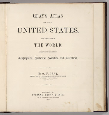
(Title Page to) Gray's Atlas Of The United States, With General Maps Of The World. Accompanied By Descriptions Geographical, Historical, Scientific and Statistical. By O.W. Gray, Civil And Topographical Engineer, No. 10 North Fifth Street, Philadelphia. Published By Stedman, Brown & Lyon, No. 10 North Fifth Street, Philadelphia. 1874.
Publisher
Stedman, Brown & Lyon
Author
Gray, Ormando Willis
Full Title
(Title Page verso) Entered, according to Act of Congress, in the year 1873, by O.W. Gray in the Office of the Librarian, Library of Congress.
Publisher
Stedman, Brown & Lyon
Author
Rand McNally and Company
Full Title
Rand, McNally & Company's indexed atlas of the world map of North Polar Regions. Copyright 1892, by Rand, McNally & Co. (Chicago. 1897)
Publisher
Rand McNally
Author
Gray, Ormando Willis
Full Title
(Table of Contents to) Gray's Atlas Of The United States, With General Maps Of The World. Accompanied By Descriptions Geographical, Historical, Scientific and Statistical. By O.W. Gray, Civil And Topographical Engineer, No. 10 North Fifth Street, Philadelphia. Published By Stedman, Brown & Lyon, No. 10 North Fifth Street, Philadelphia. 1874.
Publisher
Stedman, Brown & Lyon
Author
Gray, Ormando Willis
Full Title
Mountains & Rivers.
Publisher
Stedman, Brown & Lyon
Author
Gray, Ormando Willis
Full Title
(Text Page) Principal Mountains in the World.
Publisher
Stedman, Brown & Lyon
Author
Gray, Ormando Willis
Full Title
(Text Page) Principal Rivers and Lakes in the World.
Publisher
Stedman, Brown & Lyon
Author
[Blodget, Lorin, Gray, Ormando Willis]
Full Title
Gray's Atlas Climatological Map of the United States Showing the Average Temperature, Amount of Rain Fall &c. by Loren Blodget, 1873.
Publisher
Stedman, Brown & Lyon
Author
Rand McNally and Company
Full Title
Density of population of the principal countries of the world, 1890 ... Number and nationality of immigrants arrived in the United States during the ten fiscal years ... 1882-1891. Number of immigrants by periods arrived in the United Sates during the 103 years, 1789-1891. Rand, McNally & Co., Engravers, Chicago. (1897)
Publisher
Rand McNally
Author
[Gray, Ormando Willis, Porter, Thomas C.]
Full Title
Map of the United States Showing the Principal Botanical Divisions, by Thomas C. Porter, A.M., Professor of Botany in Lafayette College, Easton, Pa.
Publisher
Stedman, Brown & Lyon
Author
[Cope, Edward D., Gray, Ormando Willis]
Full Title
Map of the United States Showing the Principal Zoological Divisions, by Professor Edward D. Cope, A.M., Secretary of Academy of Natural Sciences, Philadephia.
Publisher
Stedman, Brown & Lyon
Author
Gray, Ormando Willis
Full Title
Gray's Atlas Map of the United States Showing the Principal Geological Formations by Cha's. H. Hitchcock, Ph.D.,Professor of Geology in Dartmouth College.
Publisher
Stedman, Brown & Lyon
Author
Rand McNally and Company
Full Title
Rand, McNally & Company's indexed atlas of the world map of Europe. Copyright 1891, by Rand, McNally & Co. ... Engravers, Chicago. (1897)
Publisher
Rand McNally
Author
Mitchell, Samuel Augustus
Full Title
Map Of South America, Showing Its Political Divisions. 45. Constructed & Engraved by W. Williams Philadelphia. (with) inset Map Showing The Proposed Atrato-Inter-Oceanic Canal Routes, for Connecting the Atlantic and Pacific Oceans. 46. Entered ... 1860, by S. Augustus Mitchell, Jr. ... Pennsylvania.
Publisher
S.A. Mitchell, Jr.
Author
Gray, Ormando Willis
Full Title
Western Hemisphere. Eastern Hemisphere.
Publisher
Stedman, Brown & Lyon
Author
Gray, Ormando Willis
Full Title
Gray's Atlas Map of Asia.
Publisher
Stedman, Brown & Lyon
Author
Gray, Ormando Willis
Full Title
Gray's Atlas Map of Oceanica, 1873.
Publisher
Stedman, Brown & Lyon
Author
Rand McNally and Company
Full Title
Rand, McNally & Company's indexed atlas of the world map of England and Wales. (with) London and environs. Copyright 1892, by Rand, McNally & Co. ... (Chicago, 1897)
Publisher
Rand McNally
Author
Gray, Ormando Willis
Full Title
Gray's Atlas Map of Africa, 1873.
Publisher
Stedman, Brown & Lyon
Author
Gray, Ormando Willis
Full Title
Gray's Atlas Map of Europe.
Publisher
Stedman, Brown & Lyon
Author
Gray, Ormando Willis
Full Title
Gray's Atlas Map of Great Britain and Ireland.
Publisher
Stedman, Brown & Lyon
Author
Rand McNally and Company
Full Title
Rand, McNally & Company's indexed atlas of the world map of Scotland. Copyright 1891, by Rand, McNally & Co. ... (Chicago, 1897)
Publisher
Rand McNally
Author
Gray, Ormando Willis
Full Title
Gray's Atlas Map of Germany, Austria, and Switzerland. Entered ... 1874 ... Librarian of Congress at Washington. Drawn by F.A. Gray. Engraved by J.M. Atwood.
Publisher
Stedman, Brown & Lyon
|