Who What Where WhenREMOVEWHEREShow More |
Author
Burr, David H., 1803-1875
Full Title
Map of the County of Franklin. By David H. Burr. Published by the Surveyor General, pursuant to an Act of the Legislature. Entered according to an Act of Congress Jany. 5th. 1829 by David H. Burr of the State of New York. Engd. by Rawdon, Clark & Co., Albany & Rawdon, Wright & Co., New York.
Publisher
D.H. Burr
Author
Burr, David H., 1803-1875
Full Title
Map of the County of St. Lawrence. By David H. Burr. Published by the Surveyor General, pursuant to an Act of the Legislature. Entered according to an Act of Congress Jany. 5th. 1829 by David H. Burr of the State of New York. Engd. by Rawdon, Clark & Co., Alby. & Rawdon, Wright & Co., N. York.
Publisher
D.H. Burr
Author
Burr, David H., 1803-1875
Full Title
Map of the County of Jefferson. By David H. Burr. Published by the Surveyor General, pursuant to an Act of the Legislature. Entered according to an Act of Congress Jany. 5th. 1829 by David H. Burr of the State of New York. Engd. by Rawdon, Clark & Co., Albany & Rawdon, Wright & Co., N. York.
Publisher
D.H. Burr
Author
Burr, David H., 1803-1875
Full Title
Map of the County of Lewis. By David H. Burr. Published by the Surveyor General, pursuant to an Act of the Legislature. Entered according to an Act of Congress Jany. 5th. 1829 by David H. Burr of the State of New York. Engd. by Rawdon, Clark & Co., Alby. & Rawdon, Wright & Co., New York.
Publisher
D.H. Burr
Author
Burr, David H., 1803-1875
Full Title
Map of the County of Herkimer. By David H. Burr. Published by the Surveyor General, pursuant to an Act of the Legislature. Entered according to an Act of Congress Jany. 5th. 1829 by David H. Burr of the State of New York. Engd. by Rawdon, Clark & Co., Albany & Rawdon, Wright & Co., New York.
Publisher
D.H. Burr
Author
Burr, David H., 1803-1875
Full Title
Map of the County of Oneida. By David H. Burr. Published by the Surveyor General, pursuant to an Act of the Legislature. Entered according to an Act of Congress Jany. 5th. 1829 by David H. Burr of the State of New York. Engd. by Rawdon, Clark & Co., Albany & Rawdon, Wright & Co., N.Y.
Publisher
D.H. Burr
Author
Burr, David H., 1803-1875
Full Title
Map of the County of Madison. By David H. Burr. Published by the Surveyor General, pursuant to an Act of the Legislature. Entered according to an Act of Congress Jany. 5th. 1829 by David H. Burr of the State of New York. Engd. by Rawdon, Clark & Co., Albany & Rawdon, Wright & Co., N.Y.
Publisher
D.H. Burr
Author
Burr, David H., 1803-1875
Full Title
Map of the County of Oswego. By David H. Burr. Published by the Surveyor General, pursuant to an Act of the Legislature. Entered according to an Act of Congress Jany. 5th. 1829 by David H. Burr of the State of New York. Engd. by Rawdon, Clark & Co., Albany & Rawdon, Wright & Co., N.Y.
Publisher
D.H. Burr
Author
Burr, David H., 1803-1875
Full Title
Map of the County of Otsego. By David H. Burr. Published by the Surveyor General, pursuant to an Act of the Legislature. Entered according to an Act of Congress Jany. 5th. 1829 by David H. Burr of the State of New York. Engd. by Rawdon, Clark & Co., Albany & Rawdon, Wright & Co., New York.
Publisher
D.H. Burr
Author
Burr, David H., 1803-1875
Full Title
Map of the County of Chenango. By David H. Burr. Published by the Surveyor General, pursuant to an Act of the Legislature. Entered according to an Act of Congress Jany. 5th. 1829 by David H. Burr of the State of New York. Engd. by Rawdon, Clark & Co., Albany & Rawdon, Wright & Co., N. York.
Publisher
D.H. Burr
Author
Burr, David H., 1803-1875
Full Title
Map of the County of Broome. By David H. Burr. Published by the Surveyor General, pursuant to an Act of the Legislature. Entered according to an Act of Congress Jany. 5th. 1829 by David H. Burr of the State of New York. Engd. by Rawdon, Clark & Co., Albany & Rawdon, Wright & Co., N.Y.
Publisher
D.H. Burr
Author
Burr, David H., 1803-1875
Full Title
Map of the County of Cortland by David H. Burr. Published by the Surveyor General, pursuant to an Act of the Legislature. Entered according to an Act of Congress Jany. 5th. 1829 by David H. Burr of the State of N. York. Engd. by Rawdon, Clark & Co., Albany & Rawdon, Wright & Co., N.Y.
Publisher
D.H. Burr
Author
Burr, David H., 1803-1875
Full Title
Map of the County of Tompkins. By David H. Burr. Published by the Surveyor General, pursuant to an Act of the Legislature. Entered according to an Act of Congress Jany. 5th. 1829 by David H. Burr of the State of New York. Engd. by Rawdon, Clark & Co., Albany & Rawdon, Wright & Co., N.Y.
Publisher
D.H. Burr
Author
Burr, David H., 1803-1875
Full Title
Map of the County of Tioga. By David H. Burr. Published by the Surveyor General, pursuant to an Act of the Legislature. Entered according to an Act of Congress Jany. 5th. 1829 by David H. Burr of the State of New York. Engd. by Rawdon, Clark & Co., Albany & Rawdon, Wright & Co., N. York.
Publisher
D.H. Burr
Author
Burr, David H., 1803-1875
Full Title
Map of the County of Steuben. By David H. Burr. Published by the Surveyor General, pursuant to an Act of the Legislature. Entered according to an Act of Congress Jany. 5th. 1829 by David H. Burr of the State of New York. Engd. by Rawdon, Clark & Co., Albany & Rawdon, Wright & Co., N. York.
Publisher
D.H. Burr
Author
Burr, David H., 1803-1875
Full Title
Map of the County of Onondaga. By David H. Burr. Published by the Surveyor General, pursuant to an Act of the Legislature. Entered according to an Act of Congress Jany. 5th. 1829 by David H. Burr of the State of New York. Engd. by Rawdon, Clark & Co., Albany & Rawdon, Wright & Co., New York.
Publisher
D.H. Burr
Author
Burr, David H., 1803-1875
Full Title
Map of the County of Cayuga. By David H. Burr. Published by the Surveyor General, pursuant to an Act of the Legislature. Entered according to an Act of Congress Jany. 5th. 1829 by David H. Burr of the State of New York. Engd. by Rawdon, Clark & Co., Albany & Rawdon, Wright & Co., N.Y.
Publisher
D.H. Burr
Author
Burr, David H., 1803-1875
Full Title
Map of the County of Seneca. By David H. Burr. Published by the Surveyor General, pursuant to an Act of the Legislature. Entered according to an Act of Congress Jany. 5th. 1829 by David H. Burr of the State of New York. Engd. by Rawdon, Clark & Co., Albany & Rawdon, Wright & Co., N. York.
Publisher
D.H. Burr
Author
Burr, David H., 1803-1875
Full Title
Map of the counties of Ontario & Yates. By David H. Burr. Published by the Surveyor General, pursuant to an Act of the Legislature. Entered according to an Act of Congress Jany. 5th. 1829 by David H. Burr of the State of New York. Engd. by Rawdon, Clark & Co., Albany & Rawdon, Wright & Co., N.Y.
Publisher
D.H. Burr
Author
Burr, David H., 1803-1875
Full Title
Map of the County of Wayne. By David H. Burr. Published by the Surveyor General, pursuant to an Act of the Legislature. Entered according to an Act of Congress Jany. 5th. 1829 by David H. Burr of the State of New York. Engd. by Rawdon, Clark & Co., Albany & Rawdon, Wright & Co., N.Y.
Publisher
D.H. Burr
Author
Burr, David H., 1803-1875
Full Title
Map of the County of Livingston. By David H. Burr. Published by the Surveyor General, pursuant to an Act of the Legislature. Entered according to an Act of Congress Jany. 5th. 1829 by David H. Burr of the State of New York. Engd. by Rawdon, Clark & Co., Albany & Rawdon, Wright & Co., N. York.
Publisher
D.H. Burr
Author
Burr, David H., 1803-1875
Full Title
Map of the County of Monroe. By David H. Burr. Published by the Surveyor General, pursuant to an Act of the Legislature. Entered according to an Act of Congress Jany. 5th. 1829 by David H. Burr of the State of New York. Engd. by Rawdon, Clark & Co., Albany & Rawdon, Wright & Co., N.Y.
Publisher
D.H. Burr
Author
Burr, David H., 1803-1875
Full Title
Map of the County of Orleans. By David H. Burr. Published by the Surveyor General, pursuant to an Act of the Legislature. Entered according to an Act of Congress Jany. 5th. 1829 by David H. Burr of the State of New York. Engd. by Rawdon, Clark & Co., Albany & Rawdon, Wright & Co., N. York.
Publisher
D.H. Burr
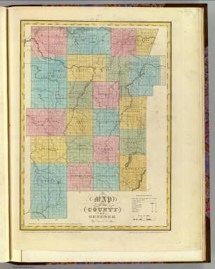
Author
Burr, David H., 1803-1875
Full Title
Map of the County of Genesee. By David H. Burr. Published by the Surveyor General, pursuant to an Act of the Legislature. Entered according to an Act of Congress Jany. 5th. 1829 by David H. Burr of the State of New York. Engd. by Rawdon, Clark & Co., Albany & Rawdon, Wright & Co., N. York.
Publisher
D.H. Burr
Author
Burr, David H., 1803-1875
Full Title
Map of the County of Allegany. By David H. Burr. Published by the Surveyor General, pursuant to an Act of the Legislature. Entered according to an Act of Congress Jany. 5th. 1829 by David H. Burr of the State of New York. Engd. by Rawdon, Clark & Co., Albany & Rawdon, Wright & Co., N. York.
Publisher
D.H. Burr
Author
Burr, David H., 1803-1875
Full Title
Map of the County of Niagara. By David H. Burr. Published by the Surveyor General, pursuant to an Act of the Legislature. Entered according to an Act of Congress Jany. 5th. 1829 by David H. Burr of the State of New York. Engd. by Rawdon, Clark & Co., Albany & Rawdon, Wright & Co., N. York.
Publisher
D.H. Burr
Author
Burr, David H., 1803-1875
Full Title
Map of the County of Erie. By David H. Burr. Published by the Surveyor General, pursuant to an Act of the Legislature. Entered according to an Act of Congress Jany. 5th. 1829 by David H. Burr of the State of New York. Engd. by Rawdon, Clark & Co., Albany & Rawdon, Wright & Co., New York.
Publisher
D.H. Burr
Author
Burr, David H., 1803-1875
Full Title
Map of the County of Cattaraugus. By David H. Burr. Published by the Surveyor General, pursuant to an Act of the Legislature. Entered according to an Act of Congress Jany. 5th. 1829 by David H. Burr of the State of New York. Engd. by Rawdon, Clark & Co., Albany & Rawdon, Wright & Co., N. York.
Publisher
D.H. Burr
Author
Burr, David H., 1803-1875
Full Title
Map of the County of Chautauque (sic). By David H. Burr. Published by the Surveyor General, pursuant to an Act of the Legislature. Entered according to an Act of Congress Jany. 5th. 1829 by David H. Burr of the State of New York. Engd. by Rawdon, Clark & Co., Albany & Rawdon, Wright & Co., New York.
Publisher
D.H. Burr
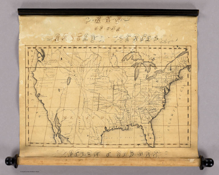
Author
Ordway, Eliza S.
Full Title
Map Of The United States. Eliza S. Ordway.
Publisher
Manuscript
Author
Hall, S. (Sidney)
Full Title
Eastern Hemisphere. By Sidney Hall. London, published by Longman, Rees, Orme, Brown & Green, Paternoster Row, June 1, 1829.
Publisher
Longman, Rees, Orme, Brown and Green
Author
Hall, S. (Sidney)
Full Title
Western Hemisphere. By Sidney Hall. London, published by Longman, Rees, Orme, Brown & Green, Paternoster Row, August 1, 1829.
Publisher
Longman, Rees, Orme, Brown and Green
Author
Hall, S. (Sidney)
Full Title
The world on Mercator's projection. By Sidney Hall. London, published by Longman, Rees, Orme, Brown & Green, Paternoster Row, Octr. 1829.
Publisher
Longman, Rees, Orme, Brown and Green
Author
Hall, S. (Sidney)
Full Title
British Isles by Sidney Hall. London, published by Longman, Rees, Orme, Brown & Green, Paternoster Row, Octr. 1, 1829.
Publisher
Longman, Rees, Orme, Brown and Green
Author
Hall, S. (Sidney)
Full Title
Portugal. By Sidney Hall. London, published by Longman, Rees, Orme, Brown & Green, Paternoster Row, June 1, 1829.
Publisher
Longman, Rees, Orme, Brown and Green
Author
Hall, S. (Sidney)
Full Title
Asia. By Sidney Hall. London, published by Longman, Rees, Orme, Brown & Green, Paternoster Row, Augt. 1, 1829.
Publisher
Longman, Rees, Orme, Brown and Green
Author
Hall, S. (Sidney)
Full Title
Turkey in Asia. By Sidney Hall. London, published by Longman, Rees, Orme, Brown & Green, Paternoster Row, April 1st. 1829.
Publisher
Longman, Rees, Orme, Brown and Green
Author
Hall, S. (Sidney)
Full Title
Birmah, with part of Anam and Siam. By Sidney Hall. London, published by Longman, Rees, Orme, Brown & Green, Paternoster Row, April 1st. 1829.
Publisher
Longman, Rees, Orme, Brown and Green
Author
Hall, S. (Sidney)
Full Title
Africa. By Sidney Hall. London, published by Longman, Rees, Orme, Brown & Green, Paternoster Row, Feby. 1, 1829.
Publisher
Longman, Rees, Orme, Brown and Green
Author
Hall, S. (Sidney)
Full Title
Egypt. By Sidney Hall. London, published by Longman, Rees, Orme, Brown & Green, Paternoster Row, Feby. 1, 1829.
Publisher
Longman, Rees, Orme, Brown and Green
Author
Hall, S. (Sidney)
Full Title
Western Africa. By Sidney Hall. London, published by Longman, Rees, Orme, Brown & Green, Paternoster Row, Octr. 1st. 1829.
Publisher
Longman, Rees, Orme, Brown and Green
Author
Hall, S. (Sidney)
Full Title
Northern Africa. By Sidney Hall. London, published by Longman, Rees, Orme, Brown & Green, Paternoster Row, June 1, 1829.
Publisher
Longman, Rees, Orme, Brown and Green
Author
Hall, S. (Sidney)
Full Title
North America. By Sidney Hall. London, published by Longman, Rees, Orme, Brown & Green, Paternoster Row, Augt. 1, 1829.
Publisher
Longman, Rees, Orme, Brown and Green
Author
Hall, S. (Sidney)
Full Title
British North America by Sidney Hall. London, published by Longman, Rees, Orme, Brown & Green, Paternoster Row, April 1st. 1829.
Publisher
Longman, Rees, Orme, Brown and Green
Author
Hall, S. (Sidney)
Full Title
South America. By Sidney Hall. London, published by Longman, Rees, Orme, Brown & Green, Paternoster Row, Octr. 1, 1829.
Publisher
Longman, Rees, Orme, Brown and Green
Author
Hall, S. (Sidney)
Full Title
Chili, La Plata, and Bolivia or Upper Peru by Sidney Hall. London, published by Longman, Rees, Orme, Brown & Green, Paternoster Row, Feby. 1, 1829.
Publisher
Longman, Rees, Orme, Brown and Green
Author
[Lapie, Alexandre Emile, Lapie, M. (Pierre), 1779-1850]
Full Title
Carte de l'Afrique Propre, et la Numidie et d'une partie de la Mauritanie. Dressee par M. Lapie, 1er. Geographe du Roi et M. Lapie, Lieutenant Ingenieur Geographe. Paris, 1829. Chez Eymery Fruger et Cie., Rue Mazarine No. 30. La gravure dirigee et gravee par Lallemand, rue St. Jacques No. 66.
Publisher
Eymery Fruger et Cie
Author
[Lapie, Alexandre Emile, Lapie, M. (Pierre), 1779-1850]
Full Title
Carte de France par departemens et divisions militaires, dressee par M. Lapie, 1er. Geographe du Roi et M. Lapie Fils., Lieutenant Ingenieur Geogphe. Paris, 1829. Chez Eymery Fruger et Cie., Rue Mazarine No. 30. La gravure dirigee et gravee par Lallemand.
Publisher
Eymery Fruger et Cie
Author
[Lapie, Alexandre Emile, Lapie, M. (Pierre), 1779-1850]
Full Title
Carte des Iles Britanniques comprenant l'Angleterre, l'Ecosse et l'Irlande. Dressee par M. Lapie, 1er. Geographe du Roi et M. Lapie Fils, Lieut. Ingr. Geoge. Paris, 1829. Chez Eymery Fruger et Cie., Rue Mazarine No. 30. La gravure dirigee et gravee par Lallemand.
Publisher
Eymery Fruger et Cie
Author
[Lapie, Alexandre Emile, Lapie, M. (Pierre), 1779-1850]
Full Title
Carte de l'Inde en deca et au dela du Gange. Dressee par M. Lapie, 1er. Geographe du Roi et M. Lapie Fils, Geographe de S.A.R.M. le Dauphin. Paris, 1829. Chez Eymery Fruger et Cie., Rue Mazarine No. 30. La gravure dirigee et executee par Lallemand.
Publisher
Eymery Fruger et Cie
|