Who What Where WhenREMOVE |
Author
[Petermann, Augustus., Milner, Thomas]
Full Title
(Text Page) Annotations to the Maps: Hydrography IV & V.
Publisher
William S. Orr & Co.
Author
[Petermann, Augustus., Milner, Thomas]
Full Title
(Text Page) Annotations to the Maps: Hydrography IV & V (continued).
Publisher
William S. Orr & Co.
Author
[Petermann, Augustus., Milner, Thomas]
Full Title
Hydrography. No. 6. Hydrographical Map of the World Showing the Currents, Temperature, etc. of the Ocean. Constructed by Augustus Petermann, F.R.G.S. Engraved by John Dower, Pentonville, London. London: Published by Orr and Compy. Amen Corner, Paternoster Row.
Publisher
William S. Orr & Co.
Author
[Petermann, Augustus., Milner, Thomas]
Full Title
(Text Page) Annotations to the Maps: Hydrography VI.
Publisher
William S. Orr & Co.
Author
[Petermann, Augustus., Milner, Thomas]
Full Title
(Text Page) Annotations to the Maps: Hydrography VI (continued).
Publisher
William S. Orr & Co.
Author
[Petermann, Augustus., Milner, Thomas]
Full Title
Meteorology. No. 7. Meteorological Map of the World Showing the Distribution of the Temperature of the Air. Constructed by Augustus Petermann, F.R.G.S. Engraved by John Dower, Pentonville, London. London: Published by Orr and Compy. Amen Corner, Paternoster Row.
Publisher
William S. Orr & Co.
Author
[Petermann, Augustus., Milner, Thomas]
Full Title
(Text Page) Annotations to the Maps: Meteorology VII.
Publisher
William S. Orr & Co.
Author
[Petermann, Augustus., Milner, Thomas]
Full Title
(Text Page) Annotations to the Maps: Meteorology VII (continued).
Publisher
William S. Orr & Co.
Author
[Petermann, Augustus., Milner, Thomas]
Full Title
Meteorology. No. 8. Map of the World showing the Distribution of the Winds and their Influence on Navigation. Constructed by Augustus Petermann, F.R.G.S. Engraved by John Dower, Pentonville, London. London: Published by Orr and Compy. Amen Corner, Paternoster Row.
Publisher
William S. Orr & Co.
Author
[Petermann, Augustus., Milner, Thomas]
Full Title
(Text Page) Annotations to the Maps: Meteorology VIII.
Publisher
William S. Orr & Co.
Author
[Petermann, Augustus., Milner, Thomas]
Full Title
(Text Page) Annotations to the Maps: Meteorology VIII (continued).
Publisher
William S. Orr & Co.
Author
[Petermann, Augustus., Milner, Thomas]
Full Title
Meteorology. No.9. Hydrographic Map showing the distribution of the Rain over the Globe. Constructed by Augustus Petermann, F.R.G.S. Engraved by John Dower, Pentonville, London. London: Published by Orr and Compy. Amen Corner, Paternoster Row.
Publisher
William S. Orr & Co.
Author
[Petermann, Augustus., Milner, Thomas]
Full Title
(Text Page) Annotations to the Maps: Meteorology IX.
Publisher
William S. Orr & Co.
Author
[Petermann, Augustus., Milner, Thomas]
Full Title
(Text Page) Annotations to the Maps: Meteorology IX (continued).
Publisher
William S. Orr & Co.
Author
[Petermann, Augustus., Milner, Thomas]
Full Title
Botanical Geography. No. 10. Botanical Map Showing the Distribution & Cultivation of some of the Most Important Plants over the Globe. Constructed by Augustus Petermann, F.R.G.S. Engraved by John Dower, Pentonville, London. London: Published by Orr and Compy. Amen Corner, Paternoster Row.
Publisher
William S. Orr & Co.
Author
[Petermann, Augustus., Milner, Thomas]
Full Title
(Text Page) Annotations to the Maps: Botanical Geography X.
Publisher
William S. Orr & Co.
Author
[Petermann, Augustus., Milner, Thomas]
Full Title
(Text Page) Annotations to the Maps: Botanical Geography X (continued).
Publisher
William S. Orr & Co.
Author
[Petermann, Augustus., Milner, Thomas]
Full Title
Zoological Geography. No. 11. Zoological Map Showing the Distribution of the Principal Mammiferous Animals (Class Mammalia) Over the Globe. Constructed by Augustus Petermann, F.R.G.S. Engraved by John Dower, Pentonville, London. London: Published by Orr and Compy. Amen Corner, Paternoster Row.
Publisher
William S. Orr & Co.
Author
[Petermann, Augustus., Milner, Thomas]
Full Title
(Text Page) Annotations to the Maps: Zoological Geography XI.
Publisher
William S. Orr & Co.
Author
[Petermann, Augustus., Milner, Thomas]
Full Title
(Text Page) Annotations to the Maps: Zoological Geography XI (continued).
Publisher
William S. Orr & Co.
Author
[Petermann, Augustus., Milner, Thomas]
Full Title
Zoological Geography. No. 12. Zoological Map Showing the Distribution of the Principal Birds and Reptiles (Aves et Reptilia) Over the Globe. Constructed by Augustus Petermann, F.R.G.S. Engraved by John Dower, Pentonville, London. London: Published by Orr and Compy. Amen Corner, Paternoster Row.
Publisher
William S. Orr & Co.
Author
[Petermann, Augustus., Milner, Thomas]
Full Title
(Text Page) Annotations to the Maps: Zoological Geography XII.
Publisher
William S. Orr & Co.
Author
[Petermann, Augustus., Milner, Thomas]
Full Title
(Text Page) Annotations to the Maps: Zoological Geography XII (continued).
Publisher
William S. Orr & Co.
Author
[Petermann, Augustus., Milner, Thomas]
Full Title
Ethnography. No. 13. Ethnographical Map of the World showing the distribution of the Human Race in the Middle of the 19th Century. Constructed by Augustus Petermann, F.R.G.S. Engraved by John Dower, Pentonville, London. London: Published by Orr and Compy. Amen Corner, Paternoster Row.
Publisher
William S. Orr & Co.
Author
[Petermann, Augustus., Milner, Thomas]
Full Title
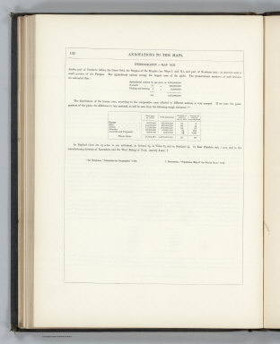
(Text Page) Annotations to the Maps: Ethnography XIII.
Publisher
William S. Orr & Co.
Author
[Petermann, Augustus., Milner, Thomas]
Full Title
(Text Page) Annotations to the Maps: Ethnography XIII (continued).
Publisher
William S. Orr & Co.
Author
[Petermann, Augustus., Milner, Thomas]
Full Title
General Physical Geography. No.14. Physical Map of the British Isles. Showing their orography, climatology, and some Botantical and Zoological Features. Constructed by Augustus Petermann, F.R.G.S. Engraved by John Dower, Pentonville, London. London: Published by Orr and Compy. Amen Corner, Paternoster Row.
Publisher
William S. Orr & Co.
Author
[Petermann, Augustus., Milner, Thomas]
Full Title
(Text Page) Annotations to the Maps: Physical Map of the British Isles. XIV.
Publisher
William S. Orr & Co.
Author
[Petermann, Augustus., Milner, Thomas]
Full Title
Physical Map of Palestine and the Adjacent Countries. Constructed by Augustus Petermann, F.R.G.S. Engraved by John Dower, Pentonville, London. London: Published by Orr and Compy. Amen Corner, Paternoster Row.
Publisher
William S. Orr & Co.
Author
[Petermann, Augustus., Milner, Thomas]
Full Title
(Text Page) Annotations to the Maps: Physical Map of Palestine and the Adjacent Countries. XV.
Publisher
William S. Orr & Co.
Author
[Petermann, Augustus., Milner, Thomas]
Full Title
(Text Page) Annotations to the Maps: Physical Map of Palestine and the Adjacent Countries. XV (continued). Index to the Atlas of Physical Geography.
Publisher
William S. Orr & Co.
Author
[Petermann, Augustus., Milner, Thomas]
Full Title
(Text Page) Annotations to the Maps: Index to the Atlas.
Publisher
William S. Orr & Co.
Author
[Petermann, Augustus., Milner, Thomas]
Full Title
(Text Page) Annotations to the Maps: Index to the Atlas (continued).
Publisher
William S. Orr & Co.
Author
[Petermann, Augustus., Milner, Thomas]
Full Title
(Text Page) Index to the Atlas (continued). Works Published by William S. Orr and Co.
Publisher
William S. Orr & Co.
Author
[Petermann, Augustus., Milner, Thomas]
Full Title
(Text Page) (Works Published by William S. Orr and Co., continued).
Publisher
William S. Orr & Co.
Author
[Petermann, Augustus., Milner, Thomas]
Full Title
(Text Page) Annotations to the Maps: Physical Map of the British Isles (continued). XIV.
Publisher
William S. Orr & Co.
Author
[Lancaster, Cyrus, Wilson, James]
Full Title
Wilson's New American Thirteen Inch Terrestrial Globe, Exhibiting with the Greatest Possible Accuracy, The Positions of the Principal Known Places of the Earth; with the Tracks of Various Circumnavigators, Together with New Discoveries and Political Alterations Down to the present Period 1850. By Cyrus Lancaster, Albany, N.Y.
Publisher
Cyrus Lancaster
Author
[McCleary, Samuel, Pierce, John]
Full Title
(Box Cover to) Dissecting Map of the State of New York. Published by McCleary & Pierce, Watervliet centre, Albany Co., N.Y. (with) McCleary & Pierce's Geographical Analysis of the State of New York, Albany 1850. Patented Sep. 1849.
Publisher
McCleary & Pierce.
Author
[McCleary, Samuel, Pierce, John]
Full Title
McCleary & Pierce's Geographical Analysis of the State of New York, Albany 1850. Patented Sep. 1849.
Publisher
McCleary & Pierce.
Author
[Sidney, J.C., Clark, Richard]
Full Title
Plan Of The Township of Raritan, Hunterdon Co., N.J. Surveyed by J.C. Sidney 80 Walnut St. Philadelphia. Published by Richard Clark 384 S. 3rd St. Philada. Entered ... 1850 by Richd. Clark ... Pa.
Publisher
R. Clark
Author
[Petermann, Augustus., Milner, Thomas]
Full Title
The Atlas Of Physical Geography: Constructed By Augustus Petermann, F.R.G.S. ... With Descriptive Letter-Press, Embracing A General View Of The Physical Phenomena Of The Globe. By The Rev. Thomas Milner, M.A., F.R.G.S. ... Illustrated by One Hundred and Thirty Vignettes on Wood. London: Wm. S. Orr And Co., Amen-Corner, Paternoster-Row. MDCCCL.
Publisher
William S. Orr & Co.
Author
[Marzolla, Benedetto, Society for the Diffusion of Useful Knowledge (Great Britain)]
Full Title
Arcipelago delle Antille ossia Indie Occidentali, America. Per questa Carta si ha avuto presente quella, pubblicata in Londra nel 1835 della Societa por la diffusione delle utili conoscenze ... Essa fa parte dell'Atlante Geografico che va pubblicandosi da B. Marzolla. Napoli 1850.
Publisher
B. Marzolla
Author
Grassl, J. (Joseph)
Full Title
Karte des Thuringer-Wald-Gebirges zugleich special Karte des Herzogthums Sachs-Meiningen-Hildburghausen, des Furstenthums Coburg und der Schwarzburgischen Furstenthumer Rudolstadt und Sondershausen. (with) Grundriss von Hildburghausen. (with) Grundriss von Coburg. Entworf. u. gezeichnet von J. Graessl. 1850. Stich, Druck und Verlag des Bibliographischen Instituts in Hildburghausen, (1860)
Publisher
Bibliographischen Instituts
Author
Radefeld, Carl Christian Franz, 1788-1874
Full Title
Ost-Africa und Madagascar, 1850. Entw. u. gez. vom Major Radefeld. E. Biedermann sc. Stich, Druck u. Verlag d. Bibliographischen Instituts in Hildburghausen, (1860)
Publisher
Bibliographischen Instituts
Author
Radefeld, Carl Christian Franz, 1788-1874
Full Title
Ueberfahrts-Karte. 1850. Entw. u. gez. von Major Radefeld. Stich, Druck u. Verlag des Bibliographischen Instituts in Hildburghausen, (1860)
Publisher
Bibliographischen Instituts
Author
[Brue, Adrien Hubert, 1786-1832, Marzolla, Benedetto, Picquet, C.]
Full Title
Turchia Europea con i Principati di Servia, Valachia e Moldavia. La presente Carta e stata eseguita su quella pubblicata in Parigi nel 1840 dal Sr. A. Brue, riveduta a corretta dal Sr. Picquet ... Atlante geografico di B. Marzolla, Napoli 1850.
Publisher
B. Marzolla
Author
[Arrowsmith, John, Marzolla, Benedetto, Parish, Woodbine]
Full Title
Provincie Unite del Rio de la Plata ossio Repubblica Argentina, e stati del Chili, Uruguay, Montevideo, e Paraguay. America meridle. La presente Carta e stata eseguita su quella, secondo i documenti comunicati da Sir Woodbine Parish, gia Incaricato di affari della Gran-Brettagna a Buenos-Ayres, e pubblicata in Londra nel 1842 da John Arrowsmith ... Atlante Geografico di B. Marzolla, Napoli 1850.
Publisher
B. Marzolla
Author
Bache, A. D.
Full Title
The Harbor of Hyannis. From a trigonometrical survey under the direction of A.D. Bache, Superintendent of the Survey of the Coast of the United States. Triangulation by C.M. Eakin assistant. Topography by W.M. Boyce assistant. Hydrography by J.N. Maffitt, Lieut. U.S. Navy, under the direction of Chas. H. Davis, Lieutenant U.S. Navy. Published in 1850. Reduction by Wm. Luce draughtsman. Engraved by Sherman & Smith, N.Y. Sailing directions &c. by W. Smith U.S.C.S. Electrotype copy no. 1 by G. Mathiot, U.S.C.S. (with logo) U.S. Coast Survey Office.
Publisher
U.S.
Author
Bache, A. D.
Full Title
The harbor of New Bedford. Founded upon a trigonometrical survey under the direction of Alex. D. Bache, Superintendent of the Survey of the Coast of the United States. Triangulation by C.M. Eakin assistant. Topography by H.L. Whiting assistant. Hydrography under the direction of G.S. Blake, Lieut. Comg., U.S. Navy. Published in 1846. Republished in 1850. Drawn by H.L. Whiting assistant. Engraved by Sherman & Smith, New York. Printed by H. Benner. Electrotype copy no. 5 by G. Mathiot, U.S.C.S. (with logo) U.S. Coast Survey Depot.
Publisher
U.S.
Author
Bache, A. D.
Full Title
Pasquotank River. From a trigonometrical survey under the direction of A.D. Bache, Superintendent of the Survey of the Coast of the United States. Triangulation by W.M. Boyce and J.C. Neilson, assistants. Topography by J.C. Neilson, assistant. Hydrography by the party under the command of W.P. McArthur, Lieutenant, U.S. Navy. Published in 1850. Drawn by J.H. Adams, draughtsman. Engraved by W. Smith and S.T. Pettit. Electrotype copy no. 1 by G. Mathiot, U.S.C.S. (with logo) U.S. Coast Survey Depot.
Publisher
U.S.
|