Browse All
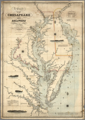
1862 A Chart of the Chesapeake And Delaware B … Chart Map A Chart of the Chesapeake And Delaware B … |

1862 Carte de la Republique du Paraguay : cou … Separate Map Carte de la Republique du Paraguay : cou … |

1862 State of Maine. Case Map Map Of The State Of Maine. From Surveys … |

1862 Naval And Military Map Of The United Sta … Wall Map The New Naval And Military Map Of The Un … |

1862 Washington Map of the United States. Wall Map The Washington Map of the United States … |

1862 Washington Map of the United States. Wall Map The Washington Map Of The United States. … |

1862 Continental Map Of North America. Wall Map The Continental Map Of North America. Co … |

1862 Cover: Part of Rappahannock River. Separate Map (Cover to) Part of the North Bank of the … |

1862 Part of the North Bank of the Rappahanno … Separate Map Part of the North Bank of the Rappahanno … |

1862 Cover: Country between Monterey, Tenn. & … Separate Map (Cover to) Map Of The Country Between Mo … |

1862 Map Of The Country Between Monterey, Ten … Separate Map Map Of The Country Between Monterey, Ten … |

1862 Map Of The Field Of Shiloh, Near Pittsbu … Separate Map Map Of The Field Of Shiloh, Near Pittsbu … |

1862 War Telegram Marking Map. Separate Map War Telegram Marking Map. L. Prang & Co. … |

1862 Official Plan of The Siege Of Yorktown V … Separate Map Official Plan of The Siege Of Yorktown V … |

1862 White House To Harrisons Landing. Separate Map Campaign Map, Army Of The Potomac. Map N … |

1862 Williamsburg To White House. Separate Map Campaign Map, Army Of The Potomac. Map N … |

1862 Yorktown To Williamsburg. Separate Map Campaign Maps, Army Of The Potomac. Map … |

1862 Cover: Historical war map. Pocket Map (Covers to) The Historical War Map. Ashe … |

1862 The Historical War Map. Pocket Map The Historical War Map. Asher & Co. Ente … |

1862 Cover: Lloyd's Virginia. Pocket Map (Covers to) Lloyd's official map of the … |

1862 Lloyd's official map of the State of Vir … Pocket Map Lloyd's official map of the State of Vir … |

1862 Lloyd's map of the Lower Mississippi Riv … Separate Map Lloyd's map of the Lower Mississippi Riv … |

1862 Vicinity of Richmond, and Peninsular Cam … World Atlas Johnson's Map of the Vicinity of Richmon … |

1860 Reading, Pennsylvania. County Atlas Plan of the City of Reading, Compiled by … |

1861 Borough of Bernville, Pennsylvania. County Atlas Plan of the Borough of Bernville, Septr. … |

1861 Boyertown, Pennsylvania. County Atlas Plan of Boyertown. Octr. 1861. |

1861 Borough of Hamburg, Berks County, Pennsy … County Atlas Plan of the Borough of Hamburg, July 186 … |

1861 Borough of Kutztown, Berks County, Penns … County Atlas Plan of Borough of Kutztown, August 1861 … |

1861 Leesport, Berks County, Pennsylvania. County Atlas Plan of Leesport, July 1861. |

1861 Womelsdorf, Berks County, Pennsylvania. County Atlas Plan of Womelsdorf, July 1861. |

1862 Das russische Reich nach seiner allmaehl … Historical Atlas Das russische Reich nach seiner allmaehl … |

1862 5. Hastings. National Atlas 5. Hastings. |

1862 61. Shrewsbury. National Atlas 61. Shrewsbury. |

1862 65. Downham. National Atlas 65. Downham. |

1862 74. Llangollen. National Atlas 74. Llangollen. |

1862 93. York. National Atlas 93. York. |

1862 94. Beverley. National Atlas 94. Beverley. |

1862 Virginia. World Atlas A New Map of the State of Virginia Exhib … |

1862 Tennessee. World Atlas The Tourist's Pocket Map of the State of … |

1862 Kentucky. World Atlas A New Map of the State of Kentucky from … |

1862 Missouri. World Atlas A New Map of the State of Missouri. Publ … |

1862 Vicinity of Richmond, and Peninsular Cam … World Atlas Johnson's Map of the Vicinity of Richmon … |

1862 Georgetown and the City of Washington D. … World Atlas Johnson's Georgetown and the City of Was … |