Who What Where WhenWHATShow MoreWHERE
|
Author
Rand McNally and Company
Full Title
Rand, McNally & Co.'s New Shippers' Railroad Map of the United States. Scale: 8 miles to one inch. Showing all railroads, each in a separate color, and all railroad stations in large, plain type. This is the Savannah section, only, of the above-named map. (Above the neatline) Copyright, 1890 by Rand, McNally & Co.
Publisher
Rand McNally & Co.
Author
Rand McNally and Company
Full Title
(Covers to) Rand, McNally & Co.'s New Shippers' Railroad Map of the United States. Scale: 8 miles to one inch. Showing all railroads, each in a separate color, and all railroad stations in large, plain type. (Below the neatline) Rand, McNally & Co.'s New Shippers' Railroad Map of the United States, Copyright, 1888 by Rand, McNally & Co. Copyright, 1891 by Rand, McNally & Co.
Publisher
Rand McNally & Co.
Author
Rand McNally and Company
Full Title
Rand, McNally & Co.'s New Shippers' Railroad Map of the United States. Scale: 8 miles to one inch. Showing all railroads, each in a separate color, and all railroad stations in large, plain type. (Below the neatline) Rand, McNally & Co.'s New Shippers' Railroad Map of the United States, Copyright, 1888 by Rand, McNally & Co. Copyright, 1891 by Rand, McNally & Co.
Publisher
Rand McNally & Co.
Author
Rand McNally and Company
Full Title
Rand, McNally & Co.'s New Shippers' Railroad Map of the United States. Scale: 8 miles to one inch. Showing all railroads, each in a separate color, and all railroad stations in large, plain type. This is the Mackinaw section, only, of the above-named map. (Below the neatline) Rand, McNally & Co.'s New Shippers' Railroad Map of the United States, Copyright, 1888 by Rand, McNally & Co. Copyright, 1891 by Rand, McNally & Co.
Publisher
Rand McNally & Co.
Author
Rand McNally and Company
Full Title
(Covers to) Rand, McNally & Co.'s New Shippers' Railroad Map of the United States. Scale: 8 miles to one inch. Showing all railroads, each in a separate color, and all railroad stations in large, plain type. This is the Mackinaw section, only, of the above-named map. (Below the neatline) Rand, McNally & Co.'s New Shippers' Railroad Map of the United States, Copyright, 1888 by Rand, McNally & Co. Copyright, 1891 by Rand, McNally & Co.
Publisher
Rand McNally & Co.
Author
Rand McNally and Company
Full Title
Rand, McNally & Co.'s New Shippers' Railroad Map of the United States. Scale: 8 miles to one inch. Showing all railroads, each in a separate color, and all railroad stations in large, plain type. This is the Richmond section, only, of the above-named map. (Below the neatline) Rand, McNally & Co.'s New Shippers' Railroad Map of the United States, Copyright, 1888 by Rand, McNally & Co. Copyright, 1891 by Rand, McNally & Co.
Publisher
Rand McNally & Co.
Author
Rand McNally and Company
Full Title
(Covers to) Rand, McNally & Co.'s New Shippers' Railroad Map of the United States. Scale: 8 miles to one inch. Showing all railroads, each in a separate color, and all railroad stations in large, plain type. This is the Richmond section, only, of the above-named map. (Below the neatline) Rand, McNally & Co.'s New Shippers' Railroad Map of the United States, Copyright, 1888 by Rand, McNally & Co. Copyright, 1891 by Rand, McNally & Co.
Publisher
Rand McNally & Co.
Author
Rand McNally and Company
Full Title
(Covers to) Rand, McNally & Co.'s New Shippers' Railroad Map of the United States. Scale: 8 miles to one inch. Showing all railroads, each in a separate color, and all railroad stations in large, plain type. This is the New York section, only, of the above-named map. (Below the neatline) Rand, McNally & Co.'s New Shippers' Railroad Map of the United States, Copyright, 1888 by Rand, McNally & Co. Copyright, 1891 by Rand, McNally & Co.
Publisher
Rand McNally & Co.
Author
Rand McNally and Company
Full Title
Rand, McNally & Co.'s New Shippers' Railroad Map of the United States. Scale: 8 miles to one inch. Showing all railroads, each in a separate color, and all railroad stations in large, plain type. This is the New York section, only, of the above-named map. (Below the neatline) Rand, McNally & Co.'s New Shippers' Railroad Map of the United States, Copyright, 1888 by Rand, McNally & Co. Copyright, 1891 by Rand, McNally & Co.
Publisher
Rand McNally & Co.
Author
Rand McNally and Company
Full Title
Rand, McNally & Co.'s New Shippers' Railroad Map of the United States. Scale: 8 miles to one inch. Showing all railroads, each in a separate color, and all railroad stations in large, plain type. This is the Montreal section, only, of the above-named map. (Below the neatline) Rand, McNally & Co.'s New Shippers' Railroad Map of the United States, Copyright, 1888 by Rand, McNally & Co. Copyright, 1891 by Rand, McNally & Co.
Publisher
Rand McNally & Co.
Author
Rand McNally and Company
Full Title
(Covers to) Rand, McNally & Co.'s New Shippers' Railroad Map of the United States. Scale: 8 miles to one inch. Showing all railroads, each in a separate color, and all railroad stations in large, plain type. This is the Montreal section, only, of the above-named map. (Below the neatline) Rand, McNally & Co.'s New Shippers' Railroad Map of the United States, Copyright, 1888 by Rand, McNally & Co. Copyright, 1891 by Rand, McNally & Co.
Publisher
Rand McNally & Co.
Author
Rand McNally and Company
Full Title
(Covers to) (Rand, McNally & Co.'s New Shippers' Railroad Map of the United States. Scale: 18 miles to one inch).
Publisher
Rand McNally & Co.
Author
Rand McNally and Company
Full Title
(North West section, Rand, McNally & Co.'s New Shippers' Railroad Map of the United States. Scale: 18 miles to one inch).
Publisher
Rand McNally & Co.
Author
Rand McNally and Company
Full Title
(South West section, Rand, McNally & Co.'s New Shippers' Railroad Map of the United States. Scale: 18 miles to one inch).
Publisher
Rand McNally & Co.
Author
Rand McNally and Company
Full Title
(Covers to) (Rand, McNally & Co.'s New Shippers' Railroad Map of the United States. Scale: 18 miles to one inch).
Publisher
Rand McNally & Co.
Author
Rand McNally and Company
Full Title
(Composite Map of) (Western section of Rand, McNally & Co.'s New Shippers' Railroad Map of the United States. Scale: 18 miles to one inch).
Publisher
Rand McNally & Co.
Author
American Telephone and Telegraph Company
Full Title
(Covers to) Lines and Metallic Circuit Connections. American Telephone and Telegraph Co. 18 Cortlandt St. New York. March 1, 1891.
Publisher
No Publisher
Author
American Telephone and Telegraph Company
Full Title
Lines and Metallic Circuit Connections. American Telephone and Telegraph Co. 18 Cortlandt St. New York. March 1, 1891.
Publisher
No Publisher
Author
Central School Supply House
Full Title
The Peerless Globe. Central School Supply House, Chicago, U.S.A. Copyright 1891 by G.W. Bacon, F.R.G.S.
Publisher
Central School Supply House
Author
Miller, H.C.
Full Title
Official Map of Yolo County, California, Compiled and Pulished by H.C. Miller. 1891. Price $10.00.
Publisher
H.C. Miller
Author
Reichsamt fur Landesaufnahme
Full Title
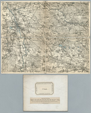
Sheet 524. Berncastel. Karte des Deutschen Reiches.
Publisher
Reichsamt fur Landesaufnahme
Author
Reichsamt fur Landesaufnahme
Full Title
(Composite of) Sheet 524. Berncastel. Karte des Deutschen Reiches.
Publisher
Reichsamt fur Landesaufnahme
Author
Reichsamt fur Landesaufnahme
Full Title
Sheet 390. Leipzig. Herausgegeben vom topogr. Bureau des Konigl. Sachs. Generalstabes. Karte des Deutschen Reiches.
Publisher
Reichsamt fur Landesaufnahme
Author
Reichsamt fur Landesaufnahme
Full Title
(Composite of) Sheet 390. Leipzig. Herausgegeben vom topogr. Bureau des Konigl. Sachs. Generalstabes. Karte des Deutschen Reiches.
Publisher
Reichsamt fur Landesaufnahme
Author
Reichsamt fur Landesaufnahme
Full Title
Sheet 393. Kamenz. Herausgegeben vom topogr. Bureau des Konigl. Sachs. Generalstabes. Karte des Deutschen Reiches.
Publisher
Reichsamt fur Landesaufnahme
Author
Reichsamt fur Landesaufnahme
Full Title
(Composite of) Sheet 393. Kamenz. Herausgegeben vom topogr. Bureau des Konigl. Sachs. Generalstabes. Karte des Deutschen Reiches.
Publisher
Reichsamt fur Landesaufnahme
Author
Reichsamt fur Landesaufnahme
Full Title
Sheet 445. Zittau (Bohmen). Herausgegeben vom topogr. Bureau des Konigl. Sachs. Generalstabes. Karte des Deutschen Reiches.
Publisher
Reichsamt fur Landesaufnahme
Author
Reichsamt fur Landesaufnahme
Full Title
(Composite of) Sheet 445. Zittau (Bohmen). Herausgegeben vom topogr. Bureau des Konigl. Sachs. Generalstabes. Karte des Deutschen Reiches.
Publisher
Reichsamt fur Landesaufnahme
Author
Reichsamt fur Landesaufnahme
Full Title
Sheet 446. Hirschfelde (Bohmen). Herausgegeben vom topogr. Bureau des Konigl. Sachs. Generalstabes. Karte des Deutschen Reiches.
Publisher
Reichsamt fur Landesaufnahme
Author
Reichsamt fur Landesaufnahme
Full Title
(Composite of) Sheet 446. Hirschfelde (Bohmen). Herausgegeben vom topogr. Bureau des Konigl. Sachs. Generalstabes. Karte des Deutschen Reiches.
Publisher
Reichsamt fur Landesaufnahme
Author
Reichsamt fur Landesaufnahme
Full Title
Sheet 474. Frankenstein. Karte des Deutschen Reiches.
Publisher
Reichsamt fur Landesaufnahme
Author
Reichsamt fur Landesaufnahme
Full Title
(Composite of) Sheet 474. Frankenstein. Karte des Deutschen Reiches.
Publisher
Reichsamt fur Landesaufnahme
Author
Reichsamt fur Landesaufnahme
Full Title
Sheet 477. Oppeln. Karte des Deutschen Reiches.
Publisher
Reichsamt fur Landesaufnahme
Author
Reichsamt fur Landesaufnahme
Full Title
(Composite of) Sheet 477. Oppeln. Karte des Deutschen Reiches.
Publisher
Reichsamt fur Landesaufnahme
Author
Geological Survey (U.S.)
Full Title
(Covers to) Topographical atlas of the state of Rhode Island and Providence Plantations, by the United States Geological Survey, in cooperation with the state. 1891. U.S. Geological Survey. J.W. Powell, Director. Henry Gannett, Chief Geographer. Marcus Baker, geographer in charge. State of Rhode Island. David W. Hoyt, John W. Ellis, Winslow Upton, commissioners. Triangulation and topography by the U.S. Geological and the U.S. Coast & Geodetic surveys. Surveyed 1885-1888. For sale by J.C. Thompson, 269 Westminster St., Providence, R.I. Under the direction of the commission. (Printed by) Geo. H. Walker & Co., Boston & N.Y.
Publisher
J.C. Thompson
Author
Geological Survey (U.S.)
Full Title
(Title Page to) Topographical atlas of the state of Rhode Island and Providence Plantations, by the United States Geological Survey, in cooperation with the state. 1891. U.S. Geological Survey. J.W. Powell, Director. Henry Gannett, Chief Geographer. Marcus Baker, geographer in charge. State of Rhode Island. David W. Hoyt, John W. Ellis, Winslow Upton, commissioners. Triangulation and topography by the U.S. Geological and the U.S. Coast & Geodetic surveys. Surveyed 1885-1888. For sale by J.C. Thompson, 269 Westminster St., Providence, R.I. Under the direction of the commission. (Printed by) Geo. H. Walker & Co., Boston & N.Y.
Publisher
J.C. Thompson
Author
Geological Survey (U.S.)
Full Title
(Contents to) Topographical atlas of the state of Rhode Island and Providence Plantations, by the United States Geological Survey, in cooperation with the state. 1891. U.S. Geological Survey. J.W. Powell, Director. Henry Gannett, Chief Geographer. Marcus Baker, geographer in charge. State of Rhode Island. David W. Hoyt, John W. Ellis, Winslow Upton, commissioners. Triangulation and topography by the U.S. Geological and the U.S. Coast & Geodetic surveys. Surveyed 1885-1888. For sale by J.C. Thompson, 269 Westminster St., Providence, R.I. Under the direction of the commission. (Printed by) Geo. H. Walker & Co., Boston & N.Y.
Publisher
J.C. Thompson
Author
Geological Survey (U.S.)
Full Title
Rhode Island county map. U.S. Geological Survey, J.W. Powell, Director. State of Rhode Island ... commissioners. Surveyed 1885-1888. Geo. H. Walker & Co., Boston & N.Y., edition of 1891.
Publisher
J.C. Thompson
Author
Geological Survey (U.S.)
Full Title
Rhode Island index map of atlas sheets. U.S. Geological Survey, J.W. Powell, Director. State of Rhode Island ... commissioners. Surveyed 1885-1888. Geo. H. Walker & Co., Boston & N.Y., edition of 1891.
Publisher
J.C. Thompson
Author
Geological Survey (U.S.)
Full Title
Rhode Island sheet no. 1. U.S. Geological Survey, J.W. Powell, Director. State of Rhode Island ... commissioners. Surveyed in 1885-1887. Geo. H. Walker & Co., Boston & N.Y., edition of 1891. For sale by J.C. Thompson, Providence, R.I.
Publisher
J.C. Thompson
Author
Geological Survey (U.S.)
Full Title
Rhode Island sheet no. 2. U.S. Geological Survey, J.W. Powell, Director. State of Rhode Island ... commissioners. Surveyed in 1886-1888. Geo. H. Walker & Co., Boston & N.Y., edition of 1891. For sale by J.C. Thompson, Providence, R.I.
Publisher
J.C. Thompson
Author
Geological Survey (U.S.)
Full Title
Rhode Island sheet no. 3. U.S. Geological Survey, J.W. Powell, Director. State of Rhode Island ... commissioners. Surveyed in 1885 and 1888. Geo. H. Walker & Co., Boston & N.Y., edition of 1891. For sale by J.C. Thompson, Providence, R.I.
Publisher
J.C. Thompson
Author
Geological Survey (U.S.)
Full Title
Rhode Island sheet no. 4. U.S. Geological Survey, J.W. Powell, Director. State of Rhode Island ... commissioners. Surveyed in 1885-1888. Geo. H. Walker & Co., Boston & N.Y., edition of 1891. For sale by J.C. Thompson, Providence, R.I.
Publisher
J.C. Thompson
Author
Geological Survey (U.S.)
Full Title
Rhode Island sheet no. 5. U.S. Geological Survey, J.W. Powell, Director. State of Rhode Island ... commissioners. Surveyed in 1888. Geo. H. Walker & Co., Boston & N.Y., edition of 1891. For sale by J.C. Thompson, Providence, R.I.
Publisher
J.C. Thompson
Author
Geological Survey (U.S.)
Full Title
Rhode Island sheet no. 6. U.S. Geological Survey, J.W. Powell, Director. State of Rhode Island ... commissioners. Surveyed in 1885 and 1888. Geo. H. Walker & Co., Boston & N.Y., edition of 1891. For sale by J.C. Thompson, Providence, R.I.
Publisher
J.C. Thompson
Author
Geological Survey (U.S.)
Full Title
Rhode Island sheet no. 7. U.S. Geological Survey, J.W. Powell, Director. State of Rhode Island ... commissioners. Surveyed in 1888. Geo. H. Walker & Co., Boston & N.Y., edition of 1891. For sale by J.C. Thompson, Providence, R.I.
Publisher
J.C. Thompson
Author
Geological Survey (U.S.)
Full Title
Rhode Island sheet no. 8. U.S. Geological Survey, J.W. Powell, Director. State of Rhode Island ... commissioners. Surveyed in 1888. Geo. H. Walker & Co., Boston & N.Y., edition of 1891. For sale by J.C. Thompson, Providence, R.I.
Publisher
J.C. Thompson
|