|
|
REFINE
Browse All : Images of Caribbean Area and North America
1-4 of 4
Author
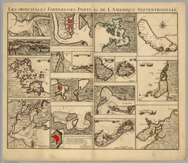
[Covens, Jean, Mortier, Corneille, (Popple, Henry)]
Full Title
Les Principales Forteresses Ports &c. De L'Amerique Septentrionale. I.K.S.
Publisher
Covens & Mortier
Author
[Fremin, A.R., Monin, C.V., Montemont, A.]
Full Title
Amerique Septentrionale. Dressee par C.V. Monin. Publiee par Armand Aubree, Editeur. Rue Taranne, 14, a Paris. Grave sur Acier par L. Grenier, Rue des Noyers, No. 33. Imprime par Mangeon. Ecrit par Benard, Rue du Foin, S.Jacques, 51. (1837)
Publisher
Armand Aubree.
Author
Bowen, Emanuel
Full Title
An accurate map of the West Indies. Drawn from the best authorities, assisted by the most approved modern maps and charts, and regulated by astronomical observations. By Eman: Bowen. (London: Printed for William Innys, Richard Ware, Aaron Ward, J. and P. Knapton, John Clarke, T. Longman and T. Shewell, Thomas Osborne, Henry Whitridge ... M.DCC.XLVII)
Publisher
William Innys [et al.]
Author
Moll, Herman, d. 1732
Full Title
A map of the West-Indies &c., Mexico or New Spain. Also ye trade winds, and ye several tracts made by ye Galeons and Flota from place to place. By H. Moll Geographer. (Printed and sold by Tho: Bowles next ye Chapter House in St. Pauls Church Yard, & Ino: Bowles at ye Black Horse in Cornhill, 1736?)
Publisher
Thos. Bowles and John Bowles
1-4 of 4
|