Who What Where WhenREMOVE |
Author
Berghaus, Hermann
Full Title
Alpenlander. (with) Aus den Dolomiten n. v. Mojsisovics. Entw. v. Herm. Berghaus 1889, Ausg. 1890. Gest. v. A. Herrmann. Gotha: Justus Perthes (1892)
Publisher
Justus Perthes
Author
Berghaus, Hermann
Full Title
Asien und Europa. (with) Japan von Dr. Edm. Naumann, Korea von Dr. C. Gottsche. (with) Indisches Salz-Gebirge. (with) Lavastrom des Asama Jama von J(ahr) 1783. (with) Java nach F. Junghulm. Entw. v. Herm. Berghaus 1887, Ausg. 1889. Gest. v. K. Poppey u. P. Grabhein. Gotha: Justus Perthes (1892)
Publisher
Justus Perthes
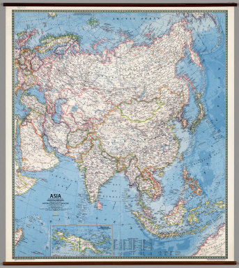
Author
[Rogers, Richard, National Geographic Society]
Full Title
Asia.
Publisher
National Geographic Society
Author
Rand McNally
Full Title
Physical/Political Europe.
Publisher
Rand McNally
Author
[Brockhaus, F.A., Leeder, Ehrenfried, Leutemann, Heinrich]
Full Title
Europa.
Publisher
F.A. Brockhaus
Author
Klett-Perthes
Full Title
Asia. Political
Publisher
Justus Perthes Verlag Gotha GmbH
Author
Klett-Perthes
Full Title
Asia. Physical.
Publisher
Justus Perthes Verlag Gotha GmbH
Author
Wyld, James, 1812-1887
Full Title
Europe. London, James Wyld, Charing Cross East. (to accompany) An Atlas of the World, Comprehending Separate Maps of its various Countries, Constructed & drawn from the latest Astronomical & Geographical Observations. By James Wyld, Geographer to Her Majesty and H. Late R.H. Prince Albert. London. Published by James Wyld (Successor to Mr. Faden) Charing Cross East. 1864.
Publisher
James Wyld
Author
Wyld, James, 1812-1887
Full Title
England & Wales. J.W. del. London, James Wyld, Charing Cross East. (to accompany) An Atlas of the World, Comprehending Separate Maps of its various Countries, Constructed & drawn from the latest Astronomical & Geographical Observations. By James Wyld, Geographer to Her Majesty and H. Late R.H. Prince Albert. London. Published by James Wyld (Successor to Mr. Faden) Charing Cross East. 1864.
Publisher
James Wyld
Author
Wyld, James, 1812-1887
Full Title
Scotland. J.W. del. (engraved by) Stockley, Sc. London, James Wyld, Charing Cross East. (to accompany) An Atlas of the World, Comprehending Separate Maps of its various Countries, Constructed & drawn from the latest Astronomical & Geographical Observations. By James Wyld, Geographer to Her Majesty and H. Late R.H. Prince Albert. London. Published by James Wyld (Successor to Mr. Faden) Charing Cross East. 1864.
Publisher
James Wyld
Author
Wyld, James, 1812-1887
Full Title
Map of Ireland Divided into Provinces and Counties. J.W. del. (engraved by) Stockley, Sc. London, James Wyld, Charing Cross East. (to accompany) An Atlas of the World, Comprehending Separate Maps of its various Countries, Constructed & drawn from the latest Astronomical & Geographical Observations. By James Wyld, Geographer to Her Majesty and H. Late R.H. Prince Albert. London. Published by James Wyld (Successor to Mr. Faden) Charing Cross East. 1864.
Publisher
James Wyld
Author
Wyld, James, 1812-1887
Full Title
Holand & Belgium formerly Kingdom of the Netherlands. J.W. del. (engraved by) Stockley Sc.London, James Wyld, Charing Cross East. (to accompany) An Atlas of the World, Comprehending Separate Maps of its various Countries, Constructed & drawn from the latest Astronomical & Geographical Observations. By James Wyld, Geographer to Her Majesty and H. Late R.H. Prince Albert. London. Published by James Wyld (Successor to Mr. Faden) Charing Cross East. 1864.
Publisher
James Wyld
Author
Wyld, James, 1812-1887
Full Title
France in provinces. J.W. del. (engraved by) Stockley Sc. London, James Wyld, Charing Cross East. (to accompany) An Atlas of the World, Comprehending Separate Maps of its various Countries, Constructed & drawn from the latest Astronomical & Geographical Observations. By James Wyld, Geographer to Her Majesty and H. Late R.H. Prince Albert. London. Published by James Wyld (Successor to Mr. Faden) Charing Cross East. 1864.
Publisher
James Wyld
Author
Wyld, James, 1812-1887
Full Title
France in Departments. J.W. del. (engraved by) Stockley Sc. London, James Wyld, Charing Cross East. (to accompany) An Atlas of the World, Comprehending Separate Maps of its various Countries, Constructed & drawn from the latest Astronomical & Geographical Observations. By James Wyld, Geographer to Her Majesty and H. Late R.H. Prince Albert. London. Published by James Wyld (Successor to Mr. Faden) Charing Cross East. 1864.
Publisher
James Wyld
Author
Wyld, James, 1812-1887
Full Title
Kingdoms of Spain and Portugal. J.W. del. (engraved by) Stockley Sc. London, James Wyld, Charing Cross East. (to accompany) An Atlas of the World, Comprehending Separate Maps of its various Countries, Constructed & drawn from the latest Astronomical & Geographical Observations. By James Wyld, Geographer to Her Majesty and H. Late R.H. Prince Albert. London. Published by James Wyld (Successor to Mr. Faden) Charing Cross East. 1864.
Publisher
James Wyld
Author
Wyld, James, 1812-1887
Full Title
Switzerland. J.W. del. (engraved by) Stockley Sculp. London, James Wyld, Charing Cross East. (to accompany) An Atlas of the World, Comprehending Separate Maps of its various Countries, Constructed & drawn from the latest Astronomical & Geographical Observations. By James Wyld, Geographer to Her Majesty and H. Late R.H. Prince Albert. London. Published by James Wyld (Successor to Mr. Faden) Charing Cross East. 1864.
Publisher
James Wyld
Author
Wyld, James, 1812-1887
Full Title
Italy. (inset) Extent of Rome at Various Periods. J.W. del. (engraved by) Stockley Sc. London, James Wyld, Charing Cross East. (to accompany) An Atlas of the World, Comprehending Separate Maps of its various Countries, Constructed & drawn from the latest Astronomical & Geographical Observations. By James Wyld, Geographer to Her Majesty and H. Late R.H. Prince Albert. London. Published by James Wyld (Successor to Mr. Faden) Charing Cross East. 1864.
Publisher
James Wyld
Author
Wyld, James, 1812-1887
Full Title
The Confederated States of Germany with the Empire of Austria and the Kingdoms of Prussia and Poland. By James Wyld, Geographer to Her Majesty. J.W. del. (engraved by) Stockley Sculp. London, James Wyld, Charing Cross East. (to accompany) An Atlas of the World, Comprehending Separate Maps of its various Countries, Constructed & drawn from the latest Astronomical & Geographical Observations. By James Wyld, Geographer to Her Majesty and H. Late R.H. Prince Albert. London. Published by James Wyld (Successor to Mr. Faden) Charing Cross East. 1864.
Publisher
James Wyld
Author
Wyld, James, 1812-1887
Full Title
Kingdom of Denmark. J.W. del. (engraved by) Stockley Sc. London, James Wyld, Charing Cross East. (to accompany) An Atlas of the World, Comprehending Separate Maps of its various Countries, Constructed & drawn from the latest Astronomical & Geographical Observations. By James Wyld, Geographer to Her Majesty and H. Late R.H. Prince Albert. London. Published by James Wyld (Successor to Mr. Faden) Charing Cross East. 1864.
Publisher
James Wyld
Author
Wyld, James, 1812-1887
Full Title
Kingdoms of Sweden and Norway. J.W. del. (engraved by) Stockley Sc. London, James Wyld, Charing Cross East. (to accompany) An Atlas of the World, Comprehending Separate Maps of its various Countries, Constructed & drawn from the latest Astronomical & Geographical Observations. By James Wyld, Geographer to Her Majesty and H. Late R.H. Prince Albert. London. Published by James Wyld (Successor to Mr. Faden) Charing Cross East. 1864.
Publisher
James Wyld
Author
Wyld, James, 1812-1887
Full Title
Russia in Europe Including Poland. J.W. del. (engraved by) Stockley Sc. London, James Wyld, Charing Cross East. (to accompany) An Atlas of the World, Comprehending Separate Maps of its various Countries, Constructed & drawn from the latest Astronomical & Geographical Observations. By James Wyld, Geographer to Her Majesty and H. Late R.H. Prince Albert. London. Published by James Wyld (Successor to Mr. Faden) Charing Cross East. 1864.
Publisher
James Wyld
Author
Wyld, James, 1812-1887
Full Title
Turkey in Europe. J.W. del. (engraved by) Stockley Sc. London, James Wyld, Charing Cross East. (to accompany) An Atlas of the World, Comprehending Separate Maps of its various Countries, Constructed & drawn from the latest Astronomical & Geographical Observations. By James Wyld, Geographer to Her Majesty and H. Late R.H. Prince Albert. London. Published by James Wyld (Successor to Mr. Faden) Charing Cross East. 1864.
Publisher
James Wyld
Author
Haack-Painke
Full Title
Asia.
Publisher
Justus Perthes Verlag Gotha GmbH
Author
Leahy, J.F.
Full Title
Leaht's Railway Distance Map of Europe. Copyrighted by J.F. Leahy, Jan., 1934. 228-234 Ontario St., Chicago, Ill.
Publisher
American Hotel register Co.
Author
Bellin, Jacques Nicolas, 1703-1772
Full Title
Carte de L'Europe.
Publisher
J.N. Bellin
Author
Bellin, Jacques Nicolas, 1703-1772
Full Title
Isles Britanniques.
Publisher
J.N. Bellin
Author
Bellin, Jacques Nicolas, 1703-1772
Full Title
Carte des entrees de la Tamise.
Publisher
J.N. Bellin
Author
Bellin, Jacques Nicolas, 1703-1772
Full Title
Plan de la Ville de Londres et aes Fauxbourga.
Publisher
J.N. Bellin
Author
Bellin, Jacques Nicolas, 1703-1772
Full Title
Carte de I'Isle de Wight.
Publisher
J.N. Bellin
Author
Bellin, Jacques Nicolas, 1703-1772
Full Title
Plan de Portsmouth et environs : Avoc les Rades de Spit Head et de Ste. Helene.
Publisher
J.N. Bellin
Author
Bellin, Jacques Nicolas, 1703-1772
Full Title
Carto de I'isle de Portsoy et havro de Portsmouth.
Publisher
J.N. Bellin
Author
Bellin, Jacques Nicolas, 1703-1772
Full Title
Plan du havre de Rye et de ses Environs.
Publisher
J.N. Bellin
Author
Bellin, Jacques Nicolas, 1703-1772
Full Title
Carte de la Baye et Port de Plimouth. Engraved by) Croisey S(culp.)
Publisher
J.N. Bellin
Author
Bellin, Jacques Nicolas, 1703-1772
Full Title
Plan des villa et Citadelle de Plymouth.
Publisher
J.N. Bellin
Author
Bellin, Jacques Nicolas, 1703-1772
Full Title
Plan de la Ville d'Yarmouth et Environs.
Publisher
J.N. Bellin
Author
Bellin, Jacques Nicolas, 1703-1772
Full Title
Carte de I'Ecosse.
Publisher
J.N. Bellin
Author
Bellin, Jacques Nicolas, 1703-1772
Full Title
Carte de Golphe d'Edinburg.
Publisher
J.N. Bellin
Author
Bellin, Jacques Nicolas, 1703-1772
Full Title
Carte des Isles d'Orkney ou Orcades.
Publisher
J.N. Bellin
Author
Bellin, Jacques Nicolas, 1703-1772
Full Title
Carte des Isles de Hetland ou Schetland.
Publisher
J.N. Bellin
Author
Bellin, Jacques Nicolas, 1703-1772
Full Title
Carte de L'Irlande.
Publisher
J.N. Bellin
Author
Bellin, Jacques Nicolas, 1703-1772
Full Title
plan de la Ville de Dublin.
Publisher
J.N. Bellin
Author
Bellin, Jacques Nicolas, 1703-1772
Full Title
Plan de Galloway et ses Environs.
Publisher
J.N. Bellin
Author
Bellin, Jacques Nicolas, 1703-1772
Full Title
Carte De La Norwege, Suede Et Laponie.
Publisher
J.N. Bellin
Author
Bellin, Jacques Nicolas, 1703-1772
Full Title
Carte Du Spits-Berg : Suivant les Hollandois.
Publisher
J.N. Bellin
Author
Bellin, Jacques Nicolas, 1703-1772
Full Title
Carte De L'Islande : Située entre le 64. et 66. Deg. de Lat. Sept.
Publisher
J.N. Bellin
Author
Bellin, Jacques Nicolas, 1703-1772
Full Title
Carte De La Mer Blanche.
Publisher
J.N. Bellin
Author
Bellin, Jacques Nicolas, 1703-1772
Full Title
Carte de la Moscovie Europeenne. I: Feuille.
Publisher
J.N. Bellin
Author
Bellin, Jacques Nicolas, 1703-1772
Full Title
Carte de la Moscovie Europeenne. II: Feuille.
Publisher
J.N. Bellin
Author
Bellin, Jacques Nicolas, 1703-1772
Full Title
Carte Du Golphe De Finlande : Suivant les Cartes Russes.
Publisher
J.N. Bellin
|