Who What Where WhenREMOVE |
Full Title
Florida. (with) Plan of Tallahassee. (with) Plan of Pensacola. (Written and engraved by Jos. Perkins. 1845)
Publisher
Tanner's Geographical Establishment
Author
Rand McNally and Company
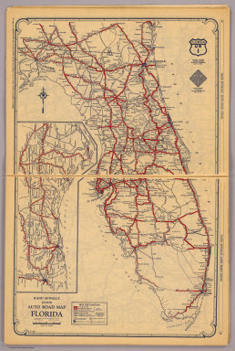
Full Title
Rand McNally junior auto road map Florida. Copyright by Rand McNally & Co., Chicago, Ill. (1927)
Publisher
Rand McNally
Author
Rand McNally and Company
Full Title
Atlanta and vicinity. Jacksonville and vicinity. Memphis and vicinity. Cleveland and vicinity. Copyright by Rand McNally & Co., Chicago, Ill. (1927)
Publisher
Rand McNally
Author
Greenleaf, Jeremiah
Full Title
Map of the State of Florida.
Publisher
J. Greenleaf.
Author
Lucas, Fielding Jr.
Full Title
Florida. Drawn and Published by F. Lucas Jr., Baltimore. B.T. Welch & Co. (1822)
Publisher
Fielding Lucas
Author
Colton, G.W.
Full Title
Florida. No. 30. Published by J.H. Colton & Co., No 172 William St., New York. Entered according to the Act of Congress in the year 1855 by J.H. Colton & Co. in the Clerk's Office of the District Court of the United States for the Southern District of New York.
Publisher
J.H. Colton
Author
Burr, David H., 1803-1875
Full Title
Map of the Territory of Florida. W.F.H. & J.H. Sc. Entered ... 1834 by Illman & Pilbrow ... New York.
Publisher
D.S. Stone
Author
Finley, Anthony
Full Title
Map of Florida according to the Latest Authorities. (with) Comparative Elevation of the Principal Mountains Cities &c. in North & South America. J.H. Young Sc. Philadelphia Published by A. Finley 1826.
Publisher
Anthony Finley
Author
Mitchell, Samuel Augustus
Full Title
Map Of Florida according to the Latest Authorities. Published by S. Augustus Mitchell Philadelphia. 1834. (inset) Comparative Elevation of the Principal Mountains , Cities &e. in North & South America. (with map) The West Indies from the Best Authorities. Published by S. Augustus Mitchell Philadelphia. 1834.
Publisher
S. Augustus Mitchell
Author
Leahy, J.F.
Full Title
(Index Page to) Leahy's Hotel Guide and Railway Distance Maps. Florida.
Publisher
American Hotel register Co.
Author
Leahy, J.F.
Full Title
Leahy's Hotel Guide and Railway Distance Map of the State of Florida. Published by American Hotel Register Company. Leahy Build., 228-234 W. Ontario St., Chicago, Ill. Copyrighted by J.F. Leahy, Jan., 1934. (inset) Continuation of the map.
Publisher
American Hotel register Co.
Author
Leahy, J.F.
Full Title
(Index Page to) Leahy's Hotel Guide and Railway Distance Maps. Florida.
Publisher
American Hotel register Co.
Author
Leahy, J.F.
Full Title
Leahy's Hotel Guide and Railway Distance Map of the State of Florida. Published by American Hotel Register Company. Leahy Build., 228-234 W. Ontario St., Chicago, Ill. Copyrighted by J.F. Leahy, Jan., 1934. (inset) Continuation of the map.
Publisher
American Hotel register Co.
Author
[Gray, Ormando Willis, Lloyd, H.H., Walling, H. F.]
Full Title
Atlas of the United States. Florida, Georgia, and South Carolina. (Published by Stedman, Brown & Lyon, Cincinnati. 1872. Entered ... 1872, by H.F. Walling, and O.W. Gray, and H.H. Lloyd & Co. ... Washington)
Publisher
Stedman, Brown & Lyon
Author
Bradford, Thomas G.
Full Title
Florida. Entered ... 1838, by T.G. Bradford ... Massachusetts. Engraved by G.W. Boynton.
Publisher
[Weeks, Jordan & Co., Wiley and Putnam.]
Author
Bellin, Jacques Nicolas, 1703-1772
Full Title
Carte De La Coste De La Floride depuis la Baye de la Mobile jusqu'aux Cayes de St. Martin.
Publisher
J.N. Bellin
Author
Bellin, Jacques Nicolas, 1703-1772
Full Title
Carte des isles Lucayes.
Publisher
J.N. Bellin
Author
Bellin, Jacques Nicolas, 1703-1772
Full Title
Isle de Cube.
Publisher
J.N. Bellin
Author
[Rose, Theodore F., Woolman, H. C.]
Full Title
Moncrief House, Jacksonville, Florida. (with) Sea Side House, Atlantic City, N.J. (both) Chas. Evans, propr. (Philadelphia, Woolman & Rose, 1878).
Publisher
Woolman & Rose
Author
W. & A.K. Johnston Limited
Full Title
Florida. Wisconsin, Michigan.
Publisher
W. & A.K. Johnston Limited
Author
U.S. General Land Office
Full Title
(Map 1 - Florida) (portion of title block shown reads:) of the United States and Territories showing the extent of Public Surveys, Indian and Military Reservations, Land Grants R.R., Rail Roads, Canals, Cities, Towns & other Details. Compiled from the Official Surveys of the General Land Office, and other authentic Sources, under the Direction of the Committee of Public Lands, House of Representatives, by W.L. Woods, Clerk of the Committee ... C. Roeser, Chief Draughtsman. Revised and Corrected to 1878. Copyright 1878 by W.L. Woods.
Publisher
Julius Bien
Author
U.S. General Land Office
Full Title
(Map 5 - Texas, Lousiana).
Publisher
Julius Bien
Author
Mitchell, Samuel Augustus
Full Title
Florida. Published By S. Augustus Mitchell. N.E. corner of Market & 7th. Streets. Philadelphia. (3 inset maps) Pensacola. Tallahassee. Harbor of St. Augustine.
Publisher
S.A. Mitchell
Author
Mitchell, Samuel Augustus Jr.
Full Title
County map of Florida. Entered ... 1874, by S. Augustus Mitchell ... Washington. (with inset map) Mobile
Publisher
S.A. Mitchell Jr.
Author
Mitchell, Samuel Augustus Jr.
Full Title
County map of Florida. Entered ... 1876 by S. Augustus Mitchell, . ... Washington. (inset map): Mobile.
Publisher
S.A. Mitchell Jr.
Author
Johnson, A.J.
Full Title
Johnson's Florida By Johnson & Browning. (with) Plan Of The Florida Keys. No. 30.
Publisher
Johnson and Browning
Author
Mitchell, Samuel Augustus
Full Title
Florida. (insets) Pensacola. Tallahassee. Harbour of St. Augustine.
Publisher
Thomas, Cowperthwait & Co.
Author
Mitchell, Samuel Augustus
Full Title
A New Map of Florida. Published by Charles Desilver, No. 251 Market St. Philadelphia. Entered ... 1856 by Charles Desilver ... Pennsylvania.
Publisher
Charles DeSilver
Author
[Raynal, G.T., Bonne, R.]
Full Title
Carte de la Louisiane, et de la Floride. Par M. Bonne, Ingenieur-Hydrographe de la Marine. (on upper margin) Liv. XVI. : No. 46. (and) 47. (to accompany) Histoire Philosophique et Politique Des Establissements et Du Commerce Des Europeens Dans Les Deux Indes.
Publisher
Jean-Leonard Pellet
Author
Tanner, Henry S.
Full Title
Florida Canal ; Morris Canal N. J. ; Union Canal Pa. ; Schuylkill Navigation Penn. ; Profile of the Pennsylvania Canal. (with inset profile) Columbia railroad Pa. (to accompany) A Description of the Canals and Railroads of the United States.
Publisher
T.R. Tanner & J. Disturnell
Author
[Blunt, Edmund M. (Edmund March), 1770-1862, Gauld, George.]
Full Title
(The Bahama Banks and Gulf of Florida by Edmund Blunt, hydrographer. East sheet. Engd. by R.M. Gaw, N.Y. Entered according to Act of Congress , the 30th day of October 1826 by E. & G.W. Blunt, of the State of New York. New York: published by E. & G.W. Blunt, 1827)
Publisher
E. & G.W. Blunt.
Author
[Blunt, Edmund M. (Edmund March), 1770-1862, Gauld, George.]
Full Title
The Bahama Banks and Gulf of Florida by Edmund Blunt, hydrographer. (West sheet). (with) Chart of Key West by George Gauld. Engd. by R.M. Gaw, N.Y. Entered according to Act of Congress , the 30th day of October 1826 by E. & G.W. Blunt, of the State of New York. New York: published by E. & G.W. Blunt, 1827.
Publisher
E. & G.W. Blunt.
Author
[Blunt, Edmund M. (Edmund March), 1770-1862, Gauld, George.]
Full Title
(Composite of) The Bahama Banks and Gulf of Florida by Edmund Blunt, hydrographer. (with) Chart of Key West by George Gauld. Engd. by R.M. Gaw, N.Y. Entered according to Act of Congress , the 30th day of October 1826 by E. & G.W. Blunt, of the State of New York. New York: published by E. & G.W. Blunt, 1827.
Publisher
E. & G.W. Blunt.
Author
[Blunt, Edmund M. (Edmund March), 1770-1862, Gauld, George.]
Full Title
The coasts of West Florida, Alabama, Mississippi & Louisiana; drawn from the surveys of Gauld, and improved from other authorities. By Edmund Blunt. New-York, published by E. & G.W. Blunt. No. 154 Water Street, corner of Maiden Lane, 1828. Engraved & printed at W. Hooker's office, New York.
Publisher
E. & G.W. Blunt.
Author
National Map Company
Full Title
Florida. (Copyrighted by) National Map Company, Indianapolis. (inset map) Northwestern portion of Florida. (to accompany) Official Paved Road and Commercial Survey of the United States.
Publisher
National Map Company
Author
Mitchell, Samuel Augustus Jr.
Full Title
County map of Florida. (inset map) 36. Mobile. Entered ... 1867 by S. Augustus Mitchell, Jr. ... Pennsylvania.
Publisher
S.A. Mitchell Jr.
Author
[Julius Bien & Co., United States. War Department]
Full Title
General topographical map. Sheet X. Julius Bien & Co., Lith., N.Y. (1891-1895)
Publisher
U.S. Government Printing Office
Author
[Julius Bien & Co., United States. War Department]
Full Title
General topographical map. Sheet XI. Julius Bien & Co., Lith., N.Y. (1891-1895)
Publisher
U.S. Government Printing Office
Author
[Julius Bien & Co., United States. War Department]
Full Title
General topographical map. Sheet XII. Julius Bien & Co., Lith., N.Y. (1891-1895)
Publisher
U.S. Government Printing Office
Author
[Hinton, Isaac Taylor, 1799-1847, Simpkin & Marshall]
Full Title
Map of the state of Florida. London, published April 1, 1832 by I.T. Hinton & Simpkin & Marshall. Engraved & printed by Fenner Sears & Co. (1832)
Publisher
[Simpkin & Marshall, Thomas Wardle]
Author
Jefferys, Thomas
Full Title
The Coast of West Florida and Louisiana. By Thos. Jefferys, Geographer to His Majesty. (London, printed for Robt. Sayer, Map & Printseller, no. 53 Fleet Street, as the Act directs 20th Feby. 1775)
Publisher
Sayer and Bennett
Author
Jefferys, Thomas
Full Title
The Peninsula and Gulf of Florida or Channel of Bahama with the Bahama Islands. By Thos. Jefferys, Geographer to His Majesty. London, printed for Robt. Sayer, Map & Printseller, no. 53 in Fleet Street, as the Act directs 20 Feby. 1775.
Publisher
Sayer and Bennett
Author
Jefferys, Thomas
Full Title
The Island of Cuba with part of the Bahama Banks & the Martyrs. By Thos. Jefferys, Geographer to his Majesty. London, printed for Robt. Sayer, Map & Printseller, no. 53 in Fleet Street, as the Act directs 20 Feby. 1775.
Publisher
Sayer and Bennett
Full Title
N. & S. Carolina, Georgia & Florida. J.H. Young Sc. (Philadelphia: John Grigg, No. 9 North Fourth Street. 1830)
Publisher
John Grigg
Author
Letts, Son & Co.
Full Title
Eastern United States. No. 10. Letts's popular atlas. Letts, Son & Co. Limited, London. (1883)
Publisher
Letts, Son & Co.
Author
Robert Laurie & James Whittle
Full Title
A new and general map of the southern dominions belonging to the United States of America, viz: North Carolina, South Carolina, and Georgia: with the bordering Indian countries, and the Spanish possessions of Louisiana and Florida. (with) Plan of Charlestown. (with) Plan of St. Augustine. London, Published by Laurie & Whittle, No. 53, Fleet Street, as the act directs 12th May, 1794.
Publisher
Laurie & Whittle
Author
Lloyd, H.H.
Full Title
Atlas of the United States. Florida, Georgia, and South Carolina. (by H.H. Lloyd. Published by Stedman, Brown & Lyon, Baltimore. 1873)
Publisher
Stedman, Brown & Lyon
Author
Poussin, Guillaume Tell, 1794-1876
Full Title
Carte generale de la Floride et du Delta du Mississippi, presentant le trace du canal projete de l'Ocean Atlantique au Golfe du Mexique, a travers l'Isthme des Florides, ainsi qui l'ensemble des ameliorations projetees ou en cours d'execution qui one ete recommandees par la Commission des ameliorations interieures pour completer le systeme de navigation interieure parallele a la cote. (with) Entree du Fleuve St. Jean. (with) Entree de la Rade et de la Riviere Ste. Marie. (with) Entree du Port Ste. Augustine. Dessine par le Major Poussin. Grave par (V.?) Adam. (1834)
Publisher
[Libraire Anselin, Libraire Carilian-Goeury]
Author
Poussin, Guillaume Tell, 1794-1876
Full Title
Plans hydrographiques des baies, rades, ports et detroits des Florides sur le Golfe du Mexique. Dessine par le Major Poussin. Grave par (V.?) Adam. (1834)
Publisher
[Libraire Anselin, Libraire Carilian-Goeury]
|