Browse All

1862 Cover: Virginia, Maryland, Delaware. Case Map (Covers to) Colton's New Topographical M … |

1862 Virginia, Maryland, Delaware. Case Map Colton's New Topographical Map of The St … |

1864 Panorama of the Seat of War View Panorama of the Seat of War. Birds Eye V … |

1862 Part of Washington County, MD. Separate Map Part of Washington County, MD. Bureau of … |

1861 Washington County Maryland Separate Map Washington County Maryland Compiled unde … |

1861 Frederick County Maryland Separate Map Frederick County Maryland Prepared under … |

1874 Planche II. Virginie et Maryland. Enviro … Military Atlas Planche II. Virginie et Maryland. (inset … |

1875 Planche XVI. Antietam (Maryland). Cedar … Military Atlas Planche XVI. Antietam (Maryland). Cedar … |

1875 Planche XXIV. Vallee du Monocacy et Cont … Military Atlas Planche XXIV. Vallee du Monocacy et Cont … |

1869 Antietam. Military Atlas Antietam. Prepared by Bvt. Brig. Gen N. … |

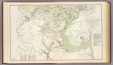
1895 N.E. Virginia, Washington 1. Military Atlas Surveys for military defenses. Map of no … |
1895 N.E. Virginia, Washington 2. Military Atlas Surveys for military defenses. Map of no … |

1895 Mil. depts. of Wash., Penn., Annapolis, … Military Atlas Part of map of portions of the military … |

1895 Antietam, Suffolk, Gettysburg. Military Atlas Map of the battle of the Antietam fought … |

1895 Antietam, Harper's Ferry, Sharpsburg. Military Atlas Antietam. Prepared by Bvt. Brig. Gen. N. … |

1895 Harper's Ferry, Hagerstown, Funkstown, W … Military Atlas Military map showing the topographical f … |

1895 Orange Co., Va., Mine Run, Rapidan River … Military Atlas Map of Orange County &c., Va. embracing … |

1895 Texas, pt. of N.M. Military Atlas Map of Texas and part of New Mexico, com … |

1895 Upper Potomac McCoys Ferry-Conrads Ferry … Military Atlas Engineer Office, Military Division of th … |

1895 2d Corps A.N. Va., camps, pickets, route … Military Atlas No. 1. Map from Maj. A.H. Campbell's sur … |

1895 Belle Grove battle. Military Atlas No. 29. Sketch of the battle of Belle Gr … |

1895 Hanging Rock; Monocacy. Military Atlas No. 10. Map of engagement at Hanging Roc … |

1895 Winchester, Cedar Run, Port Republic, Va … Military Atlas Map of route of the Army of the Valley f … |

1895 Washington, Richmond. Military Atlas Defenses of Washington. Extract of milit … |

1895 Alleghanies, Valley of Virginia. Military Atlas A map of a line of defenses in the Alleg … |

1895 Route, Gettysburg campaign. Military Atlas Route map of Gettysburg campaign. Prepar … |

1861 Covers: Topographical Map of Seat Of War … Pocket Map (Covers to) J.H. Colton's Topographical … |

1861 Topographical Map of Seat Of War In Virg … Pocket Map J.H. Colton's Topographical Map of Seat … |

1862 Covers: Topographical Map of the Seat Of … Pocket Map (Covers to) J.H. Colton's Topographical … |

1862 Topographical Map of the Seat Of War In … Pocket Map J.H. Colton's Topographical Map of the S … |

1861 Our Nation's Camp Ground. Separate Map Our Nation's Camp Ground. Published By E … |

1861 Map of the seat of war. Published by T.A … Separate Map Map of the seat of war. Published by T.A … |

1861 Cover: Panorama, Seat of War, Virginia, … View (Covers to) Panorama of the Seat of War. … |

1861 Virginia, Maryland Delaware And The Dist … View Panorama of the Seat of War. Birds Eye V … |

1861 Military Portraits. Broadside Military Portraits. Glossary Of War Term … |

1861 Map of New Orleans and Surrounding Count … Newspaper Map of New Orleans and Surrounding Count … |

1861 Cover: Map of the Seat of War. Pocket Map (Covers to) Map Of The Seat Of War Exhib … |

1861 Map Of The Seat Of War. Pocket Map Map Of The Seat Of War Exhibiting The Su … |