Who What Where WhenREMOVEWHATShow MoreWHERE
|
Author
Lay, Amos
Full Title
Map Of The Northern Part of the State Of New York. Compiled from actual Survey By Amos Lay 1812. Entered ... 16th day of July 1812 by Amos Lay ... New-York.
Publisher
Amos Lay
Author
Lay, Amos
Full Title
(Covers to) Map Of The Northern Part of the State Of New York. Compiled from actual Survey By Amos Lay 1812. Entered ... 16th day of July 1812 by Amos Lay ... New-York.
Publisher
Amos Lay
Author
Burr, David H., 1803-1875
Full Title
Map of the County of Monroe. By David H. Burr. Published by the Surveyor General, pursuant to an Act of the Legislature. Entered according to an Act of Congress Jany. 5th. 1829 by David H. Burr of the State of New York. Engd. by Rawdon, Clark & Co., Albany & Rawdon, Wright & Co., N.Y.
Publisher
D.H. Burr
Author
Burr, David H., 1803-1875
Full Title
Map of the County of Orleans. By David H. Burr. Published by the Surveyor General, pursuant to an Act of the Legislature. Entered according to an Act of Congress Jany. 5th. 1829 by David H. Burr of the State of New York. Engd. by Rawdon, Clark & Co., Albany & Rawdon, Wright & Co., N. York.
Publisher
D.H. Burr
Author
United States Coast Survey
Full Title
Map of New - York Bay And Harbor And The Environs. Founded upon a Trigonometrical Survey under the direction of F.R. Hassler Superintendent of the Survey Of The Coast Of The United States. Triangulation by James Ferguson and Edmund Blunt Assistants. The Hydrography under the direction of Thomas R. Gedney Lieutenant U.S. Navy. The Topography by C. Renard, T.A. Jenkins & B.F. Sands Assists. Published in 1845. A.D. Bache Superintendent. Verified by Lieut. A.A. Humphreys ... Topography Engraved by S. Siebert & A. Rolle, Views Engraved by O.A. Lawson. Engraving supervised & Views of the Coast drawn by J. Farley. Hydrography Engraved by F. Dankworth, Lettering by F. Dankworth & J. Knight.
Publisher
U.S.
Author
United States Coast Survey
Full Title
(Covers to) Map of New - York Bay And Harbor And The Environs. Founded upon a Trigonometrical Survey under the direction of F.R. Hassler Superintendent of the Survey Of The Coast Of The United States. Triangulation by James Ferguson and Edmund Blunt Assistants. The Hydrography under the direction of Thomas R. Gedney Lieutenant U.S. Navy. The Topography by C. Renard, T.A. Jenkins & B.F. Sands Assists. Published in 1845. A.D. Bache Superintendent. Verified by Lieut. A.A. Humphreys ... Topography Engraved by S. Siebert & A. Rolle, Views Engraved by O.A. Lawson. Engraving supervised & Views of the Coast drawn by J. Farley. Hydrography Engraved by F. Dankworth, Lettering by F. Dankworth & J. Knight.
Publisher
U.S.
Author
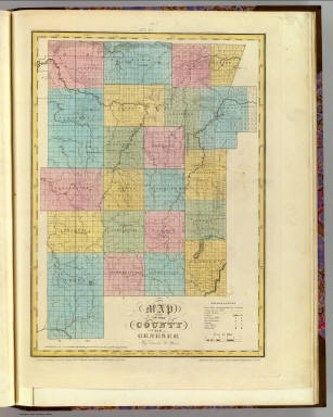
Burr, David H., 1803-1875
Full Title
Map of the County of Genesee. By David H. Burr. Published by the Surveyor General, pursuant to an Act of the Legislature. Entered according to an Act of Congress Jany. 5th. 1829 by David H. Burr of the State of New York. Engd. by Rawdon, Clark & Co., Albany & Rawdon, Wright & Co., N. York.
Publisher
D.H. Burr
Author
Burr, David H., 1803-1875
Full Title
Map of the County of Allegany. By David H. Burr. Published by the Surveyor General, pursuant to an Act of the Legislature. Entered according to an Act of Congress Jany. 5th. 1829 by David H. Burr of the State of New York. Engd. by Rawdon, Clark & Co., Albany & Rawdon, Wright & Co., N. York.
Publisher
D.H. Burr
Author
Burr, David H., 1803-1875
Full Title
Map of the County of Niagara. By David H. Burr. Published by the Surveyor General, pursuant to an Act of the Legislature. Entered according to an Act of Congress Jany. 5th. 1829 by David H. Burr of the State of New York. Engd. by Rawdon, Clark & Co., Albany & Rawdon, Wright & Co., N. York.
Publisher
D.H. Burr
Author
Burr, David H., 1803-1875
Full Title
Map of the County of Erie. By David H. Burr. Published by the Surveyor General, pursuant to an Act of the Legislature. Entered according to an Act of Congress Jany. 5th. 1829 by David H. Burr of the State of New York. Engd. by Rawdon, Clark & Co., Albany & Rawdon, Wright & Co., New York.
Publisher
D.H. Burr
Author
Burr, David H., 1803-1875
Full Title
Map of the County of Cattaraugus. By David H. Burr. Published by the Surveyor General, pursuant to an Act of the Legislature. Entered according to an Act of Congress Jany. 5th. 1829 by David H. Burr of the State of New York. Engd. by Rawdon, Clark & Co., Albany & Rawdon, Wright & Co., N. York.
Publisher
D.H. Burr
Author
Burr, David H., 1803-1875
Full Title
Map of the County of Chautauque (sic). By David H. Burr. Published by the Surveyor General, pursuant to an Act of the Legislature. Entered according to an Act of Congress Jany. 5th. 1829 by David H. Burr of the State of New York. Engd. by Rawdon, Clark & Co., Albany & Rawdon, Wright & Co., New York.
Publisher
D.H. Burr
Author
Colles, Christopher
Full Title
From New York to Stratford. (1)
Publisher
C. Colles
Author
Colles, Christopher
Full Title
From New York to Stratford. (2)
Publisher
C. Colles
Author
Colles, Christopher
Full Title
From New York to Stratford. (3)
Publisher
C. Colles
Author
Colles, Christopher
Full Title
From New York to Poughkeepsie. (8)
Publisher
C. Colles
Author
Colles, Christopher
Full Title
From New York to Poughkeepsie. (9)
Publisher
C. Colles
Author
Colles, Christopher
Full Title
From New York to Poughkeepsie. (10)
Publisher
C. Colles
Author
Colles, Christopher
Full Title
From New York to Poughkeepsie. (11)
Publisher
C. Colles
Author
Colles, Christopher
Full Title
From New York to Poughkeepsie. (12)
Publisher
C. Colles
Author
Colles, Christopher
Full Title
From New York to Poughkeepsie. (13)
Publisher
C. Colles
Author
Colles, Christopher
Full Title
From Poughkeepsie to Albany. (14)
Publisher
C. Colles
Author
Colles, Christopher
Full Title
From Stratford to Poughkeepsie. (18)
Publisher
C. Colles
Author
Colles, Christopher
Full Title
From Stratford to Poughkeepsie. (19)
Publisher
C. Colles
Author
Colles, Christopher
Full Title
From Stratford to Poughkeepsie. (20)
Publisher
C. Colles
Author
Colles, Christopher
Full Title
From Poughkeepsie to Albany. (21)
Publisher
C. Colles
Author
Colles, Christopher
Full Title
From Poughkeepsie to Albany. (22)
Publisher
C. Colles
Author
Colles, Christopher
Full Title
From Poughkeepsie to Albany. (23)
Publisher
C. Colles
Author
Colles, Christopher
Full Title
From Poughkeepsie to Albany. (24)
Publisher
C. Colles
Author
Colles, Christopher
Full Title
From Poughkeepsie to Albany. (25)
Publisher
C. Colles
Author
Colles, Christopher
Full Title
From Albany to Newborough (26).
Publisher
C. Colles
Author
Colles, Christopher
Full Title
From Albany to Newborough (27).
Publisher
C. Colles
Author
Colles, Christopher
Full Title
From Albany to Newborough (28).
Publisher
C. Colles
Author
Colles, Christopher
Full Title
From Albany to Newborough (29).
Publisher
C. Colles
Author
Colles, Christopher
Full Title
From Albany to Newborough (30).
Publisher
C. Colles
Author
Colles, Christopher
Full Title
From Albany to Newborough (31).
Publisher
C. Colles
Author
Colles, Christopher
Full Title
From Albany to Newborough (32).
Publisher
C. Colles
Author
Colles, Christopher
Full Title
From Albany to Newborough (33).
Publisher
C. Colles
Author
Colles, Christopher
Full Title
From New York to Elizabethtown. (40)
Publisher
C. Colles
Author
Mitchell, Samuel Augustus
Full Title
Map of the Middle States. Engraved to Illustrate Mitchell's School and Family Geography. No. 7. Engraved by J.H. Young. Entered ... 1839, by S. Augustus Mitchell ... Connecticut.
Publisher
Thomas, Cowperthwait & Co.
Author
Smiley, Thomas T.
Full Title
Middle States.
Publisher
Hogan & Thompson
Author
Robert Sayer and John Bennett (Firm)
Full Title
A Survey of Lake Champlain, including Lake George, Crown Point and St. John. Surveyed by Order of His Excellency Major-General Sr. Jeffery Amherst, Knight of the most Honble. Order of the Bath, Commander in Chief of His Majesty's Forces in North America, (now Lord Amherst) by William Brassier, Draughtsman. (with) A Particular Plan of Lake George. Surveyed in 1756. By Capt. Jackson. London: Printed for Robt. Sayer & Jno. Bennett ... Augst. 5th 1776.
Publisher
Sayer and Bennett
Author
Magnus, Charles
Full Title
Map of The City of Buffalo. Chs. Magnus lith. New York. (Hand colored map on a letter sheet).
Publisher
Charles Magnus
Author
Damerum, William
Full Title
Map of the Southern part of the State of New York including Long Island, the Sound, the State of Connecticut, part of the State of New Jersey and Islands adjacent. Compiled from actual late Surveys. Designed, Drawn and Published 1815 by Wm. Damerum, General Surveyor, New York. Copy Secured. P. Maverick sct.
Publisher
W. Damerum
Author
[Carey, Mathew, Lewis, Samuel]
Full Title
The State of New York Compiled from the best Authorities, By Samuel Lewis. 1795.
Publisher
Mathew Carey
Author
[Collot, George Henri Victor, Tardieu, P.F.]
Full Title
Plan of Fort Niagara. PL. 4.
Publisher
Arthus Bertrand
Author
Tanner, Henry S.
Full Title
New York By H.S. Tanner. Engraved & Published by Tanner, Vallance, Kearny & Co. No. 10 Library St. Philadelphia. Entered ... 12th day of May 1819, by Tanner, Vallance, Kearny & Co. ... Pennsylvania. American Atlas.
Publisher
Henry Tanner
Author
Anderson, P.
Full Title
Map Exhibiting The Experimental and Located Lines for the New-York and New-Haven Rail-Road ... Projected and Drawn by P. Anderson Civil Engr. Scale 1 to 40,000. Febr. 1845. Snyder & Black Lithogrs. 87 Fulton St. New-York.
Publisher
Snyder & Black Lithogrs.
Author
Arbuckle Bros.
Full Title
New York, Delaware, Tennessee, New Hampshire. Copyright 1889 Arbuckle Bros. N.Y.
Publisher
Arbuckle Bros.
Author
Mitchell, Samuel Augustus
Full Title
Map Of The State Of New York. Published by S. Augustus Mitchell Philadelphia. 1831. J.H. Young Sc. (inset) Map of the Hudson River from New York To Albany. (inset) Profile of the Levels of the Grand Erie Canal.
Publisher
S.A. Mitchell
|