Browse All

1848 Covers: Hudson River Guide Book (Covers to) Travellers' Guide of the Hud … |

1848 Hudson River Guide Book Travellers' Guide of the Hudson River. P … |

1879 Covers: New York Wilderness And The Adir … Pocket Map (Covers to) Map Of The New York Wilderne … |

1879 New York Wilderness And The Adirondacks Pocket Map Map Of The New York Wilderness And The A … |

1851 Covers: Brooklyn with Part of New York Pocket Map (Covers to) City Of Brooklyn with Part o … |

1851 Brooklyn, Vicinity of New York and Willi … Pocket Map City Of Brooklyn with Part of New York. … |

1891 Index map. City Atlas Index map showing the area covered by th … |

1891 New York City, County. City Atlas City and county of New York. Copyrighted … |

1891 Brooklyn, N.Y. Bay, Jersey City, Hoboken … City Atlas Brooklyn, New York Bay, Jersey City, Hob … |

1891 Narrows-Jamaica Bay, Brooklyn. City Atlas The Narrows to Jamaica Bay-Coney Island, … |

1891 Richmond Co., Staten Island. City Atlas Richmond County, Staten Island. Copyrigh … |

1891 Long I. Sound, Westchester, Queens. City Atlas Long Island Sound, Westchester north to … |

1891 Westchester Co., Yonkers-state line. City Atlas Westchester County, Yonkers to Dobbs Fer … |

1891 Westchester Co., Irvington-state line. City Atlas Westchester County, Irvington, Tarrytown … |

1891 Contents: Atlas Metropolitan District. City Atlas (Contents to) Atlas of the Metropolitan … |

1874 County map of the state of New York World Atlas County map of the state of New York. Dra … |

1877 County map of the State of New York World Atlas County map of the State of New York. Dra … |

1850 New York. World Atlas A New Map of New York. |

1865 North America Sheet III. World Atlas North America Sheet III, West Canada wit … |

1857 Map of the State of New York World Atlas Map of the State of New York, Compiled f … |

1891 Westchester Co., Scarborough-Putnam Co. … City Atlas Westchester County, Scarborough to Putna … |

1891 Croton Lake vicinity. City Atlas Westchester County, vicinity of Croton L … |

1891 Westchester Co., Bedford-state line. City Atlas Westchester County, Bedford to state lin … |

1891 Cover: Atlas Metropolitan District. City Atlas (Covers to) Atlas of the Metropolitan Di … |
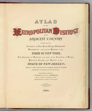
1891 Title Page: Atlas Metropolitan District. City Atlas (Title Page to) Atlas of the Metropolita … |

1837 Route of the Western railroad. West of C … Pamphlet Route of the Western railroad. West of C … |

1837 Route of the Western railroad. East of C … Pamphlet Route of the Western railroad. East of C … |

1840 A new map of New York with its canals, r … Guide Book A new map of New York with its canals, r … |

1840 Profile of the Erie Canal. Profile of th … Guide Book Profile of the Erie Canal N.Y. ; Profile … |

1860 New York. World Atlas Johnson's New York By Johnson & Browning … |

1827 The harbour of New York, Entrance to Che … Chart Atlas The harbour of New York surveyed by Edmu … |

1874 Plan of the State of New York. County Atlas Plan of the State of New York. Drawn and … |

1867 Map of New York and Vicinity Accompanyin … County Atlas Map of New York and Vicinity Accompanyin … |

1927 New York National Atlas New York. (Copyrighted by) National Map … |

1868 County map of the State of New York World Atlas County map of the State of New York. (wi … |

1868 Plan of New York &c. World Atlas Plan of New York &c. Entered ... 1867 by … |

1830 New England, N.Y. 1697. National Atlas New England and New York in 1697. From t … |

1831 New York. National Atlas Map of the state of New York, with part … |

1857 New York and its Environs. National Atlas New York and its Environs. London ... & … |

1844 Upper Canada &c. World Atlas Upper Canada &c. By J. Arrowsmith. (Map) … |

1864 Principal cities U.S. School Atlas Principal cities of the United States. E … |

1850 (New York) School Atlas State of (to be filled in). Drawn by (to … |

1891 4 Yonkers, Bergen Co. County Atlas Portion of Yonkers and 24th ward. Portio … |

1891 5 Bergen Co., Yonkers. County Atlas Portion of Bergen County, N.J. Portion o … |

1891 E1 Yonkers S. County Atlas Plan of southern part of the city of Yon … |

1891 E2 Hastings, Yonkers N. County Atlas Plan of Hastings, northern part of Yonke … |

1891 6 Rockland, Westchester counties. County Atlas Portion of Rockland County. Portion of W … |

1811 Map Of The Country Thirty Miles Round th … Case Map Map Of The Country Thirty Miles Round th … |

1817 N. United States. World Atlas Northern provinces of the United States. … |

1891 Cover: Atlas Hudson River Valley. County Atlas (Covers to) Atlas of the Hudson River Va … |