Who What Where WhenREMOVE |
Author
[Codazzi, Agustín, 1793-1859, Paz, Manuel María, 1820-1902]
Full Title
Division politica de Colombia en 1824. Grabado por Erhard Hermanos, 8 Calle Nicole, Paris. (to accompany) Atlas geografico e historico de la Republica de Colombia (Antigua Nueva Granada).
Publisher
A. Lahure
Author
[Codazzi, Agustín, 1793-1859, Paz, Manuel María, 1820-1902]
Full Title
Carta de la Nueva Granada: dividida en provincias; 1832 a 1856; Uti-possidetis de 1810. Grabado por Erhard Hermanos, 8 Calle Nicole, Paris. (to accompany) Atlas geografico e historico de la Republica de Colombia (Antigua Nueva Granada).
Publisher
A. Lahure
Author
[Codazzi, Agustín, 1793-1859, Paz, Manuel María, 1820-1902]
Full Title
Carta de la Republica de Colombia (Antigua Nueva Granada) : dividida en departmentos ; 1886. Grabado por Erhard Hermanos, 8 Calle Nicole, Paris. (to accompany) Atlas geografico e historico de la Republica de Colombia (Antigua Nueva Granada).
Publisher
A. Lahure
Author
[Codazzi, Agustín, 1793-1859, Paz, Manuel María, 1820-1902]
Full Title
Carta que representa el sistema orografico y las vertientes y hoyas hidrograficas de Colombia. Grabado por Erhard Hermanos, 8 Calle Nicole, Paris. (to accompany) Atlas geografico e historico de la Republica de Colombia (Antigua Nueva Granada).
Publisher
A. Lahure
Author
[Codazzi, Agustín, 1793-1859, Paz, Manuel María, 1820-1902]
Full Title
Carta de Colombia que representa los territorios que han existido desde 1843 hasta 1886 hoy extinguidos. Grabado por Erhard Hermanos, 8 Calle Nicole, Paris. (to accompany) Atlas geografico e historico de la Republica de Colombia (Antigua Nueva Granada).
Publisher
A. Lahure
Author
[Codazzi, Agustín, 1793-1859, Paz, Manuel María, 1820-1902]
Full Title
Carta geologico de algunas montanas de Colombia. (with) Rios navegables que banan el territorio Colombiano. (with) Guadro del estado del globo en sus diferentes epocas. Grabado por Erhard Hermanos, 8 Calle Nicole, Paris. (to accompany) Atlas geografico e historico de la Republica de Colombia (Antigua Nueva Granada).
Publisher
A. Lahure
Author
[Codazzi, Agustín, 1793-1859, Paz, Manuel María, 1820-1902]
Full Title
Carta geologica de Colombia : Venezuela y Ecuador. Grabado por Erhard Hermanos, 8 Calle Nicole, Paris. (to accompany) Atlas geografico e historico de la Republica de Colombia (Antigua Nueva Granada).
Publisher
A. Lahure
Author
[Codazzi, Agustín, 1793-1859, Paz, Manuel María, 1820-1902]
Full Title
Carta postal y telegrafica de la Republica de Colombia (Antigua Nueva Granada). Grabado por Erhard Hermanos, 8 Calle Nicole, Paris. (to accompany) Atlas geografico e historico de la Republica de Colombia (Antigua Nueva Granada).
Publisher
A. Lahure
Author
[Codazzi, Agustín, 1793-1859, Paz, Manuel María, 1820-1902]
Full Title
Carta de Colombia la division eclesiastica. Grabado por Erhard Hermanos, 8 Calle Nicole, Paris. (to accompany) Atlas geografico e historico de la Republica de Colombia (Antigua Nueva Granada).
Publisher
A. Lahure
Author
Mitchell, Samuel Augustus
Full Title
South America. Entered according to Act of Congress in the year 1860 by Charles Desilver in the Clerk's office if the District Court of the Eastern District of Pennsylvania. 42.
Publisher
Charles Desilver.
Author
[Johnston, Alexander Keith, 1804-1871, Rogers, Henry Darwin]
Full Title
The physical features of North & South America, showing the mountains, table-lands, plains & slopes. By A.K. Johnston, F.R.S.E. with original sections by H.D. Rogers. Engraved & printed by W. & A.K. Johnston. William Blackwood & Sons, Edinburgh & London. (1856)
Publisher
William Blackwood & Sons
Author
Debenham, Frank
Full Title
South America. (Copyright) G.P. Ltd. (with inset map)Tierra del Fuego. (view) West of Andes.
Publisher
Simon and Schuster
Author
Debenham, Frank
Full Title
South America. (Pictorial map).
Publisher
Simon and Schuster
Author
Debenham, Frank
Full Title
The Northern Half of South America. (Copyright) G.P. Ltd.
Publisher
Simon and Schuster
Author
Debenham, Frank
Full Title
The Southern Half of South America. (Copyright) G.P. Ltd. (inset) The southernmost tip of South America ...
Publisher
Simon and Schuster
Author
[Berghaus, Heinrich, Johnston, Alexander Keith, 1804-1871]
Full Title
The river systems of America, extended from the designs of Professor Berghaus, with additions of detailed maps of some of the principal hydrographical phenomena of the New World by A.K. Johnston, F.R.G.S. Corrected to 1855. Engraved by W. & A.K. Johnston. William Blackwood & Sons, Edinburgh & London. (1856)
Publisher
William Blackwood & Sons
Author
[Matthews-Northrup Division, J.W. Clement Co.]
Full Title
South America. Copyright, J.W. Clement Co., Matthews-Northrup Works, Buffalo, N.Y. (inset map) Puerto Rico and the Virgin Islands.
Publisher
World Publishing Company
Author
Rand McNally & Company
Full Title
Rand McNally Popular map of South America. Copyright by Rand McNally & Company, Chicago. Made in U.S.A.
Publisher
Rand McNally & Company
Author
[Rand McNally and Company, State Farm Insurance Companies Travel Bureau]
Full Title
Map of South and Central America. Showing proposed Inter-American Highway. Copyright by Rand McNally & Company, Chicago. Made in U.S.A. (to accompany) State Farm Road Atlas: United States, Canada, Mexico,Central and South America. Copyright 1940 by Rand McNally & Company, Chicago, Ill.
Publisher
State Farm Insurance Companies Travel Bureau
Author
[Geographisches Institut (Weimar, Germany), Kiepert, Heinrich, 1818-1899]
Full Title
Sud America. Gezeichnet v. H. Kiepert. Gestochen v. Wilh. Kratz. Weimar, Verlag des Geographischen Instituts, 1855.
Publisher
Weimar Geo Inst.
Author
Stieler, Adolf
Full Title
Sud-America. Entworfen u. gezeichnet von F. von Stulpnagel. Rev. v. Hm. Bgs. C. Stier sc. Gotha: Justus Perthes 1874.
Publisher
Justus Perthes
Author
Stieler, Adolf
Full Title
Sud-America in zwei Blattern, gezeichnet von F. von Stulpnagel. Neue berichtigte Auflage. Gotha: Justus Perthes 1873.
Publisher
Justus Perthes
Author
Stieler, Adolf
Full Title
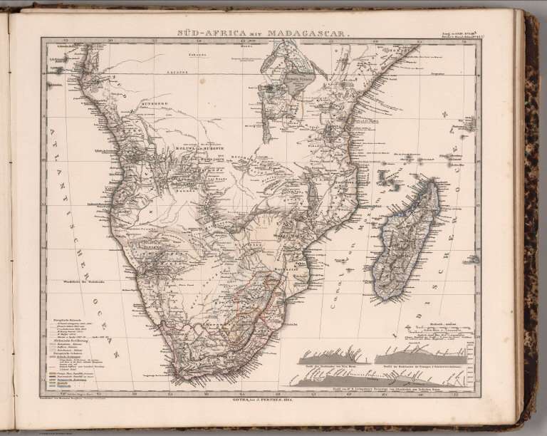
Stieler's Hand-Atlas ... No. 45c. Sud-Afrika mit Madagascar.
Publisher
Justus Perthes
Author
Stieler, Adolf
Full Title
Stieler's Hand-Atlas ... No. 45c. Sud-Afrika mit Madagascar.
Publisher
Justus Perthes
Author
[Stieler, Adolf, Stulpnagel, F.v.]
Full Title
Stieler's Hand-Atlas ... No. 49a. Sud-Amerika.
Publisher
Justus Perthes
Author
Stieler, Adolf
Full Title
Sud America : von C.G. Reichard. 1820. Th. Schriket, sc. (on upper right margin) Hand-Atl. No. 49. (to accompany) Hand-Atlas uber alle Theile der Erde, nach dem neuesten Zustande und uber das Weltgebaude. (inset) Gegend der Spanisch-Französischen Gradmessung.
Publisher
Justus Perthes
Author
Stieler, Adolf
Full Title
Der Nordliche Theil von Sud-America: enthaltend Columbia, Guyana, Peru, Brasilien und Bolivia. In Mercators Projection nach den besten Hulfsmitteln bearbeitet und gezeichnet v. Pr.L. v. Stulpnagel. Gotha, bei J. Perthes, 1828. Hase sc. Weimar. (on upper right margin) Stielers Hand-Atlas No. 49b. (to accompany) Hand-Atlas uber alle Theile der Erde, nach dem neuesten Zustande und uber das Weltgebaude.
Publisher
Justus Perthes
Author
Stieler, Adolf
Full Title
Der sudliche Theil von Sud-America: enthaltend Bolivia, das sudliche Brasilien, Paraguay, La Plata Staaten, Chile und die Sudspitze. entw. u. gez.v. Pr.L. v. Stulpnagel. 1831. (on upper right margin) Stielers Hand-Atlas No. 49c. (to accompany) Hand-Atlas uber alle Theile der Erde, nach dem neuesten Zustande und uber das Weltgebaude. (inset) Nordliche Fortsetzung der Haupt-Karte
Publisher
Justus Perthes
Author
Melish, John
Full Title
E: (Untitled outline map of South America).
Publisher
(John Melish)
Author
Stieler, Adolf
Full Title
Stieler's Hand-Atlas No. 89. Sud-Amerika.
Publisher
Justus Perthus
Author
[Stieler, Adolf, Petermann, A.]
Full Title
Stieler's Hand-Atlas No. 90. Sud-Amerika in 6 Blattern, Bl. 1.
Publisher
Justus Perthus
Author
[Stieler, Adolf, Petermann, A.]
Full Title
Stieler's Hand-Atlas No. 91. Sud-Amerika in 6 Blattern, Bl. 2.
Publisher
Justus Perthus
Author
[Stieler, Adolf, Petermann, A.]
Full Title
Stieler's Hand-Atlas No. 92. Sud-Amerika in 6 Blattern, Bl. 3.
Publisher
Justus Perthus
Author
[Stieler, Adolf, Petermann, A.]
Full Title
Stieler's Hand-Atlas No. 93. Sud-Amerika in 6 Blattern, Bl. 4.
Publisher
Justus Perthus
Author
[Stieler, Adolf, Petermann, A.]
Full Title
Stieler's Hand-Atlas No. 94. Sud-Amerika in 6 Blattern, Bl. 5. (insets) Lima. Santiago. Vlparaiso.
Publisher
Justus Perthus
Author
[Stieler, Adolf, Petermann, A.]
Full Title
Stieler's Hand-Atlas No. 95. Sud-Amerika in 6 Blattern, Bl. 6. (insets) Rio de Janeiro. Buenos Aires. Montevideo. Bahia oder San Salvador. Cartagena. La Guaira. Puerto Cabello. Santa Marta. Sabanilla Barranquilla.
Publisher
Justus Perthus
Author
McGraw-Hill Book Company
Full Title
South America.
Publisher
General Drafting Co., Inc.
Author
McGraw-Hill Book Company
Full Title
South America Thematic Maps.
Publisher
General Drafting Co., Inc.
Author
[Stieler, Adolf, Petermann, A.]
Full Title
(Composite of) Stieler's Hand-Atlas No. 90, 91, 92, 93, 94, 95. Sud-Amerika in 6 Blattern,
Publisher
Justus Perthus
Author
[Stieler, Adolf, Stulpnagel, F.v.]
Full Title
Stieler's Hand-Atlas (No. 41a). Amerika.
Publisher
Justus Perthes
Author
Stieler, Adolf
Full Title
Der Sudliche Theil Von Sud-America. Gotha: Justus Perthes 1873.
Publisher
Justus Perthes
Author
Stieler, Adolf
Full Title
(Composite of) Sud-America in zwei Blattern, gezeichnet von F. von Stulpnagel. Neue berichtigte Auflage. Gotha: Justus Perthes 1873.
Publisher
Justus Perthes
Full Title
(Colombia Prima or South America. North sheet. Drawn from the large map in eight sheets by Louis Stanislas D'Arcy Delarochette. London: published by Wm. Faden, Geographer to His Majesty and to His Royal Highness the Prince of Wales, Charing Cross, March 1st, 1811)
Publisher
William Faden
Author
[Delarochette, Louis Stanislas d'Arcy, Faden, William, 1750?-1836]
Full Title
Colombia Prima or South America. (South sheet) Drawn from the large map in eight sheets by Louis Stanislas D'Arcy Delarochette. London: published by Wm. Faden, Geographer to His Majesty and to His Royal Highness the Prince of Wales, Charing Cross, March 1st, 1811.
Publisher
William Faden
Author
[Delarochette, Louis Stanislas d'Arcy, Faden, William, 1750?-1836]
Full Title
(Composite of) Colombia Prima or South America. Drawn from the large map in eight sheets by Louis Stanislas D'Arcy Delarochette. London: published by Wm. Faden, Geographer to His Majesty and to His Royal Highness the Prince of Wales, Charing Cross, March 1st, 1811.
Publisher
William Faden
Author
[Carey, Henry Charles, Lea, Isaac]
Full Title
South America (to accompany) The Juvenile Atlas or a Series Of Maps, To Illustrate the Old and New Worlds ...1822.
Publisher
H.C. Carey & I. Lea
Author
Bartholomew, J. G.
Full Title
South America - Central Commercial Chart. (Base Map includes Vegetation).
Publisher
George Newnes, Limited
Author
Johnston, A. Keith
Full Title
The Mountains, Table Lands, Plains & Valleys of South America ....
Publisher
William Blackwood & Sons
|