Who What Where WhenREMOVE |
Author
[Smith, J. Calvin, Colton, J.H.]
Full Title
Colton's Map of the States of New England And New York, With Parts Of Pennsylvania, New Jersey, The Canadas &c. Showing The Railroads, Canals, and Stage Roads With distances from place to place. Drawn by George W. Colton. Engraved by J.M Atwood N.Y. New York Published By J.H. Colton And Co. No. 172 William St. 1856. (with four inset maps). (with map) Guide Through Ohio, Michigan, Indiana, Illinois, Missouri, Wisconsin & Iowa Showing The Township lines of the United States Surveys ... by J. Calvin Smith. New York. Published by J.H. Colton. 86 Cedar St. 1853. Engraved by S.Stiles, Sherman & Smith. D. Mc. Lellan, Print. 26 Spruce St. N.Y.
Publisher
J.H. Colton
Author
[Smith, J. Calvin, Colton, J.H.]
Full Title
Guide Through Ohio, Michigan, Indiana, Illinois, Missouri, Wisconsin & Iowa Showing The Township lines of the United States Surveys ... by J. Calvin Smith. New York. Published by J.H. Colton. 86 Cedar St. 1853. Engraved by S.Stiles, Sherman & Smith. D. Mc. Lellan, Print. 26 Spruce St. N.Y. (with map) Colton's Map of the States of New England And New York, With Parts Of Pennsylvania, New Jersey, The Canadas &c. Showing The Railroads, Canals, and Stage Roads With distances from place to place. Drawn by George W. Colton. Engraved by J.M Atwood N.Y. New York Published By J.H. Colton And Co. No. 172 William St. 1856. (with four inset maps).
Publisher
J.H. Colton
Author
Davison, G.M.
Full Title
(Covers to) Routes And Tables Of Distances Embraced In The Traveller's Guide Through The Northern And Middle States And The Canadas. Saratoga Springs: Published By G.M. Davison. 1833. (with) Map Of The Routes Through The Middle & Northern States And The Provinces Of Canada Designed to Accompany The Travelers Guide. Published by G.M. Davidson (sic) Saratoga Springs 1833. Drawn by O.H. Lee.
Publisher
G.M. Davison
Author
Davison, G.M.
Full Title
(Title Page to) Routes And Tables Of Distances Embraced In The Traveller's Guide Through The Northern And Middle States And The Canadas. Saratoga Springs: Published By G.M. Davison. 1833. (with) Map Of The Routes Through The Middle & Northern States And The Provinces Of Canada Designed to Accompany The Travelers Guide. Published by G.M. Davidson (sic) Saratoga Springs 1833. Drawn by O.H. Lee.
Publisher
G.M. Davison
Author
Davison, G.M.
Full Title
Routes And Tables Of Distances Embraced In The Traveller's Guide Through The Northern And Middle States And The Canadas. Saratoga Springs: Published By G.M. Davison. 1833. (with) Map Of The Routes Through The Middle & Northern States And The Provinces Of Canada Designed to Accompany The Travelers Guide. Published by G.M. Davidson (sic) Saratoga Springs 1833. Drawn by O.H. Lee.
Publisher
G.M. Davison
Author
Smith, J. Calvin
Full Title
(Covers to) Sherman & Smith's Railroad, Steam Boat & Stage Route Map Of New England, New-York And Canada. By J. Calvin Smith. Published by Sherman & Smith 135 Broadway. N.Y. MDCCCL. Entered ... 1850 by Sherman & Smith ... (inset) 15 Miles Around Boston. (inset) 15 Miles Around New York.
Publisher
Sherman & Smith
Author
Smith, J. Calvin
Full Title
Sherman & Smith's Railroad, Steam Boat & Stage Route Map Of New England, New-York And Canada. By J. Calvin Smith. Published by Sherman & Smith 135 Broadway. N.Y. MDCCCL. Entered ... 1850 by Sherman & Smith ... (inset) 15 Miles Around Boston. (inset) 15 Miles Around New York.
Publisher
Sherman & Smith
Author
[Gray, Ormando Willis, Lloyd, H.H., Walling, H. F.]
Full Title
Atlas of the United States. New England and New York. (Published by Stedman, Brown & Lyon, Cincinnati. 1872. Entered ... 1872, by H.F. Walling, and O.W. Gray, and H.H. Lloyd & Co. ... Washington)
Publisher
Stedman, Brown & Lyon
Author
Bellin, Jacques Nicolas, 1703-1772
Full Title
Carte de la Nouvelle Angleterre, New York, Pensilvanie et Nouveau Jersay suivant les cartes angloises.
Publisher
J.N. Bellin
Author
G.W. & C.B. Colton & Co.
Full Title
Map of the Richmond and Louisville R.R. connecting the railroads of Virginia with the railroads of Kentucky on the shortest route east and west from the Mississippi Valley to the Atlantic Ocean. Engraved, printed and manufactured by G.W. & C.B. Colton & Co. No. 182 William St. New York. Entered ... 1882 by G.W. & C.B. Colton & Co. ... at Washington.
Publisher
G.W. & C.B. Colton & Co.
Author
G.W. & C.B. Colton & Co.
Full Title
(Covers to) Map of the Richmond and Louisville R.R. connecting the railroads of Virginia with the railroads of Kentucky on the shortest route east and west from the Mississippi Valley to the Atlantic Ocean. Engraved, printed and manufactured by G.W. & C.B. Colton & Co. No. 182 William St. New York. Entered ... 1882 by G.W. & C.B. Colton & Co. ... at Washington.
Publisher
G.W. & C.B. Colton & Co.
Author
Tanner, Henry S.
Full Title
Map Of The States Of Maine, New Hampshire, Vermont, Massachusetts, Connecticut & Rhode Island By H.S. Tanner. (with) North Part of Maine. Engraved & Published by H.S. Tanner, Philadelphia. Entered ... 14th day of Novr. 1820 by H.S. Tanner ... Pennsylvania. American Atlas.
Publisher
Henry Tanner
Author
Dawson Brothers
Full Title
(Covers to) Dawson's Map Of The Dominion Of Canada. 1872. Dawson Brothers, Montreal. Engraved & Printed in Colours by J. Bartholomew, Edinburgh. (inset) Newfoundland. (inset) Environs Of Montreal. (inset) Continuation Of The Map To The Pacific, Showing British Columbia & Manitoba.
Publisher
Dawson Brothers
Author
Dawson Brothers
Full Title
Dawson's Map Of The Dominion Of Canada. 1872. Dawson Brothers, Montreal. Engraved & Printed in Colours by J. Bartholomew, Edinburgh. (inset) Newfoundland. (inset) Environs Of Montreal. (inset) Continuation Of The Map To The Pacific, Showing British Columbia & Manitoba.
Publisher
Dawson Brothers
Author
Mitchell, Samuel Augustus Jr.
Full Title
County map of the State of New York, New Hampshire, Vermont. Massachusetts, Rhode Id. and Connecticut. Drawn & Engraved by W. Williams Philadelphia. Entered ... 1860 by S. Augustus Mitchell, Jr. ... Pennsylvania. (inset maps)17. Harbor and Vicinity of New York, and 18. Harbor and Vicinity of Boston.
Publisher
S.A. Mitchell Jr.
Author
Westgard, A.L.
Full Title
(Covers to) The New England States. Compiled and published by A.L. Westgard & Co. Providence, R.I. Copyright 1896 by A.L. Westgard & Co. (inset) North Part Of Maine. (inset) Environs Of Boston.
Publisher
A.L. Westgard
Author
Westgard, A.L.
Full Title
The New England States. Compiled and published by A.L. Westgard & Co. Providence, R.I. Copyright 1896 by A.L. Westgard & Co. (inset) North Part Of Maine. (inset) Environs Of Boston.
Publisher
A.L. Westgard
Author
Dawson Brothers
Full Title
(Covers to) New Map Of The Dominion Of Canada. Dawson Brothers, Montreal. 1870. Engraved & Printed in Colours by J. Bartholomew, Edinburgh. (inset) Newfoundland. (inset) Environs Of Montreal.
Publisher
Dawson Brothers
Author
Dawson Brothers
Full Title
New Map Of The Dominion Of Canada. Dawson Brothers, Montreal. 1870. Engraved & Printed in Colours by J. Bartholomew, Edinburgh. (inset) Newfoundland. (inset) Environs Of Montreal.
Publisher
Dawson Brothers
Author
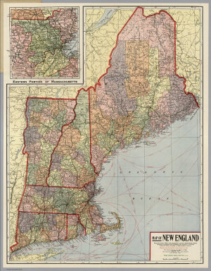
Kenyon Company
Full Title
(Covers to) Map of New England ... Copyright 1920 The Kenyon Company, Inc., Map Makers Des Moines, Iowa. Principal Automobile Highways Shown Thus ... (inset) Eastern Portion Of Massachusetts. (on verso) Index of New England States, With Official 1920 Census...
Publisher
The Kenyon Company, Inc.
Author
Kenyon Company
Full Title
(Text page to) Map of New England ... Copyright 1920 The Kenyon Company, Inc., Map Makers Des Moines, Iowa. Principal Automobile Highways Shown Thus ... (inset) Eastern Portion Of Massachusetts. (on verso) Index of New England States, With Official 1920 Census...
Publisher
The Kenyon Company, Inc.
Author
Kenyon Company
Full Title
Map of New England ... Copyright 1920 The Kenyon Company, Inc., Map Makers Des Moines, Iowa. Principal Automobile Highways Shown Thus ... (inset) Eastern Portion Of Massachusetts. (on verso) Index of New England States, With Official 1920 Census...
Publisher
The Kenyon Company, Inc.
Author
Asher & Company
Full Title
(Covers to) The Historical War Map. Asher & Co. Entered ... 1862, by Asher & Co. ... Indiana. E.R. Jewett & Co. Engravers, Buffalo, N.Y.
Publisher
Asher & Company
Author
Asher & Company
Full Title
The Historical War Map. Asher & Co. Entered ... 1862, by Asher & Co. ... Indiana. E.R. Jewett & Co. Engravers, Buffalo, N.Y.
Publisher
Asher & Company
Author
[Raynal, G.T., Bonne, R.]
Full Title
Carte de la partie nord, Des Etats Unis, de l'Amerique Septentrionale. Par M. Bonne, Ingenieur-Hydrographe de la Marine. (on upper margin) Liv. XVII et XVIII.: No. 47. (on lower margin) 48. (to accompany) Histoire Philosophique et Politique Des Establissements et Du Commerce Des Europeens Dans Les Deux Indes.
Publisher
Jean-Leonard Pellet
Author
Hubbard, William
Full Title
A map of New England, being the first that ever was here cut, and done by the best pattern that could be had, which being in some places defective, it made the other less exact: Yet doth it sufficiently show the situation of the country and conveniently well the distance of Places. The figures that are joyned with the Names of Places are to distinguish such as have been assaulted by the Indians from others. (to accompany) A Narrative of the Troubles with the Indians in New-England, from ... 1607 to this present year 1677. (with) The Happiness of a People in the Wisdome of their Rulers Directing and in Obedience of their Brethren Attending unto what Israel ought to do: Recommended in a Sermon ... Boston, Printed by John Foster. 1676.
Publisher
John Foster
Author
Johnson, A.J.
Full Title
Johnson's New England And Lower Canada By Johnson & Browning. No. 13-14.
Publisher
Johnson and Browning
Author
[Blunt, Edmund M. (Edmund March), 1770-1862, Des Barres, Joseph F. W. (Joseph Frederick Wallet), 1722-1824, Taber, W. C., Wadsworth, A. S. (Alex. S.)]
Full Title
(The north eastern coast of North America from New York to Cape Canso including Sable Island by Edmund Blunt. West sheet. (with) Buzzards Bay drawn from the survey of Des Barres and information furnished by W.C. Taber ... (with) Boston Harbour from the survey of A.S. Wadsworth, U.S.N. and the chart of Des Barres. Published & Sold by E. & G.W. Blunt, No. 154 Water Street, corner of Maiden Lane, New York. G. Ely Sct. Engd. by D.R. Harrison. Entered ... 22nd day of July 1828, by Edmund Blunt of the State of New York)
Publisher
E. & G.W. Blunt.
Author
[Adams, D. P., Blunt, Edmund M. (Edmund March), 1770-1862]
Full Title
The harbour of New York surveyed by Edmund Blunt. (with) Entrance fo the Chesapeake Bay, reduced from the surveys made by D.P. Adams and others by order of the Navy Commissioners of the U.S. by E. Blunt. (with) Views of land between Cape Henlopen and Cape Charles. (insets on 1st sheet of : The coast of the United States of North America; from New York to St. Augustine drawn and regulated according the the latest surveys and astronomical observations by Edmund Blunt). New York: published and sold by E. & G.W. Blunt, 154 Water Street cor. of Maiden Lane. Engraved & printed by W. Hooker, 202 Water Street, New York, 1827.
Publisher
E. & G.W. Blunt.
Author
Blunt, Edmund M. (Edmund March), 1770-1862
Full Title
The coast of the United States of North America; from New York to St. Augustine (2nd sheet) drawn and regulated according the the latest surveys and astronomical observations by Edmund Blunt. New York: published by E. & G.W. Blunt, 154 Water Street, corner of Maiden Lane. Engraved & printed by W. Hooker, 202 Water Street, New York. Entered acording to Act of Congress the 3rd. day of April 1827 by E. & G.W. Blunt of the State of New York.
Publisher
E. & G.W. Blunt.
Author
[Adams, D. P., Blunt, Edmund M. (Edmund March), 1770-1862]
Full Title
(Composite of) The coast of the United States of North America; from New York to St. Augustine drawn and regulated according the the latest surveys and astronomical observations by Edmund Blunt. D.R. Harrison sc. New York: published by E. & G.W. Blunt, 154 Water Street, corner of Maiden Lane. Engraved & printed by W. Hooker, 202 Water Street, New York. Entered acording to Act of Congress the 3rd. day of April 1827 by E. & G.W. Blunt of the State of New York.
Publisher
E. & G.W. Blunt.
Author
E. & G.W. Blunt (Firm)
Full Title
(covers to) (Atlas of 4 charts on 10 sheets) The north eastern coast of North America from New York to Cape Canso including Sable Island by Edmund Blunt. Published & Sold by E. & G.W. Blunt, No. 154 Water Street ... G. Ely Sct. Engd. by D.R. Harrison. Entered ... 22nd day of July 1828, by Edmund Blunt ... New York (3 sheets); The coast of the United States of North America from New York to St. Augustine: drawn and regulated according to the latest surveys and astronomical observation: by Edmund Blunt ... (4 sheets, 1827); The Bahama Banks and Gulf of Florida by Edmund Blunt Hydrographer ... (2 sheets, 1827); The coasts of West Florida, Alabama, Mississippi & Louisiana: Drawn from the surveys of Gauld, and improved from other authorities by Edmund Blunt (1 sheet, 1828).
Publisher
E. & G.W. Blunt.
Author
[Hinton, Isaac Taylor, 1799-1847, Simpkin & Marshall]
Full Title
New England and New York in 1697. From the "Magnalia americana." London: Published Nov. 1, 1830 by I.T. Hinton & Simpkin & Marshall. Engraved & printed by Fenner Sears & Co. (1832)
Publisher
[Simpkin & Marshall, Thomas Wardle]
Author
Arrowsmith, John
Full Title
Lower Canada, New Brunswick, Nova Scotia, Prince Edwards Id., Newfoundland, and a large portion of the United States. By J. Arrowsmith. (with) inset map of Newfoundland. (Map) 42. London, Pubd. 15 Feby. 1842, by J. Arrowsmith, 10 Soho Square.
Publisher
John Arrowsmith
Full Title
New England States. Middle States. H. Morse Sc. Published by Lincoln & Edmands, Boston. (1832)
Publisher
Lincoln & Edmands
Author
Cornell, S. S. (Sarah S.)
Full Title
New England or Eastern States. Designed to accompany Cornell's High school geography. Entered ... 1855, by S.S. Cornell ... Southern District of New York. New York: D. Appleton & Co., 443 & 445 Broadway. (1864)
Publisher
Appleton & Co.
Author
Cornell, S. S. (Sarah S.)
Full Title
Northern or Middle States. Designed to accompany Cornell's High school geography. Entered ... 1855, by S.S. Cornell ... Southern District of New York. New York: D. Appleton & Co., 443 & 445 Broadway. (1864)
Publisher
Appleton & Co.
Author
Cornell, S. S. (Sarah S.)
Full Title
N. Eastern division of the United States. (with) Map of Rhode Island. (with) Map of Central Connecticut. (with) Vicinity of Boston. Drawn by E. Wells, N.Y. Designed to accompany Cornell's High school geography. Entered ... 1856, by S.S. Cornell ... Southern District of New York. New York: D. Appleton & Co., 443 & 445 Broadway. (1864)
Publisher
Appleton & Co.
Author
Cornell, S. S. (Sarah S.)
Full Title
Eastern division of the United States. Designed to accompany Cornell's High school geography. Drawn by E. Wells, N.Y. Entered ... 1856, by S.S. Cornell ... Southern District of New York. New York: D. Appleton & Co., 443 & 445 Broadway. (1864)
Publisher
Appleton & Co.
Full Title
New England States. J.H. Young Sc. (Philadelphia: John Grigg, No. 9 North Fourth Street. 1830)
Publisher
John Grigg
Full Title
The Middle States, Maryland & Virginia. J.H. Young Sc. (Philadelphia: John Grigg, No. 9 North Fourth Street. 1830)
Publisher
John Grigg
Author
Thomson, John
Full Title
Northern provinces of the United States. (with view) The Great Falls of Niagara. Hewitt sc., Grafton Str. E(a)st, Tottenham Ct. Rd. Drawn & engraved for Thomson's New general atlas, 1817.
Publisher
[Baldwin, Cradock, and Joy, John Cumming, John Thomson]
Author
[Bory de Saint-Vincent, M. (Jean Baptiste GeneviFve Marcellin), 1778-1846, Desmarest, Nicolas, 1725-1815, Vincent]
Full Title
Carte des montagnes coupees par des rivieres, situees en Virginie et en Pensylvanie. Grave par Berthe. (A Paris, Chez Mme. veuve Agasse, Imprimeur-Libraire, rue des Poitevins, no. 6. M.DCCCXXVII)
Publisher
Veuve Agasse
Author
[Huntington, Francis Junius, 1802-1878, Huntington, Hezekiah, 1795-1865]
Full Title
New England States. Entered ... 12th day of August 1830 by H. & F.J. Huntington ... Connecticut.
Publisher
F.J. Huntington
Author
[Huntington, Francis Junius, 1802-1878, Huntington, Hezekiah, 1795-1865]
Full Title
The Middle States, Maryland & Virginia. Entered ... 12th day of August 1830 by H. & F.J. Huntington ... Connecticut.
Publisher
F.J. Huntington
Full Title
New England. Entered ... 1836, by Eleazer Huntington ... Connecticut.
Publisher
Reed & Barber
Full Title
Middle States and part of the Southern. Entered ... 1836, by Eleazer Huntington ... Connecticut.
Publisher
Reed & Barber
Author
Letts, Son & Co.
Full Title
Eastern United States. No. 2. Letts's popular atlas. Letts, Son & Co. Limited, London. (1883)
Publisher
Letts, Son & Co.
Author
Robert Laurie & James Whittle
Full Title
A new and correct map of the British colonies in North America. Comprehending Eastern Canada with the province of Quebec, New Brunswick, Nova Scotia, and the government of Newfoundland; with the adjacent states of New England, Vermont, New York, Pennsylvania and New Jersey. London, Publish'd by Laurie & Whittle, 53 Fleet Street, 12th May, 1794.
Publisher
Laurie & Whittle
Author
Robert Laurie & James Whittle
Full Title
A new and general map of the middle dominions belonging to the United States of America, viz. Virginia, Maryland, the Delaware-Counties, Pennsylvania, New Jersey &c., with the addition of New York, & of the greatest part of New England &c., as also of the bordering parts of the British possessions in Canada. (with) A sketch of the upper parts to shown the remainder of the lakes. London, Published by Laurie & Whittle, No. 53, Fleet Street, as the act directs 12th May, 1794.
Publisher
Laurie & Whittle
|