Who What Where WhenREMOVEWHATShow More |
Author
Chicago, Burlington & Quincy Railroad Company
Full Title
(Covers to) Burlington Route. United States map showing Burlington Lines and connections ...
Publisher
Poole Bros.
Author
[Oddy, S.A., Wallis, James]
Full Title
United States of America. London, Published by S.A. Oddy, No. 20 Warwick Lane. Engraved by Jas. Wallis.
Publisher
S.A. Oddy
Author
Willard, Emma
Full Title
Willard's Chronographer of American History. History of the U. States or Republic of America. Historic Tree.
Publisher
A.S. Barnes & Co.
Author
Gilpin, William
Full Title
Map Illustrating the System of the Parcs, and the Domestic Relations of the "Great Plains," the "North American Andes," and the Pacific Maritime Front."
Publisher
J.B. Lippincott & Co.
Author
[Ogle, George A. & Co., Cram, Geo. F.]
Full Title
Map of the United States.
Publisher
Geo. A. Ogle & Co.
Author
[United Air Lines, White, Ruth Taylor]
Full Title
(Covers to) United Air Lines. A Gay Geography of the Main Line Airway. The Main Line Mid-Continental Airway.
Publisher
United Air Lines
Author
[United Air Lines, White, Ruth Taylor]
Full Title
Flying United's Main Line Airway.
Publisher
United Air Lines
Author
Cram, George Franklin
Full Title
Map of the United States.
Publisher
A.C. Shewey and Co.
Author
Tanner, Henry S.
Full Title
(Covers to) A New American Atlas Containing Maps Of The Several States of the North American Union, Projected and drawn on a Uniform Scale from Documents found in the public Offices of the United States and State Governments, and other Original and Authentic Information, By Henry S. Tanner ... Philadelphia: Published By H.S. Tanner. 1825. (title page only) Writing Drawn and Engraved by Joseph Perkins. Barralet del. Humphrys sc.
Publisher
Henry Tanner
Author
Tanner, Henry S.
Full Title
(Half Title Page to) A New American Atlas Containing Maps Of The Several States of the North American Union, Projected and drawn on a Uniform Scale from Documents found in the public Offices of the United States and State Governments, and other Original and Authentic Information, By Henry S. Tanner ... Philadelphia: Published By H.S. Tanner. 1825. (title page only) Writing Drawn and Engraved by Joseph Perkins. Barralet del. Humphrys sc.
Publisher
Henry Tanner
Author
Tanner, Henry S.
Full Title
(Title Page to) A New American Atlas Containing Maps Of The Several States of the North American Union, Projected and drawn on a Uniform Scale from Documents found in the public Offices of the United States and State Governments, and other Original and Authentic Information, By Henry S. Tanner ... Philadelphia: Published By H.S. Tanner. 1825. (title page only) Writing Drawn and Engraved by Joseph Perkins. Barralet del. Humphrys sc.
Publisher
Henry Tanner
Author
Tanner, Henry S.
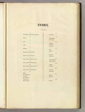
Full Title
(Index Page to) A New American Atlas Containing Maps Of The Several States of the North American Union, Projected and drawn on a Uniform Scale from Documents found in the public Offices of the United States and State Governments, and other Original and Authentic Information, By Henry S. Tanner ... Philadelphia: Published By H.S. Tanner. 1825. (title page only) Writing Drawn and Engraved by Joseph Perkins. Barralet del. Humphrys sc.
Publisher
Henry Tanner
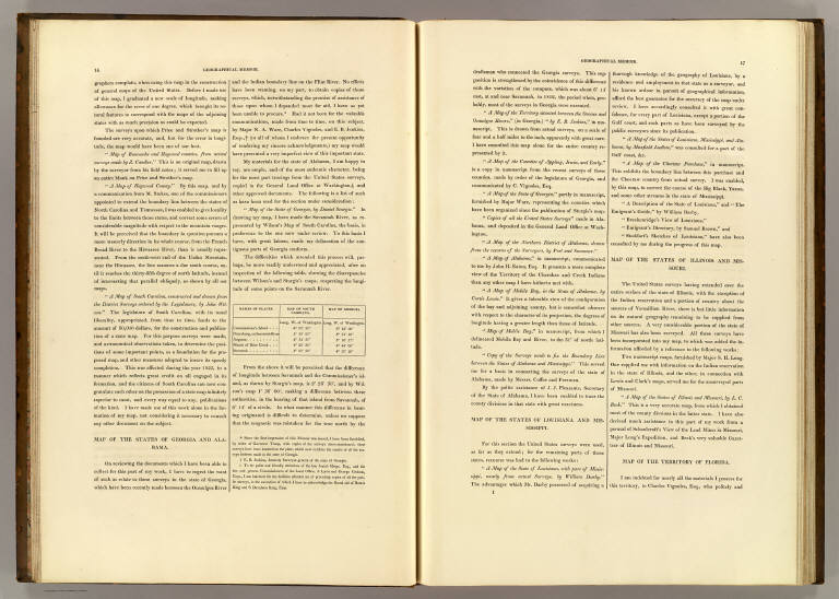
Author
Tanner, Henry S.
Full Title
(Geographical Memoir, pg. 1 in) A New American Atlas Containing Maps Of The Several States of the North American Union, Projected and drawn on a Uniform Scale from Documents found in the public Offices of the United States and State Governments, and other Original and Authentic Information, By Henry S. Tanner ... Philadelphia: Published By H.S. Tanner. 1825. (title page only) Writing Drawn and Engraved by Joseph Perkins. Barralet del. Humphrys sc.
Publisher
Henry Tanner
Author
[Tardieu, P.A.F., Lapie, Pierre, Piquet, Chles.]
Full Title
A Map of the United States, Canada, New-Scotland, New-Brunswick and New-Foundland ... Carte Des Etats - Unis, Avec Le Canada, la Nouvelle Ecosse, le Nouveau Brunswick & Terre - Neuve. A Map of the West-Indies and the Mexican Gulph (Gulf) ...Carte Des Indes Occientale et du Golfe du Mexique... Dressee par Lapie, Capitaine-Ingenieur-Geographe. Publiee par P.A.F. Tardieu, Gravveur, Editeur-proprietaire, a Paris, Chez P.A.F. Tardieu ....
Publisher
Chez P.A.F. Tardieu
Author
Tanner, Henry S.
Full Title
(Geographical Memoir, pgs. 2-3 in) A New American Atlas Containing Maps Of The Several States of the North American Union, Projected and drawn on a Uniform Scale from Documents found in the public Offices of the United States and State Governments, and other Original and Authentic Information, By Henry S. Tanner ... Philadelphia: Published By H.S. Tanner. 1825. (title page only) Writing Drawn and Engraved by Joseph Perkins. Barralet del. Humphrys sc.
Publisher
Henry Tanner
Author
Tanner, Henry S.
Full Title
(Geographical Memoir, pgs. 4-5 in) A New American Atlas Containing Maps Of The Several States of the North American Union, Projected and drawn on a Uniform Scale from Documents found in the public Offices of the United States and State Governments, and other Original and Authentic Information, By Henry S. Tanner ... Philadelphia: Published By H.S. Tanner. 1825. (title page only) Writing Drawn and Engraved by Joseph Perkins. Barralet del. Humphrys sc.
Publisher
Henry Tanner
Author
Tanner, Henry S.
Full Title
(Geographical Memoir, pgs. 6-7 in) A New American Atlas Containing Maps Of The Several States of the North American Union, Projected and drawn on a Uniform Scale from Documents found in the public Offices of the United States and State Governments, and other Original and Authentic Information, By Henry S. Tanner ... Philadelphia: Published By H.S. Tanner. 1825. (title page only) Writing Drawn and Engraved by Joseph Perkins. Barralet del. Humphrys sc.
Publisher
Henry Tanner
Author
Tanner, Henry S.
Full Title
(Geographical Memoir, pgs. 8-9 in) A New American Atlas Containing Maps Of The Several States of the North American Union, Projected and drawn on a Uniform Scale from Documents found in the public Offices of the United States and State Governments, and other Original and Authentic Information, By Henry S. Tanner ... Philadelphia: Published By H.S. Tanner. 1825. (title page only) Writing Drawn and Engraved by Joseph Perkins. Barralet del. Humphrys sc.
Publisher
Henry Tanner
Author
Tanner, Henry S.
Full Title
(Geographical Memoir, pgs. 10-11 in) A New American Atlas Containing Maps Of The Several States of the North American Union, Projected and drawn on a Uniform Scale from Documents found in the public Offices of the United States and State Governments, and other Original and Authentic Information, By Henry S. Tanner ... Philadelphia: Published By H.S. Tanner. 1825. (title page only) Writing Drawn and Engraved by Joseph Perkins. Barralet del. Humphrys sc.
Publisher
Henry Tanner
Author
Tanner, Henry S.
Full Title
(Geographical Memoir, pgs. 12-13 in) A New American Atlas Containing Maps Of The Several States of the North American Union, Projected and drawn on a Uniform Scale from Documents found in the public Offices of the United States and State Governments, and other Original and Authentic Information, By Henry S. Tanner ... Philadelphia: Published By H.S. Tanner. 1825. (title page only) Writing Drawn and Engraved by Joseph Perkins. Barralet del. Humphrys sc.
Publisher
Henry Tanner
Author
Tanner, Henry S.
Full Title
(Geographical Memoir, pgs. 14-15 in) A New American Atlas Containing Maps Of The Several States of the North American Union, Projected and drawn on a Uniform Scale from Documents found in the public Offices of the United States and State Governments, and other Original and Authentic Information, By Henry S. Tanner ... Philadelphia: Published By H.S. Tanner. 1825. (title page only) Writing Drawn and Engraved by Joseph Perkins. Barralet del. Humphrys sc.
Publisher
Henry Tanner
Author
Tanner, Henry S.
Full Title
(Geographical Memoir, pgs. 16-17 in) A New American Atlas Containing Maps Of The Several States of the North American Union, Projected and drawn on a Uniform Scale from Documents found in the public Offices of the United States and State Governments, and other Original and Authentic Information, By Henry S. Tanner ... Philadelphia: Published By H.S. Tanner. 1825. (title page only) Writing Drawn and Engraved by Joseph Perkins. Barralet del. Humphrys sc.
Publisher
Henry Tanner
Author
Tanner, Henry S.
Full Title
(Geographical Memoir, pg. 18 in) A New American Atlas Containing Maps Of The Several States of the North American Union, Projected and drawn on a Uniform Scale from Documents found in the public Offices of the United States and State Governments, and other Original and Authentic Information, By Henry S. Tanner ... Philadelphia: Published By H.S. Tanner. 1825. (title page only) Writing Drawn and Engraved by Joseph Perkins. Barralet del. Humphrys sc.
Publisher
Henry Tanner
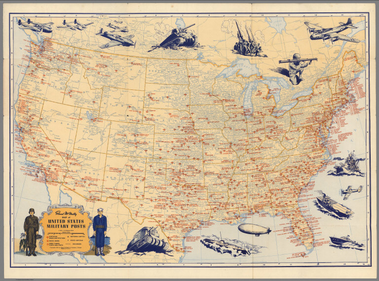
Author
Rand McNally & Co.
Full Title
Rand McNally Map of United States Military Posts.
Publisher
Rand McNally & Co.
Author
[Laurence, Dorthea Dix (1899-1979), Cimino, Harry (1898-]
Full Title
Folklore Music Map of the United States by Dorthea Dix Laurence from the Primer of American Music.
Publisher
Hagstrom Company, Inc.
Author
Colton, George Woolworth, 1827-1901
Full Title
(Covers to) G. Woolworth Colton's map of the country 500 miles around the city of Washington : showing the seat of war in the East. Drawn, engraved & published by G. Woolworth Colton, 18 Beekman Street, New York 1861. (inset) Vicinity of Ft. Monroe & Norfolk. Entered ... 1861 by G. Woolworth Colton ... New York.
Publisher
G. Woolworth Colton
Author
Colton, George Woolworth, 1827-1901
Full Title
G. Woolworth Colton's map of the country 500 miles around the city of Washington : showing the seat of war in the East. Drawn, engraved & published by G. Woolworth Colton, 18 Beekman Street, New York 1861. (inset) Vicinity of Ft. Monroe & Norfolk. Entered ... 1861 by G. Woolworth Colton ... New York.
Publisher
G. Woolworth Colton
Author
Arrowsmith, Aaron
Full Title
A map of the United States of North America. Drawn from a number of critical researches by A. Arrowsmith, Hydrographer to H.R.H. the Prince of Wales. (Sheet 1). No. 10 Soho Square. London, Published as the Act directs by A. Arrowsmith, no. 10 Soho Square -- Jan. 1st, 1796, additions to 1802.
Publisher
A. Arrowsmith
Author
Arrowsmith, Aaron
Full Title
(A map of the United States of North America. Drawn from a number of critical researches by A. Arrowsmith, Hydrographer to H.R.H. the Prince of Wales. Sheet 2). London, Published as the Act directs by A. Arrowsmith, no. 10 Soho Square -- Jan. 1st, 1796, additions to 1802.
Publisher
A. Arrowsmith
Author
Arrowsmith, Aaron
Full Title
(A map of the United States of North America. Drawn from a number of critical researches by A. Arrowsmith, Hydrographer to H.R.H. the Prince of Wales. Sheet 3). London, Published as the Act directs by A. Arrowsmith, no. 10 Soho Square. (1802).
Publisher
A. Arrowsmith
Author
Arrowsmith, Aaron
Full Title
(A map of the United States of North America. Drawn from a number of critical researches by A. Arrowsmith, Hydrographer to H.R.H. the Prince of Wales. Sheet 4). London, Published as the Act directs by A. Arrowsmith, no. 10 Soho Square -- Jan. 1st, 1796, additions to 1802.
Publisher
A. Arrowsmith
Author
Arrowsmith, Aaron
Full Title
(Composite of) A map of the United States of North America. Drawn from a number of critical researches by A. Arrowsmith, Hydrographer to H.R.H. the Prince of Wales. No. 10 Soho Square. London, Published as the Act directs by A. Arrowsmith, no. 10 Soho Square -- Jan. 1st, 1796, additions to 1802.
Publisher
A. Arrowsmith
Author
Bowen, Emanuel
Full Title
A new & accurate map of Mexico or New Spain together with California, New Mexico &c. Drawn from the best modern maps & charts & regulated by astronl. observns. By Eman: Bowen. (London: Printed for William Innys, Richard Ware, Aaron Ward, J. and P. Knapton, John Clarke, T. Longman and T. Shewell, Thomas Osborne, Henry Whitridge ... M.DCC.XLVII)
Publisher
William Innys [et al.]
Author
[National Wholesale Druggists' Association, Newcomb, Edwin]
Full Title
Medicinal plant map of the United States of America. Published by the National Wholesale Druggists' Association ; under the direction of Chairman Geo. Van Gorder ... edited by Dr. Edwin L. Newcomb ... with the assistance of Dr. Heber W. Youngken ... and Willard W. Eggleston ... Bureau of plant Industry, United States Department of Agriculture. September, 1932. Einson-Freeman Co. Inc. L.I. City New York. Litho. in U.S.A. (Text on verso) List of chemicals used in the practice of medicine and pharmacy in America ...
Publisher
[National Wholesale Druggists' Association, Einson-Freeman Co., inc,]
Author
[National Wholesale Druggists' Association, Newcomb, Edwin]
Full Title
(Text Page to) List of chemicals used in the practice of medicine and pharmacy in America ... Einson-Freeman Co. Inc. L.I. City New York. (on verso) Medicinal plant map of the United States of America. Published by the National Wholesale Druggists' Association ; under the direction of Chairman Geo. Van Gorder ... edited by Dr. Edwin L. Newcomb ... with the assistance of Dr. Heber W. Youngken ... and Willard W. Eggleston ... Bureau of plant Industry, United States Department of Agriculture. September, 1932. Einson-Freeman Co. Inc. L.I. City New York. Litho. in U.S.A.
Publisher
[National Wholesale Druggists' Association, Einson-Freeman Co., inc,]
Author
Bowen, Emanuel
Full Title
A new & accurate map of Louisiana, with part of Florida and Canada, and the adjacent countries. Drawn from surveys, assisted by the most approved English & French maps & charts. The whole being regulated by astronomical observations. By Eman. Bowen. (London: Printed for William Innys, Richard Ware, Aaron Ward, J. and P. Knapton, John Clarke, T. Longman and T. Shewell, Thomas Osborne, Henry Whitridge ... M.DCC.XLVII)
Publisher
William Innys [et al.]
Author
Greyhound Lines
Full Title
A good-natured map of the United States setting forth the services of The Greyhound Lines and a few principal connecting bus lines.
Publisher
The Greyhound Lines
Author
Byron Weston Company
Full Title
A Map of Air Mail & Passenger Routes. Prepared by Byron Weston Company, Manufacturers of Highest Grade Record and Ledger Papers. Dalton, Massachusetts and Printed on Weston's Linen Ledger. (c) B.W. Co. 1930.
Publisher
Byron Weston Company
Author
Dussieux, L.
Full Title
153. Cartes pour servir a l'Histoire de la Nouvelle-Franceou du Canada jusqu'en 1765.
Publisher
Jacques Lecoffre et Comp.
Author
Dussieux, L.
Full Title
155. Carte des Etats-Unis.
Publisher
Jacques Lecoffre et Comp.
Author
Greyhound Lines
Full Title
Transcontinental routes of Pacific Greyhound Lines : Also Pickwick -Greyhound and Greyhound Lines. "Over 35,000 miles of scenic highway routes ..."
Publisher
The Greyhound Lines
Author
Andriveau-Goujon, J.
Full Title
Carte des Etats-Unis d'Amerique comprenant une partie des districts de l'ouest et de la Nouvelle Bretagne. Publiee par J. Andriveau-Goujon, Rue du Bac, no. 21, Paris, 1850.
Publisher
J. Andriveau-Goujon
Author
[Gray, Ormando Willis, Walling, H. F.]
Full Title
Map of the United States and territories. H.F. Walling & O.W. Gray, Boston, 1871.
Publisher
Stedman, Brown & Lyon
Author
Bradford, Thomas G.
Full Title
(Plan of the principal cities in the United States). (to accompany) A Comprehensive Atlas, Geographical, Historical & Commercial. By T.G. Bradford. William D. Ticknor, Boston. Wiley & Long, New-York. Entered ... 1835, by Thos. G. Bradford ... Massachusetts.
Publisher
[William D. Ticknor, Wiley & Long]
Author
Bradford, Thomas G.
Full Title
United States, exhibiting the railroads & canals. (to accompany) A Comprehensive Atlas, Geographical, Historical & Commercial. By T.G. Bradford. William D. Ticknor, Boston. Wiley & Long, New-York. Entered ... 1835, by Thos. G. Bradford ... Massachusetts.
Publisher
[William D. Ticknor, Wiley & Long]
Author
Bradford, Thomas G.
Full Title
United states. (to accompany) A Comprehensive Atlas, Geographical, Historical & Commercial. By T.G. Bradford. William D. Ticknor, Boston. Wiley & Long, New-York. Entered ... 1835, by Thos. G. Bradford ... Massachusetts.
Publisher
[William D. Ticknor, Wiley & Long]
Full Title
Map of the United States and territories. Philadelphia, 1872. (Published by Stedman, Brown & Lyon, Philadelphia)
Publisher
Stedman, Brown & Lyon
Author
Woerl, Joseph Edmund
Full Title
Vereinigte Staaten von Nord-Amerika. (United States).
Publisher
B. Herder
Author
[Morse, Sidney E., Breese, S.]
Full Title
(Covers to) Supplement To The New-York Observer. The Cerographic Atlas Of The United States. (No. 1). By Sidney E. Morse, A.M. And Samuel Breese, A.M. New-York: Published By Sidney E. Morse & Co. 1842. [Entered ... 1841, by Sidney E. Morse and Samuel Breese ... New-York.]
Publisher
Sidney E. Morse & Co.
Author
[Morse, Sidney E., Breese, S.]
Full Title
(Advertisement to) Supplement To The New-York Observer. The Cerographic Atlas Of The United States. By Sidney E. Morse, A.M. And Samuel Breese, A.M. New-York: Published By Sidney E. Morse & Co. 1842. [Entered ... 1841, by Sidney E. Morse and Samuel Breese ... New-York.]
Publisher
Sidney E. Morse & Co.
|