|
|
Author
[Macomb, J.N., Newberry, J.S.]
Full Title
(View) Plate VII. Head of Labyrinth Creek. Looking South-Easterly. J.J. Young from a sketch by Dr. J.S. Newberry. T. Sinclair & Son. lith. Phila.
Publisher
U.S. Government Printing Office
Author
[Macomb, J.N., Newberry, J.S.]
Full Title
(View) Plate IX. Lower San Juan, Looking West from Near Camp 35. J.J. Young from a sketch by Dr. J.S. Newberry. T. Sinclair & Son. lith. Phila.
Publisher
U.S. Government Printing Office
Author
[Hayden, F.V., U.S. Geological and Geographical Survey of the Territories]
Full Title
Economic map of portions of Wyoming, Idaho and Utah. Department of the Interior, U.S. Geological and Geographical Survey of the Territories ; F.V. Hayden, U.S. Geologist in Charge. J. Bien, Lith.
Publisher
U.S. Geological and Geographical Survey of the Territories
Author
[Hayden, F.V., U.S. Geological and Geographical Survey of the Territories]
Full Title
Parts of Western Wyoming, Southeastern Idaho and Northeastern Utah. U.S. Geological and Geographical Survey of the Territories ; F.V. Hayden, U.S. Geologist in Charge. A.C. Peale, Geological Assistant. Henry Gannett, M.E. Topographical Assistant. Surveyed in 1877.
Publisher
U.S. Geological and Geographical Survey of the Territories
Author
[Lloyd, H.H., Warner & Beers]
Full Title
Atlas of the United States, Map of Utah, Arizona, New Mexico, Kansas, Colorado, and Indian Territory. Warner & Beers, Publishers. From H.H. Lloyd & Co.'s Atlas of the United States.
Publisher
Warner & Beers
Author
Johnson, A.J.
Full Title
Johnson's California also Utah, Nevada, Colorado, New Mexico, and Arizona. Entered ... 1864.
Publisher
A.J. Johnson
Author
Johnson, A.J.
Full Title
Johnson's California, Utah, Nevada, Colorado, New Mexico, and Arizona. Published by A. J. Johnson, New York. 79. 80. Entered according to the Act of Congress, in the year 1864, by A.J. Johnson in the Clerk's Office of the District Court of the United States for the Southern District of New York.
Publisher
A.J. Johnson.
Author
Asher & Adams
Full Title
Asher & Adams' Utah. Entered according to Act of Congress 187? by Asher & Adams in the Office of the Librarian of Congress at Washington. (1875)
Publisher
Asher & Adams.
Author
Wheeler, G.M.
Full Title
Southwestern Utah. Atlas Sheet Number 59. Construction by Chas. Herman. Topographical drawing by J.E. Weyss. Lettering by A.A. Aguirre. Expeditions of 1859, 1872 & 1873. 1st. Lieut. Geo. M. Wheeler, Corps of Engineers, Com'd'g. Explorations & Surveys West Of The One-Hundredth Meridian. War Department, Corps of Engineers, U.S. Army.
Publisher
U.S.
Author
Wheeler, G.M.
Full Title
Southwestern Utah. Atlas Sheet Number 59. Weyss, Herman & Aguirre, Del. Expeditions of 1872 & 1873 Under the Command of 1st. Lieut. Geo. M. Wheeler, Corps of Engineers, U.S. Army. Explorations & Surveys West Of The One-Hundredth Meridian.
Publisher
U.S.
Author
Wheeler, G.M.
Full Title
Southern And Southwestern Utah. Atlas Sheet Number 59. Weyss, Herman & Aguirre, Del's. Expeditions of 1872 & 1873 Under the Command of 1st. Lieut. Geo. M. Wheeler, Corps of Engineers, U.S. Army. Geological Assistants: G.K. Gilbert, A.R. Marvine, E.E. Howell. Explorations & Surveys West Of The One-Hundredth Meridian.
Publisher
U.S.
Full Title
Diurnal force of vapor. Pioche, Nev. Ft. Steele, Wyo. Terr. Prescott, Ariz. Ogden, Utah. Trinidad, Col. Cheyenne, Wyo. U.S. Geographical Surveys West of the 100th Meridian. (1877)
Publisher
U.S.
Full Title
(Diurnal) relative humidity. Georgetown, Col. Los Angeles, Cal. Colorado Springs, Col. Salt Lake City, Utah. Santa Fe, New Mex. Green River, Wyo. Terr. U.S. Geographical Surveys West of the 100th Meridian. (1877)
Publisher
U.S.
Full Title
Diurnal relative humidity. Camp Independence, Cal. Cottonwood Springs, Nev. Beaver, Utah. Hughes, Col. Labran, Col. U.S. Geographical Surveys West of the 100th Meridian. (1877)
Publisher
U.S.
Full Title
Rain sculpture, Salt Creek Canon, Utah. (1875)
Publisher
U.S.
Full Title
Rock carved by drifting sand, near mouth of Grand Wash, Utah. (1875)
Publisher
U.S.
Full Title
Lava from valley of Lower Sevier, Utah. (1875)
Publisher
U.S.
Full Title
Cretaceous. P. Roetter del. J. Bien lith. (1877)
Publisher
U.S.
Author
C.C. Pierce & Co.
Full Title
Oregon and the Pacific Northwest. (Published by Ellis A. Davis. Berkeley, Cal. Seattle. 1909)
Publisher
E.A. Davis
Full Title
Utah. (Published by George F. Cram, Chicago, Ill. 1909)
Publisher
E.A. Davis
Author
Cram, George Franklin
Full Title
Cram's Rail Road & Township Map of Utah. Published by Geo. F. Cram. Proprietor of the Western Map Depot. 66, Lake St. Chicago Ills. 1875.
Publisher
Cram Atlas Company
Author
Rand McNally and Company
Full Title
Rand McNally junior auto road map Utah. Copyright by Rand McNally & Co., Chicago, Ill. (1927)
Publisher
Rand McNally
Author
Wheeler, G.M.
Full Title
Parts Of Eastern And Southern Nevada And Southern Utah, Atlas Sheet No. 58. The Graphic Co. Photo-Lith. 39 & 41 Park Place N.Y. Weyss, Herman & Aguirre Del. Expeditions Of 1869, 1871 & 1872 Under the Command of 1st. Lieut. Geo. M. Wheeler, Corps of Engineers. Geographical Explorations & Surveys West Of The 100th Meridian.
Publisher
U.S.
Author
Wheeler, G.M.
Full Title
Parts Of Eastern & Southern Nevada And Southwestern Utah. Atlas Sheet No. 58. Weyss, Herman & Aguirre Del. Expeditions of 1869, 1871 & 1872 Under the Command of 1st. Lieut. Geo. M. Wheeler, Corps of Engineers, U.S. Army. Explorations & Surveys West Of The One-Hundredth Meridian.
Publisher
U.S.
Author
Wheeler, G.M.
Full Title
Atlas Sheet Number 58. Parts Of E. California, S.E. Nevada, N.W. Arizona & S.W. Utah. Atlas Sheet Number 66. Weyss, Herman & Aguirre, Del. Expeditions of 1872 & 1873, Under the Command of 1st. Lieut. Geo. M. Wheeler, Corps of Engineers, U.S. Army. Geological Assistants: G.K. Gilbert, A.R. Marvine and E.E. Howell. U.S. Geographical Surveys West Of The One-Hundredth Meridian.
Publisher
U.S.
Author
Wheeler, G.M.
Full Title
Parts Of Eastern & Southeastern Nevada & Southwestern Utah. Atlas Sheet Number 66. Expeditions of 1869, 1872 & 1873. 1st. Lieut. Geo. M. Wheeler, Corps of Engineers, Com'd'g. Explorations & Surveys West Of The One-Hundredth Meridian. War Department Corps Of Engineers. U.S. Army. (1876?)
Publisher
U.S.
Author
Wheeler, G.M.
Full Title
Parts Of Eastern & Southeastern Nevada & Southwestern Utah. Atlas Sheet Number 66. Weyss, Herman & Aguirre, Del's. Expeditions of 1869, 1871, 1872. 1st. Lieut. Geo. M. Wheeler, Corps of Engineers, Com'd'g. Explorations & Surveys West Of The One-Hundredth Meridian.
Publisher
U.S.
Author
Wheeler, G.M.
Full Title
Parts Of Eastern Nevada And Western Utah, Atlas Sheet No. 49. The Graphic Co. Photo-Lith. 39 & 41 Park Place, N.Y. Weyss, Herman & Lang Del. Expeditions Of 1869 & 1872 Under the Command of 1st Lieut. Geo. M. Wheeler, Corps of Engineers. Geographical Explorations & Surveys West Of The 100th Meridian.
Publisher
U.S.
Author
[Beckwith, Lieut., Schumann, C.]
Full Title
Weber Lower Canyon. April 5th at 2 P.M. from an island in Weber River; Valley of Great Salt Lake. C. Schumann from F.W. Egloffstein. Selmar Siebert's Engraving & Printing Establishment, Washington, D.C. U.S.P.R.R. Exp. & Surveys 41st Parallel. Expl. by Lieut. Beckwith. Vol. II.
Publisher
[A.O.P. Nicholson I-XI, T. Ford XII.]
Author
[Beckwith, Lieut., Hinshelwood, R., Schumann, C.]
Full Title
Second or Sheeprock Canyon of Weber River. April 6th at 1 P.M. View Looking East. C. Schumann from F.W. Egloffstein. R. Hinshelwood. U.S.P.R.R. Exp. & Surveys 41st Parallel. Expl. by Lieut. Beckwith. Vol. II.
Publisher
[A.O.P. Nicholson I-XI, T. Ford XII.]
Author
[Beckwith, Lieut., Schumann, C.]
Full Title
Porcupine Terrace. Uintah Mountains in the Distance. Camp. April 16th to 17th. C. Schumann from F.W. Egloffstein. Selmar Siebert's Engraving & Printing Establishment, Washington, D.C. U.S.P.R.R. Exp. & Surveys 41st Parallel. Expl. by Lieut. Beckwith. Vol. II.
Publisher
[A.O.P. Nicholson I-XI, T. Ford XII.]
Author
[Beckwith, Lieut., Schumann, C.]
Full Title
Round Prairie From Head of the Same. April 21st at 10 A.M. C. Schumann from F.W. Egloffstein. S.V. Hunt Sc. U.S.P.R.R. Exp. & Surveys 41st Parallel. Expl. by Lieut. Beckwith. Vol. II.
Publisher
[A.O.P. Nicholson I-XI, T. Ford XII.]
Author
[Beckwith, Lieut., Schumann, C.]
Full Title
Goshoot Passage showing 65 miles of the proposed line of railroad from the desert west of Great Salt Lake to the Humboldt Mountains. May 17th-20th. C. Schumann from F.W. Egloffstein. Selmar Siebert's Engraving & Printing Establishment, Washington, D.C. U.S.P.R.R. Exp. & Surveys 41st Parallel. Expl. by Lieut. Beckwith. Vol. II.
Publisher
[A.O.P. Nicholson I-XI, T. Ford XII.]
Author
Beckwith, E.G.
Full Title
From the Valley of Green River to the Great Salt Lake; from Explorations and Surveys made under the direction of the Hon. Jefferson Davis Secretary of War by Capt. E.G. Beckwith, 3d. Artillery. F.W. Egloffstein, Topographer for the Route. 1855. Explorations and surveys for a railroad route from the Mississippi River to the Pacific Ocean. War Department. Route near the 41st Parallel. Map No. 1. Selmar Siebert's Engraving & Printing Establishment. Washington, D.C.
Publisher
[A.O.P. Nicholson I-XI, T. Ford XII.]
Author
Beckwith, E.G.
Full Title
From Great Salt Lake to the Humboldt Mountains; from Explorations and Surveys made under the direction of the Hon. Jefferson Davis Secretary of War by Capt. E.G. Beckwith, 3d. Artillery. F.W. Egloffstein, Topographer for the Route. 1855. Explorations and surveys for a railroad route from the Mississippi River to the Pacific Ocean. War Department. Route near the 41st Parallel. Map No. 2. Selmar Siebert's Engraving & Printing Establishment. Washington, D.C.
Publisher
[A.O.P. Nicholson I-XI, T. Ford XII.]
Author
Gunnison, J.W.
Full Title
From the Coo-che-to-pa Pass to the Wahsatch Mountains; from Explorations and Surveys made under the direction of the Hon. Jefferson Davis Secretary of War by Capt. J.W. Gunnison. Topl. Engrs. assisted by Capt. E.G. Beckwith 3d Artillery. R.H. Kern Topographer in the field. Map made under the supervision of Capt. E.G. Beckwith 3d Artillery by F.W. Egloffstein, Topographer for the Route. 1855. Explorations and surveys for a railroad route from the Mississippi River to the Pacific Ocean. War Department. Route near the 38th & 39th Parallels. Map No. 4. Engr. by Selmar Siebert.
Publisher
[A.O.P. Nicholson I-XI, T. Ford XII.]
Author
Nichols, H. H.
Full Title
Scenery on the High Plateaus. H.H. Nichols. (1895)
Publisher
Flood & Vincent
Full Title
Tabernacle Crater and lava beds of the Basin Province. (1895)
Publisher
Flood & Vincent
Author
Nichols, H. H.
Full Title
View on Great Salt Lake Desert, showing mountains half buried by lake sediments. H.H. Nichols. (1895)
Publisher
Flood & Vincent
Full Title
Pavant Butte, over a submarine volcano of the Great Basin. (1895)
Publisher
Flood & Vincent
Author
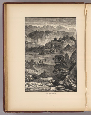
Nichols, H. H.
Full Title
The Gray Cliffs. Nichols. (1895)
Publisher
Flood & Vincent
Full Title
Pink Cliffs, Paunsagunt Plateau. (1895)
Publisher
Flood & Vincent
Full Title
A Permian butte (Utah? 1895)
Publisher
Flood & Vincent
Full Title
Vermilion Cliffs at Kanab. (1895)
Publisher
Flood & Vincent
Full Title
A midsummerday's dream on the color (Utah? 1895)
Publisher
Flood & Vincent
Author
Wheeler, G.M.
Full Title
Parts Of Eastern Nevada And Western Utah, Atlas Sheet No. 49. Weyss, Herman & Lang Del. Expeditions Of 1869 & 1872 Under the Command of 1st Lieut. Geo. M. Wheeler, Corps of Engineers, U.S. Army. U.S. Geographical Surveys West Of The 100th Meridian.
Publisher
U.S.
Full Title
The Hurricane Fault. (1895)
Publisher
Flood & Vincent
Full Title
Towers of the Vermilion Cliffs. (1895)
Publisher
Flood & Vincent
Full Title
Temples and towers of the Rio Virgen. (1895)
Publisher
Flood & Vincent
|