Browse All

1877 Map of the Black Hills & Big Horn Countr … Pocket Map Thayer's Map of the Black Hills & Big Ho … |

1934 Index: Wyoming. Railway Distance Maps Guide Book (Index to) Leahy's Hotel Guide and Railw … |

1934 Railway Distance Map of the State of Wyo … Guide Book Leahy's Hotel Guide and Railway Distance … |

1937 Road map Idaho, Mont., Wyo. Pocket Map Texaco road map Idaho, Montana, Wyoming. … |

1937 Cover: Road map Idaho, Mont., Wyo. Pocket Map (Covers to) Texaco road map Idaho, Monta … |

1906 Montana, Wyoming (North). Utah, Colorado … World Atlas Montana, Wyoming (North). Utah, Colorado … |

1876 Green River from the Union Pacific Rail … Geologic Atlas Green River from the Union Pacific Rail … |

1876 Green River from the Union Pacific Rail … Geologic Atlas Green River from the Union Pacific Rail … |

1876 Structure sections through the Uinta Mou … Geologic Atlas Structure sections through the Uinta Mou … |

1876 Displacement diagrams ... through the Ui … Geologic Atlas Displacement diagrams derived from the S … |

1876 Stereogram of the displacements of the U … Geologic Atlas Stereogram of the displacements of the e … |

1876 Bird's-eye view of a part of the Uinta U … Geologic Atlas Bird's-eye view of a part of the Uinta U … |

1876 Structure sections, displacement diagram … Geologic Atlas No. 1. Structure section through the Asp … |

1876 Cover: Atlas accompanying the report. ge … Geologic Atlas (Covers to) Atlas accompanying the repor … |

1876 Title Page: Atlas accompanying the repor … Geologic Atlas (Title Page to) Atlas accompanying the r … |

1879 Bird's eye view of the Black Hills to il … [Exploration Book, Regional Atlas] Bird's eye view of the Black Hills to il … |

1879 Map of the Black Hills of Dakota. [Exploration Book, Regional Atlas] Map of the Black Hills of Dakota, from e … |

1879 Geological map of the Black Hills of Dak … [Exploration Book, Regional Atlas] Geological map of the Black Hills of Dak … |

1879 Cover: Topographical, geological atlas, … [Exploration Book, Regional Atlas] (covers to) Topographical and Geological … |

1879 Title Page: Topographical and geological … [Exploration Book, Regional Atlas] (Title Page to) Topographical and Geolog … |

1878 (Map 11 - Wyoming, Nebraska, Colorado, K … Case Map (Map 11 - Wyoming, Nebraska, Colorado, K … |

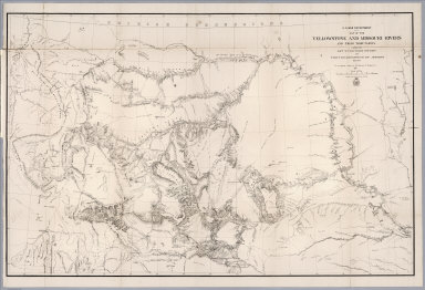
1876 Map Of The Yellowstone And Missouri Rive … Separate Map War Department Map Of The Yellowstone An … |

1900 Map Of The State Of Wyoming. Separate Map Department Of The Interior General Land … |

1874 County map of Colorado, Wyoming, Dakota, … World Atlas County map of Colorado, Wyoming, Dakota, … |

1900 Map Of The State Of Wyoming. Separate Map Department Of The Interior General Land … |

1874 A geological map of the Black Hills: by … Exploration Book A geological map of the Black Hills: by … |

1875 Drawings of new fossils found on a recon … Exploration Book Drawings of new fossils found on a recon … |

1874 Map of a reconnaissance of the Black Hil … Exploration Book Map of a reconnaissance of the Black Hil … |

1874 Map of the Black Hills from a reconnaiss … Exploration Book Map of the Black Hills from a reconnaiss … |
1868 Map of the Yellowstone and Missouri Rive … Exploration Book U.S. War Department : Map of the Yellows … |

1877 County map of Colorado, Wyoming, Dakota, … World Atlas County map of Colorado, Wyoming, Dakota, … |

1927 Wyoming National Atlas Wyoming. (Copyrighted by) National Map C … |

1877 Winnemucca, Ft. Fred Steele, Laramie, Gr … Exploration Book Sketch of Winnemucca, Nevada showing pos … |

1877 Beaver, Cheyenne, Fort Union, Georgetown … Exploration Book Sketch of Beaver, Utah showing position … |

1877 Diurnal barometric curves. Exploration Book Diurnal barometric curves. Horary curves … |

1877 Diurnal barometric curves. Exploration Book Diurnal barometric curves. Trinidad, Col … |

1877 Diurnal barometric curves. Exploration Book Diurnal barometric curves. Prescott, Ari … |

1877 Diurnal temperature. Exploration Book Diurnal temperature. Georgetown, Col. Sa … |

1877 Diurnal temperature. Exploration Book Diurnal temperature. Trinidad, Col. Pres … |

1877 Differences, wet, dry bulb thermometers. Exploration Book Mean differences, wet and dry bulb therm … |

1877 Differences, wet, dry bulb thermometers. Exploration Book Mean differences, wet and dry bulb therm … |

1890 Mont., Ida., Wyo. World Atlas County and township map, Montana, Idaho … |

1880 Wyoming. World Atlas Territory of Wyoming. (By S. Augustus Mi … |

1900 Plate CXXXVIII. Dayton Quadrangle, Wyomi … [Geologic Atlas, Geology Book] Plate CXXXVIII. Dayton Quadrangle, Wyomi … |

1900 Plate CXXXIX. Bald Mountain Quadrangle, … [Geologic Atlas, Geology Book] Plate CXXXIX. Bald Mountain Quadrangle, … |

1900 Plate CXL. Cloud Peak Quadrangle, Wyomin … [Geologic Atlas, Geology Book] Plate CXL. Cloud Peak Quadrangle, Wyomin … |

1900 Plate CXLI. Newcastle Quadrangle, Wyomin … [Geologic Atlas, Geology Book] Plate CXLI. Newcastle Quadrangle, Wyomin … |

1966 Domes & Basin. Geology of the Michigan B … Physical Atlas Domes & Basin. Geology of the Michigan B … |

1966 Domes & Basin. Laccolithic Domes. Sundan … Physical Atlas Domes & Basin. Laccolithic Domes. Sundan … |

1966 Domes & Basin. Salt Domes. Derouen, LA. … Physical Atlas Domes & Basin. Salt Domes. Derouen, LA. … |