Who What Where WhenREMOVEWHATShow MoreWHO
|
Author
Thayer, H. L.
Full Title
Thayer's Map of the Black Hills & Big Horn Country. Published By H.L Thayer Denver, Colorado. Carefully prepared from the Official Maps of the General Land Office. Explorations of Capt. Wm. Ludlow and from latest Maps of the routes of General Custer and other Officers of the Army, furnished by Capt. W.S. Stanton Chief Engr. Dept. of the Platte and from the Engineer Dept. at Washington. Entered ... 1877 by H.L. Thayer ... Washington. Edward Rollandet, Draftsman.
Publisher
H.L. Thayer
Author
Leahy, J.F.
Full Title
(Index to) Leahy's Hotel Guide and Railway Distance Maps. Wyoming.
Publisher
American Hotel register Co.
Author
Leahy, J.F.
Full Title
Leahy's Hotel Guide and Railway Distance Map of the State of Wyoming. Published by American Hotel Register Company. Leahy Build., 228-234 W. Ontario St., Chicago, Ill. Copyrighted by J.F. Leahy, Jan., 1934.
Publisher
American Hotel register Co.
Author
[Rand McNally and Company, Texas Company]
Full Title
Texaco road map Idaho, Montana, Wyoming. Copyright by Rand McNally & Company, Chicago, Illinois. Made in U.S.A. ... Texaco Touring Service, 210 Fourteenth Street, Denver, Colo. (seal) Texaco T Reg. T.M. Made by the Texas Company. Gasoline. Motor oil. (1937)
Publisher
Rand McNally
Author
[Rand McNally and Company, Texas Company]
Full Title
(Covers to) Texaco road map Idaho, Montana, Wyoming. Copyright by Rand McNally & Company, Chicago, Illinois. Made in U.S.A. ... Texaco Touring Service, 210 Fourteenth Street, Denver, Colo. (seal) Texaco T Reg. T.M. Made by the Texas Company. Gasoline. Motor oil. (1937)
Publisher
Rand McNally
Author
W. & A.K. Johnston Limited
Full Title
Montana, Wyoming (North). Utah, Colorado, Wyoming (South).
Publisher
W. & A.K. Johnston Limited
Author
[Bishop, F. M., De Motte, B. C., Geological and Geographical Survey of the Territories (U.S.), Powell, John Wesley, 1834-1902, Thompson, A. H. (Almon Harris), 1839-1906]
Full Title
Green River from the Union Pacific Rail Road to the mouth of White River, 1873 (land cover). Department of the Interior. U.S. Geological and Geographical Survey of the Territories. Second Division. J.W. Powell, geologist in charge, A.H. Thompson, geographer, B.C. De Motte & F.M. Bishop, topographers. W.H. Graves del. Outlines engraved by S.J. Kubel. U.S. G. and G. Survey, 2d. Div. ... Geology of the Unita Mountains. (Julius Bien Lith.)
Publisher
Julius Bien
Author
[Bishop, F. M., De Motte, B. C., Geological and Geographical Survey of the Territories (U.S.), Powell, John Wesley, 1834-1902, Thompson, A. H. (Almon Harris), 1839-1906]
Full Title
Green River from the Union Pacific Rail Road to the mouth of White River, 1873 (geology). Department of the Interior. U.S. Geological and Geographical Survey of the Territories. Second Division. J.W. Powell, geologist in charge, A.H. Thompson, geographer, B.C. De Motte & F.M. Bishop, topographers. W.H. Graves del. Outlines engraved by S.J. Kubel. U.S. G. and G. Survey, 2d. Div. ... Geology of the Unita Mountains. (Julius Bien Lith.)
Publisher
Julius Bien
Author
[Geological and Geographical Survey of the Territories (U.S.), Powell, John Wesley, 1834-1902]
Full Title
Structure sections through the Uinta Mountains. U.S. G. and G. Survey, 2d. Div., J.W. Powell, geologist in charge. Geology of the Unita Mountains. (Julius Bien Lith.)
Publisher
Julius Bien
Author
[Geological and Geographical Survey of the Territories (U.S.), Powell, John Wesley, 1834-1902]
Full Title
Displacement diagrams derived from the Structure sections through the Uinta Mountains, pl. I. U.S. G. and G. Survey, 2d. Div., J.W. Powell, geologist in charge. Geology of the Unita Mountains. (Julius Bien Lith.)
Publisher
Julius Bien
Author
[Geological and Geographical Survey of the Territories (U.S.), Powell, John Wesley, 1834-1902]
Full Title
Stereogram of the displacements of the eastern portion of the Uinta Mountains. U.S. G. and G. Survey, 2d. Div., J.W. Powell, geologist in charge. Geology of the Unita Mountains. (Julius Bien Lith.)
Publisher
Julius Bien
Author
[Geological and Geographical Survey of the Territories (U.S.), Gilbert, Grove Karl, 1843-1918, Powell, John Wesley, 1834-1902]
Full Title
Bird's-eye view of a part of the Uinta Uplift. Designed by G.K. Gilbert. U.S. G. and G. Survey, 2d. Div., J.W. Powell, geologist in charge. Geology of the Unita Mountains. (Julius Bien Lith.)
Publisher
Julius Bien
Author
[Geological and Geographical Survey of the Territories (U.S.), Marvine, Archibald Robertson, 1848-1876, Powell, John Wesley, 1834-1902]
Full Title
No. 1. Structure section through the Aspen Mountain Uplift. No. 2. Displacement diagram derived from the above section. (with) Generalized structure section through the Park Mountains. By Archibald R. Marvine. U.S. G. and G. Survey, 2d. Div., J.W. Powell, geologist in charge. Geology of the Unita Mountains. (Julius Bien Lith.)
Publisher
Julius Bien
Author
[Geological and Geographical Survey of the Territories (U.S.), Powell, John Wesley, 1834-1902]
Full Title
(Covers to) Atlas accompanying the report on the geology of a portion of the Uinta Mountains and a region of country adjacent thereto by J.W. Powell, Geologist in charge 1876. Julius Bien Lith. Department of the Interior, U.S. Geographical and Geological Survey of the Territories, Second Division.
Publisher
Julius Bien
Author
[Geological and Geographical Survey of the Territories (U.S.), Powell, John Wesley, 1834-1902]
Full Title
(Title Page to) Atlas accompanying the report on the geology of a portion of the Uinta Mountains and a region of country adjacent thereto by J.W. Powell, Geologist in charge 1876. Julius Bien Lith. Department of the Interior, U.S. Geographical and Geological Survey of the Territories, Second Division.
Publisher
Julius Bien
Author
[Geographical and Geological Survey of the Rocky Mountain Region (U.S.), Jenney, Walter Proctor, 1849-1921, Newton, Henry, 1845-1877]
Full Title
Bird's eye view of the Black Hills to illustrate the geological structure. Dept. of the Interior, U.S.G. and G. Survey, J.W. Powell, in charge. Geology of the Black Hills by Henry Newton, E.M. (Julius Bien, Lith. New York, 1879)
Publisher
Julius Bien
Author
[Geographical and Geological Survey of the Rocky Mountain Region (U.S.), Jenney, Walter Proctor, 1849-1921, M'Gillycuddy, V. T., Mahlo, Emil, 1851-1904, Newton, Henry, 1845-1877, Tuttle, H. P.]
Full Title
Map of the Black Hills of Dakota, from explorations made in 1873. W.P. Jenney, Engineer of Mines, in charge. H. Newton, Engineer of Mines, geologist. V.T. M'Gillycuddy, M.D., topographer. H.P. Tuttle, A.M., astronomer. Drawn by Emil Mahlo. Dept. of the Interior, U.S.G. and G. Survey, J.W. Powell, in charge. Geology of the Black Hills by Henry Newton, E.M. (Julius Bien, Lith. New York, 1879)
Publisher
Julius Bien
Author
[Geographical and Geological Survey of the Rocky Mountain Region (U.S.), Newton, Henry, 1845-1877]
Full Title
Geological map of the Black Hills of Dakota by Henry Newton, E.M. Dept. of the Interior, U.S.G. and G. Survey, J.W. Powell, in charge. Geology of the Black Hills by Henry Newton, E.M. (Julius Bien, Lith. New York, 1879)
Publisher
Julius Bien
Author
[Geographical and Geological Survey of the Rocky Mountain Region (U.S.), Jenney, Walter Proctor, 1849-1921, Newton, Henry, 1845-1877]
Full Title
(covers to) Topographical and Geological Atlas of the Black Hills of Dakota to accompany the report of Henry Newton, E.M., assistant geologist. Department of the Interior, United States Geographical and Geological Survey of the Rocky Mountain Region, J.W. Powell, in charge. Julius Bien, Lith. New York, 1879.
Publisher
Julius Bien
Author
[Geographical and Geological Survey of the Rocky Mountain Region (U.S.), Jenney, Walter Proctor, 1849-1921, Newton, Henry, 1845-1877]
Full Title
(Title Page to) Topographical and Geological Atlas of the Black Hills of Dakota to accompany the report of Henry Newton, E.M., assistant geologist. Department of the Interior, United States Geographical and Geological Survey of the Rocky Mountain Region, J.W. Powell, in charge. Julius Bien, Lith. New York, 1879.
Publisher
Julius Bien
Author
U.S. General Land Office
Full Title
(Map 11 - Wyoming, Nebraska, Colorado, Kansas, South Dakota).
Publisher
Julius Bien
Author
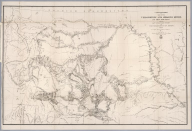
[Raynolds,W.F., Maynadier, H.E., Gillespie,G.]
Full Title
War Department Map Of The Yellowstone And Missouri Rivers And Their Tributaries explored by Capt. W.F. Raynolds Topl. Engrs. and 1st Lieut. H.E. Maynadier 10th Infy. Assistant. 1859-60. Revised and Enlarged by Major G.L. Gillespie ... 1876 ... Published by the authority of the Hon. the Secretary Of War Office of the Chief Of Engineers, U.S. Army. 1876. Engraved in the Office of the Chief of Engineers. Western Sheet Map Of Yellowstone And Missouri Rivers ... 1877.
Publisher
U.S. War Dept.
Author
U.S. General Land Office
Full Title
Department Of The Interior General Land Office Hon. Binger Hermann, Commissioner. Map Of The State Of Wyoming. Compiled from the official Records of the General Land Office and other sources under the direction of Harry King, C.E., Chief of Drafting Division G.L.O. 1900. Compiled, Drawn and Lettered by I.P. Berthrong. A.B. Graham Photo. Lith. Washington, D.C.
Publisher
A.B. Graham Photo Lith.
Author
Mitchell, Samuel Augustus Jr.
Full Title
County map of Colorado, Wyoming, Dakota, Montana. Entered ... 1874, by S. Augustus Mitchell ... Washington.
Publisher
S.A. Mitchell Jr.
Author
U.S. General Land Office
Full Title
Department Of The Interior General Land Office Hon. Binger Hermann, Commissioner. Map Of The State Of Wyoming. Compiled from the official Records of the General Land Office and other sources under the direction of Harry King, C.E., Chief of Drafting Division G.L.O. 1900. Compiled, Drawn and Lettered by I.P. Berthrong.
Publisher
No publisher.
Author
[Ludlow, William, 1843-1901, United States. Army. Corps of Engineer]
Full Title
A geological map of the Black Hills: by Professor N.H. Winchell to accompany the report of Capt. William Ludlow U.S. Engineers. (to accompany) Report of a reconnaissance of the Black Hills of Dakota, made in the summer of 1874. By William Ludlow, Captain of Engineers, Bvt. Lieut. Colonel, U. S. Army; Chief Engineer Department of Dakota. Washington : Government Printing Office. 1875.
Publisher
Government Printing Office
Author
[Ludlow, William, 1843-1901, United States. Army. Corps of Engineer]
Full Title
Drawings of new fossils found on a reconnaissance of the Black Hills of Dakota, July and August 1874. To accompany report from Mr. George Bird Grinnell. .M. Martin, del. Thos. Sinclair & Son, lith. Phila. (to accompany) Report of a reconnaissance of the Black Hills of Dakota, made in the summer of 1874. By William Ludlow, Captain of Engineers, Bvt. Lieut. Colonel, U. S. Army; Chief Engineer Department of Dakota. Washington : Government Printing Office. 1875.
Publisher
Government Printing Office
Author
[Ludlow, William, 1843-1901, United States. Army. Corps of Engineer]
Full Title
Map of a reconnaissance of the Black Hills of Dakota, July and August 1874. With troops under command of Lt. Col. G.A.Custer, 7th., Cavalry, by Capt. Wm. Ludlow, Corps of Engineers. (on upper margin) Brig. Genl. A.A.Humphreys, Chief of Engineers U.S.A. ; Brig. Genl. A.H. Terry Comdg. Department. (to accompany) Report of a reconnaissance of the Black Hills of Dakota, made in the summer of 1874. By William Ludlow, Captain of Engineers, Bvt. Lieut. Colonel, U. S. Army; Chief Engineer Department of Dakota. Washington : Government Printing Office. 1875.
Publisher
Government Printing Office
Author
[Ludlow, William, 1843-1901, United States. Army. Corps of Engineer]
Full Title
Map of the Black Hills from a reconnaissance by Capt. Wm. Ludlow, Corps of Engineers. 1874, and map of Warren and Raynolds. Drawn by Sergt. C. Becker. (to accompany) Report of a reconnaissance of the Black Hills of Dakota, made in the summer of 1874. By William Ludlow, Captain of Engineers, Bvt. Lieut. Colonel, U. S. Army; Chief Engineer Department of Dakota. Washington : Government Printing Office. 1875.
Publisher
Government Printing Office
Author
Raynolds, W.F.
Full Title
U.S. War Department : Map of the Yellowstone and Missouri Rivers and their tributaries. Explored by Capt. W. F. Raynolds, TopL. Engrs. and 1st. Lieut. H. E. Maynadier, 10th. Infy. Assistant 1859-60. To accompany a report to the Bureau of Engineers 1867. Engraved in the Engineer Bureau, War Dept. (to accompany) Report of the Secretary of War, communicating ... the report of Brevet Brigadier General W.F. Raynolds, on the exploration of the Yellowstone and the country drained by that river.
Publisher
War Dept.
Author
Mitchell, Samuel Augustus Jr.
Full Title
County map of Colorado, Wyoming, Dakota, Montana. Entered ... 1877 by S. Augustus Mitchell, . ... Washington.
Publisher
S.A. Mitchell Jr.
Author
National Map Company
Full Title
Wyoming. (Copyrighted by) National Map Company, Indianapolis. (to accompany) Official Paved Road and Commercial Survey of the United States.
Publisher
National Map Company
Author
[United States. Army. Corps of Engineers, Wheeler, G.M.]
Full Title
Sketch of Winnemucca, Nevada showing position of observing block and meridian mark. Sketch of Ft. Fred Steele, Wyoming showing position of observing block and meridian mark. Sketch of Laramie, Wyoming showing position of observing block and meridian mark. Sketch of Green River, Wyoming showing position of observing block and meridian mark. Sketch of Carlin, Nevada showing position of astronomical monument and meridian marks. Sketch of Battle Mountain, Nevada showing position of astronomical monument and meridian mark. Surveyed in 1873. Expeditions of 1871, 1872, 1873 & 1874, under the command of 1st Lieut. Geo. M. Wheeler, Corps of Engineers, U.S. Army. U.S. Geographical Surveys West of the 100th Meridian. George D. Clarke, del. The Graphic Co., N.Y. By order of the honorable the Secretary of War, under the direction of Brig. Gen. A.A. Humphreys, Chief of Engineers, U.S. Army. (1877)
Publisher
U.S.
Author
[United States. Army. Corps of Engineers, Wheeler, G.M.]
Full Title
Sketch of Beaver, Utah showing position of astronomical monument. Sketch of Cheyenne, Wyoming showing position of astronomical monument. Sketch of Fort Union, New Mexico showing position of astronomical monument. Sketch of Georgetown, Colorado showing position of astronomical monument and meridian mark. Sketch of St. George, Utah showing position of astronomical monument. Military reservation, Santa Fe, New Mexico showing position of astronomical monument. Expeditions of 1872, 1873, 1874, 1875 & 1876, under the command of 1st Lieut. Geo. M. Wheeler, Corps of Engineers, U.S. Army. U.S. Geographical Surveys West of the 100th Meridian. George D. Clarke, del. The Graphic Co., N.Y. By order of the honorable the Secretary of War, under the direction of Brig. Gen. A.A. Humphreys, Chief of Engineers, U.S. Army. (1877)
Publisher
U.S.
Full Title
Diurnal barometric curves. Horary curves Georgetown, Col. ... Colorado Springs, Col. ... Green River, Wyo. Terr. ... Los Angeles, Cal. ... Salt Lake City, Utah ... Santa Fe, New Mexico ... U.S. Geographical Surveys West of the 100th Meridian. (1877)
Publisher
U.S.
Full Title
Diurnal barometric curves. Trinidad, Col. Odgen, Utah. Cheyenne, Wyo. Terr. Truxton Springs, Ariz. Pioche, Nev. Ft. Fred Steele, Wyo. Terr. U.S. Geographical Surveys West of the 100th Meridian. (1877)
Publisher
U.S.
Full Title
Diurnal barometric curves. Prescott, Ariz. Winnemucca, Nev. Gunnison, Utah. Virginia City, Nev. Laramie, Wyo. Terr. Bozeman, Montana. U.S. Geographical Surveys West of the 100th Meridian. (1877)
Publisher
U.S.
Full Title
Diurnal temperature. Georgetown, Col. Salt lake City, Utah. Green River Sta., Wyo. Terr. Santa Fe, New Mex. Los Angeles, Cal. Colorado Springs, Col. U.S. Geographical Surveys West of the 100th Meridian. (1877)
Publisher
U.S.
Full Title
Diurnal temperature. Trinidad, Col. Prescott, Ariz. Cheyenne, Wyo. Terr. Pioche, Nev. Ogden, Utah. Ft. Steele, Wyo. Terr. U.S. Geographical Surveys West of the 100th Meridian. (1877)
Publisher
U.S.
Full Title
Mean differences, wet and dry bulb thermometers. Georgetown, Col. Salt Lake City, Utah. Green River, Wyo. Santa Fe, N.M. Los Angeles, Cal. Colorado Springs, Col. U.S. Geographical Surveys West of the 100th Meridian. (1877)
Publisher
U.S.
Full Title
Mean differences, wet and dry bulb thermometers. Trinidad, Col. Prescott, Ariz. Cheyenne, Wyo. Terr. Pioche, Nev. Ogden, Utah. Ft. Steele, Wyo. Terr. U.S. Geographical Surveys West of the 100th Meridian. (1877)
Publisher
U.S.
Full Title
County and township map, Montana, Idaho and Wyoming. Copyright 1887 by Wm. M. Bradley & Bro. (1890)
Publisher
John Y. Huber & Co.
Full Title
Territory of Wyoming. (By S. Augustus Mitchell. 1880)
Publisher
S.A. Mitchell
Author
[USGS (U.S. Geological Survey), Walcott, Charles D., Tweedy, Frank]
Full Title
Plate CXXXVIII. Dayton Quadrangle, Wyoming, Land Classification and Density of Standing Timber. Julis Bien & Co. Lith. N.Y.
Publisher
Government Printing Office
Author
[USGS (U.S. Geological Survey), Walcott, Charles D., Tweedy, Frank]
Full Title
Plate CXXXIX. Bald Mountain Quadrangle, Wyoming, Land Classification and Density of Standing Timber. Julis Bien & Co. Lith. N.Y.
Publisher
Government Printing Office
Author
[USGS (U.S. Geological Survey), Walcott, Charles D., Matthes, F.E.]
Full Title
Plate CXL. Cloud Peak Quadrangle, Wyoming, Land Classification and Density of Standing Timber. Julis Bien & Co. Lith. N.Y.
Publisher
Government Printing Office
Author
[USGS (U.S. Geological Survey), Walcott, Charles D., Herron, W.H.]
Full Title
Plate CXLI. Newcastle Quadrangle, Wyoming - South Dakota, Land Classification and Density of Standing Timber. Julis Bien & Co. Lith. N.Y.
Publisher
Government Printing Office
Author
[Scovel, James L., O'Brien, Emmett J]
Full Title
Domes & Basin. Geology of the Michigan Basin. (on opposite page) Anticlinal Domes. Sinclair, Wyo. 1:24,000. (with inset view) Stereotriplet of Grenville Dome).
Publisher
John Wiley & Sons Inc.
Author
[Scovel, James L., O'Brien, Emmett J]
Full Title
Domes & Basin. Laccolithic Domes. Sundance, Wyo. (with view on opposite page): Stereotriplet of Suncance, Wyoming, and Assumed Cross-sections of Laccoliths near Sundance, Wyoming.
Publisher
John Wiley & Sons Inc.
|