|
Author
[USGS (U.S. Geological Survey), Walcott, Charles D., Gannett, Henry, Leiberg, John B.]
Full Title
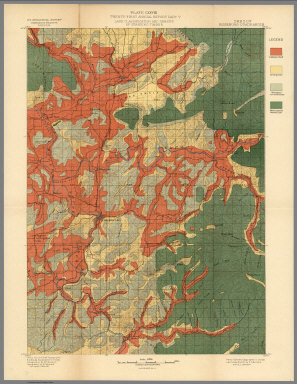
Plate LXXXIV. Part of Southern Oregon Showing Distribution of Lodgepole Pine by John B. Leiberg. 1899.
Publisher
Government Printing Office
Author
[USGS (U.S. Geological Survey), Walcott, Charles D., Thompson, A.H., Sudworth, George B., Gannett, Henry]
Full Title
Plate LXXXV. Placerville Quadrangle, Land Classification and Density of Standing Timber.
Publisher
Government Printing Office
Author
[USGS (U.S. Geological Survey), Walcott, Charles D., Gannett, Henry, Sudworth, George B.]
Full Title
Plate LXXXVI. Pyramid Peak Quadrangle, Land Classification and Density of Standing Timber. Julius Bien & Co. Lith. N.Y.
Publisher
Government Printing Office
Author
[USGS (U.S. Geological Survey), Walcott, Charles D., Sudworth, George B.]
Full Title
Plate LXXXVII. Jackson Quadrangle, Land Classification and Density of Standing Timber. Julius Bien & Co. Lith. N.Y.
Publisher
Government Printing Office
Author
[USGS (U.S. Geological Survey), Walcott, Charles D., Sudworth, George B.]
Full Title
Plate LXXXVIII. Big Trees Quadrangle, California. Land Classification and Density of Standing Timber.
Publisher
Government Printing Office
Author
[USGS (U.S. Geological Survey), Walcott, Charles D., Sudworth, George B.]
Full Title
Plate LXXXIX. Markleeville Quadrangle, California. Land Classification and Density of Standing Timber. Julius Bien & Co. Lith. N.Y.
Publisher
Government Printing Office
Author
[USGS (U.S. Geological Survey), Sudworth, George B., Walcott, Charles D.]
Full Title
Plate XC. Dardanelles Quadrangle, California. Land Classification and Density of Standing Timber. Julius Bien & Co. Lith. N.Y.
Publisher
Government Printing Office
Author
[USGS (U.S. Geological Survey), Walcott, Charles D., Sudworth, George B.]
Full Title
Plate CXV. Sonora Quadrangle, California. Land Classification and Density of Standing Timber.
Publisher
Government Printing Office
Author
[USGS (U.S. Geological Survey), Walcott, Charles D., Sudworth, George B.]
Full Title
Plate CXVI. Yosemite Quadrangle, California. Land Classification and Density of Standing Timber. Julius Bien & Co. Lith. N.Y.
Publisher
Government Printing Office
Author
[USGS (U.S. Geological Survey), Walcott, Charles D., Sudworth, George B.]
Full Title
Plate CXVII. Mt. Lyell Quadrangle, California. Land Classification and Density of Standing Timber. Julius Bien & Co. Lith. N.Y.
Publisher
Government Printing Office
Author
[USGS (U.S. Geological Survey), Walcott, Charles D.]
Full Title
Plate CXXV. San Jacinto Quadrangle, California. Land Classification and Density of Standing Timber.
Publisher
Government Printing Office
Author
[USGS (U.S. Geological Survey), Walcott, Charles D.]
Full Title
Plate CXXVI. Port Orford Quadrangle, Oregon, Land Classification and Density of Standing Timber.
Publisher
Government Printing Office
Author
[USGS (U.S. Geological Survey), Walcott, Charles D., Gannett, Henry]
Full Title
Plate CXXVII. Coos Bay Quadrangle, Oregon, Land Classification and Density of Standing Timber.
Publisher
Government Printing Office
Author
[USGS (U.S. Geological Survey), Walcott, Charles D., Gannett, Henry]
Full Title
Plate CXXVIII. Roseburg Quadrangle, Oregon, Land Classification and Density of Standing Timber.
Publisher
Government Printing Office
Author
[USGS (U.S. Geological Survey), Gannett, Henry, Walcott, Charles D.]
Full Title
Plate CXXIX. Tacoma Quadrangle, Washington, Land Classification and Density of Standing Timber.
Publisher
Government Printing Office
Author
[USGS (U.S. Geological Survey), Walcott, Charles D., Gannett, Henry]
Full Title
Plate CXXX. Seattle Quadrangle, Washington, Land Classification and Density of Standing Timber.
Publisher
Government Printing Office
Author
[USGS (U.S. Geological Survey), Gannett, Henry, Walcott, Charles D.]
Full Title
Plate CXXXI. Mount Stuart Quadrangle, Washington, Land Classification and Density of Standing Timber.
Publisher
Government Printing Office
Author
[USGS (U.S. Geological Survey), Walcott, Charles D., Gannett, Henry]
Full Title
Plate CXXXII. Ellensburg Quadrangle, Washington, Land Classification and Density of Standing Timber. Julis Bien & Co. Lith. N.Y.
Publisher
Government Printing Office
Author
[USGS (U.S. Geological Survey), Gannett, Henry, Walcott, Charles D.]
Full Title
Plate CXXXIII. Chelan Quadrangle, Washington, Land Classification and Density of Standing Timber. Julis Bien & Co. Lith. N.Y.
Publisher
Government Printing Office
Author
[USGS (U.S. Geological Survey), Gannett, Henry, Walcott, Charles D.]
Full Title
Plate CXXXIV. Spokane Quadrangle, Washington-Idaho, Land Classification and Density of Standing Timber. Julis Bien & Co. Lith. N.Y.
Publisher
Government Printing Office
Author
[USGS (U.S. Geological Survey), Walcott, Charles D., Leiberg, John B., Barnard, E.C., Searle, A.B.]
Full Title
Plate CXXXV. Sandpoint Quadrangle, (Kootenai Co) Idaho, Land Classification and Density of Standing Timber. Julis Bien & Co. Lith. N.Y.
Publisher
Government Printing Office
Author
[USGS (U.S. Geological Survey), Gannett, Henry, Walcott, Charles D.]
Full Title
Plate CXXXVI. Hamilton Quadrangle, Montana-Idaho, Land Classification and Density of Standing Timber. Julis Bien & Co. Lith. N.Y.
Publisher
Government Printing Office
Author
[USGS (U.S. Geological Survey), Walcott, Charles D., Barnard, E.C.]
Full Title
Plate CXXXVII. Fortymile Quadrangle, Alaska, Land Classification and Density of Standing Timber. Julis Bien & Co. Lith. N.Y.
Publisher
Government Printing Office
Author
[USGS (U.S. Geological Survey), Walcott, Charles D., Tweedy, Frank]
Full Title
Plate CXXXVIII. Dayton Quadrangle, Wyoming, Land Classification and Density of Standing Timber. Julis Bien & Co. Lith. N.Y.
Publisher
Government Printing Office
Author
[USGS (U.S. Geological Survey), Walcott, Charles D., Tweedy, Frank]
Full Title
Plate CXXXIX. Bald Mountain Quadrangle, Wyoming, Land Classification and Density of Standing Timber. Julis Bien & Co. Lith. N.Y.
Publisher
Government Printing Office
Author
[USGS (U.S. Geological Survey), Walcott, Charles D., Matthes, F.E.]
Full Title
Plate CXL. Cloud Peak Quadrangle, Wyoming, Land Classification and Density of Standing Timber. Julis Bien & Co. Lith. N.Y.
Publisher
Government Printing Office
Author
[USGS (U.S. Geological Survey), Walcott, Charles D., Herron, W.H.]
Full Title
Plate CXLI. Newcastle Quadrangle, Wyoming - South Dakota, Land Classification and Density of Standing Timber. Julis Bien & Co. Lith. N.Y.
Publisher
Government Printing Office
Author
[USGS (U.S. Geological Survey), Walcott, Charles D.]
Full Title
Plate CXLII. Map of Indian Territory, Showing Distribution of Woodland, Compiled under the Direction of C.H.Fitch by Gilbert Thompson, F.E. Matthes and M.L. Cudlipp. 1899.
Publisher
Government Printing Office
Author
[USGS (U.S. Geological Survey), Walcott, Charles D.]
Full Title
Plate CXLIII. Pine Region of Minnesota Showing Classification of Lands, Compiled under the direction of Henry Gannet, Geographer in Charge, by H.B. Ayres. 1899. Julius Bien & Co. Lith. N.Y.
Publisher
Government Printing Office
Author
[USGS (U.S. Geological Survey), Walcott, Charles D., Gannett, Henry]
Full Title
Plate I. Map Showing Location and Extent of the Forest Reserves and National Parks in Western United States, 1899. Julius Bien & Co. Lith. N.Y.
Publisher
Government Printing Office
Author
[USGS (U.S. Geological Survey), Walcott, Charles D., Ayers, H.B.]
Full Title
Plate III. Lewis and Clark Forest Reserve, Montana, Showing Classification of Lands ... by H.B. Ayers, 1899.
Publisher
Government Printing Office
Author
[USGS (U.S. Geological Survey), Walcott, Charles D., Ayers, H.B.]
Full Title
Plate VIII. Lewis and Clark Forest Reserve, Montana, by H.B. Ayers, 1899. Julius Bien & Co, N.Y.
Publisher
Government Printing Office
Author
[USGS (U.S. Geological Survey), Walcott, Charles D., Ayers, H.B.]
Full Title
Plate XIV. Lewis and Clark Forest Reserve, Montana, Showing distribution of cedar, hemlock, white pine and silver fir ... by H.B. Ayers. Julius Bien & Co. N.Y.
Publisher
Government Printing Office
Author
[USGS (U.S. Geological Survey), Walcott, Charles D., Ayers, H.B.]
Full Title
Plate XXVII. Lewis and Clark Forest Reserve, Montana, Showing distribution of yellow pine, white-bark pine, and limber pine ... by H.B.Ayers. 1899.
Publisher
Government Printing Office
Author
[USGS (U.S. Geological Survey), Walcott, Charles D., Plummer, Fred G.]
Full Title
Plate XXXIII. Mount Rainier Forest Reserve, Washington, Showing Classification of Lands, by Fred G. Plummer. 1899.
Publisher
Government Printing Office
Author
[U.S. Coast and Geodetic Survey, Alaskan Boundary Tribunal]
Full Title
(Facsimile) General Map Adjacent Parts of North America and Asia. Prepared at the Office of the Coast and Geodetic Survey. Alaskan Boundary Tribunal, 1903. No. 1. Photo. Lith. by A. Hoen & Co. Baltimore, MD.
Publisher
Government Printing Office
Author
[U.S. Coast and Geodetic Survey, Alaskan Boundary Tribunal]
Full Title
(Facsimile) Map of Southeastern Alaska. Prepared at the Office of the U.S. Coast and Geodetic Survey from the Latest Official U.S. and Canadian Surveys. Alaskan Boundary Tribunal, 1903. 2. Photo. Lith. by A. Hoen & Co. Baltimore, MD.
Publisher
Government Printing Office
Author
[U.S. Coast and Geodetic Survey, Alaskan Boundary Tribunal]
Full Title
(Facsimile) Map of Southeastern Alaska. Showing the Four Boundary Lines proposed by Sir Charles Bagot during the British-Russian Negotiations. Prepared at the Office of the U.S. Coast and Geodetic Survey from the Latest Official U.S. and Canadian Surveys. Alaskan Boundary Tribunal, 1903. 3. Photo. Lith. by A. Hoen & Co. Baltimore, MD.
Publisher
Government Printing Office
Author
[Alaskan Boundary Tribunal, Vancouver, George]
Full Title
(Facsimile) A Chart shewing part of the Coast of N.W. America (portion) with the Tracks of His Majesty's Sloop Discovery and Armed Tender Chatham Commanded by George Vancouver, Esq.... Alaskan Boundary Tribunal, 1903. 4. (inset) A Survey of Port Stewart. London: Published May 1st, 1798 by J. Edwards Pall Mall & G. Robinson Paternoster Row. Photo. Lith. by A. Hoen & Co. Baltimore, MD.
Publisher
Government Printing Office
Author
[Alaskan Boundary Tribunal, Vancouver, George]
Full Title
(Facsimile) A Chart shewing part of the Coast of N.W. America (portion) with the Tracks of His Majesty's Sloop Discovery and Armed Tender Chatham, Commanded by George Vancouver Esq.... Alaskan Boundary Tribunal, 1903. 5. (inset) Entrance to Cross Sound. (inset) A Survey of Point Conclusion. (inset) A Survey of Port Protection. London: Published May 1st, 1798 by J. Edwards Pall Mall & G. Robinson Paternoster Row. Photo. Lith. by A. Hoen & Co. Baltimore, MD.
Publisher
Government Printing Office
Author
Alaskan Boundary Tribunal
Full Title
(Facsimile) Russian Explorations of Pacific and Icy Seas (portion). Alaskan Boundary Tribunal, 1903. 6. Photo. Lith. by A. Hoen & Co. Baltimore, MD.
Publisher
Government Printing Office
Author
[Alaskan Boundary Tribunal, Walch, Joh.]
Full Title
(Facsimile) Charte von Nordamerica (portion) nach den neuesten Entdeckungen und zuverlassigsten astronomischen Ortsbestimmungen entworsen. Augsburg, bey Joh. Walch. 1807. Alaska Boundary Tribunal, 1903. 7. Photo. Lith. by A. Hoen & Co. Baltimore, MD.
Publisher
Government Printing Office
Author
[Pinkerton, Alaskan Boundary Tribunal, Arrowsmith]
Full Title
(Facsimile) British Possessions in North America (portion). From Mr. Arrowsmith's Map of North America. Pinkerton's Modern Atlas. 1818. Alaska Boundary Tribunal, 1903. 8. Photo. Lith. by A. Hoen & Co. Baltimore, MD.
Publisher
Government Printing Office
Author
[Brue, Adrien Hubert, 1786-1832, Alaskan Boundary Tribunal]
Full Title
(Facsimile) Carte Encyprotype de L'Amerique Septentrionale (portion), Dedice et Presentee a Monsieur Par M. Brue, Ingenieur-Geographe de J.A. Royale a Paris. Chez Desray, Libraire-Editeur, Rue Haute-feuille, No. 4 pres celle St. Andre des Ares; (Chez) J. Goujon, Marchand de Cartes Geographiques, Rue de Bac, No. 6. (1815). Revue & Augmentee par l'Auteur en Avril 1819. Alaska Boundary Tribunal, 1903. 9. Photo. Lith. by A. Hoen & Co. Baltimore, MD.
Publisher
Government Printing Office
Author
[Arrowsmith, Aaron, Alaskan Boundary Tribunal]
Full Title
(Facsimile) Map of America (portion) by A. Arrowsmith. 1822. Additions to 1823. Alaska Boundary Tribunal, 1903. 10. Photo. Lith. by A. Hoen & Co. Baltimore, MD.
Publisher
Government Printing Office
Author
[Alaskan Boundary Tribunal, Russian Admiralty]
Full Title
(Facsimile) Russian Admiralty's Chart Northeast Pacific (portion). Alaska Boundary Tribunal, 1903. 11. Photo. Lith. by A. Hoen & Co. Baltimore, MD. 1266.
Publisher
Government Printing Office
Author
[Arrowsmith, Aaron, Alaskan Boundary Tribunal]
Full Title
(Facsimile) A Map Exhibiting All the New Discoveries in the Interior Parts of North America, Inscribed by Permission to the Honorable Governor and Company of Adventurers of England, Trading into Hudson's Bay. A Testimony to their Liberal Communications To their most Obedient and very Humble Servant A. Arrowsmith. ... January 1, 1795. Additions to 1811, 18, 19, 20, 24, 33. London. Published Jan. 1, 1833 by S. Arrowsmith No. 10 Soho Square _ Hydrographer to His Majesty. Alaska Boundary Tribunal, 1903. 12. Photo. Lith. by A. Hoen & Co. Baltimore, MD.
Publisher
Government Printing Office
Author
[Brue, Adrien Hubert, 1786-1832, Alaskan Boundary Tribunal]
Full Title
(Facsimile) Nouvelle Carte de L'Amerique Septentrionale du Groenland (portion) et de Iles qui en Dependent dediee a l'Academie royale des sciences de l'Institut de France par A.H. Brue, Geographe du Roi ... Paris, 1833. Chez Mme. Vve. Brue, rue des Macons-Sorbonne, No. 11 .... Alaskan Boundary Tribunal, 1903. 13. Photo. Lith. by A. Hoen & Co. Baltimore, MD.
Publisher
Government Printing Office
Author
[Alaskan Boundary Tribunal, Tanner, H.S.]
Full Title
(Facsimile) A Map of North America Constructed According to the Latest Information by H.S. Tanner (portion). 1839. Alaskan Boundary Tribunal, 1903. 14. Photo. Lith. by A. Hoen & Co. Baltimore, MD.
Publisher
Government Printing Office
Author
[Alaskan Boundary Tribunal, Greenhow, Robert]
Full Title
(Facsimile) Map of the Western & Middle Portions of North America (portion), to illustate the History of California, Oregon, and the Other Countries on the North-West Coast of America, by Robert Greenhow. Compiled from the best Authorities by Robert Greenhow. Drawn by George H. Ringgold, Engraved by E.F. Woodward Philada. Alaskan Boundary Tribunal, 1903. 15. Photo. Lith. by A. Hoen & Co. Baltimore, MD.
Publisher
Government Printing Office
|