Who What Where WhenREMOVEWHATShow MoreWHEREShow More |
Author
U.S. General Land Office
Full Title
(Map 10 - Texas, New Mexico, Indian Territories, Utah).
Publisher
Julius Bien
Author
U.S. General Land Office
Full Title
(Map 11 - Wyoming, Nebraska, Colorado, Kansas, South Dakota).
Publisher
Julius Bien
Author
U.S. General Land Office
Full Title
(Map 12 - Montana, North Dakota).
Publisher
Julius Bien
Author
U.S. General Land Office
Full Title
(Map 13 - Alaska).
Publisher
Julius Bien
Author
U.S. General Land Office
Full Title
(Map 14 - California, Arizona, Nevada).
Publisher
Julius Bien
Author
U.S. General Land Office
Full Title
(Map 15 - California, Nevada, Utah, Idaho).
Publisher
Julius Bien
Author
U.S. General Land Office
Full Title
(Map 16 - Washington, Oregon, Montana, Idaho).
Publisher
Julius Bien
Author
U.S. General Land Office
Full Title
(Composite of) Centennial Map Of The United States and Territories Showing the Extent of Public Surveys, Indian and Military Reservations...& Other Details.
Publisher
Julius Bien
Author
[Freyhold, Edward, Warren, Gouverneur Kemble, 1830-1882]
Full Title
Territory Of The United States From The Mississippi River To The Pacific Ocean; Originally prepared to accompany the Reports of the Explorations For A Pacific Railroad Route ... Compiled from authorized explorations and other reliable data by Lieut. G.K. Warren, Top'l. Eng'rs. In the Office of Pacific R.R. Surveys, War Dept. under the direction of Bvt. Maj. W.H. Emory, Top'l. Eng'rs. in 1854. Capt. A.A. Humphreys, Top'l. Eng'rs. in 1854-58. Recompiled and redrawn under the direction of the Chief of Corps of Engineers By Edward Freyhold 1865-66-67-68. Head Quarters Corp Of Engineers, War Department. Engraved & printed by Julius Bien, N.Y. (inset) Territory Of Alaska Ceded By Russia To The United States 1868.
Publisher
Julius Bien
Author
King, Clarence
Full Title
(Cover to) Atlas Accompanying Volume III on Mining Industry.
Publisher
Julius Bien
Author
King, Clarence
Full Title
(Title Page) United States Geological Exploration of the Fourtieth Parallel. Clarence King. Geologist in Charge. Atlas Accompanying Volume III on Mining Industry. (Table of Contents - list of plates).
Publisher
Julius Bien
Author
King, Clarence
Full Title
Plate 1. Part of the U.S. Engineer Department's Map of the Western States and Territories, Showing Location of Mining Districts.
Publisher
Julius Bien
Author
King, Clarence
Full Title
Plate 2. Geological Map of the Washoe Mining District, Geology: C. King. Topography: J.T. Gardner.
Publisher
Julius Bien
Author
King, Clarence
Full Title
Plate 3. Horizontal Map Gold Hill Mines Workings, Comstock Lode.
Publisher
Julius Bien
Author
King, Clarence
Full Title
Plate 4. Horizontal Map Virginia Mines Workings, Comstock Lode.
Publisher
Julius Bien
Author
King, Clarence
Full Title
Plate 6. Longitudinal Elevation Gold Hill Mines, Comstock Lode.
Publisher
Julius Bien
Author
King, Clarence
Full Title
Plate 7. Longitudinal Elevation Virginia Mines, Comstock Lode.
Publisher
Julius Bien
Author
King, Clarence
Full Title
Plate 8. Cross Sections Gold Hill Mines, Comstock Lode.
Publisher
Julius Bien
Author
King, Clarence
Full Title
Plate 11. Cross Sections Virginia Mines, Comstock Lode.
Publisher
Julius Bien
Author
King, Clarence
Full Title
Plate 12. Sections, Comstock Lode.
Publisher
Julius Bien
Author
King, Clarence
Full Title
Plate 13. Geological Map of the Toyabe (Toiyabe) Mountains. Geology: S.F. Emmons. Topography: A.D. Wilson.
Publisher
Julius Bien
Author
King, Clarence
Full Title
Plate 14. Geological Map of the White Pine Mining District. Geology: A. Hague. Topography: F.A. Clark.
Publisher
Julius Bien
Author
King, Clarence
Full Title
Plate 5. Horizontal Map North Virginia Mines Workings, Comstock Lode.
Publisher
Julius Bien
Author
King, Clarence
Full Title
Plate 9. Cross Sections Virginia Mines, Comstock Lode.
Publisher
Julius Bien
Author
King, Clarence
Full Title
Plate 10. Cross Sections Virginia Mines, Comstock Lode.
Publisher
Julius Bien
Author
[U.S. North West Boundary Survey, Campbell, Archibald]
Full Title
Sheet No. 1. Photo-Lithographic Copy Of The Detailed Maps Of The North West Boundary ...Between The United States And The British Possessions Under the Treaty of June 15th 1846. (A-kwote-katl-nam Lake to Kootenay River, Washington Territory and British Columbia).
Publisher
Julius Bien
Author
[U.S. North West Boundary Survey, Campbell, Archibald]
Full Title
Sheet No. 2. Photo-Lithographic Copy Of The Detailed Maps Of The North West Boundary ...Between The United States And The British Possessions Under the Treaty of June 15th 1846. (Kootenay River to Camp Kootenay W., Washington Territory and British Columbia).
Publisher
Julius Bien
Author
[U.S. North West Boundary Survey, Campbell, Archibald]
Full Title
Sheet No. 3. Photo-Lithographic Copy Of The Detailed Maps Of The North West Boundary ...Between The United States And The British Possessions Under the Treaty of June 15th 1846. (Camp Kootenay W. to Camp Columbia and Yome-tsin Creek, Washington Territory and British Columbia).
Publisher
Julius Bien
Author
[U.S. North West Boundary Survey, Campbell, Archibald]
Full Title
Sheet No. 4. Photo-Lithographic Copy Of The Detailed Maps Of The North West Boundary ...Between The United States And The British Possessions Under the Treaty of June 15th 1846. (Little Dalles and Yome-tsin Creek to Rock Creek, Washington Territory and British Columbia).
Publisher
Julius Bien
Author
[U.S. North West Boundary Survey, Campbell, Archibald]
Full Title
Sheet No. 5. Photo-Lithographic Copy Of The Detailed Maps Of The North West Boundary ...Between The United States And The British Possessions Under the Treaty of June 15th 1846. (Camp O-so-yoos and O-so-yoos Lake to Camp Pa-say-ten, Washington Territory and British Columbia).
Publisher
Julius Bien
Author
[U.S. North West Boundary Survey, Campbell, Archibald]
Full Title
Sheet No. 6. Photo-Lithographic Copy Of The Detailed Maps Of The North West Boundary ...Between The United States And The British Possessions Under the Treaty of June 15th 1846. (Camp Pa-say-ten to Chiloweyuck River, Washington Territory and British Columbia).
Publisher
Julius Bien
Author
[U.S. North West Boundary Survey, Campbell, Archibald]
Full Title
Sheet No. 7. (Sheet with Title). Photo-Lithographic Copy Of The Detailed Maps Of The North West Boundary ...Between The United States And The British Possessions Under the Treaty of June 15th 1846. (Chiloweyuck River to Point Roberts, Washington Territory and British Columbia).
Publisher
Julius Bien
Author
[U.S. North West Boundary Survey, Campbell, Archibald]
Full Title
(Composite of) Sheets No. 1-7. Photo-Lithographic Copy Of The Detailed Maps Of The North West Boundary ...Between The United States And The British Possessions Under the Treaty of June 15th 1846. (A-kwote-katl-nam Lake to Point Roberts, Washington Territory and British Columbia).
Publisher
Julius Bien
Author
U.S. General Land Office
Full Title
Department Of The Interior General Land Office J.A. Williamson, Commissioner. State Of California. 1876. Compiled from the official Records of the General Land Office and other sources by C. Roeser, Principal Draughtsman G.L.O. Photo lith & print by Julius Bien 16 & 18 Park Place N.Y.
Publisher
Julius Bien
Author
[Bien, Joseph Rudolf, Vermeule, C. C. (Cornelius Clarkson), 1858-1950]
Full Title
Index map showing the area covered by this atlas, and boundaries and numbers of the various maps. Copyrighted by Julius Bien & Co., 1890. (1891)
Publisher
Julius Bien
Author
[Bien, Joseph Rudolf, Vermeule, C. C. (Cornelius Clarkson), 1858-1950]
Full Title
City and county of New York. Copyrighted by Julius Bien & Co., 1890. (1891)
Publisher
Julius Bien
Author
[Bien, Joseph Rudolf, Vermeule, C. C. (Cornelius Clarkson), 1858-1950]
Full Title
Brooklyn, New York Bay, Jersey City, Hoboken, Bayonne and Newark Bay. Copyrighted by Julius Bien & Co., 1890. (1891)
Publisher
Julius Bien
Author
[Bien, Joseph Rudolf, Vermeule, C. C. (Cornelius Clarkson), 1858-1950]
Full Title
The Narrows to Jamaica Bay-Coney Island, north to Brooklyn. Copyrighted by Julius Bien & Co., 1890. (1891)
Publisher
Julius Bien
Author
[Bien, Joseph Rudolf, Vermeule, C. C. (Cornelius Clarkson), 1858-1950]
Full Title
Richmond County, Staten Island. Copyrighted by Julius Bien & Co., 1890. (1891)
Publisher
Julius Bien
Author
[Bien, Joseph Rudolf, Vermeule, C. C. (Cornelius Clarkson), 1858-1950]
Full Title
Newark, Elizabeth, the Oranges and vicinity. Copyrighted by Julius Bien & Co., 1890. (1891)
Publisher
Julius Bien
Author
[Bien, Joseph Rudolf, Vermeule, C. C. (Cornelius Clarkson), 1858-1950]
Full Title
Newark to Paterson East. Copyrighted by Julius Bien & Co., 1890. (1891)
Publisher
Julius Bien
Author
[Bien, Joseph Rudolf, Vermeule, C. C. (Cornelius Clarkson), 1858-1950]
Full Title
Long Island Sound, Westchester north to Mt. Vernon, Queens south to Jamaica. Copyrighted by Julius Bien & Co., 1890. (1891)
Publisher
Julius Bien
Author
[Bien, Joseph Rudolf, Vermeule, C. C. (Cornelius Clarkson), 1858-1950]
Full Title
Westchester County, Yonkers to Dobbs Ferry, east to state line. Copyrighted by Julius Bien & Co., 1890. (1891)
Publisher
Julius Bien
Author
[Bien, Joseph Rudolf, Vermeule, C. C. (Cornelius Clarkson), 1858-1950]
Full Title
Westchester County, Irvington, Tarrytown to Sing Sing, east to state line. Copyrighted by Julius Bien & Co., 1890. (1891)
Publisher
Julius Bien
Author
[Bien, Joseph Rudolf, Vermeule, C. C. (Cornelius Clarkson), 1858-1950]
Full Title
(Contents to) Atlas of the Metropolitan District and adjacent country comprising the counties of New York, Kings, Richmond, Westchester and part of Queens in the state of New York, the County of Hudson and parts of the counties of Bergen, Passaic, Essex and Union in the state of New Jersey ... From original surveys by J.R. Bien and C.C. Vermeule, the U.S. Coast and Geodetic Survey and the Geological Survey of New Jersey. Published by Julius Bien & Co. New York. 1891.
Publisher
Julius Bien
Author
[Bien, Joseph Rudolf, Vermeule, C. C. (Cornelius Clarkson), 1858-1950]
Full Title
Westchester County, Scarborough to Putnam County line east. Copyrighted by Julius Bien & Co., 1890. (1891)
Publisher
Julius Bien
Author
[Bien, Joseph Rudolf, Vermeule, C. C. (Cornelius Clarkson), 1858-1950]
Full Title
Westchester County, vicinity of Croton Lake. Copyrighted by Julius Bien & Co., 1890. (1891)
Publisher
Julius Bien
Author
[Bien, Joseph Rudolf, Vermeule, C. C. (Cornelius Clarkson), 1858-1950]
Full Title
Westchester County, Bedford to state line. Copyrighted by Julius Bien & Co., 1890. (1891)
Publisher
Julius Bien
Author
[Bien, Joseph Rudolf, Vermeule, C. C. (Cornelius Clarkson), 1858-1950]
Full Title
(Covers to) Atlas of the Metropolitan District and adjacent country comprising the counties of New York, Kings, Richmond, Westchester and part of Queens in the state of New York, the County of Hudson and parts of the counties of Bergen, Passaic, Essex and Union in the state of New Jersey ... From original surveys by J.R. Bien and C.C. Vermeule, the U.S. Coast and Geodetic Survey and the Geological Survey of New Jersey. Published by Julius Bien & Co. New York. 1891.
Publisher
Julius Bien
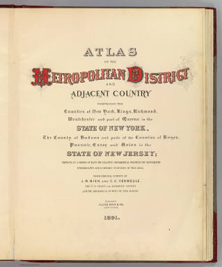
Author
[Bien, Joseph Rudolf, Vermeule, C. C. (Cornelius Clarkson), 1858-1950]
Full Title
(Title Page to) Atlas of the Metropolitan District and adjacent country comprising the counties of New York, Kings, Richmond, Westchester and part of Queens in the state of New York, the County of Hudson and parts of the counties of Bergen, Passaic, Essex and Union in the state of New Jersey ... From original surveys by J.R. Bien and C.C. Vermeule, the U.S. Coast and Geodetic Survey and the Geological Survey of New Jersey. Published by Julius Bien & Co. New York. 1891.
Publisher
Julius Bien
|