|
REFINE
Browse All : Images by Drake and DeFerrer and Ellicott from 1833 and 1874Author
Nichols, Beach
Full Title
Tyrone, Town of Tyrone. Altay, Town of Tyrone. Weston, Town of Tyrone.
Publisher
Pomeroy, Whitman & Co.
Author
Woodbridge, William C.
Full Title
(Covers to) Modern Atlas, Physical, Political And Statistical; Exhibiting On Separate Maps, The Physical And Political Characteristics Of Countries, The Prevailing Religions, Forms Of Government And Degrees Of Civilization, The Climates And Productions Of The Earth, And The Comparative Size Of Countries, Towns, Rivers And Mountains; Accompanied By Geographical And Statistical Tables. By William C. Woodbridge ... Entered ... 1843, by W.C. Woodbridge ... Massachusetts. Hartford. Published By Belknap And Hamersley.
Publisher
Belknap and Hamersley
Author
Woodbridge, William C.
Full Title
(Title Page to) Modern Atlas, Physical, Political And Statistical; Exhibiting On Separate Maps, The Physical And Political Characteristics Of Countries, The Prevailing Religions, Forms Of Government And Degrees Of Civilization, The Climates And Productions Of The Earth, And The Comparative Size Of Countries, Towns, Rivers And Mountains; Accompanied By Geographical And Statistical Tables. By William C. Woodbridge ... Entered ... 1843, by W.C. Woodbridge ... Massachusetts. Hartford. Published By Belknap And Hamersley.
Publisher
Belknap and Hamersley
Author
Woodbridge, William C.
Full Title
(Statistical Table to) Geographical And Statistical Tables. Mountains in order of their height. Rivers in the order of their length. Lakes in order of their size. Principal canals of the World. United States and Canada. Eastern Continent. (to accompany) Modern Atlas, Physical, Political And Statistical; Exhibiting On Separate Maps, The Physical And Political Characteristics Of Countries, The Prevailing Religions, Forms Of Government And Degrees Of Civilization, The Climates And Productions Of The Earth, And The Comparative Size Of Countries, Towns, Rivers And Mountains. By William C. Woodbridge ... Entered ... 1843, by W.C. Woodbridge ... Massachusetts. Hartford. Published By Belknap And Hamersley.
Publisher
Belknap and Hamersley
Author
Woodbridge, William C.
Full Title
(Statistical Tables to) Tables Of The Extent And Population Of Countries. Table Of Principal Cities Of The World In Order Of Their Populations. (to accompany) Modern Atlas, Physical, Political And Statistical; Exhibiting On Separate Maps, The Physical And Political Characteristics Of Countries, The Prevailing Religions, Forms Of Government And Degrees Of Civilization, The Climates And Productions Of The Earth, And The Comparative Size Of Countries, Towns, Rivers And Mountains. By William C. Woodbridge ... Entered ... 1843, by W.C. Woodbridge ... Massachusetts. Hartford. Published By Belknap And Hamersley.
Publisher
Belknap and Hamersley
Author
Woodbridge, William C.
Full Title
(Statistical Tables to) Tables Of The Population Of The United States. (to accompany) Modern Atlas, Physical, Political And Statistical; Exhibiting On Separate Maps, The Physical And Political Characteristics Of Countries, The Prevailing Religions, Forms Of Government And Degrees Of Civilization, The Climates And Productions Of The Earth, And The Comparative Size Of Countries, Towns, Rivers And Mountains. By William C. Woodbridge ... Entered ... 1843, by W.C. Woodbridge ... Massachusetts. Hartford. Published By Belknap And Hamersley.
Publisher
Belknap and Hamersley
Author
Woodbridge, William C.
Full Title
Map Of The World. Adapted To Woodbridge's Geography. Exhibiting The Eastern & Western Hemisphere, And the Land Hemisphere, Together With Comparative View Of the Rivers And Lake of the Two Continents. Includes 2 insets and Comparative View of Rivers & Lakes on The Eastern and Western Continents. Entered ... 1845, by W.C. Woodbridge ... Massachusetts. Hartford. Published By Wm. Jas. Hamersley. (to accompany) Modern Atlas, Physical, Political And Statistical; Exhibiting On Separate Maps ... Entered ... 1843, by W.C. Woodbridge ... Massachusetts. Hartford. Published By Belknap And Hamersley.
Publisher
Belknap and Hamersley
Author
Woodbridge, William C.
Full Title
Moral And Political Chart Of the Inhabited World. Exhibiting The Prevailing Religions, Forms Of Government And Degrees Of Civilization, And Population Of Each Country. By W.C. Woodbrige. Entered ... 1845, by W.C. Woodbridge ... Massachusetts. Hartford. Published By Wm. Jas. Hamersley. (inset map) Central Europe. (inset untitled map) showing Polynesia and Australia. (to accompany) Modern Atlas, Physical, Political And Statistical; Exhibiting On Separate Maps ... Entered ... 1843, by W.C. Woodbridge ... Massachusetts. Hartford. Published By Belknap And Hamersley.
Publisher
Belknap and Hamersley
Author
Woodbridge, William C.
Full Title
Isothermal Chart Or View Of Climates: Showing also The Situations Of The Principal Plants & Animals Of The World. By W.C. Woodbridge. (to accompany) Modern Atlas, Physical, Political And Statistical; Exhibiting On Separate Maps ... Entered .. . 1843, by W.C. Woodbridge ... Massachusetts. Hartford. Published By Wm. Jas. Hamersley. (inset map) Animals of New Holland.
Publisher
Belknap and Hamersley
Author
Woodbridge, William C.
Full Title
Political Map Of North America. Adapted To Woodbridge's Geography. Entered ... 1843, by W.C. Woodbridge ... Massachusetts. Hartford. Published By Wm. Jas. Hamersley. (to accompany) Modern Atlas, Physical, Political And Statistical; Exhibiting On Separate Maps ...
Publisher
Belknap and Hamersley
Author
Woodbridge, William C.
Full Title
Physical Map Of North America. Adapted To Woodbridge's Geography. Entered ... 1843, by W.C. Woodbridge ... Massachusetts. Hartford. Published By Wm. Jas. Hamersley. (to accompany) Modern Atlas, Physical, Political And Statistical; Exhibiting On Separate Maps ...
Publisher
Belknap and Hamersley
Author
Woodbridge, William C.
Full Title
Physical Map Of The United States. Adapted To Woodbridge's Geography. Figures 1. 2, 3, 4., near Rivers Indicated their Rank. Entered ... 1843, by W.C. Woodbridge ... Massachusetts. Hartford. Published By Wm. Jas. Hamersley. (to accompany) Modern Atlas, Physical, Political And Statistical; Exhibiting On Separate Maps ... Includes 4 inset maps.
Publisher
Belknap and Hamersley
Author
Woodbridge, William C.
Full Title
Political Map Of The United States, Mexico And The British Provinces. Adapted To Woodbridge's Geography. Engraved by J.M. Atwood. N. York. Entered ... 1845, by W.C. Woodbridge ... Massachusetts. Hartford. Published By Wm. Jas. Hamersley. (to accompany) Modern Atlas, Physical, Political And Statistical; Exhibiting On Separate Maps ... (inset) Map Of Railways & Canals In The Middle States. (inset map) Michigan, Wisconsin, & Iowa. (inset map) District of Columbia.
Publisher
Belknap and Hamersley
Author
Woodbridge, William C.
Full Title
Physical & Political Map Of The N. Eastern States. Adapted To Woodbridge's Geography. Drawn and Engrd. by Story & Atwood. N. York. Entered ... 1843, by W.C. Woodbridge ... Massachusetts. Hartford. Published By Wm. Jas. Hamersley. (to accompany) Modern Atlas, Physical, Political And Statistical; Exhibiting On Separate Maps ...
Publisher
Belknap and Hamersley
Author
Woodbridge, William C.
Full Title
Political Map Of the Northern Division Of The United States. Adapted To Woodbridge's Geography. Entered ... 1843, by W.C. Woodbridge ... Massachusetts. Hartford. Published By Wm. Jas. Hamersley. (to accompany) Modern Atlas, Physical, Political And Statistical; Exhibiting On Separate Maps ...
Publisher
Belknap and Hamersley
Author
Woodbridge, William C.
Full Title
Physical & Political Map Of the Southern Division Of The United States. Adapted To Woodbridge's Geography. Entered ... 1843, by W.C. Woodbridge ... Massachusetts. Hartford. Published By Wm. Jas. Hamersley. (to accompany) Modern Atlas, Physical, Political And Statistical; Exhibiting On Separate Maps ... (inset map) Vicinity of Charleston. (inset map) vicinity of New Orleans.
Publisher
Belknap and Hamersley
Author
Woodbridge, William C.
Full Title
Physical Map Of America & Africa And The Atlantic Ocean. Adapted To Woodbridge's Geography. Entered ... 1843, by W.C. Woodbridge ... Massachusetts. Hartford. Published By Wm. Jas. Hamersley. (to accompany) Modern Atlas, Physical, Political And Statistical; Exhibiting On Separate Maps ...
Publisher
Belknap and Hamersley
Author
Woodbridge, William C.
Full Title
Political Map Of South America and Africa. Adapted To Woodbridge's Geography. Entered ... 1843, by W.C. Woodbridge ... Massachusetts. Hartford. Published By Wm. Jas. Hamersley. (to accompany) Modern Atlas, Physical, Political And Statistical; Exhibiting On Separate Maps ... (inset) Map Of the Andes. (inset map) Liberia.
Publisher
Belknap and Hamersley
Author
Woodbridge, William C.
Full Title
Physical Map Of Europe. Adapted To Woodbridge's Geography. Entered ... 1843, by W.C. Woodbridge ... Massachusetts. Hartford. Published By Wm. Jas. Hamersley. (to accompany) Modern Atlas, Physical, Political And Statistical; Exhibiting On Separate Maps ...
Publisher
Belknap and Hamersley
Author
Woodbridge, William C.
Full Title
Political Map Of Europe. Adapted To Woodbridge's Geography. Entered ... 1843, by W.C. Woodbridge ... Massachusetts. Hartford. Published By Wm. Jas. Hamersley. (to accompany) Modern Atlas, Physical, Political And Statistical; Exhibiting On Separate Maps ...
Publisher
Belknap and Hamersley
Author
Woodbridge, William C.
Full Title
Political Map Of Great Britain And Ireland. Adapted To Woodbridge's Geography. Engraved by Story & Atwood. N. York. Entered ... 1843, by W.C. Woodbridge ... Massachusetts. Hartford. Published By Wm. Jas. Hamersley. (to accompany) Modern Atlas, Physical, Political And Statistical; Exhibiting On Separate Maps ...
Publisher
Belknap and Hamersley
Author
Woodbridge, William C.
Full Title
Political Map Of Germany. Adapted To Woodbridge's Geography. Engraved by Story & Atwood. N. York. Entered ... 1843, by W.C. Woodbridge ... Massachusetts. Hartford. Published By Wm. Jas. Hamersley. (to accompany) Modern Atlas, Physical, Political And Statistical; Exhibiting On Separate Maps ...
Publisher
Belknap and Hamersley
Author
Woodbridge, William C.
Full Title
Physical Map Of Asia. Adapted To Woodbridge's Geography. Entered ... 1843, by W.C. Woodbridge ... Massachusetts. Hartford. Published By Wm. Jas. Hamersley. (to accompany) Modern Atlas, Physical, Political And Statistical; Exhibiting On Separate Maps ...
Publisher
Belknap and Hamersley
Author
Woodbridge, William C.
Full Title
Political Map Of Asia. Adapted To Woodbridge's Geography. Entered ... 1843, by W.C. Woodbridge ... Massachusetts. Hartford. Published By Wm. Jas. Hamersley. (to accompany) Modern Atlas, Physical, Political And Statistical; Exhibiting On Separate Maps ... (inset map) Syria and Palestine.
Publisher
Belknap and Hamersley
Author
Woodbridge, William C.
Full Title
Oceanica And The Pacific Ocean. Adapted To Woodbridge's Geography. "Note: For Cities of Malaysia, see Map of Asia." Entered ... 1843, by W.C. Woodbridge ... Massachusetts. Hartford. Published By Wm. Jas. Hamersley. (to accompany) Modern Atlas, Physical, Political And Statistical; Exhibiting On Separate Maps ...
Publisher
Belknap and Hamersley
Author
Woodbridge, William C.
Full Title
Comparative Chart Of The Extent Of Countries. (to accompany) Modern Atlas, Physical, Political And Statistical; Exhibiting On Separate Maps ...
Publisher
Belknap and Hamersley
Author
[Howden, J.A., Odbert, A.]
Full Title
(Covers to) Howden & Odbert's Atlas Of Warren County, Pennsylvania. From Actual Surveys & Records by & under the directions of J.A. Howden & A.O. Odbert, Publishers, Washington, Pa. 1878. Assisted by J.J. Power, T.M.D. McCloy, F.G. Longdon, Capt. W.H. Horn. Artists, Wilson Porter, F. Robejohn, E. Bott, & M.B. Leisser. Engraved, Lithographed & Printed By Otto Krebs, Pittsburgh, Pa.
Publisher
J.A. Howden & A. Odbert
Author
Mitchell, Samuel Augustus Jr.
Full Title
Map of Asia Showing its Gt. Political Divisions, and, also, the Various routes of Travel Between London & India, China & Japan &c. Constructed & Engraved by W. Williams Phila. Entered ... 1860 by S. Augustus Mitchell, Jr. ... Pennsylvania.
Publisher
S.A. Mitchell Jr.
Author
Mitchell, Samuel Augustus Jr.
Full Title
Map of Persia, Turkey in Asia. Afghanistan, Beloochistan. (inset map) 79. Palestine or the Holy Land. Entered ... 1860 by S. Augustus Mitchell, Jr. ... Pennsylvania.
Publisher
S.A. Mitchell Jr.
Author
Mitchell, Samuel Augustus Jr.
Full Title
A New map of Palestine or the Holy Land. (inset map) Modern Jerusalem. Entered ... 1864 by S. Augustus Mitchell, Jr. ... Pennsylvania.
Publisher
S.A. Mitchell Jr.
Author
Mitchell, Samuel Augustus Jr.
Full Title
Map of Hindoostan, Farther India, China, and Tibet. Constructed & Engraved by W. Williams Phila. Entered ... 1860 by S. Augustus Mitchell, Jr. ... Pennsylvania.
Publisher
S.A. Mitchell Jr.
Author
Mitchell, Samuel Augustus Jr.
Full Title
Map of Oceanica, exhibiting its Various Divisions, Island Groups &c. (inset map) 82. Map of the Sandwich Islands. Entered ... 1860 by S. Augustus Mitchell, Jr. ... Pennsylvania.
Publisher
S.A. Mitchell Jr.
Author
Mitchell, Samuel Augustus Jr.
Full Title
Map Of Africa, Showing Its Most Recent Discoveries. (inset map) 84. Island of St. Helena. Constructed & Engraved by W. Williams. Philadelphia. . Entered ... 1860 by S. Augustus Mitchell, Jr. ... Pennsylvania.
Publisher
S.A. Mitchell Jr.
Author
Mitchell, Samuel Augustus Jr.
Full Title
(Covers to) Mitchell's New General Atlas, Containing Maps Of The Various Countries Of The World, Plans Of Cities, Etc., Embraced In Fifty-Five Quarto Maps, Forming A Series Of Eighty-Seven Maps And Plans, Together With Valuable Statistical Tables. Philadelphia: Published By S. Augustus Mitchell, Jr. No. 31 South Sixth Street. 1865. Entered ... 1860, by S. Augustus Mitchell, Jr. ... Pennsylvania.
Publisher
S.A. Mitchell Jr.
Author
Mitchell, Samuel Augustus Jr.
Full Title
(Text Page to) Mitchell's New General Atlas, Containing Maps Of The Various Countries Of The World, Plans Of Cities, Etc., Embraced In Fifty-Five Quarto Maps, Forming A Series Of Eighty-Seven Maps And Plans, Together With Valuable Statistical Tables. Philadelphia: Published By S. Augustus Mitchell, Jr. No. 31 South Sixth Street. 1865. Entered ... 1860, by S. Augustus Mitchell, Jr. ... Pennsylvania.
Publisher
S.A. Mitchell Jr.
Author
Mitchell, Samuel Augustus Jr.
Full Title
(Title Page to) Mitchell's New General Atlas, Containing Maps Of The Various Countries Of The World, Plans Of Cities, Etc., Embraced In Fifty-Five Quarto Maps, Forming A Series Of Eighty-Seven Maps And Plans, Together With Valuable Statistical Tables. Philadelphia: Published By S. Augustus Mitchell, Jr. No. 31 South Sixth Street. 1865. Entered ... 1860, by S. Augustus Mitchell, Jr. ... Pennsylvania.
Publisher
S.A. Mitchell Jr.
Author
Mitchell, Samuel Augustus Jr.
Full Title
(Contents to) Mitchell's New General Atlas, Containing Maps Of The Various Countries Of The World, Plans Of Cities, Etc., Embraced In Fifty-Five Quarto Maps, Forming A Series Of Eighty-Seven Maps And Plans, Together With Valuable Statistical Tables. Philadelphia: Published By S. Augustus Mitchell, Jr. No. 31 South Sixth Street. 1865. Entered ... 1860, by S. Augustus Mitchell, Jr. ... Pennsylvania.
Publisher
S.A. Mitchell Jr.
Author
Mitchell, Samuel Augustus Jr.
Full Title
The World in Hemispheres. With others Projections &c.&c. Constructed & Engraved by W. Williams Philadelphia. Entered ... 1860, by S. Augustus Mitchell, Jr. ... Pennsylvania. (insets) North Polar Region. The World on a Polar Projection. Land and Water Hemispheres.
Publisher
S.A. Mitchell Jr.
Author
Mitchell, Samuel Augustus Jr.
Full Title
A time table indicating the difference in time between the principal cities of the World and also showing their air-line distance from Washington. Entered ... 1864 by S. Augustus Mitchell, Jr. ... Pennsylvania.
Publisher
S.A. Mitchell Jr.
Author
Mitchell, Samuel Augustus Jr.
Full Title
Map of the World in Mercator projection. Exhibiting the American Continents as its center. Entered ... 1864 by S. Augustus Mitchell, Jr. ... Pennsylvania.
Publisher
S.A. Mitchell Jr.
Author
Mitchell, Samuel Augustus Jr.
Full Title
Map of North America. Showing its political divisions, and recent discoveries in the Polar Regions. Constructed & Engraved by W. Williams Philadelphia. Entered ... 1860 by S. Augustus Mitchell, Jr. ... Pennsylvania.
Publisher
S.A. Mitchell Jr.
Author
Mitchell, Samuel Augustus Jr.
Full Title
County map of Nova Scotia, New Brounswick, Cape Breton Id. and Pr. Edward's Id. Entered ... 1860 by S. Augustus Mitchell, Jr. ... Pennsylvania. (inset map) 5. City and Harbor of Halifax.
Publisher
S.A. Mitchell Jr.
Author
Mitchell, Samuel Augustus Jr.
Full Title
Map of Canada East in Counties. Entered ... 1860 by S. Augustus Mitchell, Jr. ... Pennsylvania. (inset map) 7. Environs of Montreal.
Publisher
S.A. Mitchell Jr.
Author
Mitchell, Samuel Augustus Jr.
Full Title
Map of Canada West in Counties. Entered ... 1860 by S. Augustus Mitchell, Jr. ... Pennsylvania.
Publisher
S.A. Mitchell Jr.
Author
Mitchell, Samuel Augustus Jr.
Full Title
Map of the United States, and Territories. together with Canada &c. Constructed & Engraved by W. Williams Philadelphia. Entered ... 1860 by S. Augustus Mitchell, Jr. ... Pennsylvania. (inset map) Island of Newfoundland.
Publisher
S.A. Mitchell Jr.
Author
Mitchell, Samuel Augustus Jr.
Full Title
County map of the State of Maine. Entered ... 1860 by S. Augustus Mitchell, Jr. ... Pennsylvania. (inset map) 13. Portland Har. and Vicinity.
Publisher
S.A. Mitchell Jr.
Author
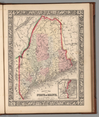
Mitchell, Samuel Augustus Jr.
Full Title
New Hampshire and Vermont. Drawn and Eng. by W.H. Gamble. Entered ... 1862 by S. Augustus Mitchell, Jr. ... Pennsylvania.
Publisher
S.A. Mitchell Jr.
Author
Mitchell, Samuel Augustus Jr.
Full Title
County map of Massachusetts, Connecticut, and Rhode Island. Drawn & Engraved by W.H. Gamble Philad. Entered ... 1862 by S. Augustus Mitchell, Jr. ... Pennsylvania.
Publisher
S.A. Mitchell Jr.
Author
Mitchell, Samuel Augustus Jr.
Full Title
County map of the State of New York, New Hampshire, Vermont. Massachusetts, Rhode Id. and Connecticut. Drawn & Engraved by W. Williams Philadelphia. Entered ... 1860 by S. Augustus Mitchell, Jr. ... Pennsylvania. (inset maps)17. Harbor and Vicinity of New York, and 18. Harbor and Vicinity of Boston.
Publisher
S.A. Mitchell Jr.
|